All Activity
- Past hour
-
Banger of a weekend on tap
-
.75”
-
My guess is that next winter will be warmer than this last one was from Philly to Boston. Every La Nina with such a strong +PNA in December had winters around it which were warmer. But since the snowfall was so low anyway, there is a chance that one larger snowstorm if it should occur could rival or exceed last winter from Philly to Boston. I will update again after we see what clues we get in October.
-
0.42” overnight
-
AWT
-
Looks like most areas .75-2” or so. Maybe some spots more but not a big deal.
-

2025 Lawns & Gardens Thread. Making Lawns Great Again
amarshall replied to Damage In Tolland's topic in New England
Morning run musings. At the end of no mow may is some poor sap husband or landscaper who gets stuck with a check he cant cash. You want no mow may, mow it yourself. -
Back edge of rain and heavier clouds on Friday morning appear to be reaching Garrett County. After a good overnight rain, at 6am we have 46° in Grantsville. Forecasted Friday high temp 55 with frost advisories for Friday night.
-
.thumb.jpg.6a4895b2a43f87359e4e7d04a6fa0d14.jpg)
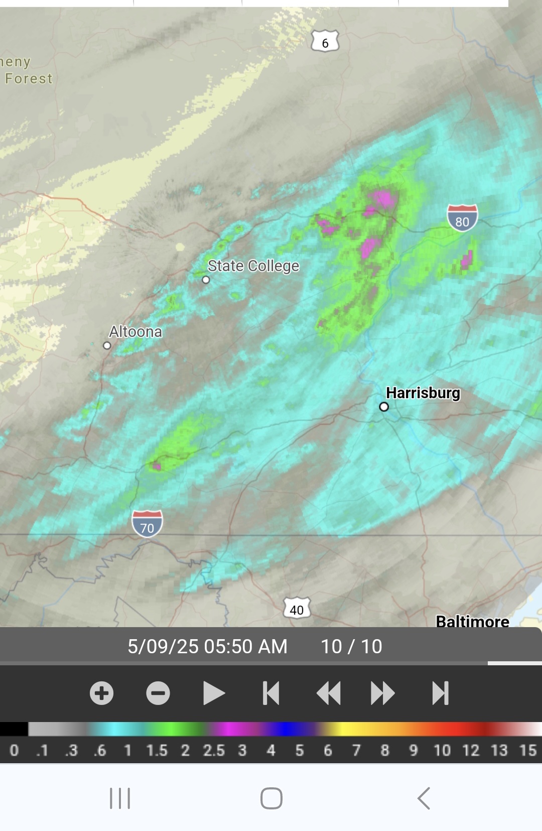
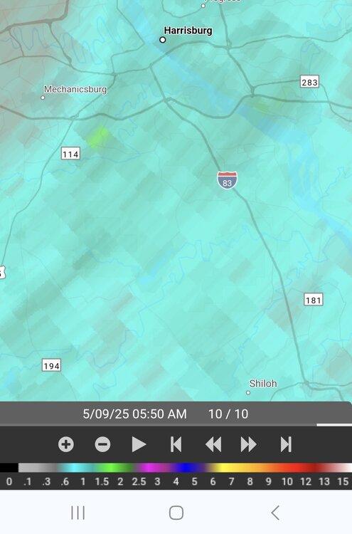
Central PA Spring 2025
Yardstickgozinya replied to canderson's topic in Upstate New York/Pennsylvania
Radar estimations of over an inch for some of us now and over 2" in a few places for this event.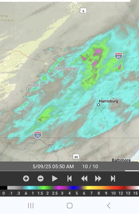
-
Rapidly approaching 3" here since last weekend.
-
Doesn’t look like a big deal on overnight guidance.
-
Picked up .26” overnight
-
It’s starting to look like we see, at minimum, a cold-neutral ENSO, with a weak La Niña becoming a distinct possibility
-
That's an impressive precip shield to our NW.
-

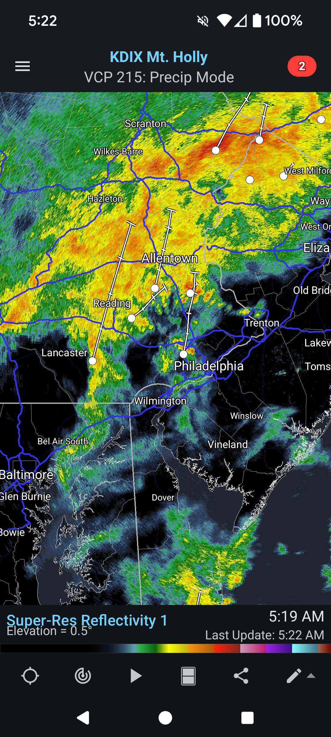
E PA/NJ/DE Spring 2025 Obs/Discussion
Birds~69 replied to PhiEaglesfan712's topic in Philadelphia Region
Wave after wave of steady to heavy rain overnight and currently. 54F and looks to stay in the 50s all day with more rain... -
It is past time for Hyde to go. Like seriously. Team needs a shake up and a new perspective. The pitching woes are problematic and wont be resolved unless they get some healthy arms back, but the offense is just pathetic, and it shouldn't be.
-

2025 Spring/Summer Mountain Thread
ncjoaquin replied to Maggie Valley Steve's topic in Southeastern States
.40 inches of rain here at my house. 2.78 inches of rain at the airport!! -
My area did pretty well for a while there. Last event underperformed, but still managed 0.6" or so. Starting to get dry again, so really could have used a half inch+ from this. NW areas getting more rain now, which is needed for that area. The worm has turned lol.
-
0.13” out of a forecast ~1”. What’s the bigger underperformer? Every damn rain event or the O’s lineup??
-
Surprised to see a flood watch for the island. There are some discrete cells off the jersey shore, that could consolidate as they head north.
-

OBS for OKX Flood Watch (attached) into early Saturday 5/10/25
IrishRob17 replied to wdrag's topic in New York City Metro
Steady rain with .67" in the last 24 hours, 2.82" for the month, 48/47 up here in north central Orange County. The radar is loaded with the heaviest just to my west at the moment. -
0.85" finished off yesterday, and so far this morning, 0.70" since midnight.
- Today
-

E PA/NJ/DE Spring 2025 Obs/Discussion
Nodriveslow replied to PhiEaglesfan712's topic in Philadelphia Region
Only a trace overnight!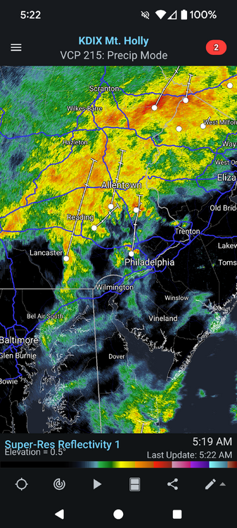
-
So sorry to hear this. Hopefully this gets resolved quickly and fully.
-
Fortunate I stayed dry yesterday afternoon; the rain falling to the North and West. Let’s see what today brings. BOX has Windham County included in the Flood Watch.