Search the Community
Showing results for tags 'heavy rainfall'.
-
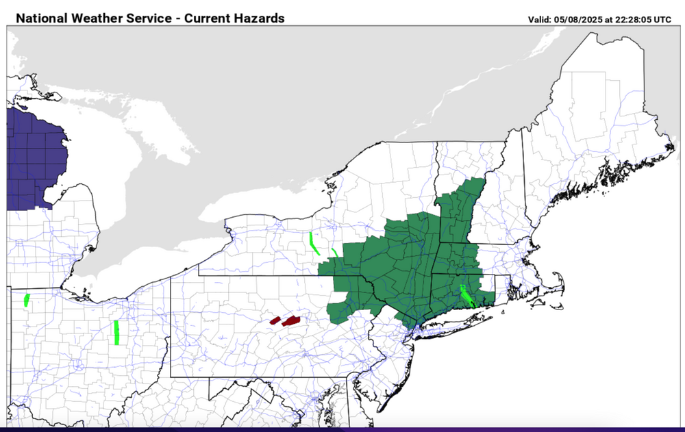
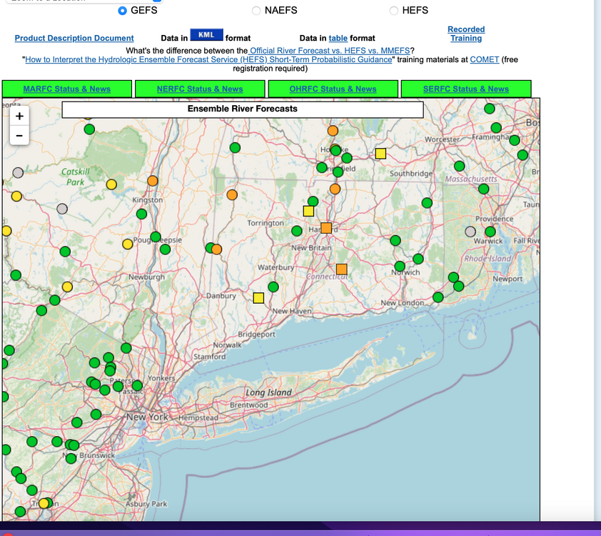
Isolated 4" rainfall possible by daybreak Saturday for w CT, se NYS where OKX has issued a flood watch this Friday afternoon 5/8/25. Most modeling has a needed 1-3" spread out over a 36-42 hour period ending Saturday morning. Flood guidance suggests we'll need 2.5" in a 6 hour period for flooding. Lesser rainfall LI NJ and ne PA under 1.5". A snapshot of ensemble forecasts showing minor flooding anticipated at several gages in the north part of the NYC subforum. Long ways to go. We'll add some CoCoRaHs amounts at 9A Friday and see where we stand.
-
Go!
- 1,188 replies
-
- 1
-

-
A fall to remember? Post your obs and discussion here.
- 1,105 replies
-
- tropics
- heavy rainfall
-
(and 5 more)
Tagged with:
-
A September to remember? Post your obs and discussion here.
- 1,154 replies
-
- tropics
- heavy rainfall
-
(and 3 more)
Tagged with:
-
Tropics are potentially heating up. Let's get things rolling.
- 1,764 replies
-
- hurricanes
- tropics
-
(and 5 more)
Tagged with:
-
512P/3 hitttled topic header to the 5th-6th. Further topic update Saturday morning. NORA's life as TC will end as it nears AZ late next week, but its vorticity and PWAT infusion can be tracked across northern Rockies then northern USA, near and north of I80 (near and north of latitude 40N). The associated 500MB wind max appears to track across our area late on the 4th, but the moisture infusion is stretched to possibly lay out arross our area the 5th-6th. If the cold front stalls in our area, then the moisture release could be of 3" interest. Just need to wait a few more days to figure out if its just 1/4" convective showers or a stripe of 3" rainfall somewhere in our subforum. If the front does not stall passing through our area, then the impact will be nominal-all of this presuming the model track of NORA's remains is reasonably accurate. So, am not guaranteeing big impact but I do think this merits monitoring in our wetter than usual summer pattern. IF this does come into better focus as a significant player here, headline and tags will be upgraded.
-
Uncertainty is considerable and confidence in any severe storm today is below average. Feel best chance 3P-10P and mainly southern CT. Much greater confidence for an event to monitor late tonight-Friday morning, especially midnight-Noon when the front stalls, surface convergence produces heavy showers and isolated strong thunderstorms in NJ-LI in high PWAT airmass, especially I78 south where 6 hour "isolated 3-4" rains could occur in Ocean, Monmouth or Mercer County. It is s of I78 where a storm may become severe after midnight and a little concerned about a supercell there early Friday. A fair amount of low level shear in a somewhat high CAPE environment is modeled down toward the Jersey shore s of Sandy Hook Friday morning. So not guaranteeing the second paragraph above but a number of models are heading in this direction as of 6AM/30. Meanwhile, some beneficial rainfall is seeming headed for parts of nw NJ, maybe even all of the forum area where storms missed last week.
-
SPC D1 prompts this topic. Have a little concern that todays strongest storms (2-3" rain producers/damaging wind) will be concentrated down in central or s NJ, but some spots in our NY metro from NYC westward should see isolated SVR late today. Think eastern LI is out of it today. However, with the large CAPE axis just s of us, cannot rule out a cluster of drenching thunderstorms forming-developing eastward later tonight and eventually making it to eastern LI. This latter is with considerable uncertainty.
-
I guess today will be bigger in Ny metro than yesterday? Figured I'd start this if you want to use and keep the rest of the reports off yesterdays disappointment topic. Will start with the first posted LSR. Will replace these LSR maps as time permits and events dictate. See SPC D1 and local NWS offices/friends etc for any comments.
- 58 replies
-
- 1
-

-
- hail
- damaging wind
-
(and 1 more)
Tagged with:


