All Activity
- Past hour
-
wisconsin delivered some photogenic stuff huh
-
Just picked up 1.62". My garden said thanks.
-

2026-2027 Super El Nino
40/70 Benchmark replied to Stormchaserchuck1's topic in Weather Forecasting and Discussion
I think it's important to be mindful of both if you are genuinely interested in the weather and especially if you forecast. It's important to take CC into account in forecasts, so it helps to be in tune with the rate at which it continues to progress, regardless of whether the NE CONUS was in a pocket of colder air last season. -
 RRFS can eat it. I’m still pumping out my basement from its output last week.
 -
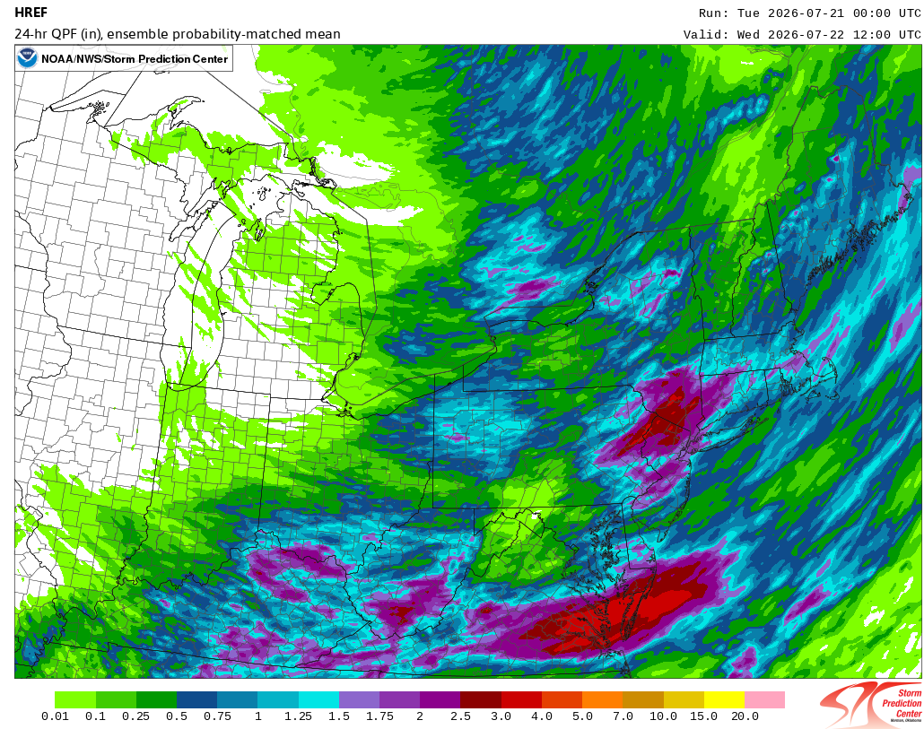
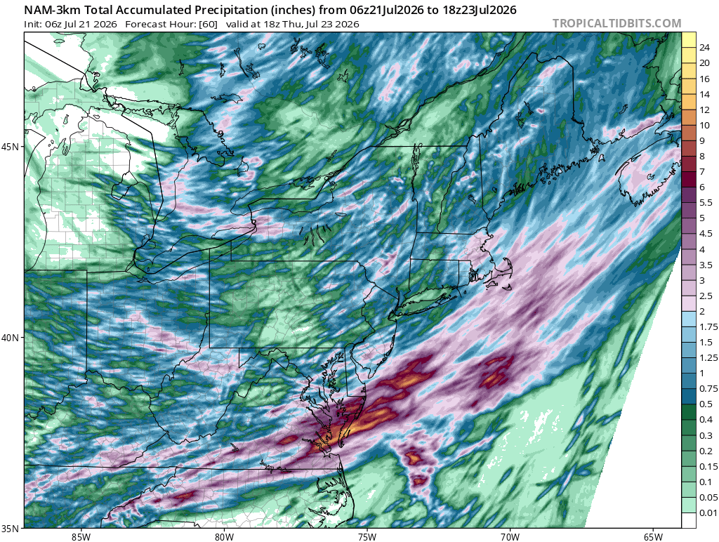
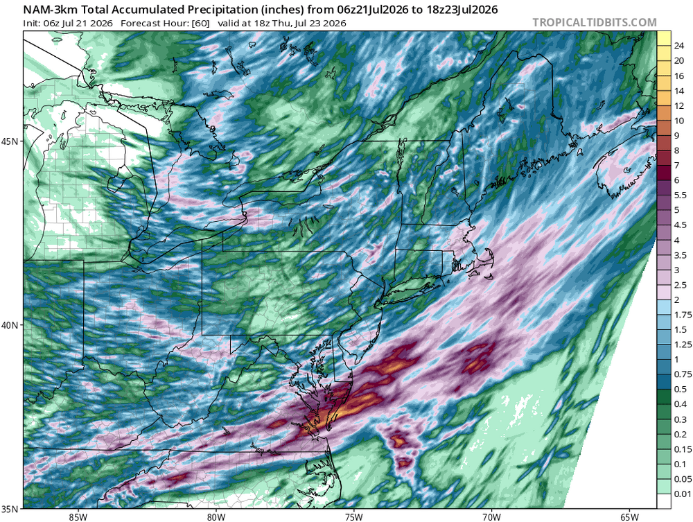
The futurecast is essentially useless at 36-48 hours. It's akin to a 120-hour NAM run (NAM ends at 84 hours, just so one has context for my analogy). Not surprisingly, last night's figures were dramatically lowered and are now in line with the guidance. https://pix11.com/news/local-news/projected-rainfall-totals-in-ny-nj-ahead-of-storms/
-
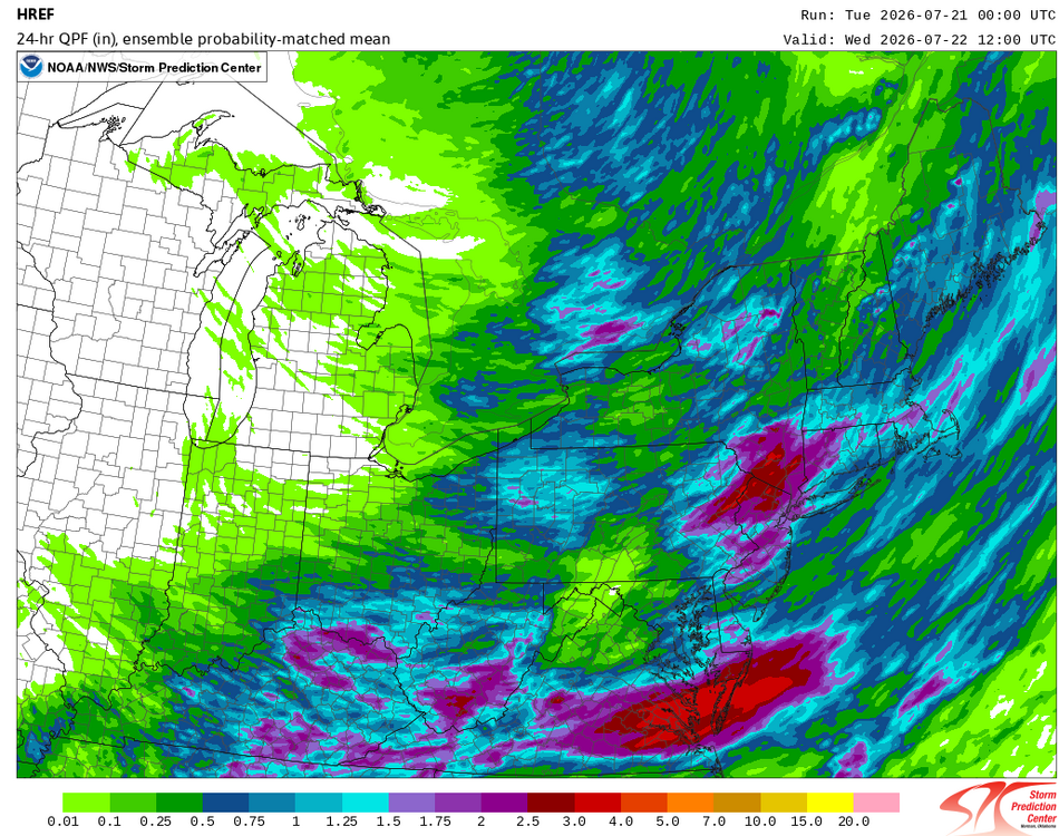
The overnight HREF:
-
that's awful, every 4-6 weeks? you and your neighbors must all be so pissed at the POCO. Is the issue mostly related to overhead wires and mature trees, or is it due to older under ground infrastructure?
-
Picked up an additional 0.12” overnight a some point which brings us up over 9” up to 9.02” MTD
-
 HRRR was a solid line moving through
 -
Back to "Bad Gateway" again when logging on.
-

2026 Mid-Atlantic Severe Storm General Discussion
dailylurker replied to Kmlwx's topic in Mid Atlantic
Congrats fokes south and east today. Looks like 2-3" of rain and lots of storms. Models looks pretty unenthusiastic for central Maryland. Probably just the normal spots like Fredrick and Glen Burnie see action lol. Crickets in here for a severe day. -
 Yikes. Cheetah and SkiMarge have entered the chat. Definitely need the rain here. Tired of watering my bean pole and tomatoes daily.
 -

Central PA Summer 2026 Discussion/Obs Thread
Mount Joy Snowman replied to Voyager's topic in Upstate New York/Pennsylvania
Low of 70. Could be an interesting day. -

Central PA Summer 2026 Discussion/Obs Thread
Voyager replied to Voyager's topic in Upstate New York/Pennsylvania
Yeah, I think we're just about done as the last cell has moved northeast. I didn't think we'd pick up close to an inch in the forecasted first round. Ended up with 0.92" in my backyard. Locations to my immediate north (Hometown, Lake Hauto) are showing between 1.25" and 1.50". - Today
-

Central PA Summer 2026 Discussion/Obs Thread
mahantango#1 replied to Voyager's topic in Upstate New York/Pennsylvania
Zilch here. -
.thumb.jpg.6a4895b2a43f87359e4e7d04a6fa0d14.jpg)
Central PA Summer 2026 Discussion/Obs Thread
Yardstickgozinya replied to Voyager's topic in Upstate New York/Pennsylvania
Certainly, can't rule out, you're seeing more storms this morning but either way, it looks like you'll see some sun.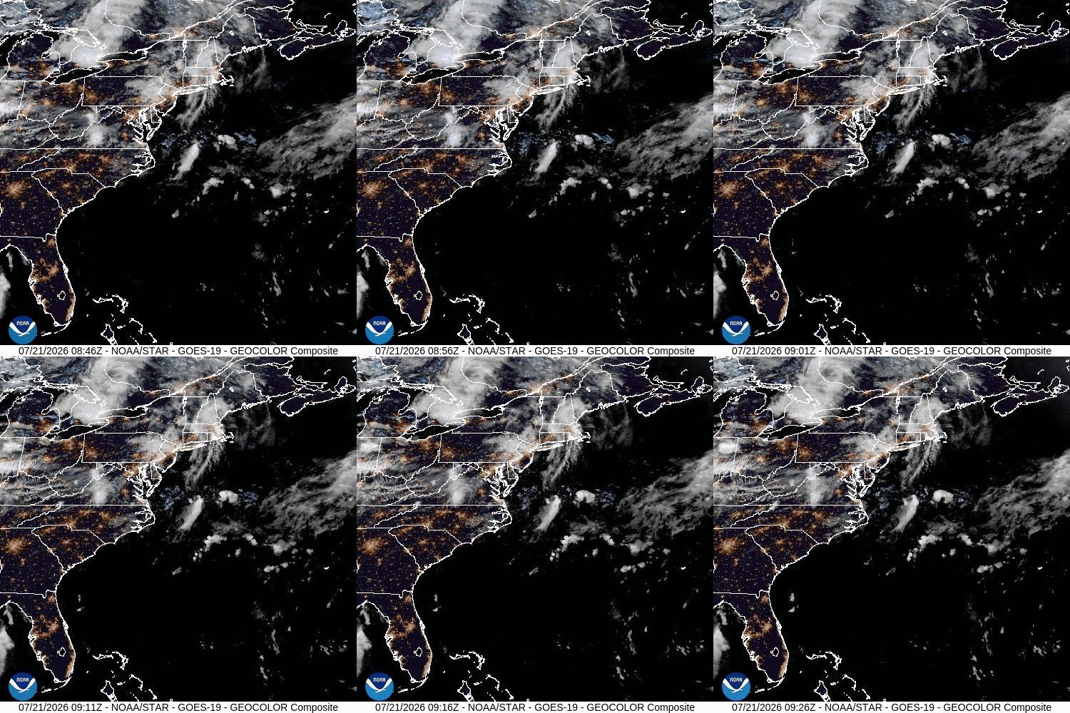
-

Chester County PA - Analytical Battle of Actual vs. Altered Climate Data
chubbs replied to ChescoWx's topic in Climate Change
Repeating what I said above garbage in, garbage out. Your analysis and AI's conclusion is faulty. You aren't telling AI that the Chesco COOPs are included in the SE PA climate division. You can't conclude that Chester County is the same as the non-Chesco stations if you include Chester County with the other stations. Second the regression slopes depend on the end-date. You need to include enough years before and after the moves for the station moves to be fully reflected in the regression. For the period 1941-1975 I get a much bigger difference in slopes -.69 for Chesco and only -.32 for the Division. Excluding Chester County from the Division would lower the Division slope further. Finally AI already has a Pvalue of 0.057, i.e, there is a 94% chance that Chesco is different using your faulty comparisons. Correct the errors and the Pvalue will shrink considerably. However I don't need stats, the chart clearly shows that Chesco COOPS cool vs the SEPA Climate Div.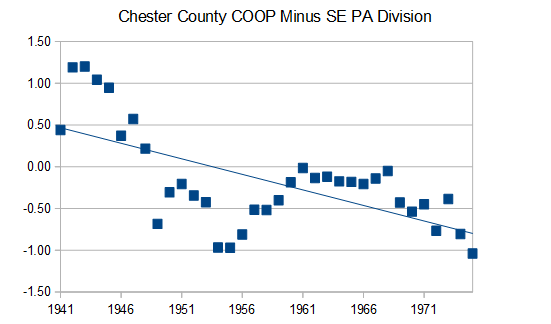
-
 Temp down to 54F this am; looks like storms already firing in PA/NJ border. Congrats W CT?
 -
Central PA Summer 2026 Discussion/Obs Thread
Yardstickgozinya replied to Voyager's topic in Upstate New York/Pennsylvania
. What's your experiencing should lift north with the warm front , it looks like we're gonna bake off nicely in the warm sector today.
-
-
Central PA Summer 2026 Discussion/Obs Thread
Voyager replied to Voyager's topic in Upstate New York/Pennsylvania
Outside with my second coffee and smoke, and she's flashing and booming a bit now. And as I type this the rain is getting heavy again. These morning storms seem to be training right up through Schuylkill County. -
Central PA Summer 2026 Discussion/Obs Thread
Yardstickgozinya replied to Voyager's topic in Upstate New York/Pennsylvania
I saw some lighting and heard some thunder from a distance but no rain here . It started as a little blip near Carlisle and became a nice little cluster relatively quickly. Very fast NE motion on those storms already with another weak echo, blazing, due west across the mason dixon. It already seems like there's going to be some ugly stuff around today. -
Central PA Summer 2026 Discussion/Obs Thread
Voyager replied to Voyager's topic in Upstate New York/Pennsylvania
Yeah. No thunder, but heavy rain. Woke me up at 4:30AM and already got 0.36" -
Central PA Summer 2026 Discussion/Obs Thread
Yardstickgozinya replied to Voyager's topic in Upstate New York/Pennsylvania
Right now lol. -
As of 121am Texas time July 21, Bertha is disorganized. Most of the precip is south of the center of circulation. This puppy needs to be monitored. With any luck she will reach hurricane status and continue lumbering slowly westward toward Texas where I hope she will move in and take up a happy productive residence swirling around for a week about 40-50 miles southwest of Buda. We are parched and need more rain. I'd love it if Bertha would please spin me up some highly efficient tropical rainbands then train them right over the Austin/Buda Corridor for days on end. I'd love to see the Plum Creek rise right over Rt 1626 and 967. I'd walk down there with my old snow ruler and take water level readings, while blasting the latest Gen Z tracks on my headphones! Another thing I crave for is to get so much heavy efficient tropical rain, that all the water storage facilities scattered all over Buda and Kyle would get filled right to the brim, even overflowing and running down the streets! I'd definitely enjoy a truly EPIC jebwalk!