All Activity
- Past hour
-
But February is sun angle season
-

January 24-26: Miracle or Mirage JV/Banter Thread!
Snowciopathic Snow Bro replied to SnowenOutThere's topic in Mid Atlantic
Up to 19F here in Gainesville. Time to don my swimsuit, set out the lawn sprinkler, and jump through it to cool off a bit. -
Adding a little more to this, it might even hurt us with aiding in downsloping off the mountains. Obviously the wind direction wouldn’t be ideal for downsloping, but it would still be coming somewhat from the east. .
- 183 replies
-
- observations
- obs thread
-
(and 1 more)
Tagged with:
-
Richmond Metro/Hampton Roads Area Discussion
eaglesin2011 replied to RIC Airport's topic in Mid Atlantic
Hmm definitely no sign of flurries yet where I am.. Short pump -

“Cory’s in LA! Let’s MECS!” Jan. 24-26 Disco
RUNNAWAYICEBERG replied to TheSnowman's topic in New England
Pretty reasonable imo. You 20”+ congrats. -
Southern Crippler - Get well soon Jimbo Storm Obs
WinstonSalemArlington replied to BooneWX's topic in Southeastern States
Greensboro’s dewpoint is -1. Temperature is 21 degrees -
So this is what the 13z NBM has to say about next Sun-Mon. I just chose 0.3in because I figured it makes the precip presentation more manageable and also might as well focus on something at least in the advisory ballpark. I assume max temp is a 24hr high but I am not sure.
-

Pittsburgh/Western PA WINTER ‘25/‘26
MikeB_01 replied to Burghblizz's topic in Upstate New York/Pennsylvania
Oh my oh my oh my… that would be an absolute treat . -
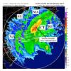
Radar right now doesn’t match any of the weather models I saw leading up to the event. This has been interesting so far.
- 183 replies
-
- observations
- obs thread
-
(and 1 more)
Tagged with:
-
Extreme Cold, Snow & Sleet: SECS 1/25 - 1/26
sussexcountyobs replied to TriPol's topic in New York City Metro
From EPAWA text alert just now: Sussex: Snow moves in 4-6am Sunday, mixes with sleet evening, ending 8-10pm, snow showers linger to Monday AM Snow/sleet: 12-18 inches -

Jan 24-26 Weekend Snow and Sleetfest Model Thread Part Tres
Solution Man replied to H2O's topic in Mid Atlantic
Pictures? -
MO/KS/AR/OK 2025-2026 Winter Discussion
MUWX replied to stormdragonwx's topic in Central/Western States
Hard to fathom how unlucky this area is when it comes to winter weather. -

Central PA Winter 25/26 Discussion and Obs
Mount Joy Snowman replied to MAG5035's topic in Upstate New York/Pennsylvania
HRRR nearly identical in terms of evolution and totals to its 12z run. I'd sign up for it right now. Would be kind of fun to be right on the snow line for that long too. Why not ha. -
Central PA Winter 25/26 Discussion and Obs
AccuChris replied to MAG5035's topic in Upstate New York/Pennsylvania
HRRR kuchera snow . -

1/24-1/25 Major Winter Storm - S. IL, IN, and OH
Chicago WX replied to A-L-E-K's topic in Lakes/Ohio Valley
Bingo. If we’re compared short range models, 18z RAP looks to be handling things better. -
34 in Kingsport. 31 in Gate City with light snow starting.
- 183 replies
-
- observations
- obs thread
-
(and 1 more)
Tagged with:
-
Someone with more talent can correct me if I’m wrong, but I believe a high pressure north east of us is going to send its air down the east side of the apps. So I don’t think it does it any good even if it was closer to us .
- 183 replies
-
- observations
- obs thread
-
(and 1 more)
Tagged with:
-
what's Boston's 24-hour snow record? and any chance it gets broken?
-
Using NYC as a reference point, there will be a couple hours of light snow, followed by a couple hours of moderate snow. Then there will be a big thump between 12 and about 6(ish)pm before any mxing. I think 8-12" is a good forecast. I wouldn't be surprised if there was a little more if it snows at 2-3" an hour for a couple hours. With that said, it also wouldn't completely shock me if it mixed earlier. Usually I would think the NAM would be spot on with the mid-levels. I think it's too aggressive in this case. I kind of like the idea of a thump then nyc turns to sleet for a couple hours then precip shuts off completely or there's some freezing drizzle.
-
Southern Crippler - Get well soon Jimbo Storm Obs
WinstonSalemArlington replied to BooneWX's topic in Southeastern States
It’s showing up on some radars -

E PA/NJ/DE Winter 2025-26 Obs/Discussion
The Iceman replied to LVblizzard's topic in Philadelphia Region
I was thinking the same, my high currently is 18F. Seriously cold airmass overhead. Coldest high of the season. -
Moderate sleet coming down now. I'm pretty sure everyone north, east, west, and even southwest of me as reported at least a little snow, but I'm apparently in some kind of warm bubble. Down to 31.5 degrees
- 183 replies
-
- 1
-

-
- observations
- obs thread
-
(and 1 more)
Tagged with:
-

Southern Crippler - Get well soon Jimbo Storm Obs
SouthboundYank replied to BooneWX's topic in Southeastern States
Currently 41 degrees w/ 23 DP, heavy overcast w/ general 5-10 mph winds...here at the far southern point of City of Myrtle Beach, just shy of Surfside. -
Jan 24-26 Weekend Snow and Sleetfest Model Thread Part Tres
EHoffman replied to H2O's topic in Mid Atlantic
That's a lot of ZR for the metros on the HRRR -
The airplane is from Fort Myers to Cincinnati and it is landing now .
- 183 replies
-
- 1
-

-
- observations
- obs thread
-
(and 1 more)
Tagged with:


