All Activity
- Past hour
-

Central PA Winter 25/26 Discussion and Obs
paweather replied to MAG5035's topic in Upstate New York/Pennsylvania
Looks like a chase again -
Ur always full of good news lol
-
The 25th seems to have some long distance legs
-
Latest euro run reminds me of that commute disaster about 15 years ago. We got 5" of wet snow in a few hours. That's for the Thursday Friday thing.
-
Whats the point? This is a weather forum and we are talking about a possible upcoming storm. Maybe change the thread to Possible Snowstorm
-
GSP with nice AFD this morning for those interested https://forecast.weather.gov/product.php?site=NWS&issuedby=GSP&product=AFD&format=ci&version=1&glossary=1&highlight=off
-
I bet you couldn’t wait to post this.
-
Records: Highs: EWR: 70 (2020) NYC: 69 (2020) LGA: 66 (2020) JFK: 59 (1975) Lows: EWR: -2 (1982) NYC: 3 (1968) LGA: 4 (1982) JFK: 5 (1982) Historical: 1898: An estimated F4 tornado struck the city of Fort Smith, Arkansas, just before midnight. The tornado, which touched down about 100 miles southwest of town, killed 55 people and injured 113 others along its track. 1918 - A tremendous blizzard completely immobilized the Midwest, stopping mail service for two weeks. The vast storm then moved through the Great Lakes Region and the Ohio Valley. Winds reached 60 mph at Toledo OH, and the temperature plunged from 28 above to 15 below zero during passage of the cold front. (David Ludlum) 1918: A powerful area of low pressure brought snow and bitterly cold temperatures to Chattanooga, Little Rock, and Shreveport. Birmingham, Alabama, picked up an inch of snow. In far southeastern Alabama, an estimated F3 tornado virtually damaged every building in the town of Webb. The tornado leveled one rural school, killing one teacher and seven students. Please note, the date on the historical marker is an error. January 10th in 1918 was a Thursday. 1922: Severe coastal storm gave one to three inches of rain in Washington and 20 inches of snow in the mountains. (Bob Ryan's 2000 Almanac) 1942: Rhode Island's record low temperature of 23 degrees below zero was set at Kingston. This record was broken on 2/5/1996. Locations across the east that reported daily record low temperatures for the date included: Concord, NH: -24°, Allentown, PA: -11°, Hartford, CT: -10°, Worcester, MA: -8°, Williamsport, PA: -8°, Richmond, VA: -8°, Greensboro, NC: -5 °F, Charleston, WV: -4°, Asheville, NC: -2°, Newark, NJ: 2°, Wilmington, DE: 3°, Raleigh, NC: 6°, Greensville-Spartanburg, SC: 12°, Charleston, SC: 14°, Macon, GA: 15°, Baton Rouge, LA: 19°, Tallahassee, FL: 19°, Gainesville, FL: 24°-Tied and Fort Myers, FL: 37°-Tied. Out west, Palomar Mountain, CA set their January record high with 82°. (Ref. Wilson Wx. History) 1951: An unusually strong California tornado (F2) struck Los Gatos and Sunnyvale, causing $1.5 million in damage. San Jose, CA also was hit by an F2 tornado. (Ref. AccWeather Weather History) 1963: An F2 tornado was reported in Scott County, Indiana, north of Louisville, Kentucky. It was on the ground for 5 miles north of Scottsburg and damaged or destroyed several homes and barns. 1969: Heavy snow fell across northern Oregon on the 11th and 12th. There was heavy damage to trees, which knocked out ninety percent of the power in the area. Blizzard conditions brought traffic to a standstill, particularly over Mt. Hood, where traffic was backed up for eighteen miles. (Ref. AccWeather Weather History) 1970: This was the last day of record lows across parts of the East as the arctic high pressure moved off the southeast coast and the upper level over Eastern Canada and refused to move out. Locations that reported record lows included: Elkins, WV: -15°, Sterling (Dulles Airport), VA: 0°, Myakka River, FL: 24°, Mountain Lake, FL: 25°, Weekiwachee, FL: 25 °F - Tied, Vero Beach, FL: 28°, Winter Haven, FL: 28°, Bartow, FL: 28°-Tied, Tampa, FL: 30° - Tied, Fort Myers, FL: 33° and Key West, FL: 48°. 1972 - Downslope winds hit the eastern slopes of the Rockies in northern Colorado and southeastern Wyoming. Boulder CO reported wind gusts to 143 mph and twenty-five million dollars property damage. (David Ludlum) 1972: A deep and very strong upper level trough dug in west of the Mississippi River. Idaho hit hard by wind and snowfall that was said to be the worst in memory. 2,000 travelers were stuck on the road and had to spend the night in the National Reactor Test Facility near Idaho Falls. (Ref. AccWeather Weather History) 1975: The maximum temperature for the date in Washington, DC is 75°F. (Ref. Washington Weather Records - KDCA) "The Blizzard of the Century" continues-- An intense low pressure system moved nearly straight northward from south central Iowa to southeast Minnesota producing a severe blizzard in the tri-state area. This storm turned out to be one of the worst winter events of all time and is often referred to as "The Blizzard of the Century". Snow amounts of 8 to 15 inches were accompanied by wind gusts to 75 mph. Snow drifted to 20 feet paralyzing the entire area. Thousands of motorists were stranded. In northwest Iowa, 15 deaths were attributed to the storm. In addition, livestock losses were substantial. Estimates included 15,000 cattle; 15,000 hogs; 1,500 sheep; and 70,000 chickens totaling to about $20 million dollars in losses. The governor of Iowa requested that 40 northwest counties be declared as Federal Disaster areas. Behind the storm, Alamosa, CO set a record low with -28 °F. (Ref. Wilson Wx. History) 1980: The temperature at the Great Falls, MT International Airport rose from -32F to 17F in just seven minutes as a Chinook wind warmed the arctic air. This temperature rise stands as the most rapid temperature change ever registered in the United States.(Ref. AccWeather Weather History) 1982: Snow squalls buried Buffalo, NY under 25.3 inches of snow to set a new 24-hour record up until that time. 800 fans were stranded at the Buffalo Municipal Auditorium after a hockey game snowed them in the previous night. Buffalo, NY was buried under 28 inches of snow from snow squalls with 25.3 inches falling in 24 hours to set a new 24 hour record until 1995. A huge arctic outbreak invaded the Deep South as high pressure was centered over eastern Texas. The zero degree isotherm was all the way to central Alabama and Georgia. The freezing line was all the way into central Florida. Locations that reported record low temperatures for the date included: Rapid City, SD: -21°, Akron, OH: -9°-Tied, Jackson, KY: -8°, Erie, PA: -8°, Youngstown, OH: -8°, Pittsburgh, PA: -8°, Oak Ridge, TN: -8°, Asheville, NC: -6°, Huntington, WV: -6°, Atlanta, GA: -5°, Lynchburg, VA: -3°, Huntsville, AL: -2°, Atlantic City, NJ: -2°, Newark, NJ: -2°, Birmingham, AL: -1°, Wilmington, DE: -1°, Athens, GA: 0°, Harrisburg, PA: 0°, Roanoke, VA: 0°, Augusta, GA: 1°, Baltimore, MD: 1°, Philadelphia, PA: 1°, Chattanooga, TN: 1°, Washington, DC: 2 °F. (Ref. Wilson - Additional Temperatures Listed On This Link) 1987 - A storm in the northeastern U.S. buried the mountains of central Vermont with up to 26 inches of snow, and snowfall totals in Maine ranged up to 27 inches at Telos Lake. Winds gusted to 45 mph at Newark NJ and Albany NY. (National Weather Summary) (Storm Data) 1988 - Snow and high winds in Utah resulted in a fifty car pile-up along Interstate 15. Winds in Wyoming gusted to 115 mph at Rendezvous Peak. (National Weather Summary) (Storm Data) 1989 - A cold front which the previous day produced 21 inches of snow at Stampede Pass WA and wind gusts to 75 mph at Mammoth Lakes CA, spread snow across Colorado. Totals in Colorado ranged up to 17 inches at Steamboat Springs. (National Weather Summary) (Storm Data) 1990 - Strong northwesterly winds associated with a deep low pressure system crossing the Upper Great Lakes Region ushered cold air into the central U.S. Winds gusted to 72 mph at Fort Dodge IA, and wind gusts reached 75 mph at Yankton SD. Snow and high winds created blizzard conditions in northwestern Minnesota. Squalls produced heavy snow in parts of Upper Michigan and northern Lower Michigan, with 16 inches reported at Wakefield. (National Weather Summary) (Storm Data) 2005: A big storm produced heavy rain and mountain snows across the Sierra Nevada area in California. Farewell Gap, CA recorded 152.5 inches of snow over a 5-day period beginning on the 7th. 123 inches of snow fell at Wet Meadow and 108” at Ostrander Lake, West Woodchuck Meadow and Pascoes, CA. For the 15 day period beginning 12/28/2004 through this date, Reno, NV picked up 81 inches of snow. The storm produced unprecedented rainfall across the lower elevations. Opid's Camp, CA measured 31.25 inches of rain in a 108 hour period. From 12/26/2004 through this date, the site picked up an amazing 51.77 inches of rain. (Ref. Wilson Wx. History) 2008 - Iraqis in Baghdad woke up to the novelty of falling snowflakes as the city experienced its first snowfall in about 100 years. (NCDC) 2010: Bitter cold temperatures gripped central and southern Florida with lows in the teens and 30s.
-
The GFS has a likely flaw with the 17th system. That error is causing the big runs with the slider. It is trying to hook a Pacific tropical system into the front from 1000+ miles away. There is a faint signature of that on the GEM and nothing on the Euro. That front could work, but it would have to be a Gulf feed or Pineapple Express setup. I don’t see the GFS PAC tropical feature (anomalous for this time of year anyway) on other modeling. The GFS has really struggled this winter….almost unusable at times.
-

January 2026 regional war/obs/disco thread
dendrite replied to Baroclinic Zone's topic in New England
Oh lol. I was just getting excited for his next snowfall event. -
I'm afraid that will be the best Euro run we see. Guidance is already shifting north with it. Hopefully the south west trend will pick back up later..
-

Winter 25/26 General Obs
Holston_River_Rambler replied to Holston_River_Rambler's topic in Tennessee Valley
@Carvers Gap Kingsport looks like it is about to get a decent squall. -

January 2026 regional war/obs/disco thread
CoastalWx replied to Baroclinic Zone's topic in New England
You mentioned 2” from .10 QPF. I think we both thought you were reporting what fell last night. -
.55” yesterday
-
43 / 40 0.70 inthe bucket last night. Should see clearing and sunshine around noon or so. Overall above normall till Wed. Trough into the east / Ridge balloons and colder / below normal by the 16th.. Still have storm potential Jan 15 - Jan 19 or so or is it mainly dry. Beyond there still looks to edge below normal overall.
-
This is still pinned. Idk it could be a generic hoping to see a squall thread
-
Can one of the mods put a weenie tag next to the title of this thread?
-

January 2026 Medium/Long Range Discussion
NorthArlington101 replied to snowfan's topic in Mid Atlantic
I feel like we’ve learned a fair bit about the character of this threat last night. GFS and EURO outcomes at 6z really aren’t that far apart, even in terms of distance. Storm has maybe a 6-8” max for those perfectly in its crosshairs but otherwise it’s gonna be pretty standard despite the awesome h5 look. We’re praying for the deform to cash in and missing all of the WAA. Tricky. -
January 2026 regional war/obs/disco thread
dendrite replied to Baroclinic Zone's topic in New England
2” from what? -
The GEFS and EPS are still an open wave frontal boundary evolution. The very early mid level cut off over the southeast is just a potent meso vort traversing the boundary. It doesn’t allow for a bend back or strengthening of the already diffuse BZ… So on top of all the limitations—you’re not gonna get the mid level magic out of this either.
-
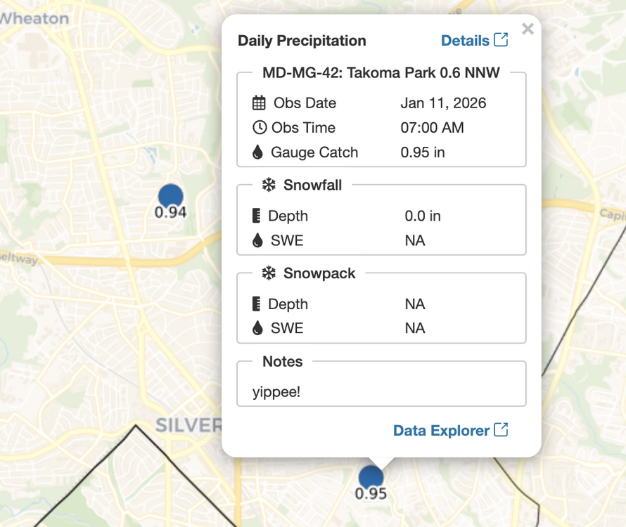
1.67", went outside this morning to let the dog out in rain and sleet
-
-
Lots to like in that overnight guidance. The Euro op has quite a bit of support as well. It’s been a while since we’ve had a Manitoba Mauler. Just a little more digging south and west and boom!
-
It’s kind of cool that there’s so much uncertainty. Given the persistent weak solutions, I would have to think it will be weak. But sometimes these things have a way of returning to what they were showing initially. Probably the second system is going to be better. The CPC flagged that potential a couple of days ago and if it’s a swfe it’s probably a lot less complicated
-
i share the sentiments from the notes by my nearest cocorahs reporter.