All Activity
- Past hour
-
00z HRRR was good for big storm coverage in the DC Metro. 06z has backed off somewhat. 00z was putting it all in one big hit 3-7pm. 06z has sct storms in the area around 5pm, then good coverage e-cntrl and sern VA, then a second decent area coming from the PA border spreading SE 8pm-midnight. 00Z RRFS crushes DC metro at 5pm. 06z was a little less impressive but still solid. It does have the best storms in the RIC area. The MCS that moves from OH overnight to WV and wrn VA by noon appears to weaken enough and far enough away, so by peak heating, we should be ok in the much of the DMV. The best winds at 500 and 250 are S of the DC Metro, so I see why 5% tor risk is in sern VA. The NAM has excellent 925 and 850 winds in the DC Metro w/ nice curved hodographs, but the RRFS is less impressive and the GFS/ECWMF as well. Again, best winds fields are S and SE closer to the NC border.
-
In SPC's defense, they did have 2% tor risk for the area, and there was only one tor in WI. And at an atypical time of day, before noon CDT! Intense tornadoes in the morning are rather uncommon. It was not synoptically-evident event, but you do not need that for a significant tornado to occur. Sometimes it all works out on a very local scale. Storms deviate more to the right, ride along a warm front/boundary, storm mergers, etc. that can quickly escalate the situation and give you a high-end tornado event. Case in point - 5/25/2016 ern KS. Large area of sight risk and 2% tor area. A long-tracked EF4 occurred at Chapman KS. It is the #1 tornado chase for many chasers who were on it due to its slow movement, visibility, and structure. It avoided populated areas and no fatalities or injures, so it did not get much attention. That supercell that produced it was it for the state that day. See here: https://www.weather.gov/top/longtracktornadohitsnorthcentralks Plainfield IL in Aug 1990 and Jarrell TX in May 1997 are two other classic examples. 8/24/2016, 22 tors in IN/OH in a small cluster, and quite a surprise! https://www.spc.noaa.gov/climo/reports/160824_rpts.html And then we have 6/5/2024 here, 2% tor risk, and we ended up w/ 13 tors! That caught many by surprise. Warm fronts can be sneaky! Isolated intense tornadoes or local outbreaks can occur at times when it does not look impressive overall synoptically or even on the mesoscale hours before the event. It is not common, but law of averages and large numbers guarantees this will happen every so often.
- Today
-
 I appreciate you input and response! My point is that 102 there is not the same as 102 in New England b/c the mean temps in the summer are significantly higher in this part of the county, so they are more used to 100 deg temps, so not as impactful net-net. It all relative to the normal climate. 102 in MLS is like 95 in BOS (dry bulb temp). Also, when they hit 102 on 7/26, dew points were in the mid 30s, so that gave a max heat index of 96, so that's a lot closer to their avg high, and this from a human impact standpoint, is that not better? But the media ignores this. Heat index is only mentioned when it is higher than the air temp. MLS POR is 1937 to present, at least for continuous records for monthly averages, so that removes a significant part of the very hot 1930s as to reference the hottest Julys, so although it has hot periods in recent decades, it is not likely as impressive as it seems given the POR. Yes it is still hot, but we need to adjust for climate of the location and the dew points present. It needs to be scaled. Again, going back to the E Coast media bias, they do not take this into account when reporting. They think 90 is "hot" everywhere. I've seen before, "oh it was so hot in DFW today w/ high of 95!", and their normal high in July is 97. See the problem here? The have no context or perspective. Facts are meaningless w/o context. To them it is all just one "furnace" that will end things.
 -
Spc has d1 slight risk out with also marginal for eastern middle and east tn Cumberland plateau parts of i65 corridor for 5-15% wind and 5% hail no 2% tornado threat .
-

2026-2027 Super El Nino
Jebman replied to Stormchaserchuck1's topic in Weather Forecasting and Discussion
Are you saying the Nino will hit 12 C ? if so I am just elated! That should ROID up that STJ so much that Texas will resemble Waterworld in places!!! There is nothing in this world that gladdens my heart more, than watching that water level rise from a flood! Watching water levels rise in Ft Myers Beach from Ian truly gladdened my heart. I have watched this shweet vid probably hundreds of times! I LOVE storm surge!!! The transformation between 1:00:00 and 1:30:00 was so fascinating! I loved this ENTIRE VID! I am absolutely IN SUBLIME LOVE with the STORM SURGE! -
 I will say as a proud member of the dew crew that those few days when that wildfire smoke mixed with haze from Canada overtook us, the air had to be the most soupy and stagnant it’s been all season, at least around here. I remember going outside on one of those days to work on the garden and my face was drenched with sweat after just 15 minutes. Maybe we can squeak out one or two more stretches of full body stankness before the seasons through.
 -
Tomorrow looks more promising for widespread showers/storms.
-
Long term, Denver averages 2" in July and 1.7" in August. So I'd say for this area anyway, on average it peaks second half of July and is often basically over by second half of August. That being said, there have been many times where August has been much wetter than July (2022 is the only real recent example, but quite a few further back). We are badly due for a very wet August for the region...the last one was 2008. Of course, we had the wettest September and month ever in 2013, which was due to unusually late monsoonal activity.
-
 online pharmacy india: LifeAccess Pharmacy - legitimate online pharmacies india
 -
Dew has dropped to 72 here now. Just stepped out and it's amazing how much better a 72 degree dew feels compared to an 82 degree dew.
-

2026 Mid-Atlantic Severe Storm General Discussion
high risk replied to Kmlwx's topic in Mid Atlantic
The evening cams don't fully sort out the details, but if we look for some modest consensus, the morning MCS threat for most of us has decreased a lot. And the severe threat ramps up quickly after lunch. Even if some cloud cover reduces the heating, I don't think that's a big deal unless we stay really cool. Full heating is not critical to this event, because we have forcing and good shear. Some solutions still screw us in terms of coverage and rainfall, but again, I'm looking for some sort of consensus, and the screw outcomes are on the table but seemingly less likely. Oh, and there is case to be made for including a corridor bounding roughly Rocky Mount, NC to Harrisburg to Trenton and all points to the east with a tornado threat (5%). SPC might keep our local area in a 2, but a 5 would be justifiable, as some solutions keep the sfc low just to our west or northwest with modestly increasing low level flow during the afternoon beneath strengthening west-northwest mid-level flow..- 1,499 replies
-
- 4
-

-
- severe
- thunderstorms
- (and 7 more)
-
2% tornado risks in our area this year are the scariest things known to man, this is like the 4th time its happened.
-
It probably happens a lot more often. All I know is that there was no weathergami today.
-
 NAM 3KM washes away the Catskills.
 -
DCA hit 90F.
-
Looks like it is heading right for you. HRRR still doesn’t have it.
-
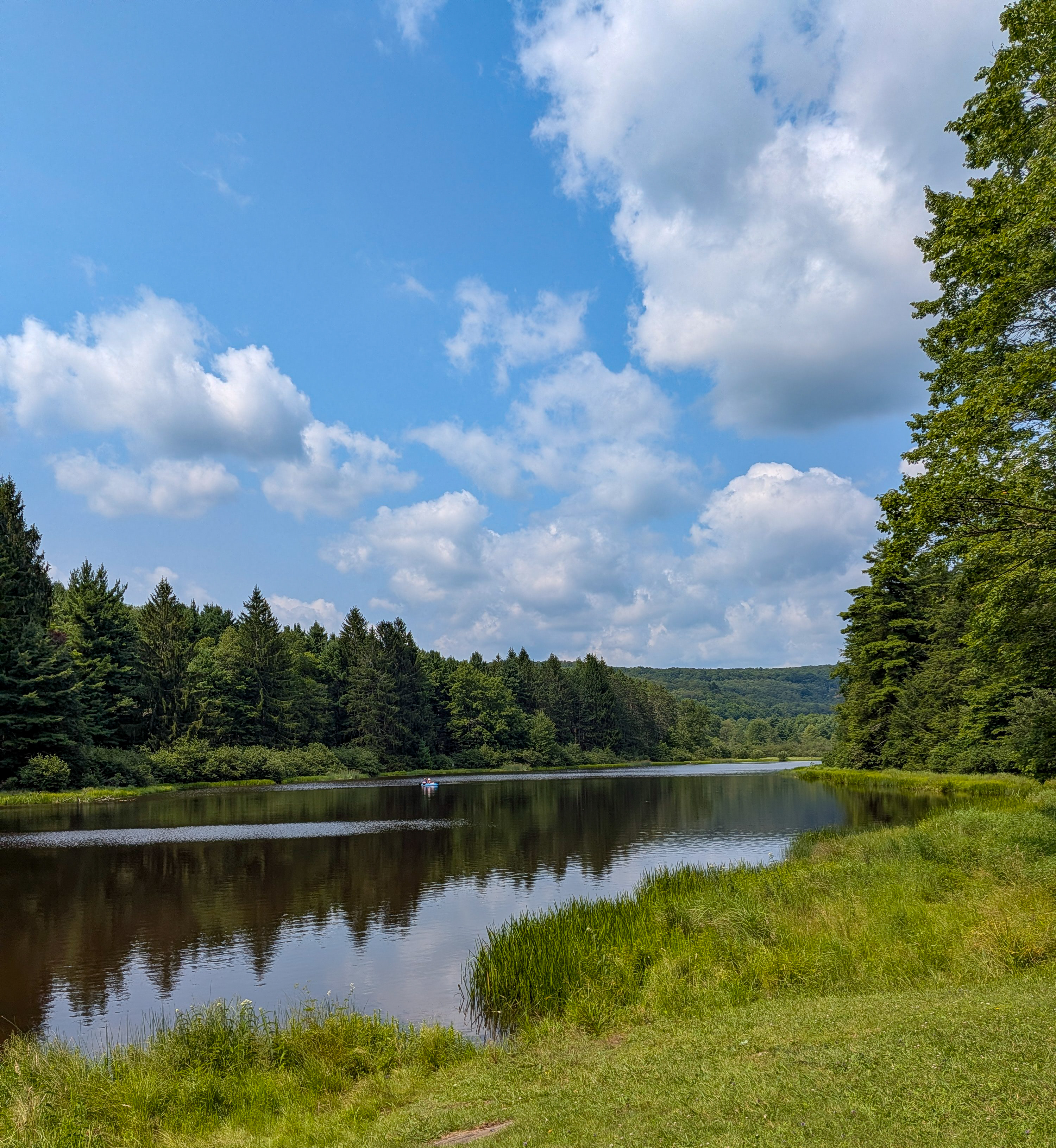
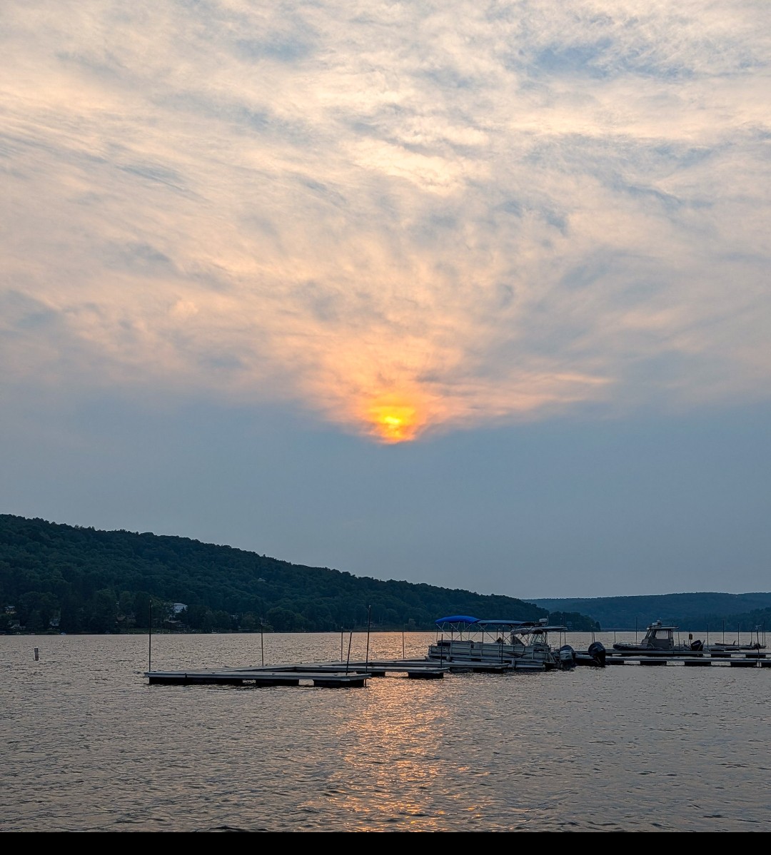
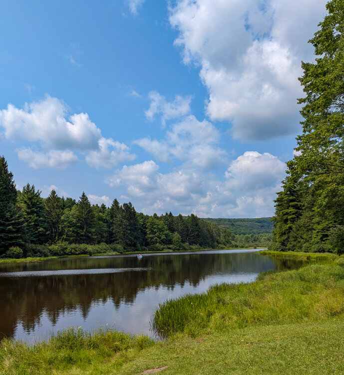
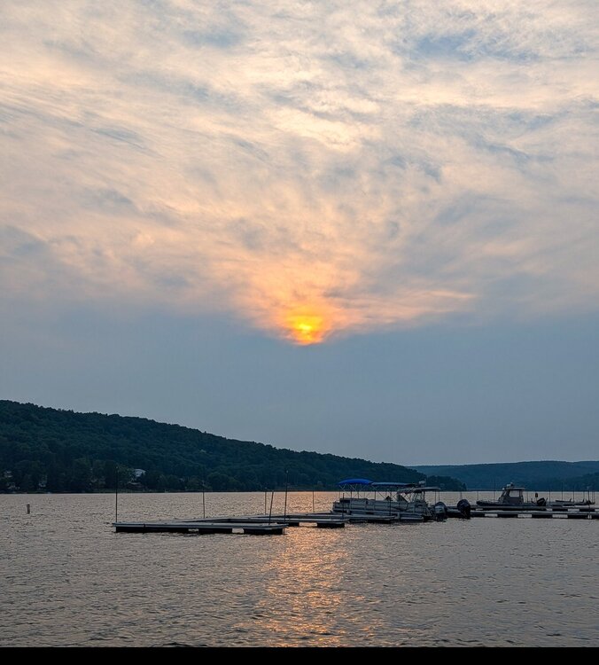
Beautiful day in Western Maryland with temps in the upper 70s/low 80s. I can see why people come up here in the summer! New Germany State Park Last bit of sun before it was hidden by the clouds over Deep Creek Lake
-
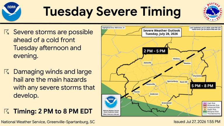
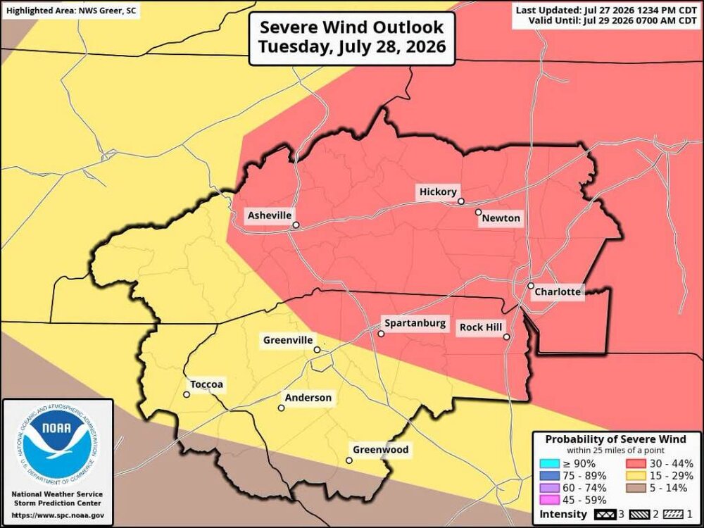
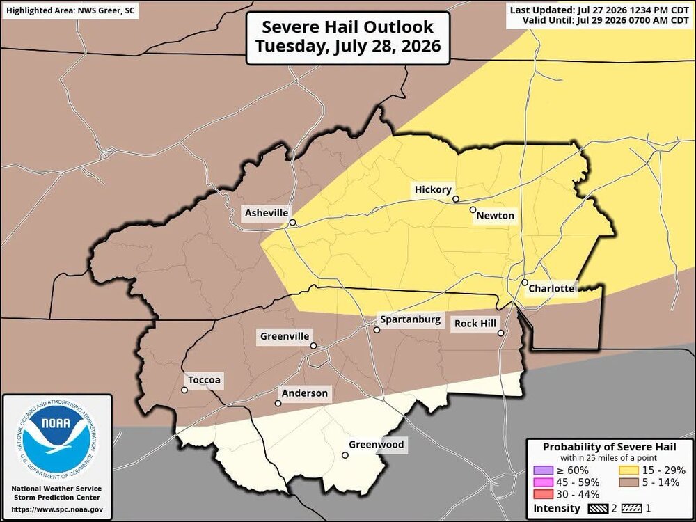
Hopefully some big time storms tomorrow. Sent from my SM-G998U using Tapatalk
-
Yeah last Winter we had something like the 4th longest streak since the 1800s where Baltimore had >6" on the ground (22 days or something). I love that - 8" of snow and 3" of ice on top there for almost a whole month of the Winter! That storm was really anomalous to the overall pattern last Winter. I'm glad it was timed at the beginning of the pattern.
-
 Meanwhile Nam will stein western CT. I’ll toss that.
 -
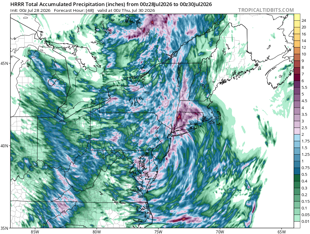
 Another convective round to go in eastern areas. Healthy run.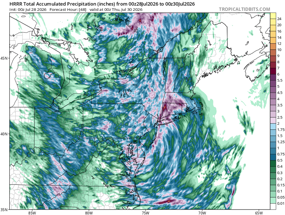
-

2026-2027 Super El Nino
snowman19 replied to Stormchaserchuck1's topic in Weather Forecasting and Discussion
IMO we ain’t seen nothing yet. Once this massive WWB and DWKW do their dirty work over the next month or so, I think we pop +12C subsurface anomalies in the EPAC -
Gonna setup a gravy train further east at the end of jts run. That depiction makes sense overall on HRRR.
-
Yeah it was fairly localized
-

2026-2027 Super El Nino
40/70 Benchmark replied to Stormchaserchuck1's topic in Weather Forecasting and Discussion
Yes we can; it's gong to be positive. I'll bet you $500 right now- There is absolutely zero doubt in my mind. The PDO is another story, as that is much more nebulous.