All Activity
- Past hour
-
1.59”
-
Finished with 1.66 at my station
-
I got at least 3+ qpf. My pond was really low and now its overflowing.
-
 https://queticarerx.com/# secure medical online pharmacy
 -
Beats my .29" At least the growing season is pretty much ended.
-

E PA/NJ/DE Autumn 2026 Obs/Discussion
JTA66 replied to PhiEaglesfan712's topic in Philadelphia Region
Finished with 1.50”. I also heard a few cracks of thunder last night but was too zonked out to rollover and look at the time. -

October 2026 general discussion
Prismshine Productions replied to Typhoon Tip's topic in New England
[emoji102] Sent from my SM-S176V using Tapatalk -

2026-2027 Record-breaking El Nino
LakePaste25 replied to Stormchaserchuck1's topic in Weather Forecasting and Discussion
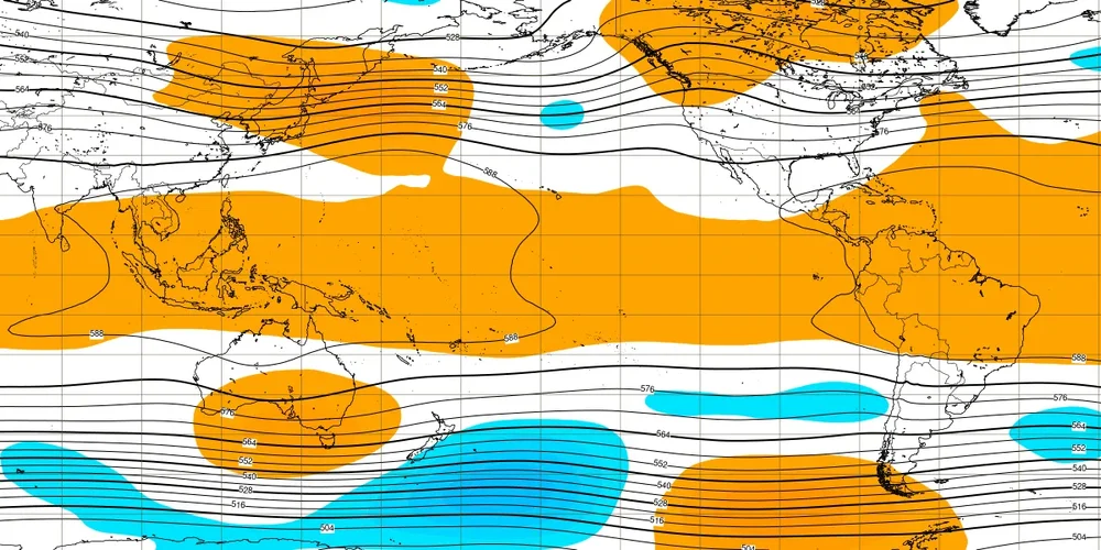
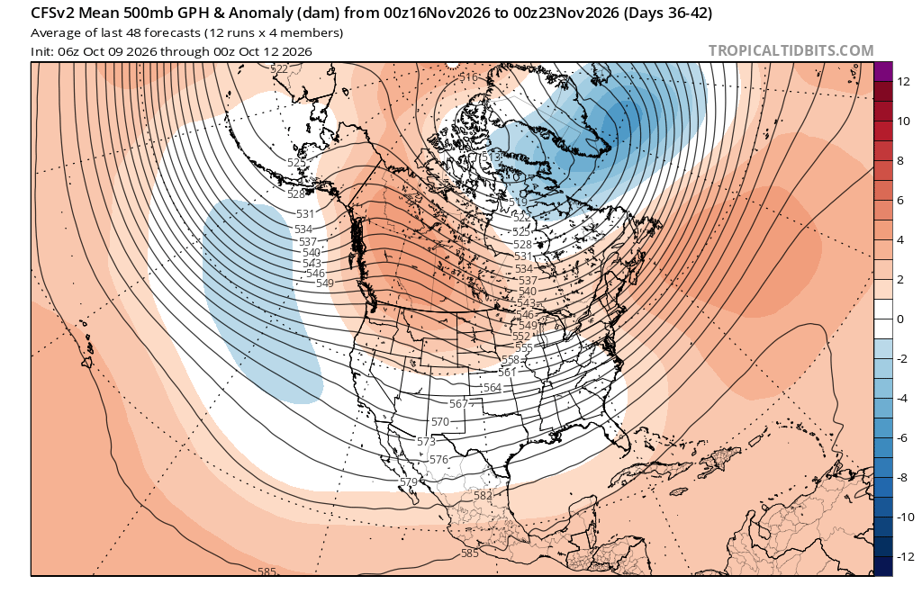
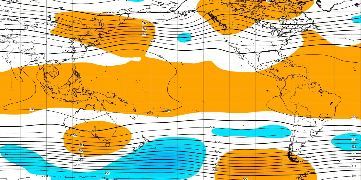
Way out there but the sub seasonals begin to show more of a cool season Nino H5 pattern in November.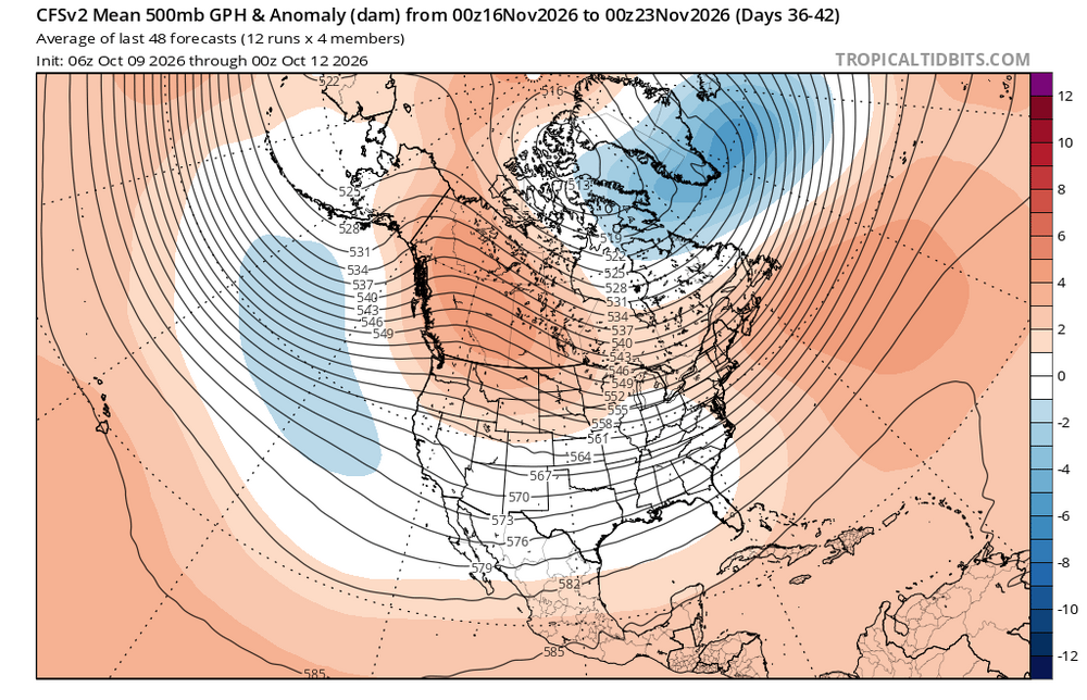
-

E PA/NJ/DE Autumn 2026 Obs/Discussion
MGorse replied to PhiEaglesfan712's topic in Philadelphia Region
Well then, event total of 3.67 inches. More than I was expecting! -
Thanks! I got about another 0.4 overnight and water is stilllll sitting on one end of my new garden bed. That's gonna be a problem. About 1.8 total here.
-
Finished with 2.21" Heard some thunder as well last night.
-
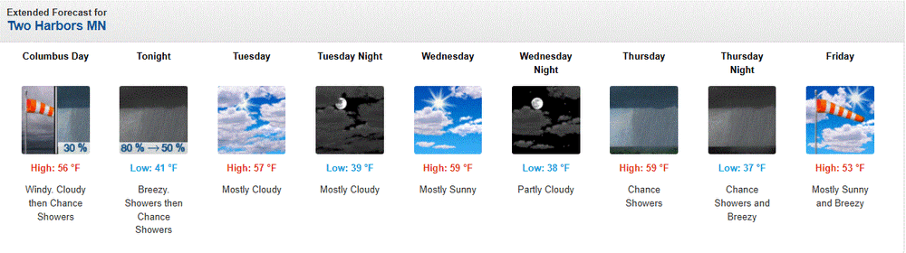
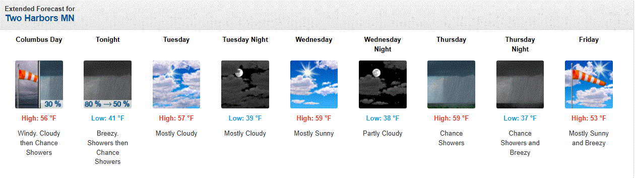
Back to reality. Highs in the 50's with a stiff Lake breeze. Rain possible later.
-
October 12 1969: Snow accumulates in several locations. Minneapolis receives 2 inches, while St. Cloud records 3.6 inches, Redwood Falls gets 1.7 inches, and Springfield records 1.5 inches. 1918: Dry fall weather sets the stage for dangerous fires. Several fires roar through large areas of Carlton and St. Louis Counties. The towns of Cloquet, Moose Lake and Brookston are the hardest hit. The Carlton County Vidette calls it a 'Hurricane of burning leaves and smoke'. At least 453 fatalities are reported, and possibly as many as 1,000 occurred. Over 11,000 people would be left homeless. For Monday, October 12, 2026 1836 - A third early season storm produced heavy snow in the northeastern U.S. Bridgewater NY received 18 inches, a foot of snow fell at Madison NY, and for the third time all the mountains of the northeastern U.S. were whitened. (David Ludlum) 1918 - Forest fires ravaged parts of Minnesota from the Duluth area northeastward, claiming the lives of 600 persons. Smoke with a smell of burnt wood spread to Albany NY and Washington D.C. in 24 hours. Smoke was noted at Charleston SC on the 14th, and by the 15th was reported in northeastern Texas. (David Ludlum) (The Weather Channel) 1962 - The "Columbus Day Big Blow" occurred in the Pacific Northwest. It was probably the most damaging windstorm of record west of the Cascade Mountains. Winds reached hurricane force, with gusts above 100 mph. More than 3.5 billion board feet of timber were blown down, and communications were severely disrupted due to downed power lines. The storm claimed 48 lives, and caused 210 million dollars damage. (David Ludlum) 1987 - Floyd, the only hurricane to make landfall the entire season, moved across the Florida Keys. Floyd produced wind gusts to 59 mph at Duck Key, and up to nine inches of rain in southern Florida. Sixteen cities in the Ohio Valley and the Middle Mississippi Valley reported record low temperatures for the date. Record lows included 27 degrees at Paducah KY, and 24 degrees at Rockford IL and Springfield IL. (The National Weather Summary) (Storm Data) 1988 - Twenty cities in the Upper Midwest reported record low temperatures for the date, including International Falls MN with a reading of 17 degrees. The town of Embarass MN reported a morning low of 8 degrees. Snow showers in the northeastern U.S. produced five inches at Corry PA. (The National Weather Summary) (Storm Data) 1989 - Temperatures again warmed into the 80s in the Central Plains Region and the Middle Mississippi Valley, with 90s in the south central U.S. Six cities reported record high temperatures for the date, including Fort Smith AR with a reading of 92 degrees. Strong winds along a cold front crossing the Great Lakes Region and the Ohio Valley gusted to 61 mph at Johnstown PA. (The National Weather Summary) Observances: 12 Mon Columbus Day (Most regions) 12 Mon National Savings Day 12 Mon World Arthritis Day 12 Mon Native Americans' Day 12 Mon National Farmers Day 12 Mon Indigenous Resistance Day 12 Mon International: Day of respect for cultural diversity 12 Mon Farmers Day 12 Mon National Freethought Day 12 Mon National Gumbo Day 12 Mon National Pulled Pork Day 12 Mon National Vermont Day
-
.91 overnight for a total of 3.74 That was about 14% of my yearly total to date.
-
2.05" total. Great soaking rain.
-
Storm total of 1.52” in Syosset & 1.48” in Muttontown.
-
First freeze potential for IAD on Sunday morning and first frost for many 'burbs.
-
.50" today. 2.24" total
-
For the valley BAF 2.04, CEF 1.84.
-
Well is getting slow to fill here again. Soil moisture sensor is 37cb which is getting a little dry for the subsurface…even after 1/3” of rain. Usually that value is dropping (getting more moist) as the soil temp steps down in the fall. As usual we get the crumbs to SNE’s feast.
-
Imby/Columbia 2.29” for Sunday’s event.
-

Central PA Autumn 2026
Mount Joy Snowman replied to canderson's topic in Upstate New York/Pennsylvania
Low of 56 with “only” 2.36” of rain. Looks like a few nice warm days upcoming. -
Another 0.40 overnight....Total 2.20"
-
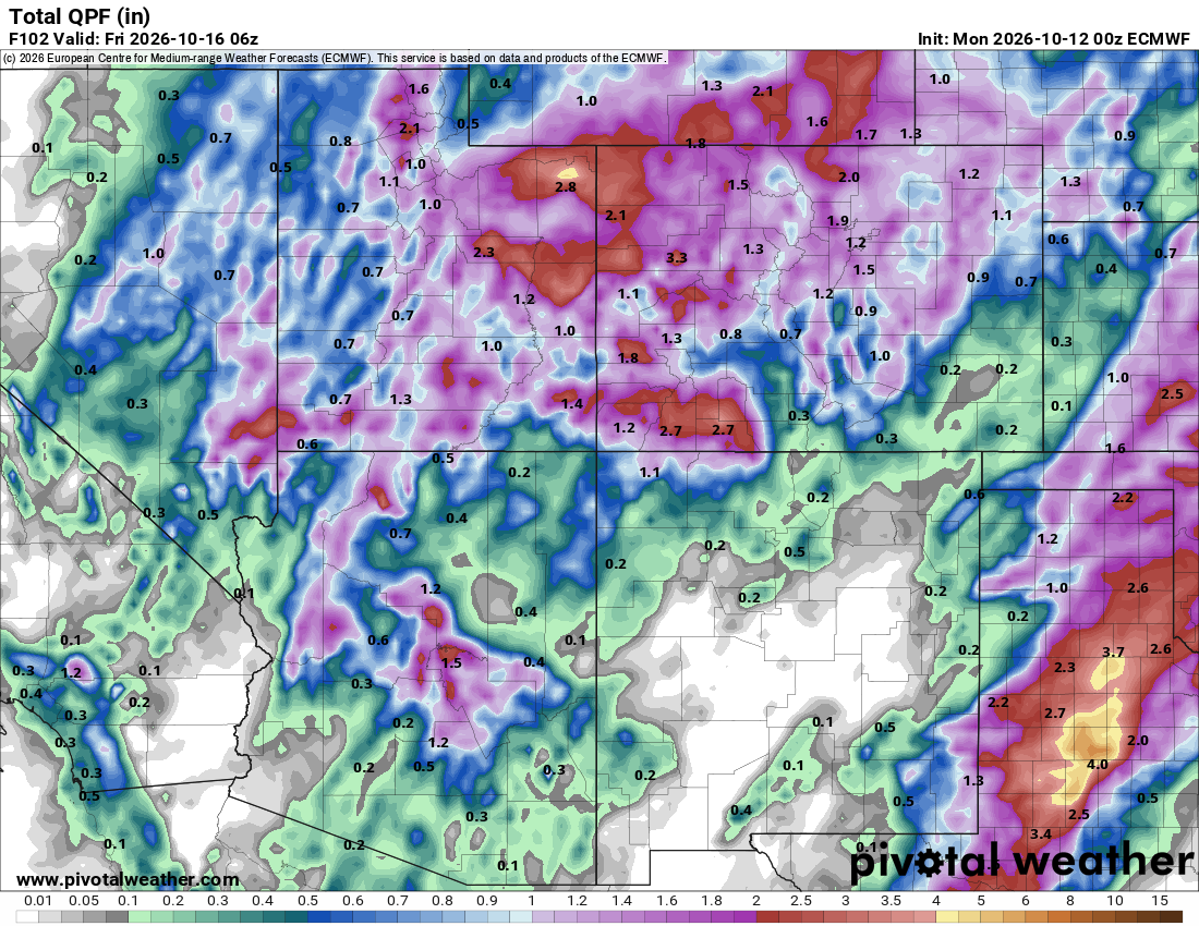
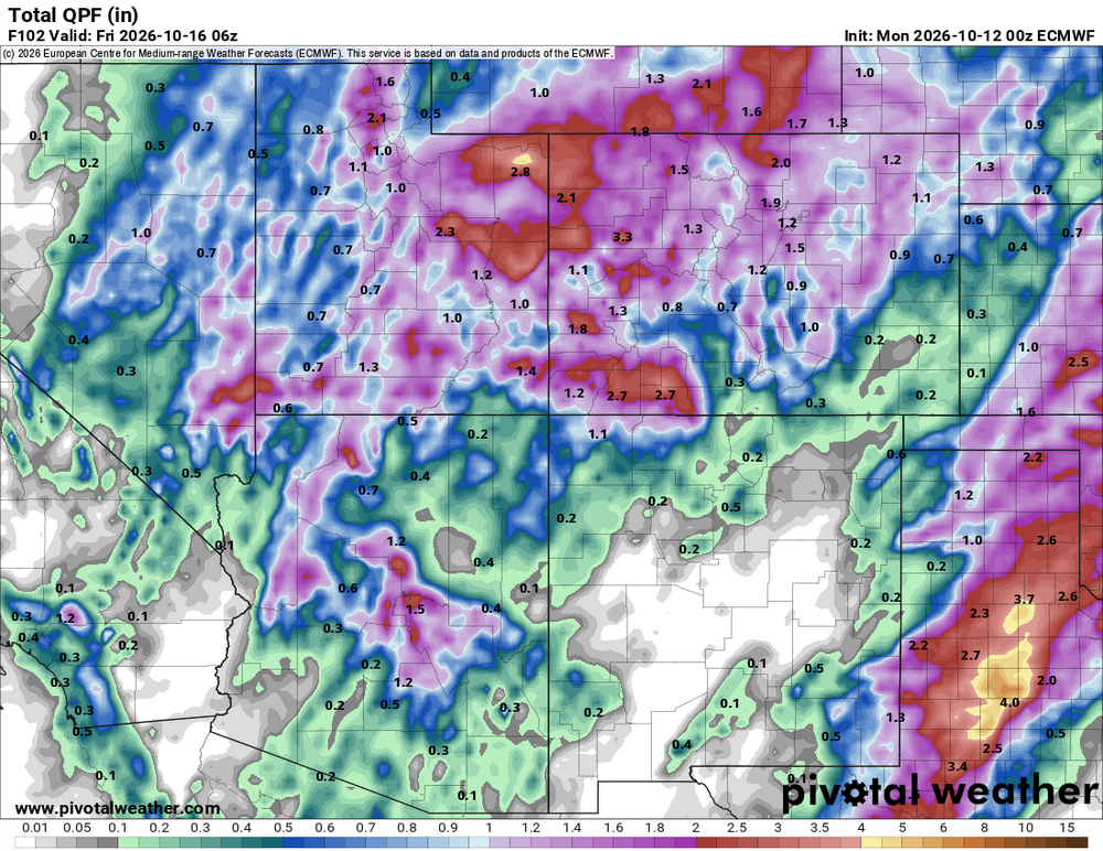
Wed/Thu looks like the first regional soaker in quite awhile.
-
Total event = 1.80 Sunday + 0.40 overnight = 2.20"










.thumb.JPG.418e8a9a2902ae687ec35ff4bc0e038e.JPG)