All Activity
- Past hour
-

2025-2026 ENSO
40/70 Benchmark replied to 40/70 Benchmark's topic in Weather Forecasting and Discussion
Yea, I think once we get beyond 2026, its becomes less hostile for -NAO, but +NAO still favored until we hit the min early next decade. The ascending portion of the cycle is best for -NAO. -
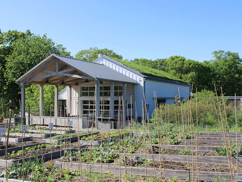
Was able to get a mow in
-
Tomorrow through much of Tuesday will be dry and pleasant days. Tempertures will generally top out in the lower 70s. Some showers are possible Tuesday night into Wednesday. The extended guidance has grown cooler for the second half of May than it had been. Both the CFSv2 and ECMWF weekly guidance are now in good agreement that the second half of the month could average near normal overall. The ENSO Region 1+2 anomaly was +0.1°C and the Region 3.4 anomaly was -0.1°C for the week centered around April 30. For the past six weeks, the ENSO Region 1+2 anomaly has averaged +0.68°C and the ENSO Region 3.4 anomaly has averaged -0.05°C. Neutral ENSO conditions will likely continue through at least early summer. Early indications are that summer 2025 will be warmer than normal in the New York City and Philadelphia areas. The potential exists for a much warmer than normal summer (more than 1° above normal). The SOI was -16.68 today. The preliminary Arctic Oscillation (AO) was +1.412 today. Based on sensitivity analysis applied to the latest guidance, there is an implied near 78% probability that New York City will have a warmer than normal May (1991-2020 normal). May will likely finish with a mean temperature near 65.8° (2.6° above normal). That would tie 2025 with 1975 as the 10th warmest May on record.
-
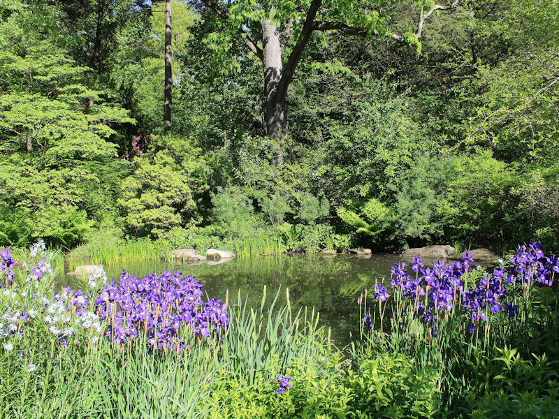
After a morning low of 50°, NYC topped out at a sunny 71°. Even as the rain washed down a lot of the blossoms at the New York Botanical Garden, there were still some picturesque scenes.

-
Forecasting with the desired vibes instead of models sometimes does work out. More often in the summer than winter, haha.
-
At times there’s too much model reliance and not enough forecast what actually should happen . Even AEMATT got some sun
- Today
-
Sun broke out up here too… I will say these evenings feel 10x better after two shitty days. Definitely enjoy the last couple hours of daylight outside today. I was wrong too. The models 48 hours ago were lingering the system much later. Definitely leaned nicer on the fringes as we got closer.
-

E PA/NJ/DE Spring 2025 Obs/Discussion
MGorse replied to PhiEaglesfan712's topic in Philadelphia Region
Ended up with a whopping 0.16 inches of rain yesterday. Unreal! -
you new to spring in chicago?
-
Beautiful day. 75 was the high and th breeze made it feel cooler. Next weekend looks like summer hits hard with humidity.
-
KFS knew.
-
I mean what an evening . He never acknowledges all the times KFS forecasts well
-
Hopefully Scooter does the right thing and hands his degree over to you.
-
63 was the high here at 1k. I was off by 2 degrees so missed that a bit I’ll let you all be the judge .. who had the better Tolland forecast today ?
-
We have been due for a crappy Memorial Day weekend. Looking more likely now.
-
Last week at this time looked like 80s this upcoming week, reality is clouds and rain
-
Woke up to 57 this am. Beautiful day here with a high of 78.
-
Funny, had almost the opposite. .98 this time, .28 last storm
-
The last "event" was one of the biggest short term busts in recent memory. Forecast rainfall totals here before last minute adjustments as the event was unfolding: 1-1.5" Total rainfall here: 0.05" Luckily prior events performed/overperformed and got my area out of the drought. Really need a solid inch of rain now though as it has gotten pretty dry again.
-
Next Friday into the weekend looks intriguing per afternoon AFD from LWX After a short reprieve, the system later in the week will have a lot more fuel to work with. As high temperatures on Friday are expected to rise into the mid/upper 80s (coupled with dew points approaching 70 degrees), instability should be plentiful. Some strong to severe thunderstorms are possible as this system tracks through on Friday into early next weekend. Details hopefully become more apparent in the next few days.
- 482 replies
-
- 2
-

-
- severe
- thunderstorms
- (and 2 more)
-
Afternoon AFD from LWX makes it sound good The upper low will continue to slowly drift northeastward from the Lower Mississippi Valley into the Tennessee Valley Monday into Monday night. As this occurs, showers will gradually overspread the area from southwest to northeast. As it stands now, most guidance holds precipitation off in the DC Metro until the late afternoon or early evening hours, with precipitation not starting until after dark Monday night around Baltimore. The rain may start to become steadier and moderate to locally heavy at times by late Monday night, especially across Central Virginia. By Monday night, model soundings show deep, saturated profiles, with very limited instability and precipitable water values closing in on 1.5 inches. The lack of instability should limit rainfall rates somewhat, with most of the rain falling as a steady, soaking rain as opposed to very heavy downpours that you`d typically see with a summer thunderstorm. Still, model guidance hints that rainfall totals may reach around 1-2 inches across Central Virginia by daybreak Tuesday, with more rain expected to fall Tuesday into at least Wednesday (see long term discussion below). && .LONG TERM /TUESDAY THROUGH SATURDAY/... A highly amplified and blocky synoptic pattern sets up for a majority of next week. The initial feature of interest is a slow moving closed low which is currently spinning over the Deep South. This deep and anomalous system is set to become more negatively- tilted in time while crossing the Tennessee Valley on Tuesday. Eventually this trough begins to evolve into more of an open wave as it treks toward the Mid-Atlantic region by mid-week. The slow forward motion of this particular system may not see the trough axis pass by until Thursday morning. At this point, the associated surface fronts exit into the coastal Atlantic as high pressure briefly returns. Mid/upper heights begin to build in earnest by late in the work week ahead of the next weather maker. What is currently a strong upper trough off the West Coast will undergo a complex evolution across the nation over the next several days. As expected, a large array of spread is noted across the board when evaluating all recent guidance. The overall pattern shift does favor unsettled conditions on Friday into portions of next weekend. Looking more closely at Tuesday into Wednesday, the mentioned closed low will tap into anomalous Gulf moisture. Characterized by anomalies around 1 to 1.5 standard deviations above normal, this system will interact with strong dynamics with the upper low to produce periods of moderate to heavy rainfall. Ensembles support around 2 to 3 inches of rain during a 24 to 48 hour period. Depending on how much of this falls at once, there will be some flood threat that emerges. However, this will depend on location and intensity of such showers.
-
Yeah, this afternoon/ early evening is really nice. Gets the drying out process going so hopefully fields will dry out for sports tomorrow.
-
The latest guidance takes the heaviest rain next week west of the B.R...............................
-
Can't wait to see how we get screwed again this time.
-
Sun peaking out. At last.


