All Activity
- Past hour
-

Saturday, July 18, 2026 Thunderstorm/Severe Weather Potential
LSC97wxnut replied to weatherwiz's topic in New England
Not sure which thread to put this in, but are the storms in New York all there is for today, or are those supposed to die off and we'll see more later? -

Saturday, July 18, 2026 Thunderstorm/Severe Weather Potential
WxWatcher007 replied to weatherwiz's topic in New England
Discrete this afternoon, the line this evening. -
Their meadow tea is amazing.
-
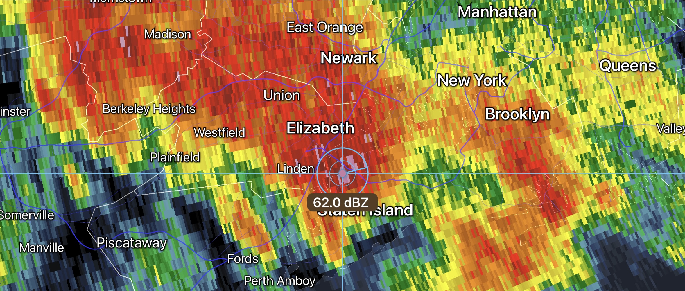
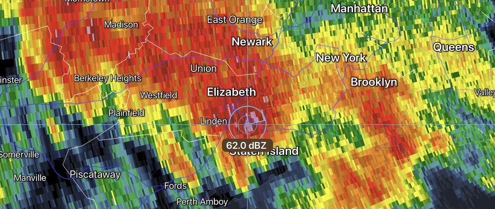
Flash flood threat NYC metro with this warm frontal training first round of convection. Some hail also beginning to show up. Tropical PWATS with this.
-
If this is the appetizer, can't wait for the entree
-

2026 Atlantic Hurricane Season
Windspeed replied to Stormchaserchuck1's topic in Tropical Headquarters
If nothing else, at least it is a feature to track and watch. There is nothing much to add beyond the most recent posts. Spot on. It's a mid-level system / pulsing MCS. Let's see if it will ramp up again this evening. We need persistent deep convection to drive inflow and get vorticity to resolve in the low levels. That happening out over the GOM sooner than later determines if we get get a TC or just beneficial rains to the upper peninsula. Again, it's something interesting to watch, and we may not get many of these this season. -
Nice morning for a bike ride. 0.22" this morning. 3.87" for the month.
-
That’s fair, I like to think most of us here understand how these discussions work but weenies may not. The clouds and smoke as mentioned will obviously help tell the story of what may or may not happen later.
-
@high risk could there be some differential heating boundaries later? I'm assuming that with the rain/storms in PA, the WF will not push as far north and increase risk for a few tornadoes?
- 1,060 replies
-
- 1
-

-
- severe
- thunderstorms
- (and 7 more)
-

Saturday, July 18, 2026 Thunderstorm/Severe Weather Potential
weatherwiz replied to weatherwiz's topic in New England
Definitely going to be interesting early evening, guidance increases instability just out ahead of the main activity moving in. If we can get upwards of 1500 J of MLCAPE to build in like some guidance shows there will be some wind damage for sure. Of course given the directional shear there would be the risk for a few tornadoes. Won't be getting much sun today but our instability is going to be coming from increasing dewpoints...if we get dews 73-74-75 in...watch out -
Make sure you check for ticks!
-
But why no watch for later yet?
-
Just wanted to clarify since some would assume it covered the entire days activities.
-
The steady rain in NE PA is drying up. All these things are great signs. Full steam ahead for mid to late afternoon.
-
You don’t say
-
Should be getting a MCD soon, probably in next hour
- 1,060 replies
-
- 1
-

-
- severe
- thunderstorms
- (and 7 more)
-
This is only regarding the morning threat.
-

2026 Mid-Atlantic Severe Storm General Discussion
batmanbrad replied to Kmlwx's topic in Mid Atlantic
visible does seem to show some decent clearing as you get west of MoCo...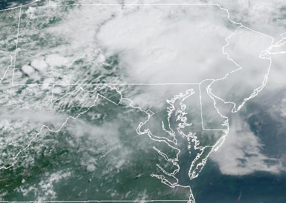
- 1,060 replies
-
- 2
-
-
- severe
- thunderstorms
- (and 7 more)
-

Central PA Summer 2026 Discussion/Obs Thread
canderson replied to Voyager's topic in Upstate New York/Pennsylvania
Heavy rain now -
Drive north where it’s pouring in Hershey. So we’re at Troegs until it stops haha
-
Had a heavy downpour with thunder in Carteret. In a lull now, just dark.
-
Looks like things are dying as they march east, which comes as no surprise for most of LI. Especially, along the south shore in western Suffolk.
-
Just lost power in Wantage. We didn’t even get a storm yet. We didn’t even lose power on July 3rd. We’re throwing a grad today. We already have it set up to be inside. But, no power already? Getting windy, though.
-
 Torrential downpours here with loud thunder and frequent lightning.
 -
Sky has brightened