All Activity
- Past hour
-
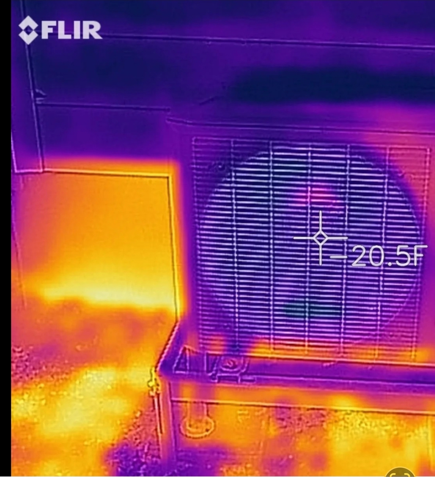
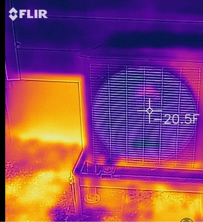
I think the last legit subzero cold shot here was back in Feb 23. I think it dropped to -5 here. I have been using heat pumps since 2016 and went out and took this infrared picture of my heat pump still pulling heat out of the air at -5.
-
Where's Lake Ontario? Is that in Canada? Lol
-
Hopefully a big ole heat dome sits over the lakes getting LAKE ONTARIO water nice and warm. I want that thing putting out dangerously intense snow bands by Dec 1 right over Barnes Corner. I've never rooted for a warm fall in my life until now lol
-
We'll hit 80s into November, and wager this is the year we hit 80 in December.
-
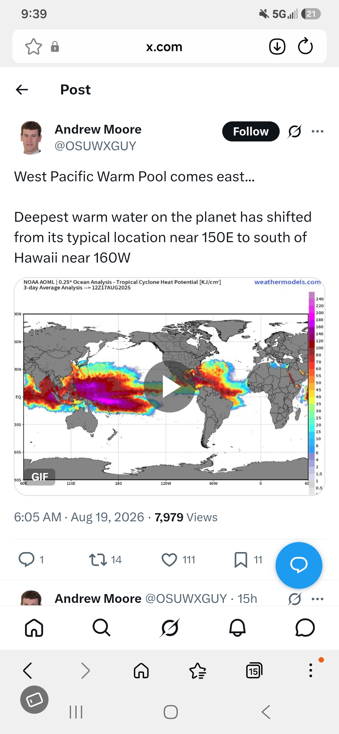
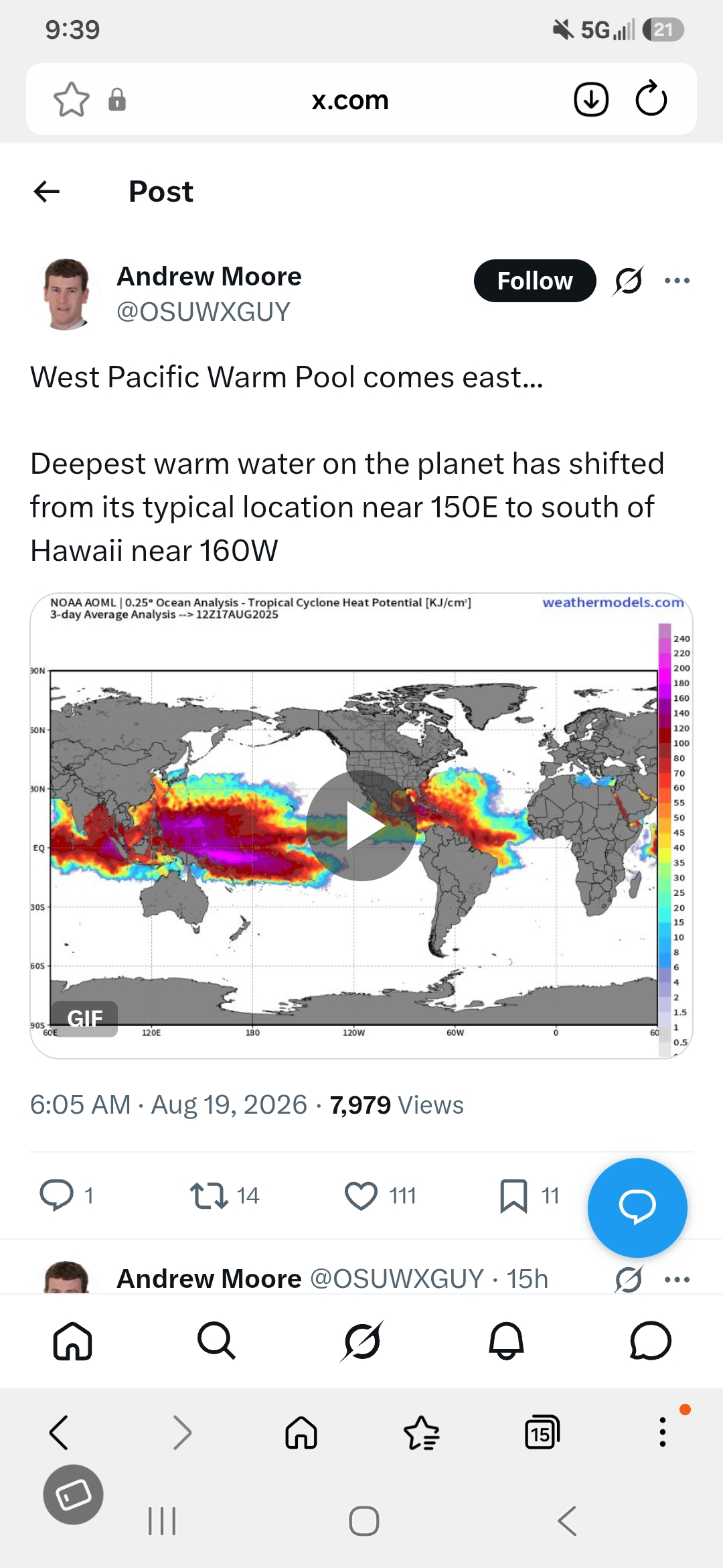
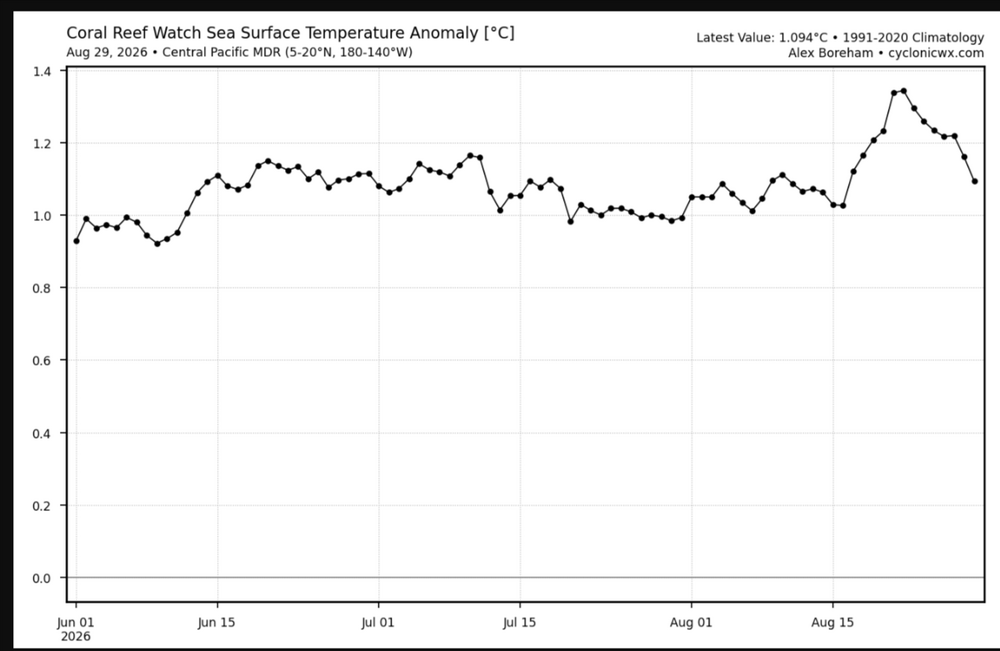
More than likely this was because of LaLa when it hit Hawaii
-
 where to get generic clomid without prescription: how to buy cheap clomid price - where can i get clomid without prescription
 -

Augdewst 2026: Summer's Last Stand
moneypitmike replied to Prismshine Productions's topic in New England
You know not of what you speak.I get more snow than ORH and have better retention. . -

2026-2027 Record-breaking El Nino
EasternLI replied to Stormchaserchuck1's topic in Weather Forecasting and Discussion
Yeah this pesky ridge east of Japan still being pesky. Not really any signs yet of it going away for the foreseeable future as of now. Interestingly, that seems to be a hallmark of a negative PDO during Sept. Meanwhile, the el nino during Sept would have you believe it should have some resistance or begin to fade away. That's a curious feature. Will be interesting to continue watching that. Want that to go away so we can get a recurving typhoon or two. -
https://x.com/TylerSebreezy/status/2094060893793300908 Tyler Sebree @TylerSebreezy 1h The latest NSSL machine-learning severe probabilities highlight the northwest flow pattern from the Midwest to the Great Lakes to the Mid-Atlantic this week. There will be some severe weather potential Monday through Thursday or Friday for these areas.
-
-
.thumb.gif.f92b16c631a1d15d405ed77b33f0710d.gif)
Monday, August 31 - Wednesday, September 2, 2026 Convective Episodes
Torch Tiger replied to weatherwiz's topic in New England
once we accepted there would be little rain and no storms, it's not too bad. Hopefully SW areas get rocked Tuesday -

2026-2027 Record-breaking El Nino
Terpeast replied to Stormchaserchuck1's topic in Weather Forecasting and Discussion
I’ve been thinking given how east based this super nino is so far, how will the marine heat wave off japan influence or interfere with the aleutian/GOA low? will upstream N Pac ridging further amplify the GOA low, pushing it further east and flooding the conus with mild air and cutting off cold air for everyone. Or might it destructively interfere with the aleutian/goa low, weakening it relative to what its strength should be with this nino’s strength - possibly pulling it west. Maybe both at different points in this winter? -

Augdewst 2026: Summer's Last Stand
dendrite replied to Prismshine Productions's topic in New England
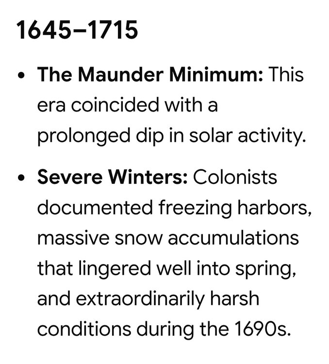
At least they had Lake Ontario then - Today
-
Augdewst 2026: Summer's Last Stand
dendrite replied to Prismshine Productions's topic in New England
Lots of witches back then…can’t trust the data. -
stromectol 15 mg [url=https://iverindia.com/#]Ever India Pharmacy[/url] and generic ivermectin
-
https://iverindia.shop/# ivermectin 50ml
-
-
We have homebrew potential in the Gulf as an area of low pressure has formed in the northern part of the region and is producing persistent disorganized convection. The NHC has taken note, and the odds of development have gradually risen to 30%. The key inhibitor here is time, although the guidance has pointed to a more modest development signal, this is likely to be onshore near the Texas/LA border in 48-72 hours. Generally speaking, however, the conditions do seem to be favorable with very warm SSTs (not thinking about OHC needed to sustain a strong system given proximity to land and timing) in the northern Gulf. There is dry air to its north, and that could also be an inhibiting factor, but so far that hasn't prevented consistent convection, which has been deep at times. The more consistent deep convection can be, the more likely we see eventual pressure falls and the tightening of the low pressure. However, should dry air make an intrusion it could disrupt any progress toward organization into a TC. Importantly, shear is low in the basin. In fact, it's basically the only place in the Atlantic that has a large enough area of low shear to have a meaningfully large enough window for development. That's consistent with my peak season forecast, but we'll see if it leads to another short lived TC here. Shear may be kept at bay, but the signal is a bit mixed on whether we see some southerly shear eventually develop. Overall, I think this is a legitimate homebrew opportunity for a weak tropical storm that would impact the northern Gulf coast in a couple of days. I think there's a good chance 97L has slightly increased odds and is an orange for the 2pm outlook. Northern Gulf of America (AL97): Showers and thunderstorms associated with an area of low pressure located about 125 miles south of the coast of southeastern Louisiana have become more concentrated. However, current surface observations indicate that the system has not yet strengthened. Slow development of this system is possible during the next couple of days as it drifts westward to west-northwestward across the northern Gulf. Interests along the Louisiana and Upper Texas coasts should monitor the progress of this system. * Formation chance through 48 hours...low...30 percent. * Formation chance through 7 days...low...30 percent. $$ Forecaster Beven
-

Central PA Summer 2026 Discussion/Obs Thread
mahantango#1 replied to Voyager's topic in Upstate New York/Pennsylvania
Let's see if it come to fruition. -

Monday, August 31 - Wednesday, September 2, 2026 Convective Episodes
Cyclone-68 replied to weatherwiz's topic in New England
Jesus….This summer blows like few others -
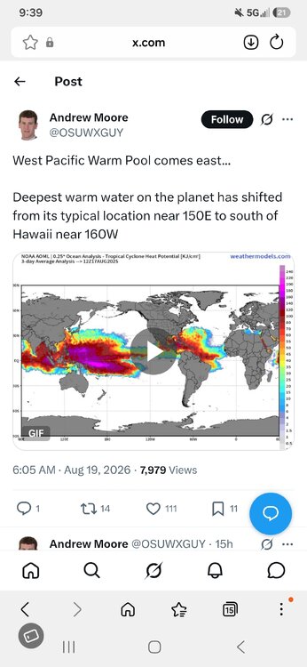
I hardly ever post in these forums, but I thought this was interesting.
-

Augdewst 2026: Summer's Last Stand
powderfreak replied to Prismshine Productions's topic in New England
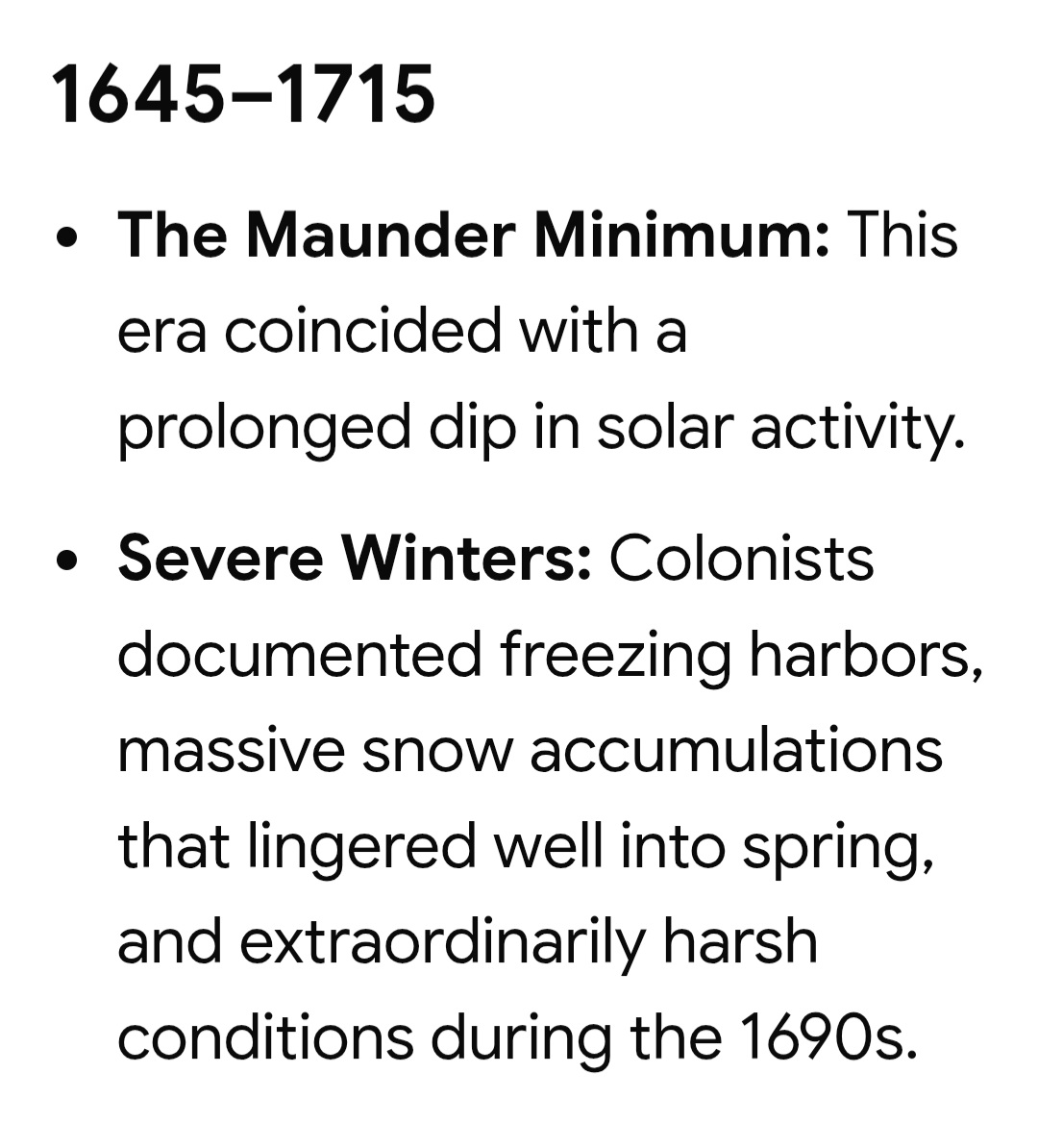
I bet everything about life was harsh in the 1690s too. -

2026-2027 Record-breaking El Nino
GaWx replied to Stormchaserchuck1's topic in Weather Forecasting and Discussion
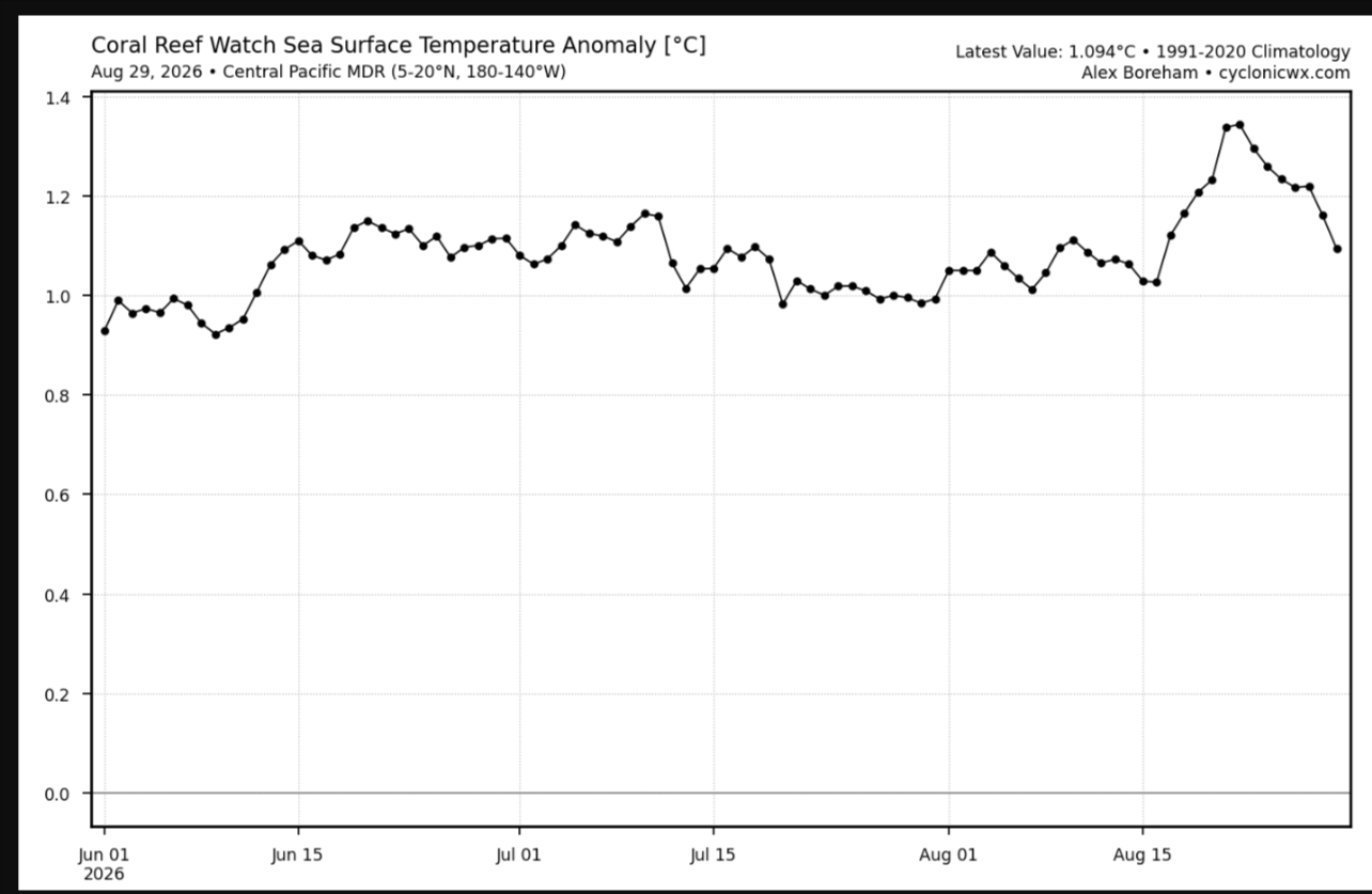
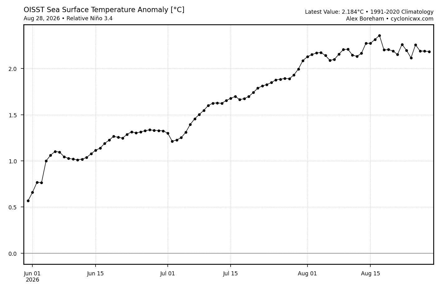
August overall was a notable bust for Nino 3.4 as several models had had a steep anomaly warming of a record breaking ~1C from July to Aug whereas the last 4 weeks have overall been net ~flat meaning a warming from July to August of only ~0.5C. Thus, the progged Nov peaks have recently been dropping on the CFS: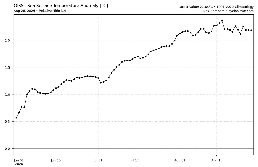
-
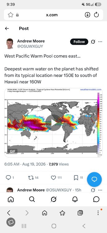
Jax, you seem pretty smart with weather stuff. I found this image interesting. What are your thoughts?
-
Yeah but, we already had elevated normals compared to 1645-1715. Run of the mill cold. Two can play this game...