All Activity
- Past hour
-

2026-2027 Strong/Super El Nino
Stormchaserchuck1 replied to Stormchaserchuck1's topic in Weather Forecasting and Discussion
Not even in Weak Nino threshold in almost mid May.. RONI has some ground to cover if this is going to be Super 57-58, +2.0 peak was +1.1 in May 65-66, +2.0 peak was +0.6 in May 72-73, +2.3 peak was +0.9 in May 82-83, +2.5 peak was +0.8 in May 91-92, +2.3 peak was +0.5 in May *closest analog 97-98, +2.4 peak was +1.0 in May 15-16, +2.4 peak was +0.8 in May -
2026-2027 Strong/Super El Nino
Stormchaserchuck1 replied to Stormchaserchuck1's topic in Weather Forecasting and Discussion
The 1895-1950 composite has some very warm Strong Nina Winter's. Since the dataset is somewhat small, flip that signal around for Strong Nino's unless it is based way more east... Here on the EC you don't call Strong La Nina's and Strong El Nino's both warm, if they are both based in Nino 3.4. People fall in the trap of looking solely at analogs, and imo this El Nino is developing a bit different (forcing west) vs previous Super Nino's. -
2026-2027 Strong/Super El Nino
Stormchaserchuck1 replied to Stormchaserchuck1's topic in Weather Forecasting and Discussion
I just don't know how reliable ENSO SST data from before 1948 is.. I know we kept a meticulous record of SOI though. Point is, I think this one is developing with ENSO forcing further west than the classic Strong Nino's of 72-73, 82-83, 97-98, so the corresponding pattern in the N. Pacific may be different - instead of so much NPH impact, there may be some movement of the PNA. It seems easy to call the temp composite warm because 6/6 Strong Nino's are, but besides the 80-85% chance that we have of having a +departure every month these days, I'm not so sure there is a warm signal in the mean for the East coast, US for the Winter, besides the +NAO probability (decadally and +2 years after Solar Max). -
.54” here in E CT, lawn is happy.
- Today
-
Yep. The predicted rainfall has basically crashed out now. If we get a tenth that will be lucky with how most model runs look at this point. At some point, el nino should take hold and rain should return.
-
Oh what could have been if winter didn't disappear and March and April in 1977. It was already a big snow year as it was, but it could have been even bigger if March and April didn't absolutely torch. More recently, there was a snow on May 9, 2020 (as well as a freeze on May 18, 2023). Those events happened after very warm and low snow winters.
-

2026-2027 Strong/Super El Nino
PhiEaglesfan712 replied to Stormchaserchuck1's topic in Weather Forecasting and Discussion
1998-99 was the first year of a double-year strong la nina. 1997-98 was the super el nino year, and yes, that one was a record low snow year. 1982-83 was a classic backloaded el nino winter, with the blizzard in February and late freeze/snow event on April 19-20. -
I got only ~0.08” last night and only ~.01” during the daytime today, both pretty disappointing vs expectations. MTD is ~1.3”, ~1.2” of which fell one week ago (5/2) with a nice soaking 18 hour rain.
-
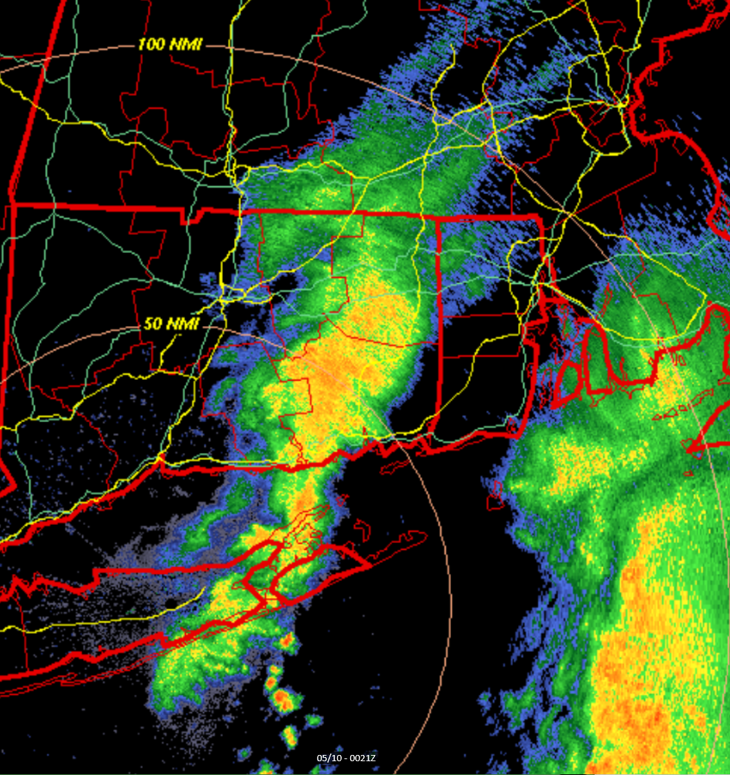
Tomorrow seems like it has potential for at least some storms of substance, even if not severe.
-
Nothing more soothing than a sunset nad knock.
-
.52 here. About what I expected. Nasty raw day and the clearing line as the sun was setting was a nice kick in the groin.
-
1.10” nice drink. Everything will stay nice and lush
-
Monday stein too. Lawn will be meh.
-
Half inch over the last few weeks. Webbed hands all over.
-
Drying up and Steined.
-
My place had like 10 min of thunder and some rain in between lots of sunshine
-
We bloom, we use snow messurement tools before harvest, and we arrange. Oh and we always dandy.


-
They’re simply not good. They should be good, or at least better, but they’re not.
-

Central PA Spring 2026 Discussion/Obs Thread
canderson replied to Voyager's topic in Upstate New York/Pennsylvania
Beautiful afternoon
-
.74 today and had .78 Wednesday . Drenched
-
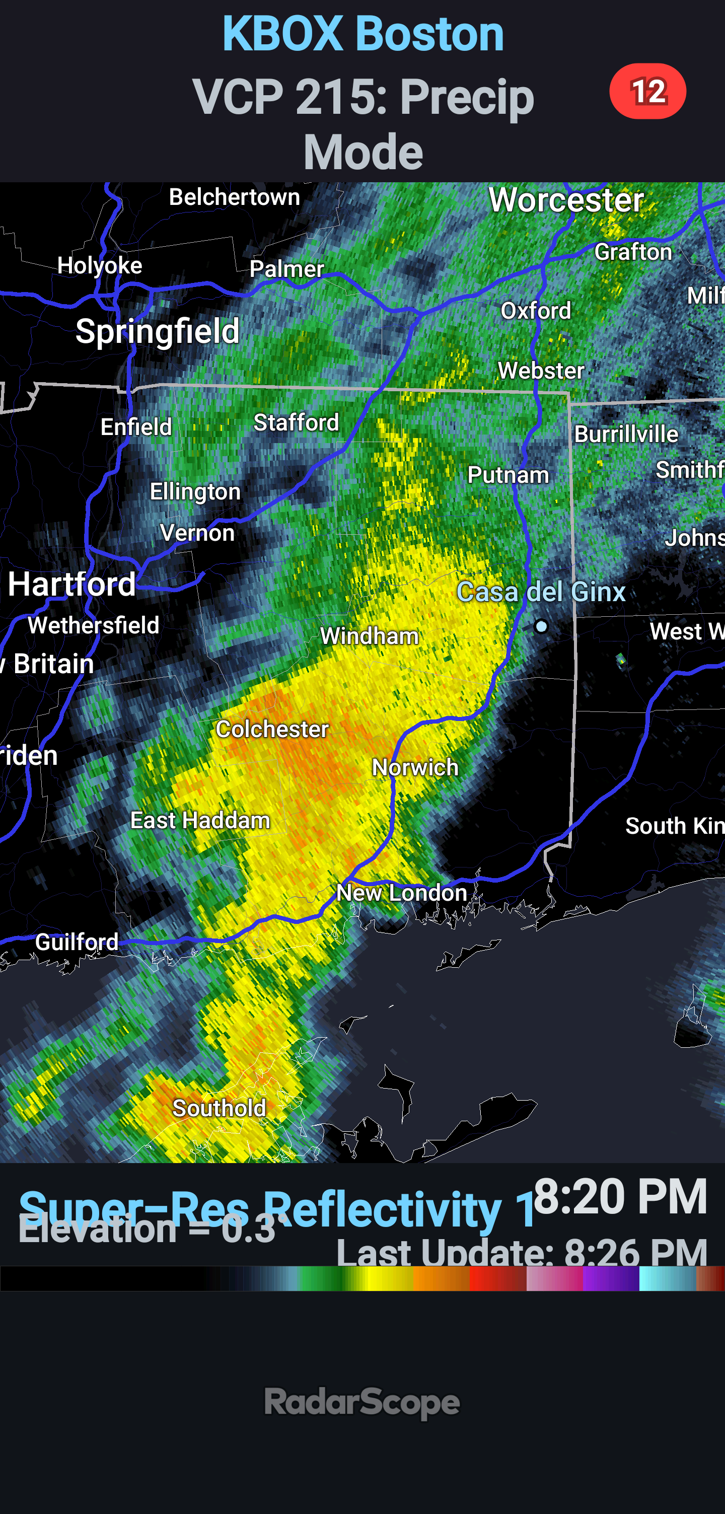
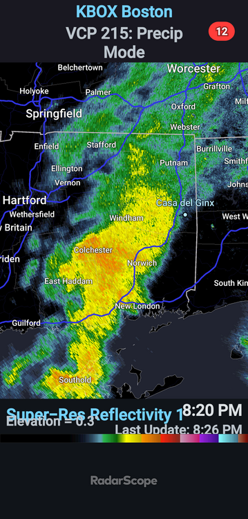
That’s moving NE right at S Wey
-
Ha ha ok
-
Cats n dogs

-
.54 and more to go.
-
He’s alive and well