All Activity
- Past hour
-
Interesting how the sea breeze at JFK seems to be keeping their vis way up vs other stations. Probably is clearing out that bottom 1500-2000ft
-

-
Mets at my work said we hit upper 400s for AQI around midday, shattering the old record for Madison (set during Smokeageddon '23). However my phone hasn't budged from the 156 it displayed early this morning, even after I rebooted it.
-

Texas 2026 Discussion/Observations
Stx_Thunder replied to Stx_Thunder's topic in Central/Western States
Lots of significant flood reports have been coming in from the Edwards Plateau region (west of SAT), since Tuesday. Especially in Uvalde county where lots of rivers/creeks are now at major flood stage and overflowing their banks. Del Rio radar storm totals are now over 2 feet in Uvalde county. The setup in this region is similar to the one that occurred around this same time last year in 2025 (except that it's not a tropical Low entity that was the remnants of TS Barry). -
They would blame Canada
-

E PA/NJ/DE Summer 2026 Obs/Discussion
BBasile replied to PhiEaglesfan712's topic in Philadelphia Region
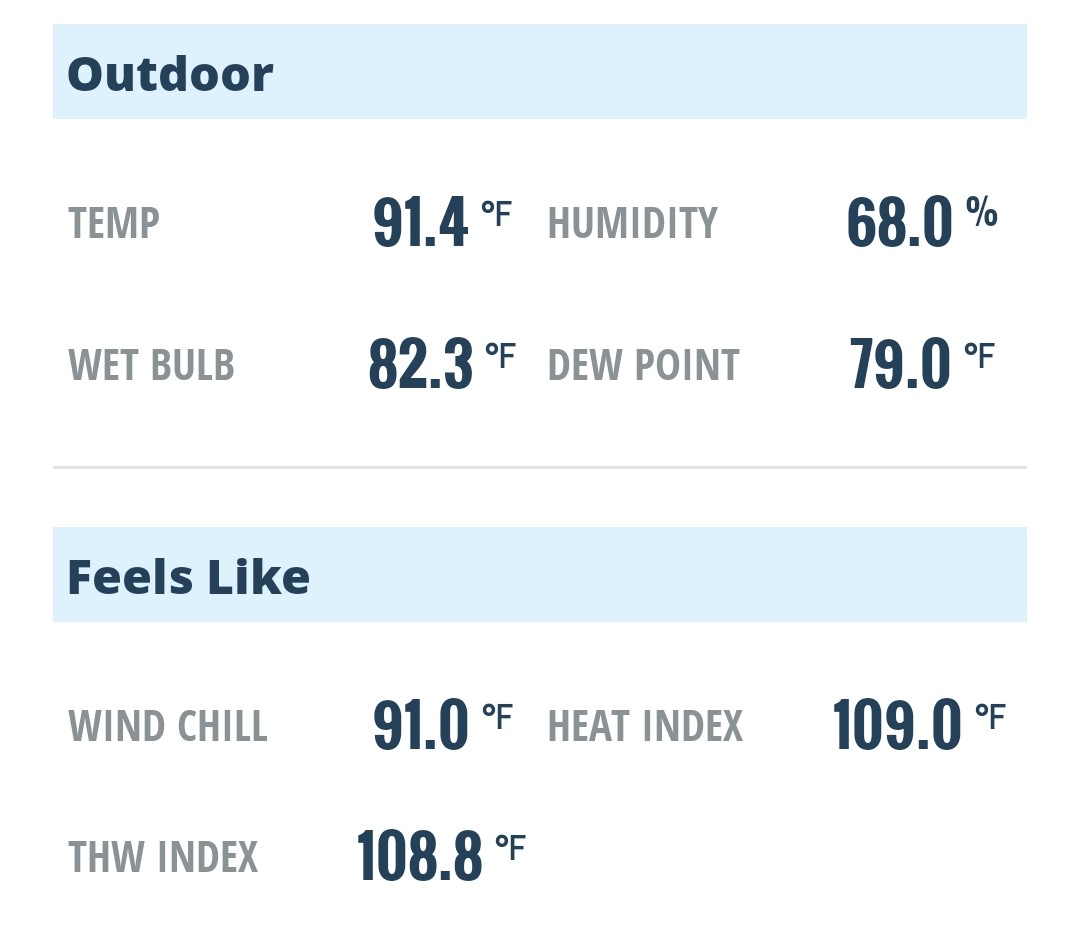
Basically identical to yesterday. Another 79F dew. Can smell the smoke today, though.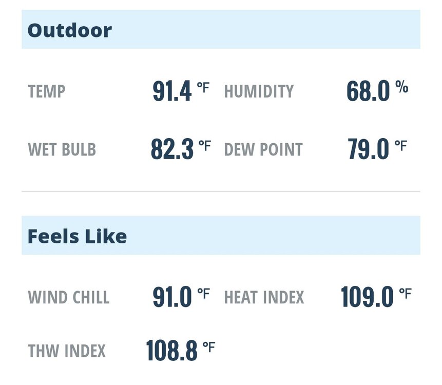
-
By Sunday the smoke is supposed to be gone.
-
E PA/NJ/DE Summer 2026 Obs/Discussion
BBasile replied to PhiEaglesfan712's topic in Philadelphia Region
You sure it's not your diet? -
 He moves in mysterious ways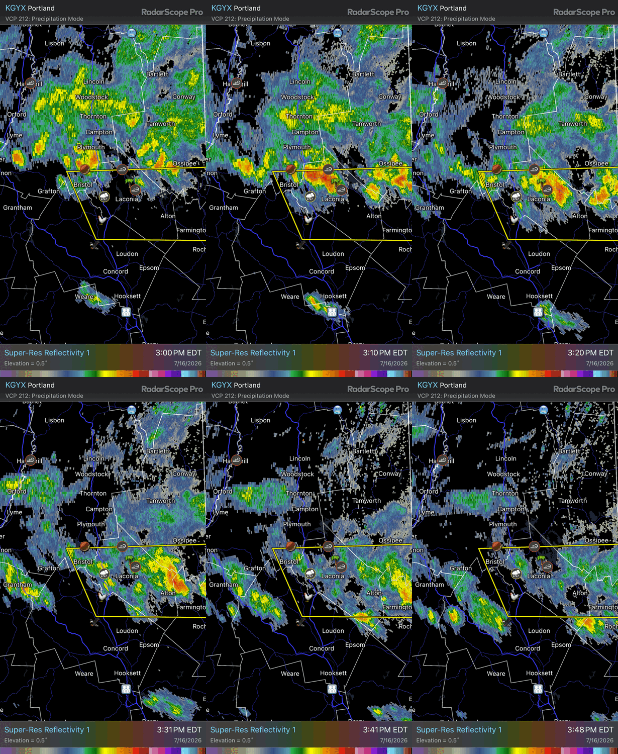
-
One of the candidates running for governor of mi is using the smoke as a platform to get votes. He promises if he is elected he will force Canada to take action and stop the fires from harming the lives of the people of mi.
-
hope it clears before the entire world sees messi and yamal struggling to breathe......of course messi doesn't do much running anyway.....
-
Rebooting https://weather.cod.edu/satrad/?parms=subregional-New_England-02-24-1-100-1&checked=map&colorbar=undefined
-
Yes
-

2026 Atlantic Hurricane Season
WxWatcher007 replied to Stormchaserchuck1's topic in Tropical Headquarters
Interesting given the ensembles look a little more active in the Gulf today. -
Has gotten much more hazy/smokey over the last hr. Appears to be at surface level now. From Lower Manhattan, Midtown is totally obscured.
-
Wind is roaring…I can hear trees falling in the woods from the run.
-
Updated afternoon Day 3 SPC disco Day 3 Convective Outlook NWS Storm Prediction Center Norman OK 0227 PM CDT Thu Jul 16 2026 Valid 181200Z - 191200Z ...THERE IS A SLIGHT RISK OF SEVERE THUNDERSTORMS FOR PARTS OF THE OHIO VALLEY AND LOWER GREAT LAKES INTO THE MID-ATLANTIC... ...SUMMARY... Strong to severe thunderstorms are expected across portions of the Ohio Valley and lower Great Lakes into the Mid-Atlantic, mainly Saturday afternoon into the evening. Some threat may linger into late Saturday night. ...Ohio Valley into the Mid Atlantic and vicinity... Some amplification of a mid/upper-level trough is expected over the northeastern CONUS on Saturday, as multiple shortwaves move through the base of the trough. The primary surface low is expected to deepen as it moves across southern Quebec toward northern Maine. A trailing cold front will move through parts of the Ohio Valley and Northeast. A remnant surface front initially draped from western PA toward the Delmarva region is forecast to lift northeastward as a warm front through the period. As deep-layer flow strengthens atop a richly moist and destabilizing warm sector, organized severe potential is expected to develop across a relatively broad region from the Ohio Valley into the Mid Atlantic, with at least an isolated threat potentially reaching parts of New England. Uncertainties include the influence of early-day convection and potential persistent smoke on the northeastward extent of substantial surface-based destabilization. Along the cold front, the greatest relative threat is currently expected from the lower Great Lakes into eastern parts of the Ohio Valley, where stronger 850-700 mb flow (around 25-40 kt) is forecast. Organized cells/clusters capable of damaging wind and isolated hail may evolve along/ahead of the front and spread eastward. Rich boundary-layer moisture and modest enhancement to low-level SRH may also result in some tornado threat, depending on storm-mode evolution. Favorable moisture/buoyancy will also extend westward along/ahead of the front into parts of the Midwest and lower Ohio Valley, but there may be more of a tendency for convection to be undercut by the front with westward extent. Farther south/east, organized convection may evolve or reintensify near the effective warm front by afternoon into parts of PA/NJ, and also develop into parts of MD/VA along/east of a surface trough. Very warm temperatures and steepening low-level lapse rates will become supportive of damaging-wind potential, and isolated hail may also occur. Some tornado threat could also evolve in closer proximity to the warm frontal zone. An extensive frontal QLCS may develop by evening, and continue to pose some wind-damage threat for as long as it persists into Saturday night.
- 1,020 replies
-
- 2
-

-
- severe
- thunderstorms
- (and 7 more)
-
 I am so ready to rip a squall line through Saturday night
 -
Close https://weather.cod.edu/satrad/?parms=regional-midwest-02-24-1-100-1&checked=map&colorbar=undefined
-

2026 Mid-Atlantic Severe Storm General Discussion
SnowenOutThere replied to Kmlwx's topic in Mid Atlantic
This is one of the more legitimate discussions we've gotten this year. Not too often large hail is mentioned so often for us. 3k NAM into the future has CAPE nearly reaching 5000 in ffx county as the first round of storms roll through. Has appreciable supercell/tor composite values thanks to the shear mentioned in the AFD and some turning with height alongside the directional stuff. As mentioned, even after it gets dark we stay with impressive CAPE values of 3000+! Question for our mets, but could the D-word get tossed around with that line of storms overnight?- 1,020 replies
-
- 3
-
-
- severe
- thunderstorms
- (and 7 more)
-
GOES East on COD's website has been up and running for a couple hours.
-

2026 Mid-Atlantic Severe Storm General Discussion
biodhokie replied to Kmlwx's topic in Mid Atlantic
Depends on how you prompt the AI and what model you use. If you use the most complex model and give it a detailed prompt and question, you'll get a detailed answer in return. It's still simply a tool rather than an absolute source. Have I used it in my own work? Yes, and it's inadvertently given me academic papers that I or my coworkers are on as sources and quoted it correctly so YMMV. I personally compare the quickest, and usually free versions of the AI to be the same as chatting with friends about random topics while hammered. -
One of the downsides of the smoke is that it has reduced the surface heating and therefore boundary layer depth. The high dews are not being mixed out as they would on a day without smoke.
-
Pretty crazy how this happens. There is research too about damage paths in the South contributing to local enhancement of thunderstorm activity because of the temperature gradient which becomes established between the vegetation and the damage path. I think even some research with burn scars in the West with rain/storms
-
 Definitely back to an orange tint. Nothing like yesterday