All Activity
- Past hour
-

Septorcher 2026 Discussion - Endless Summer
weatherwiz replied to Damage In Tolland's topic in New England
The potential is certainly there to be quite above average and this is the time of year (along with spring) where one needs to be extremely careful with using model 2M temperature output to forecast temperatures. I mean I don't think this is as big of an issue in our region but you look at the midwestern states this time of year and model 2M temps (and MOS) can bust 10-20F too low. Anyways, the look has the potential to be quite warm, however, I think there is going to be potential for more "blocky" or BDCF risk moving into the second half of the month. The other thing we're starting to see too is with stronger shortwaves coming down from Canada, that upper-level ridge which has been locked in since July is starting to get beat up. That GFS "cold blast" which DT was probably referring too I think is just typical extended range GFS overblown crap but we'll probably end up seasonal for temps...and maybe a bit below if we get the BDCF riddled pattern -
Even in the two Super El Ninos (1972-73 and 1997-98) that produced near shutout winters, it wasn't because of lack of opportunities. There were big storms, just elsewhere. January 1973 was one of the biggest daily snowfalls in Virginia Beach's history. Then February 1973 was one of the most greatest snowstorms in the Southeast. 1998 had one of the worst ice storms on record in New England and an all timer blizzard in Kentucky. Even interior areas of the Northeast managed to do well in some of the events that were all rain near I-95. It's not hard to see how those storms could become an I-95 hit instead if the deck is reshuffled. Pinpointing whether storms are a hit or miss comes down to storm track, which partially comes down to luck but more so based on large scale teleconnections that cannot be accurately pinpointed this far out. Either way, warm overall (dare I say torch) with a higher than usual chance of a KU seems like a reasonable call.
-
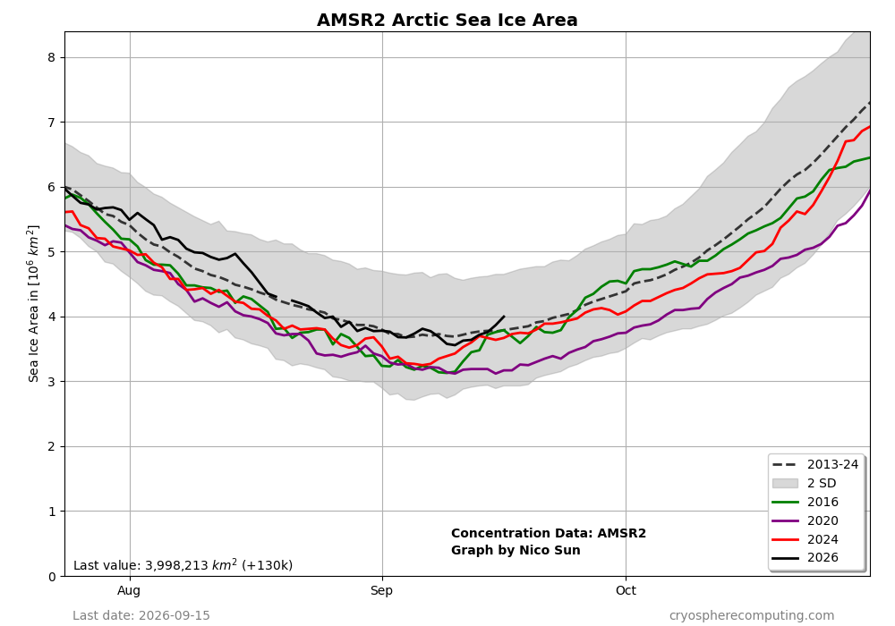
This chart agrees with your data that the minimum has passed due to increases during the last week: 2026 is now back to ~175K sq km above the 2013-24 avg for Sept 15th, which is the best in relation to that avg in about a month. It’s now over a whopping 800K higher than it was on 9/15/2020! 2020 didn’t reach yesterday’s level til ~Oct 5th! The cold Arctic N of 80N during summer very likely helped:
-

Septorcher 2026 Discussion - Endless Summer
Ginx snewx replied to Damage In Tolland's topic in New England
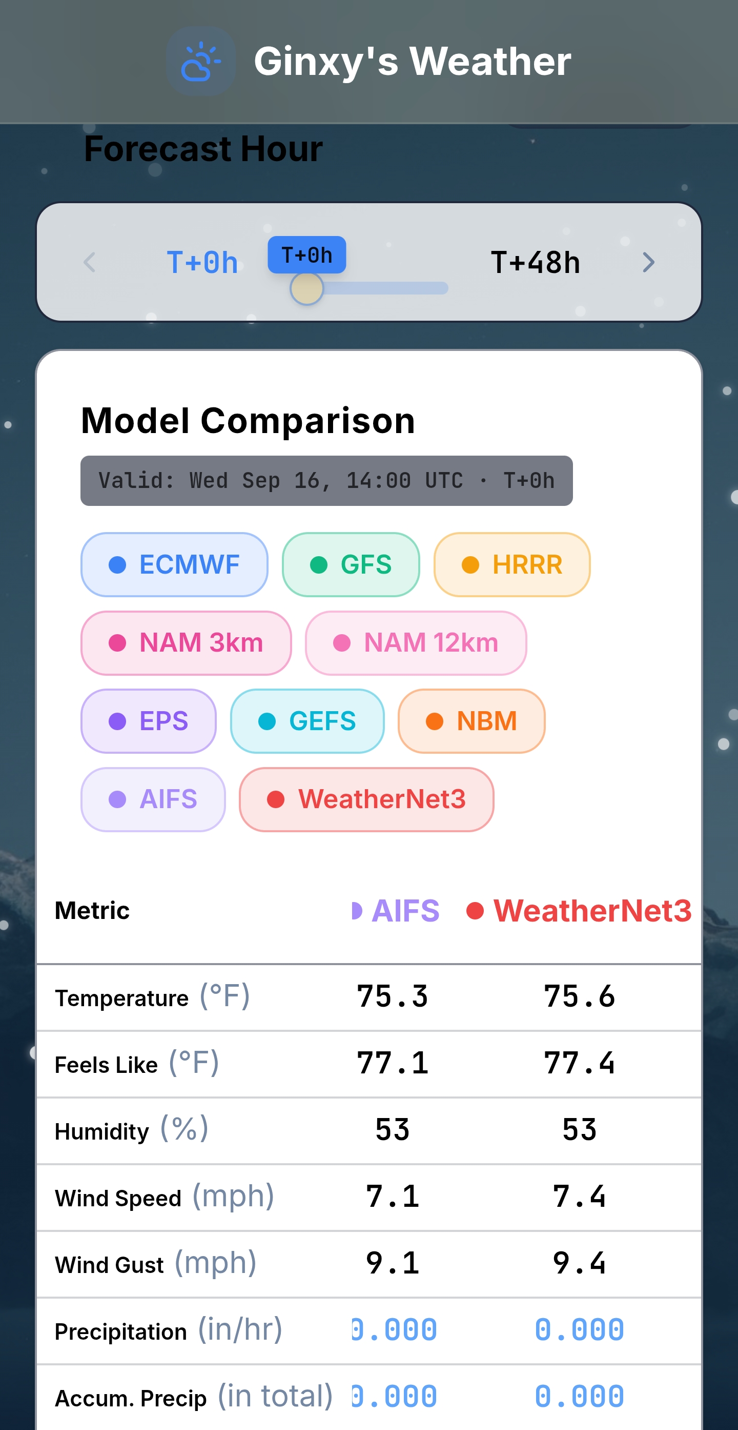
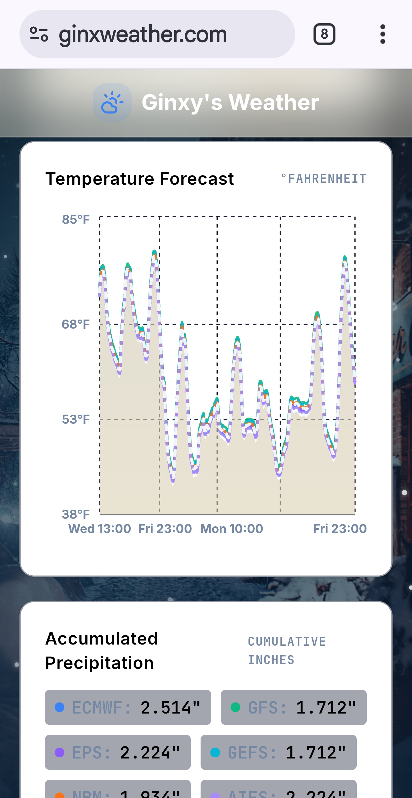
I have weathernet3 data available on my ginxweather.com website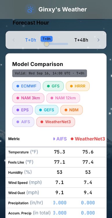
-
Is there an OT thread there where people can fight about who is stealing snow?
-

E PA/NJ/DE Autumn 2026 Obs/Discussion
RedSky replied to PhiEaglesfan712's topic in Philadelphia Region
Incredibly boring top 10 weather days -
Prob safe to call the extent min now too....about a 130k increase in the last two days as rapid refreezing is occurring in the high central arctic basin. So it looks like the final minimums this year will be 2.711 million sq km on NSIDC area and 4.574 million sqkm on NSIDC extent.
-
 viagra canada: Get Belvion - Buy Viagra online cheap
 -

Septorcher 2026 Discussion - Endless Summer
Typhoon Tip replied to Damage In Tolland's topic in New England
It's a torch in the other deep layer synoptic metrics ... just not at the surface. It's unusual to have 590 dm non-hydrostats and keep it less than 80 in an offshore flow. I've actually seem this sort of oddity with increasing frequency in recent years. Not sure if it's a Gretta or not but ... it's when non-hydrostats and even the hydrostatic heights (thickness) are elevated enough for very warm (relative to season...) yet the surface is some significantly blunted below the potential. The lower troposphere is oddly lagging behind the mid/upper air sounding. interesting -
Septorcher 2026 Discussion - Endless Summer
Ginx snewx replied to Damage In Tolland's topic in New England
Endless summer fail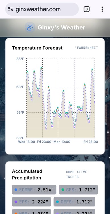
-
I do think we'll see some fall like weather next week with temps in the 60's to near 70 and rain chances as autumn arrives
- Today
-

2026-2027 Fall/Winter Mountain Thread
Maggie Valley Steve replied to BlueRidgeFolklore's topic in Southeastern States
Leaf change is beginning to show up in earnest now. Driving back from Sylva this morning I noticed Fall colors along 74 coming up the mountain to the Parkway. Around the house, some trees are dumping now and even the Poplar trees are showing yellows and beginning to fall. Looks like a prolonged rainy stretch coming this Friday extending well into next week. -
Thanks. I agree 100% with the above analysis as of Sept 13th MTD suggesting Sept of 2026 at GSO would (assuming the model projection is in the ballpark of reality of course) obliterate 2019’s 76.4F! Update: Sept 1-15 is at 80.0, which is consistent with the graph. But FYI regarding GSO’s warmest Septembers on record: 1921 at 78.2 and 1925 at 77.9 were warmer than 3rd place’s 2019 at 76.4. Even so: if I look at projections for these projections for the 2nd half of September and assuming they’re in the ballpark of reality, GSO would even be flirting with 1921’s 78.2! The projection I ran was 78.1, which would obliterate 2019’s 76.4. https://www.weather.gov/wrh/Climate?wfo=rah
-
We should get a paid vac day for national apple dumpling day.
-
Made it to 63 but still haven’t hit 50s yet. Thought today we would
-
Not to mention the Japan tsunami and (not weather, but still) the earthquake felt up here that damaged the Washington Monument. That was one crazy stretch.
-
Decided not to replace my 20+ year old snowblower. Count on the deepest, densest snowpack we've ever experienced. Take it to the bank.
-
I think we all favor blocking lol. Too bad Mother Nature doesn’t care about our preferences
-
After having a central Gulf TD late on yesterday’s 12Z per the quoted post and then not on the 0Z, today’s 12Z UKMET at the identical time (18Z on 9/21) has a TD form albeit in the E Gulf rather than C Gulf and with it moving very slowly WNW just like yesterday’s run had: NEW TROPICAL CYCLONE FORECAST TO DEVELOP AFTER 126 HOURS FORECAST POSITION AT T+126 : 26.8N 84.1W LEAD CENTRAL MAXIMUM WIND VERIFYING TIME TIME POSITION PRESSURE (MB) SPEED (KNOTS) -------------- ---- -------- ------------- ------------- 0000UTC 22.09.2026 132 26.6N 84.0W 1008 21 1200UTC 22.09.2026 144 27.0N 84.7W 1008 20 0000UTC 23.09.2026 156 27.1N 84.7W 1008 25 1200UTC 23.09.2026 168 27.2N 85.4W 1006 31
-
100%. Strong ninos tend to run on the mild side but they also favor decent qpf makers and good storm tracks for our specific region. A good track can't do it by itself though so now we're drilled down into a level a detail that can only be wildly guessed at and not predicted until much further down the road. East based and basin wide ninos don't "eliminate" cold air in the east when it matters and there is no reason to assume warmth will completely overwhelm at this stage. I feel pretty confident that the AO will not be hostile and is more likely to be favorable than the opposite. December is important there. Even if it doesn't help during December, a solid -AO in December often translates into a -AO in Jan and/or Feb. NAO? Beats me. Fickle beast... lol I don't see anyone around here banging a big snow drum in the MA region. Cautiously optimistic until proven otherwise is a fair take imho. The only thing I feel pretty certain about is this winter will not be as cold and dry as last winter. Easy call there.
-
have we gotten through all the days yet?
-
they death ridge, we garden variety
-

E PA/NJ/DE Autumn 2026 Obs/Discussion
JTA66 replied to PhiEaglesfan712's topic in Philadelphia Region
You can feel the humidity creeping up again. Oh well, it was fun while it lasted. 77F/DP 65F -
Who is saying it will be? Most I see are saying it's likely to be warm and wet but at least we have a chance to score one huge snowstorm if we get lucky and time up one of the storms with cold...which is what all the east based strong nino's indicate is our fate.
-
I beleaf the leaves are going to be pretty solidly changed for my vacation next week, very hyped.