All Activity
- Past hour
-
Yes, Aug 26th, but the new Euro Seasonal isnt due out for a couple more days, which means that product included the early August edition. That is clearly not the Sept edition of the ECMWF Seasonal forecast for Feb 2027, as is suggested by Ji. Now if he misinterpreted it or the dude who posted it fucked up, I have no idea lol.
-
97 here today. Hottest temp this summer. Currently 93.
-

2026-2027 Record-breaking El Nino
40/70 Benchmark replied to Stormchaserchuck1's topic in Weather Forecasting and Discussion
He never left, X. -

2026-2027 Record-breaking El Nino
GaWx replied to Stormchaserchuck1's topic in Weather Forecasting and Discussion
Thanks to forky, Adam @snowman19 is back! -
.thumb.jpg.6a4895b2a43f87359e4e7d04a6fa0d14.jpg)
Central PA Summer 2026 Discussion/Obs Thread
Yardstickgozinya replied to Voyager's topic in Upstate New York/Pennsylvania
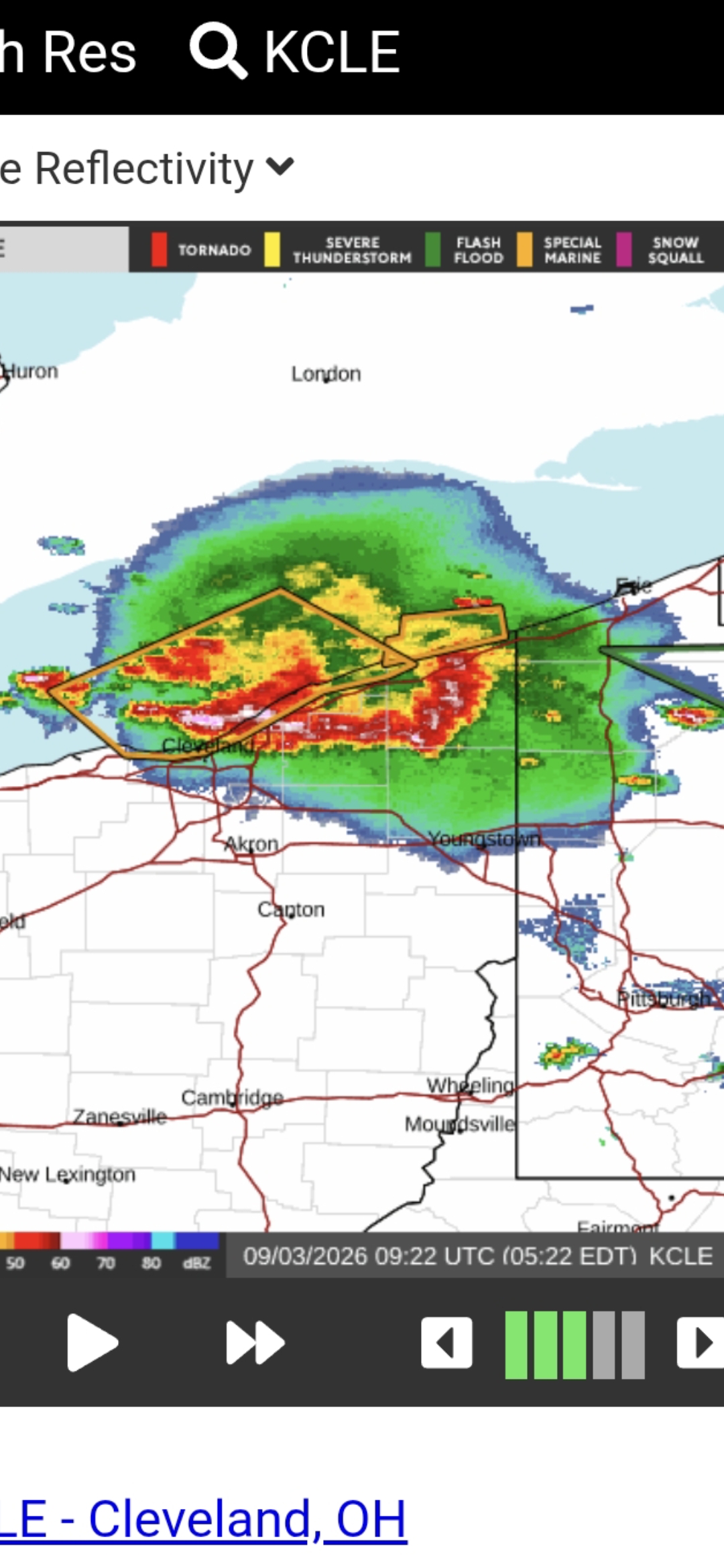
I'm talking about the complex that I posted about around 4:30 in the morning that was due to get here around 8:00 9:00 am this morning If it made it. I stayed up all night last night watching lightning and listening to thunder. Im prepared to do the same tonight. If need be, we don't get these patterns too often and i'm not one to miss it.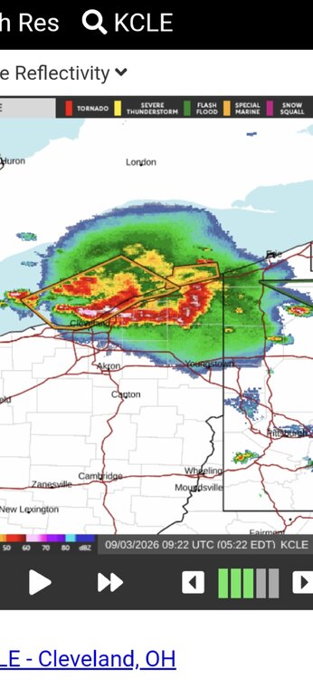
-
Central PA Summer 2026 Discussion/Obs Thread
Yardstickgozinya replied to Voyager's topic in Upstate New York/Pennsylvania
We're working with stable lapse rates today compared to previous days. We don't have 6 to 7°C cooling per kilometer this evening and these storms aren't maintaining vigor quite like they've been the past few nights. I'm not saying there won't be storms in the area tonight just pointing out an observation. -

Central PA Summer 2026 Discussion/Obs Thread
Superstorm replied to Voyager's topic in Upstate New York/Pennsylvania
Storms were pretty bad in Lanco. Lots of thunder and lightning and flooding. Woke me up at 1:00 am. . -
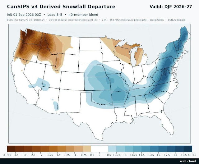
The Cansips released 9/1/26 was snowy fwiw.
-
2026-2027 Record-breaking El Nino
40/70 Benchmark replied to Stormchaserchuck1's topic in Weather Forecasting and Discussion
No it isn't, since the PDO has yet to respond to said record breaking El Niño. -

Septorcher 2026 Discussion - Endless Summer
ineedsnow replied to Damage In Tolland's topic in New England
Trust me I didn't ask for it when they tested me -
Or maybe just August 2026
-

Central PA Summer 2026 Discussion/Obs Thread
canderson replied to Voyager's topic in Upstate New York/Pennsylvania
Wonder what kept temps down so much today -
Got to just 88 but it was so humid that the grass had drops of water on it at 2 pm with the sun out. Steamy
-
TWs starting to fly from PBZ
-
https://x.com/metrodetroitn/status/2095634694255829219
-
Most worrisome thing about the Ravens heading into the season, esp with a brand new offense. Ravens still evaluating center competition ahead of Week 1 https://sports.yahoo.com/articles/ravens-still-evaluating-center-competition-195226603.html
-

Monday, August 31 - Thursday, September 3, 2026 Convective Episodes
JACKASS replied to weatherwiz's topic in New England
Back yard or facing the street? Makes a difference! -
This might be the easiest winter for DT WxRisk. He can just leave the Heat Miser as his profile pic the whole winter.
-

Monday, August 31 - Thursday, September 3, 2026 Convective Episodes
weatherwiz replied to weatherwiz's topic in New England
almost took clothes off -
Central PA Summer 2026 Discussion/Obs Thread
Yardstickgozinya replied to Voyager's topic in Upstate New York/Pennsylvania
I don't believe all the convection, allowing models bring storms this far south and east, This morning, two of three brought that early morning Glaks complex through our area with some strong embedded thunderstorms. And that never happened. The other one dropped a complex through western pennsylvania, and that never happened either. Nevertheless, we have thunderstorms heading in this general direction, and we have plenty of a destabilized environment. -
Just caught the outflow from the storm sitting over RDU and it feels incredible
-
Monday, August 31 - Thursday, September 3, 2026 Convective Episodes
JACKASS replied to weatherwiz's topic in New England
Checking in on eBay bids, so I switch back and forth between sites. You put way too much thought into nothing. -
 Can always tell how much you’ve been drinking by the nature of your posts. Initially you just lurked and never posted. Then you got a little bravery and would troll a few of mine.. and now you’re posting Pantera videos . It’s been interesting to watch you come along
 -

2026 Mid-Atlantic Severe Storm General Discussion
batmanbrad replied to Kmlwx's topic in Mid Atlantic
good summary of what's been going on upstream from us, including the Pittsburgh area MCS activity: Mesoscale Discussion 2220 NWS Storm Prediction Center Norman OK 0513 PM CDT Thu Sep 03 2026 Areas affected...portions of southeastern Pennsylvania Concerning...Severe Thunderstorm Watch 649...650... Valid 032213Z - 032345Z The severe weather threat for Severe Thunderstorm Watch 649, 650 continues. SUMMARY...An organizing MCS will yield a greater risk for severe wind gusts across portions of southwestern Pennsylvania over the next 1-2 hours. DISCUSSION...Regional radar imagery depicts an organizing MCS across portions of western Pennsylvania, with volume scans over the past 30 minutes from KPBZ depicting embedded velocities up to 65 kts at 600 ft AGL. Numerous reports of wind damage have been noted with this complex, including downed trees and power lines, with a 62 mph wind gust also recently measured at KHLG in far northern West Virginia. The downstream environment remains favorable for damaging/severe wind gusts, with steep low-level lapse rates (7.5-8.0 K/km), moderately strong instability (2500-3000 J/kg MLCAPE), and around 30-40 kts of effective shear in place, as sampled by the 18z PIT observed sounding and recent objective analysis. Given this environment and the organizing MCS, a locally greater risk for damaging/severe wind gusts is likely to accompany this system as it progresses east-southeastward across portions of southwestern Pennsylvania. -
96 again here today, 95 for 3rd day in a row at MLI.