All Activity
- Past hour
-
Nice trajectory of rain over me...looks like I can add a little bit to my totals
-
Hey we don't need NOAA/NWS. Cut funding. AccuWeather can do the same job even better!
-
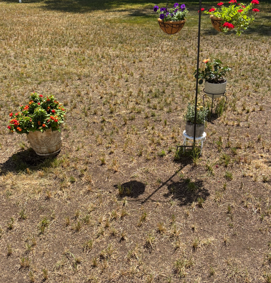
Here's my actual yard, including pathetic garden attempt
-
Web cams from Colorado show a lot of haze from forest fires.
-
I left guest viewing turned off, but I turned new registrations back on. Let me know if you experience slowdowns. I think it should be okay unless I get barraged with forum signups from overseas.
-
Thanks for confirming that, I was just checking in here to see if anyone else noticed forecasts aren't loading and haven't all day thus far. Even when I can get to LWX's main site or the weather.gov main site (after a bit of a wait), the point-and-click for a location just sits and spins. I thought there was some issue with my wi-fi, but no other sites I visited had any issues. Wonder if they're getting hit with a ton of traffic due to the upcoming heat this week.
-

Intermittent (but frequent) Bad Gateway 502 Errors
dendrite replied to Kmlwx's topic in Forum Information & Help
I shut down guest viewing to block the 10k+ foreign IPs at once. The board instantly sped up after that. JohnWow will have to take a deeper look later. -
While technicians are actively working to restore the servers, you can track their status and updates via the National Weather Service Network Issues page lol that wont load either. Who is to blame for this mess?
-
Can't browse while logged out
dendrite replied to JenkinsJinkies's topic in Forum Information & Help
Correct. we had over 10k "guests" from foreign IPs on the site at once and it was causing the slow forum issues. I had to shut the guest viewing down until John gets another look at it. -
Congrats! Let us know how it goes!
-
My first date with my girlfriend was 2/3/23. It was in the single digits when we met. I plan on proposing to her on Friday when it's triple digits. I think that's good symmetry.
-
June 28 1876: The latest ice breakup in history for Duluth occurs on Lake Superior. For Sunday, June 28, 2026 1788 - The Battle of Monmouth in central New Jersey was fought in sweltering heat. The temperature was 96 degrees in the shade, and there were more casualties from the heat than from bullets. (David Ludlum) 1892 - The temperature at Orogrande UT soared to 116 degrees to establish a record for the state. (Sandra and TI Richard Sanders) 1923 - A massive tornado hit Sandusky, OH, then swept across Lake Erie to strike the town of Lorain. The tornado killed 86 persons and caused twelve million dollars damage. The tornado outbreak that day was the worst of record for the state of Ohio up until that time. (David Ludlum) 1975 - Lee Trevino and two other golfers are struck by lightning at the Western Open golf tournament in Oak Brook, IL. (The Weather Channel) 1980 - The temperature at Wichita Falls, TX, soared to 117 degrees, their hottest reading of record. Daily highs were 110 degrees or above between the 24th of June and the 3rd of July. (The Weather Channel) 1987 - Thunderstorms developing along a cold front produced severe weather in the north central U.S. Thunderstorms in Nebraska produced wind gusts to 70 mph and baseball size hail at Arapahoe, and wind gusts to 80 mph along with baseball size hail at Wolback and Belgrade. Six cities in the Ohio Valley reported record low temperatures for the date, including Cincinnati, OH, with a reading of 50 degrees. (The National Weather Summary) (Storm Data) 1988 - Showers and thunderstorms brought much needed rains to parts of the central U.S. Madison, WI, received 1.67 inches of rain, a record for the date, and their first measurable rain since the Mother's Day tornado outbreak on the 8th of May. (The National Weather Summary) 1989 - Evening thunderstorms deluged Winnfield LA with eleven inches of rain in four hours and fifteen minutes, and Baton Rouge LA reported 11 inches of rain in two days. Totals in west central Louisiana ranged up to 17 inches. Thunderstorms produced severe weather in the Northern High Plains. Two inch hail broke windows in nearly every building at Comstock, NE. Thunderstorms in North Dakota produced two inch hail at Killdeer, and golf ball size hail at Zap. (The National Weather Summary) (Storm Data) Observances: 28 Sun National Insurance Awareness Day 28 Sun Tau Day 28 Sun National Climate-Smart Skin Awareness Day 28 Sun National Logistics Day 28 Sun National Tapioca Day 28 Sun Paul Bunyan Day 28 Sun Stonewall Riots Anniversary 28 Sun House Paint Touch-Up Day
-
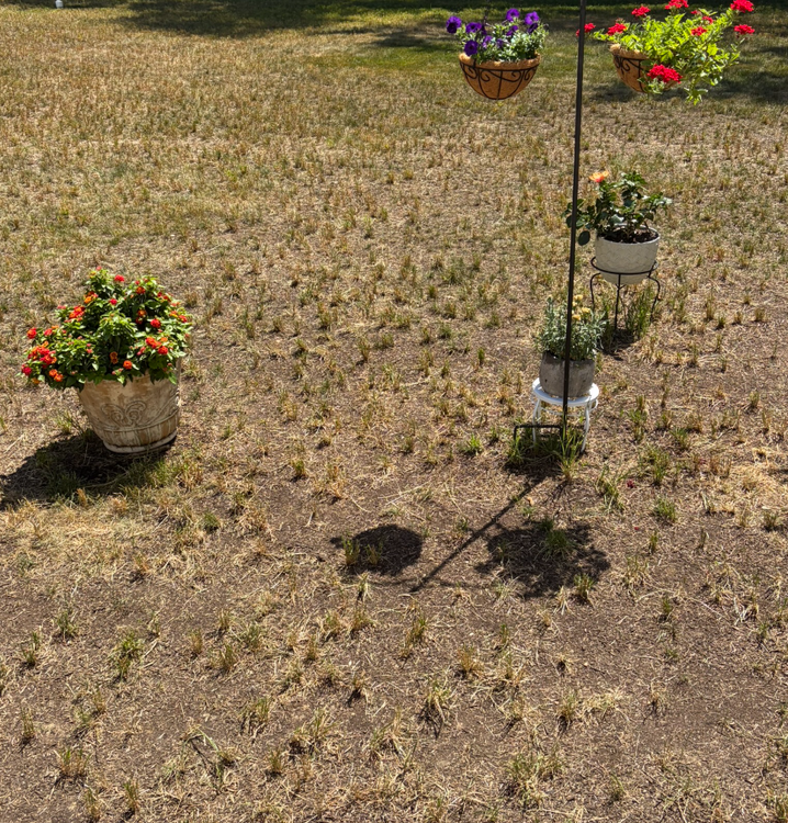
I took a pick of EastCoast NPZs yard
-
0.35 for me Sat and today
-

Central PA Summer 2026 Discussion/Obs Thread
mahantango#1 replied to Voyager's topic in Upstate New York/Pennsylvania
.09 rain here this afternoon. -
Monday might be a high temp bust for my area if we get storms or storm outflow tonight. Could use any rain at this point though, and Tuesday and Wednesday will not bust.
-
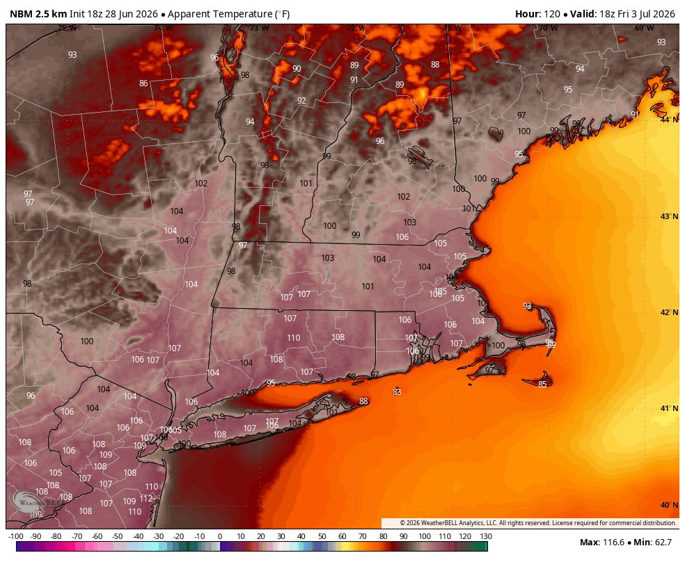
A warming trend has gotten underway. The warmth will continue to build through the remainder of June before culminating in a severe heatwave to start July. Some of the guidance suggests that the heat could rival that of early July 1966. Much of the region will likely experience its highest temperatures so far this summer. Baltimore, Newark, Philadelphia, and Washington, DC will all likely see the temperatures peak at or above 100°. Washington, DC could make a run at its all-time record of 106°. The ENSO Region 1+2 anomaly was +3.0°C and the Region 3.4 anomaly was +1.7°C for the week centered around June 17. For the past six weeks, the ENSO Region 1+2 anomaly has averaged +2.42°C and the ENSO Region 3.4 anomaly has averaged +1.22°C. The ongoing El Niño will continue to strengthen through the summer. The SOI was -11.81 today. The preliminary Arctic Oscillation (AO) was +1.126 today. Based on sensitivity analysis applied to the latest guidance, there is an implied near 100% probability that New York City will have a warmer than normal June (1991-2020 normal). June will likely finish with a mean temperature near 73.2 (1.2° above normal). Supplemental Information: The projected mean would be 1.8° above the 1981-2010 normal monthly value.
-

E PA/NJ/DE Summer 2026 Obs/Discussion
JTA66 replied to PhiEaglesfan712's topic in Philadelphia Region
My AC died in July 2011. Went 2 or 3 weeks before a new one was installed. I wouldn’t say I got used to the heat so much as I came to accept the poor state of affairs I found myself in. -
This is apparent temp, not actual air temp. Apparent temp is a biological factor only. A world exists beyond the biological. And we assume everyone has the same tolerance to heat, which is false. It varies widely. There are been a noticeable shift focusing way more on apparent temp than the actual air temp, which is what matters most in the end. We do not have a solid climo history of apparent temp either for historical perspective. And ever notice apparent temp is only talked about when it is higher than the air temp? I wonder why. I'll tell you why, for a dew point of about 58 or less, the apparent temp is actually *lower* than the air temp, so it feels better/less bad. Can't hype that. The door swings both ways here.
-
NWS page still really struggling today
-
A 110 HI wouldn’t be unprecedented, but it would be upper echelon for the area (speaking of BDL/HFD)
-
What?

-
Supercell pix Danvers MA from 6/26 https://www.facebook.com/share/1JPtm7q9nt/?mibextid=wwXIfr
-
Keep your expectations in check for this winter. Expect the worst and hope for the best.
-
Bomb Heat Dome.