All Activity
- Past hour
-
Low of 49 overnight marks the warmest morning low of the year at my place. A very warm and dry day on tap. Should reach low 80's.
-

Junorch obs and discussion 2026
Damage In Tolland replied to Damage In Tolland's topic in New England
Dewy -
Much of central (and western) North Carolina got down into the 40s this morning.
-

Central PA Summer 2026 Discussion/Obs Thread
mahantango#1 replied to Voyager's topic in Upstate New York/Pennsylvania
44 this morning. -

Central PA Summer 2026 Discussion/Obs Thread
Mount Joy Snowman replied to Voyager's topic in Upstate New York/Pennsylvania
52 when I left the house. Oh what’s that, you’d like another perfect weather day? Your wish is my command. - Today
-

Central PA Summer 2026 Discussion/Obs Thread
pawatch replied to Voyager's topic in Upstate New York/Pennsylvania
41 degrees this morning. Gone fishing -
RDU has at least tied the record low for today (49)
-
Central PA Spring 2026 Discussion/Obs Thread
pawatch replied to Voyager's topic in Upstate New York/Pennsylvania
41 degrees this morning. -
Looks like some models are hinting at finally some warmth and dews possibly beyond mid month, which would start to make sense climatologically.
-
Temp down to a beautiful 43 degrees currently.
-

2026-2027 Strong/Super El Nino
snowman19 replied to Stormchaserchuck1's topic in Weather Forecasting and Discussion
-
We got smacked again tonight by a complex of storms that dumped another inch of rain on Buda ! Now we are up to 22 inches on the year. Normal is 30 inches for the entire year. We are just stackin 'em, rackin' em and packin' em in every time we turn around! The line starts at the Mississippi and everyone better take a number! With another disturbance forming in the Gulf of Mexico, and a Brobdingnagian El Nino intensifying, I think this summer could end up being like 2021, 2014 and 2015 and 2007. This is becoming surrealistic. Usually places like Dallas, TX and WinStar Casino in Oklahoma are at 6 inches above us here in Buda. This year it is inverted. Buda is 6-7 inches ahead of Dale City. It's absolutely unheard of! I want that Super Nino SO BAD! I want feet and feet of rain all year!
-
I'm really looking forward to 8 weeks of posts arguing if it will be 85F or 88F. It's summertime, let's enjoy it!
-
Great, nice way to kick off the summer season. No prolonged big heat, but enough short burst big warmth to get the vibe rollin'.
-
Just a perfect early summer day. Days like this right through June would be alright with me
-

2026-2027 Strong/Super El Nino
GaWx replied to Stormchaserchuck1's topic in Weather Forecasting and Discussion
Lower anomalies in 3/1+2 than 3.4/4. The bigger/smaller the differential, the stronger/weaker the Modoki. -

2026-2027 Strong/Super El Nino
Stormchaserchuck1 replied to Stormchaserchuck1's topic in Weather Forecasting and Discussion
^Nice cold pool SE of New Foundland developing. Warming in the Davis Strait too and south of Greenland. There is SSTA correlation there May-Sept with following Winter NAO, that's pretty high. The current SSTA setup would favor more -NAO conditions in the Winter. Let's see if it holds going forward. -
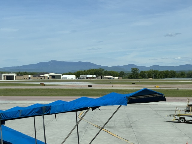
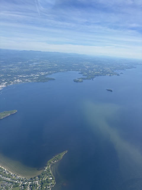
It was beautiful flying out of BTV this afternoon.
-
Can we please keep this weather for the rest of the..... century? Highs in the low to mid 70s. Lows in the low to mid 50s. It's just perfect.
-
Forecast few points look fantastic for the next several days, not getting out of the 50s.
-

2026-2027 Strong/Super El Nino
so_whats_happening replied to Stormchaserchuck1's topic in Weather Forecasting and Discussion
Well for starters I feel we are not easily getting rid of the -PDO state we will need to watch how this evolves into the end of summer. Around now through August has been the timeframe we have seen the -PDO dip hard over the last 2-3 years. I do believe if we can maintain where we are now we stand a chance at having a +PDO (weak) spike as we go into winter. As for the ENSO state I have been very leery as far as overall strength of this event but currently it looks like a strong Nino is well supported, super not out of the question but I'm not sold on it yet. The -PDO will fight back on that potential and I personally can't quite place it but something feels a little off for super chances. I could be wrong with that and that is fine, a few tenths of a degree anomaly between strong to super is not going to make the world of difference on the overall effects we see come fall/winter over the Conus. Placement of ENSO forcing is the big one that needs to be watched with the second being to overall strength of the event, if we have further west VP and anomalies compared to past super events this becomes a different outcome for the forcing come winter. I would also like to really see the uptick in tropical activity that tends to take place from El Nino events through much of the Pacific. If the central Pacific tends to have more of the storms this season versus EPAC we are on the path probably to a more Modoki style Nino. The waters off Baja have cooled quite a bit over the last few months this is that kick from the -PDO still in play as well as the cooler waters around Alaska. As Bluewave states over and over, ad infinitum, the warm pool east of Japan is certainly still playing a role in how things progress and even much of the South Pacific is still very warm. In some ways we are starting to see some dual warm regions take place which is fascinating to see. You have competing factors still at play in the subtropics and mid latitudes that certainly will affect the outcome of this event. It still amazes me even with the warming of the central and EPAC tropical waters that MJO just halts at 7 and pushes to COD. Lastly the Atlantic... Are we about to witness a reversal in the AMO? We also don't have the classic Atlantic La Nina taking place yet through the tropics this will also be something to monitor coming up. If folks can make a forecast this far out and know almost close to what will happen come winter good on you but to me there are still many things that show a lot of uncertainty still exists. If I had to guess at an anomaly standpoint for this event we end up fairly similar in threshold to the 23-24 event. Nothing else other than the anomaly threshold. -

2026-2027 Strong/Super El Nino
mitchnick replied to Stormchaserchuck1's topic in Weather Forecasting and Discussion
Cansips was the only seasonal model showing any BN temps in the GL/east/NE. In that respect, it was, as you stated, the best in at least those areas. It was similar in 24/25 with a cooler forecast than other models. The Cfs2 and Euro have been boiler plate AN across the country the last 2 years. Speaking for myself, I don't care about the rest of the country or any other part of the world, fry or freeze. -
The low dews are leading to spectacular mornings and evenings. While it feels great, no humidity means no rain. This is the second time in five weeks we've gone two weeks without rain.
-
Spectacular evening out there now. Crisp air and a stellar sunset. Could take a few more of these...
-
 Therein lies the rub, there's been ample opportunities for that to break down these last 3 years but when that opportunity arises the nw flow abruptly injects steroids or if it is beaten back it's only fleeting and it comes roaring back in as little as a few days. A niño should be able to overcome that but like in 2023 we're instead dealing with winter style futility until we're well past the summer solstice.


