All Activity
- Past hour
-
About .75 for the day.
-
There's about 4 or 5 crappy teams gunning for the last wild card spot. One of them will be in the playoffs. Atleast briefly lol. Although I wouldn't feel to bad trotting out Bradish ,Rodgers and Baz in a best of 3 series. Problem is we wouldn't score any runs against the other team top of the rotation
-

2026 Mid-Atlantic Severe Storm General Discussion
jewell2188 replied to Kmlwx's topic in Mid Atlantic
It all equals fail for the mid-Atlantic is what it means. The watches etc from the NWS are ridiculous and have been for a while now. This evening is a perfect example of why the general public take weather as a joke around here. -
https://goldensnowball.com/past-snow-seasons-champs/ This is a good resource for seeing how a season was for Lake Effect in upstate NY. 2015-16 was a bad snow year everywhere with Syracuse being the champ at 80” which is only 2/3 of its normal 120”
-
After Wednesday, we may finally break the Summer heat.
-
What a joke lol
-

2026 Mid-Atlantic Severe Storm General Discussion
wxmeddler replied to Kmlwx's topic in Mid Atlantic
Poor lapse rates and all of the 0-6km shear is in the lowest 2km. 2-8km shear is near zero. Water loading (updrafts on top of downdrafts due to lack of shear) and no CAPE = showers. -
I don't see it being the warmest for the entire CONUS i think there will be plenty of western troughs and storminess. record warm for northeast however is almost a given, especially december.
-

Spring/Summer 2026 Pattern Discussion Thread
KakashiHatake2000 replied to Carvers Gap's topic in Tennessee Valley
Supposedly there could be a cool down 8-10 days from now we will see but wouldn’t this be nice . - Yesterday
-
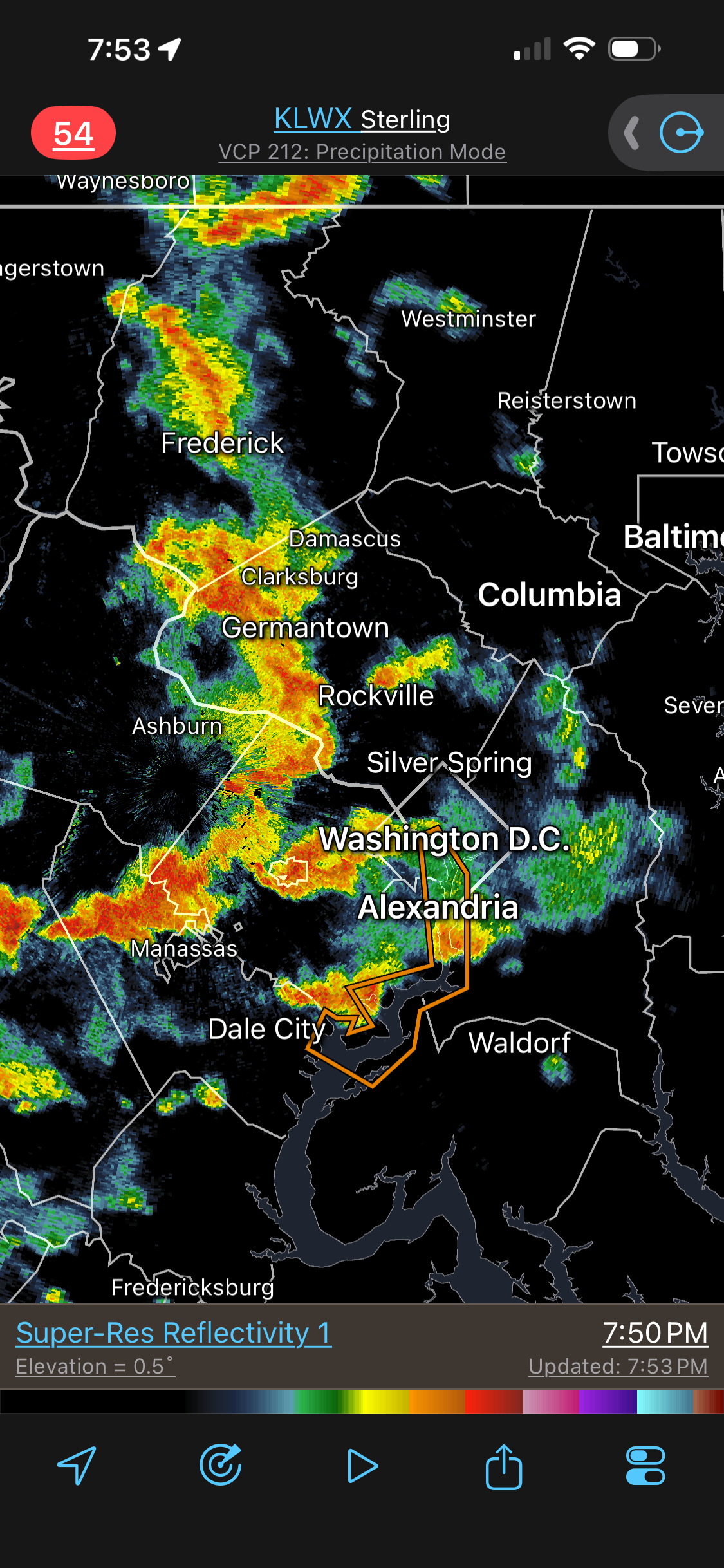
HRRR fcst radar is good, but just not getting the svr. That strong finger of CAPE just to the W of DC verified. 925 dew points and PWATs have increased over the entire area last few hr (big 2.3" PWAT now over all of DC area). DCA dew point went from 69 to 74. 35 kt 0-6 km shear. So I don't get! And it's not the DC split, its everywhere! Even the CGs are MEH!
-
That cell just south or south southwest of Urbana could be on the way, close call.
-
So far this is matching HRRR that did show that "bow" but if you looked at the wind gust product on those runs - there was almost no severe wind with it.
-
Rainbow falls is roaring

-
2026 Mid-Atlantic Severe Storm General Discussion
jewell2188 replied to Kmlwx's topic in Mid Atlantic
Happy that severe watch and flood watch verified lolI’m- 1,969 replies
-
- 1
-

-
- severe
- thunderstorms
- (and 7 more)
-
Well my area went back to look at that storm coming in, oh wait it is Ballenger Creek que up the split and then reform just to the East.
-

Augdewst 2026: Summer's Last Stand
Damage In Tolland replied to Prismshine Productions's topic in New England
Wow. I just figured since Dendy has been flooded all summer you were too . That’s similar to last summer there right? -
The storm that came thru here about 45-50 minutes ago should be knocking on your door any minute.
- 1,969 replies
-
- 1
-

-
- severe
- thunderstorms
- (and 7 more)
-
Yep, I am at 2.20" since June 30th. I live about 10 miles south of Rattlesnake. The surface is very dry. I thought we would finally get some real rain tonight but it looks like that won't happen. Arrggghhhh
-
Alleghany County VA. Between Covington and Clifton Forge.
-
Damn going to be a pretty awful bust for MBY. Euro was steady with 1.5”+ today for many runs.
-
Looks like a fizzler up here. Congrats to Moco/DC.
-
2-3 inches of rain per hour rates right now with over .7 in the gauge.
-

2026 Mid-Atlantic Severe Storm General Discussion
SolidIcewx replied to Kmlwx's topic in Mid Atlantic
Hook on that storm in FFXC -

Augdewst 2026: Summer's Last Stand
HIPPYVALLEY replied to Prismshine Productions's topic in New England
Pouring rain right now, kind of caught me off guard. Probably won’t last long but good drink for the plants. -
Heavy rain moving back in!