All Activity
- Past hour
-
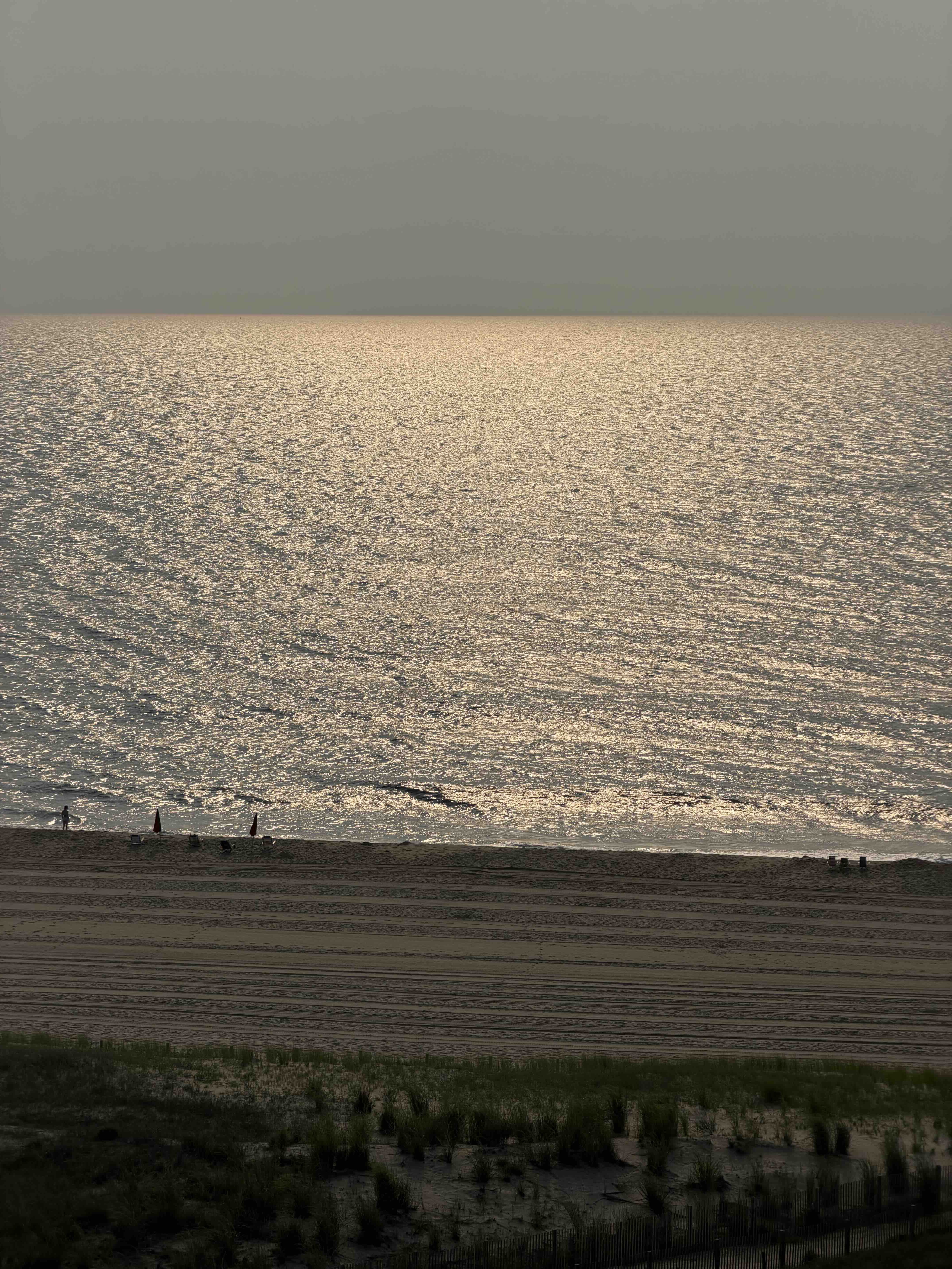
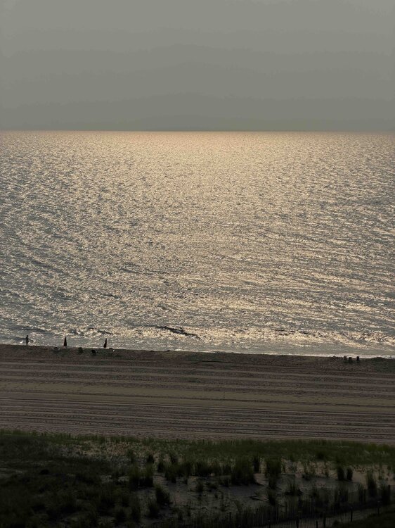
Nice morning in OC
-
Lots of cloud cover with it, though. I know @high risk indicated we may not need ABUNDANT sunshine - but I can't help feeling like we've seen this movie a million times.
-
I'm hoping it misses here-the big totals-still alot of cleanup ongoing after last week's flooding/damage
-
Yep, seems pretty straightforward to me. Models almost unanimously nailing that area that got hit last week too.
-
It looks like its leaving a gap in the middle
-
Turn the shower head down.
-

2026 Mid-Atlantic Severe Storm General Discussion
Eskimo Joe replied to Kmlwx's topic in Mid Atlantic
Hope this crapvection over this mountains sorts itself out and quick.- 1,503 replies
-
- 1
-

-
- severe
- thunderstorms
- (and 7 more)
-
yep-let's see how accurate the models are -N NJ and the HV look like the target
-
Looks like this will weaken and by this afternoon around 2 things should start heating up.
-
Brad Panovich just put out a great video about today's storms. The models or the model he was showing actually shows two waves of storms moving through. One wave starts around 2 to 3 today then another wave around 8 or 9 tonight. Looks like we could see some discreet cells developing as well. Fun times.
-
....so true!! ...and some already are doing dry runs in preparation..

-
-
His forecast was much better than other forecasts..
-

Central PA Summer 2026 Discussion/Obs Thread
canderson replied to Voyager's topic in Upstate New York/Pennsylvania
.02” rain sometime overnight. -
Tolleris or JB ???
-

2026-2027 Super El Nino
Yanksfan replied to Stormchaserchuck1's topic in Weather Forecasting and Discussion
With a raging southern jet I think we can all agree on a stormy winter. What are the early thoughts on storm tracks; benchmark vs. inland runners? -
(002).thumb.png.6e3d9d46bca5fe41aab7a74871dd8af8.png)
Central PA Summer 2026 Discussion/Obs Thread
ChescoWx replied to Voyager's topic in Upstate New York/Pennsylvania
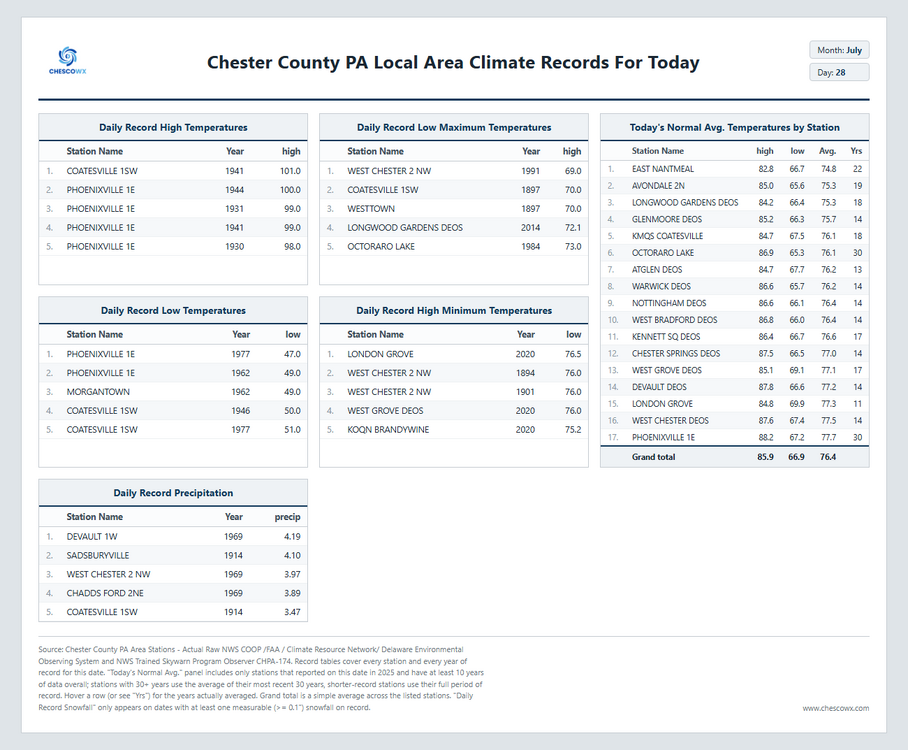
Despite our hot start to July we have turned much cooler over the last 10 days, which has brought us all the way back to average temperatures so far for the month of July. Today looks to be the most impactful day with flash flood threats although as many of you know much of Northern Chesco has not seen as much beneficial rains as the rest of the area. Shower chances will continue but not a wash out by any means through Thursday. We finally dry out on Friday with sun returning both Friday and Saturday.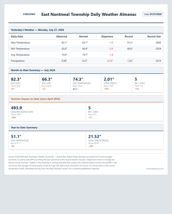
-
E PA/NJ/DE Summer 2026 Obs/Discussion
ChescoWx replied to PhiEaglesfan712's topic in Philadelphia Region
Despite our hot start to July we have turned much cooler over the last 10 days, which has brought us all the way back to average temperatures so far for the month of July. Today looks to be the most impactful day with flash flood threats although as many of you know much of Northern Chesco has not seen as much beneficial rains as the rest of the area. Shower chances will continue but not a wash out by any means through Thursday. We finally dry out on Friday with sun returning both Friday and Saturday.
-
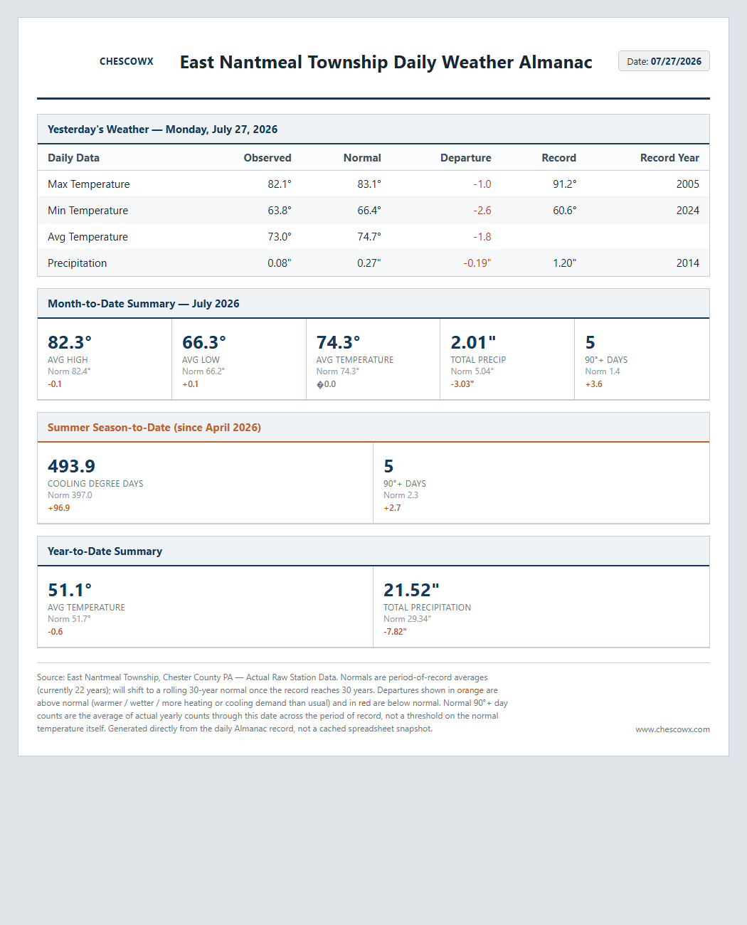
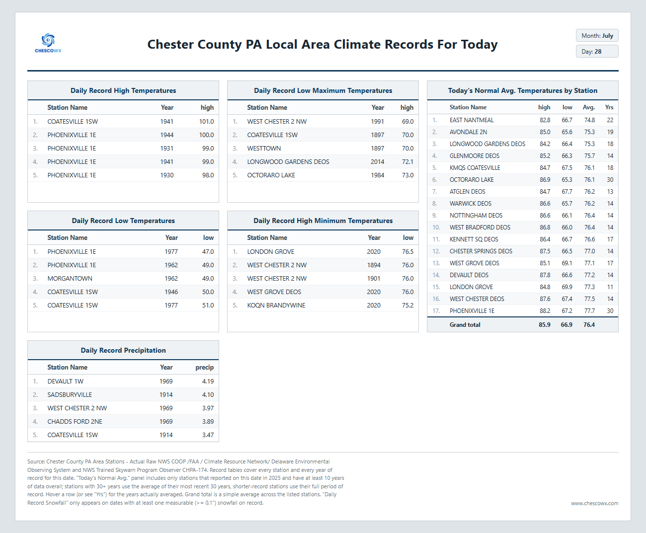
Thanks Charlie! Much more to come with more area stations to support the raw data.
- Today
-
 ...at least their TV ratings will take a bump up....
 -
 canada pharmacy reviews: EverNorth Pharmacy - best canadian online pharmacy reviews
 -
canada pharmacy reviews: EverNorth Pharmacy - best canadian online pharmacy reviews
-
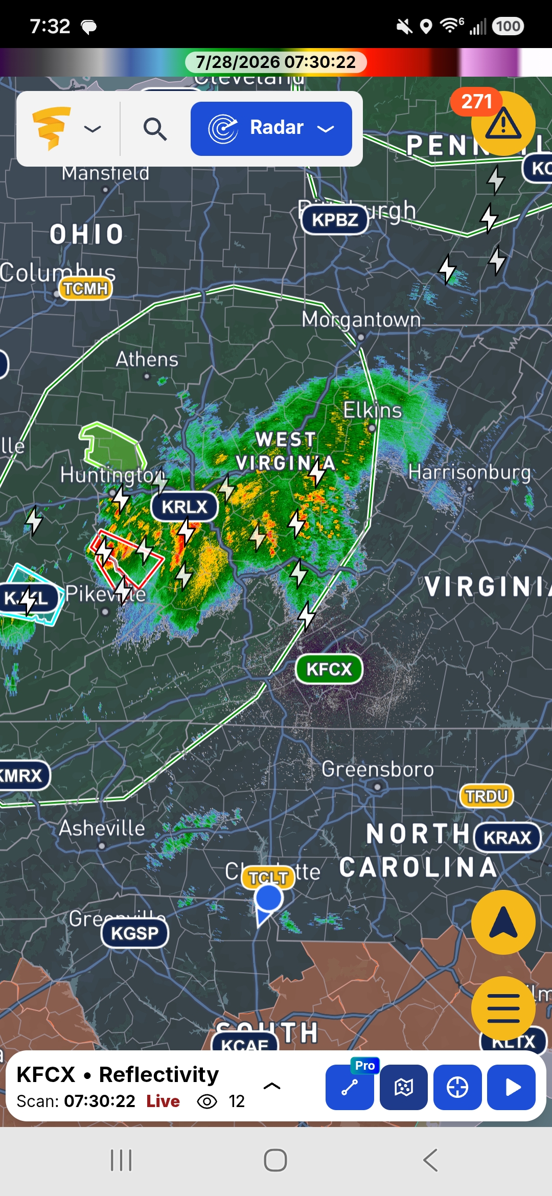
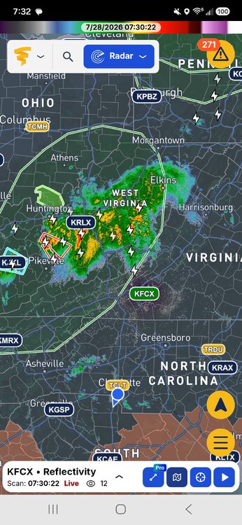
And a last second major wild card for this evening has shown. Heading SSE, this could thwart the severe threat for a lot.
-

2026-2027 Super El Nino
LakePaste25 replied to Stormchaserchuck1's topic in Weather Forecasting and Discussion
My early thoughts is we see a predominately bootleg +PNA/extended pac jet state in the mean that will occasionally retrograde to a -EPO/+TNH for brief periods. Still need to see where the Hadley cell will set up though. -
 Still some disagreement, which is no surprise with these cold season synoptics in the warm season. I do think someone’s gonna get dumped on, especially if we have these little embedded meso lows to enhance the rainfall locally.