All Activity
- Past hour
-
79/57 at 12:40. Amazing
-
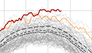
Personally here I am prepping for an all time record low snowfall season
-
yet here we are out to the 25th and we're bouncing around 17
-
*Almost* unanimous model support for *some* development but it is apparent this system has serious hurdles ahead of it. There is likely a window for development/strengthening over next few days, but then it hits a wall of shear, so options at that time are dissipation or weakening. Beyond that, location will be everything. If the system survives into the SW basin, there could possibly be an area of lower shear allowing for development as it likely recurves. If the system goes into Caribbean, it will be heading towards its grave. You're starting to see even the GFS back off on its latest run to a more realistic scenario given the harsh conditions ahead of the system. I am fairly confident this becomes a named storm but I do not think it has much of chance to be a long-tracked hurricane, and it likely won't have much window to intensify at all unless it makes it through the TUTT intact. Probably looking a weak, sheared TS for awhile
-

E PA/NJ/DE Summer 2026 Obs/Discussion
RedSky replied to PhiEaglesfan712's topic in Philadelphia Region
September will have a heat wave -
I’d really like to know what they’re smoking given how 2015 went…
-

Augdewst 2026: Summer's Last Stand
weatherwiz replied to Prismshine Productions's topic in New England
In addition to some locally strong-to-severe weather potential both Thursday and Friday, there should be some risk for flash flooding as well -
 https://indiamedok.com/# indian pharmacies safe
 -
nah you gotta stand behind your forecast man. 100+" for CON. thanks.
-
Too late
-

E PA/NJ/DE Summer 2026 Obs/Discussion
Birds~69 replied to PhiEaglesfan712's topic in Philadelphia Region
We may not hit 90F for the rest of the season? Overnight lows in the 50s are super nice... 74F/DP 62F -
https://x.com/JimCantore/status/2092170030330900537 Jim Cantore @JimCantore 7h Baking HOT ridge in the southwest and south central USA will flatten and expand east with its HEAT. This should commence over the weekend finally giving the southwest a break to start the new week. Meanwhile the Central USA, the Mid-South and Southeast bake once again as we start September. Some thunderstorm activity will give some a break.
-
Augdewst 2026: Summer's Last Stand
weatherwiz replied to Prismshine Productions's topic in New England
yup, the 90's seem to be a thing of the past -
Would sign in a heartbeat.
- Today
-
Are we going to get less snow from Canada this year because of the tariffs?
-

Augdewst 2026: Summer's Last Stand
Cyclone-68 replied to Prismshine Productions's topic in New England
https://en.wikipedia.org/wiki/New_York_State_Labor_Day_derechos I’d have a stroke if we missed TWO derechos in the same day -

Augdewst 2026: Summer's Last Stand
forkyfork replied to Prismshine Productions's topic in New England
i've given up on ever getting those again -
.thumb.gif.f92b16c631a1d15d405ed77b33f0710d.gif)
Augdewst 2026: Summer's Last Stand
Torch Tiger replied to Prismshine Productions's topic in New England
Yeah hopefully a few early Sept. severe events to track, maybe a 'recho or two. to inevitably miss this area -
More clouds now and despite that still a gorgeous day
-
 Almost my response exactly!
 -
Eh, seems like the heat will have moderated by the time it gets to us, maybe +5 degrees above average for a stretch
-
I saw that when I went fishing thought it was a UFO lol got a good video.
-
Augdewst 2026: Summer's Last Stand
weatherwiz replied to Prismshine Productions's topic in New England
One thing to watch moving through the first week of September is the increasing likelihood for ridging to be centered more towards or just off the Southeast coast. For much of the last several weeks (At least) we've seen the ridging centered more Texas/New Mexico. This will open the room for widespread 80's and 90's in the typical hot spots and we probably become active with convective potential too given a westerly flow developing aloft. -
Awesome! That is about 6 miles to my NW. Will be pinning that one. Thanks!!
-
August 25 1976: The Roy Lake Fire results in 2,600 acres burned during a drought. 1875: A tornado strikes near Hutchinson. For Tuesday, August 25, 2026 1814 - In the early afternoon, a strong tornado struck northwest Washington D.C. and downtown. The severe tornadic storm arrived the day after the British Troops had set fire to the Capitol, the White House, and other public buildings. The storm's rains would douse those flames. The tornado did major structural damage to the residential section of the city. The tornado's flying debris killed more British soldiers than by the guns of the American resistance. The storm blew off roofs and carried them high up into the air, knocked down chimneys and fences and damaged numerous homes. Some homes were destroyed. It lifted two pieces of cannon and deposited them several yards away. At least 30 Americans were killed or injured in the heavily damaged buildings, and an unknown number of British killed and wounded. 1885 - A severe hurricane struck South Carolina causing 1.3 million dollars damage at Charleston. (David Ludlum) 1940 - New Jersey experienced its coldest August morning of record, with lows of 32 degrees at Layton and Charlotteburg. (The Weather Channel) 1987 - Morning thunderstorms produced heavy rain in eastern Nebraska and southwestern Iowa. Stanton IA reported 10.50 inches of rain. Water was reported up to the handle of automobiles west of Greenwood NE. Rainfall totals for a two day period ranged from 7 to 14 inches across southwestern Iowa. Crop damage was in the millions for both states. Subsequent flooding of streams in Iowa the last week of August caused millions of dollars damage to crops, as some streams crested ten feet above flood stage. (Storm Data) 1988 - Seven cities in California reported record high temperatures for the date, including Sacramento with an afternoon reading of 104 degrees. Thunderstorms produced locally heavy rains in Arizona. Chino Valley was drenched with 2.50 inches of rain in just thirty minutes washing out a couple of streets in town. (The National Weather Summary) 1989 - Morning thunderstorms drenched Spencer, IN, with 4.10 inches of rain in three hours causing extensive street flooding. Evening thunderstorms in eastern Kansas produced up to six inches of rain around Emporia, and four inches of rain in just forty-five minutes near Parsons, and also produced wind gusts to 70 mph at Lake Melvern. (The National Weather Summary) (Storm Data) 2005 - Katrina becomes a hurricane just before landfall in south Florida between Hallandale Beach and North Miami Beach. Maximum sustained winds at the time of landfall were near 80 mph. There were eleven fatalities in South Florida, including four by falling trees. More than 1.3 million customers lost electrical services, and preliminary insured loss estimates ranged from $600 million to $2 billion in the state of Florida (Associated Press). Observances: 25 Tue National Kiss and Make Up Day 25 Tue National Secondhand Wardrobe Day 25 Tue National Park Service Founders Day 25 Tue Mawlid an-Nabi ( Eid-e-Milad an-Nabi) 25 Tue Kiss and Make Up Day 25 Tue National Banana Split Day 25 Tue National Whiskey Sour Day