All Activity
- Yesterday
-
Boy that coming along real nice! Nice work!
-

July 2025 Obs/Disco ... possible historic month for heat
512high replied to Typhoon Tip's topic in New England
Yup, bigger saw then my old 14" Johnsered saw lol, you are a pro! -

July 2025 Obs/Disco ... possible historic month for heat
Snowedin replied to Typhoon Tip's topic in New England
It just got noticeably more humid here in the last hour or so. Was there some kind of invisible boundary that just passed through? Crazy how quickly things can change with a sudden wind shift. Those damn flies are popping up everywhere too! -
I am hearing the death toll might be north of 200 in Texas. The river rose 30 feet in less than an hour - rising 1” every six seconds for a period of time.
-

2025 Lawns & Gardens Thread. Making Lawns Great Again
DavisStraight replied to Damage In Tolland's topic in New England
My lawn that gets the most sun is burned, won't have to cut that area for a while. -
I was 15 feet up painting a shutter one day and two bats flew out, I almost fell off the ladder. No stings just a heart attack.
-

July 2025 Obs/Disco ... possible historic month for heat
kdxken replied to Typhoon Tip's topic in New England
Yup -
Historic for the most mysterious wx curio! Lasts so long and the extreme brightness it gives off to the ground below it, wow!! I was befuddled as to why there were no good ball lightning videos in existence even with all the phones, security cams, ring doorbells, etc.
-
As expected the Iowa stuff is breaking up as it moves into IL. The outflow has cooled it off nicely though.
-
I ripped out a rotted window sill once that had a yellow jacket nest in it. I was like 25ft up on a ladder and took a half dozen stings to my face. My face swelled up so much I could barely see for a day or 2.
-
Per this in C: -Biggest warmings in 1 yr (per eyeballing) (all >0.2) 1. 2022 to 23 0.30 2. 1976 to 77 0.27 3. 1887 to 88 and 1956 to 57 0.24 5. 1929 to 30 0.21 -Biggest warmings in 2 yr 1. 2022 to 24 0.39 2. 1887 to 89 0.29 3. 2014 to 16 0.28 4. 1971 to 73, 1996 to 98, and 1956 to 58 0.27 7. 1904 to 06 and 1929 to 31 0.26
-
As someone who agrees with a lot of the points you are making, dude you need to cut this shit out. I’m all for calling idiots idiots, but look at Yanksfans post history, he is not some dumbass climate change denier. Seems to me like he was just busting your balls, that kind of response to a joke is uncalled for.
-
Yea I never said that at all or alluded to it dumbass
-
We have been fortunate from Philly to Boston that it hasn’t happened yet. But it has come close at Philly. They managed to narrowly miss a complete shutout twice with 0.3” in 19-20 and 22-23. So they avoided the T from 72-73. NYC also has avoided a complete shutout with their lowest season out of the last 7 coming in at 2.3” in 22-23. Boston was able to stay over 5” with their low season coming in at 9.8” in 23-24. People would really start to say it’s never going to snow again if Philly had a T or their first 0.0”. With a T to 0.9” in NYC and under 5.0” at Boston. Thankfully we are yet to see a snowfall season this low from Philly to Boston.
-
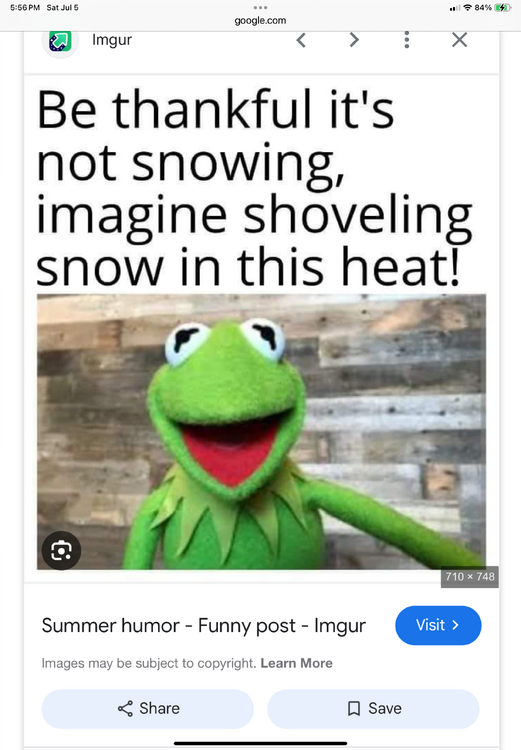
Two gorgeous days in a row. Humidity ain’t as bad as the weather media was acting like. .
-
Understood! There is always a bright side……. As always ….
-

July 2025 Obs/Disco ... possible historic month for heat
ineedsnow replied to Typhoon Tip's topic in New England
Ya looks that way but by humid in the 60 to 65 range most days.. with a couple higher mixed in -

E PA/NJ/DE Summer 2025 Obs/Discussion
donsutherland1 replied to Hurricane Agnes's topic in Philadelphia Region
87 degrees at Longwood Gardens.
-

July 2025 Discussion-OBS - seasonable summer variability
Wannabehippie replied to wdrag's topic in New York City Metro
Wouldn't rooftop stations give us inaccurate readings due to elevation? -
Yet another meteorologically unremarkable tropical system overperforms in the impacts/fatalities department due to freshwater flooding.
-

2025 Lawns & Gardens Thread. Making Lawns Great Again
Chrisrotary12 replied to Damage In Tolland's topic in New England
Just noticed today, that lawns are starting to burn out all around. -

July 2025 Obs/Disco ... possible historic month for heat
Damage In Tolland replied to Typhoon Tip's topic in New England
Nice humid week -

2025-2026 ENSO
40/70 Benchmark replied to 40/70 Benchmark's topic in Weather Forecasting and Discussion
I'd kill for 2016-2017 right now...featured about normal snowfall and I haven't seem that since 2017-2018. -

2025-2026 ENSO
PhiEaglesfan712 replied to 40/70 Benchmark's topic in Weather Forecasting and Discussion
16-17 had a very sharp cutoff right around PHL, which had 15 inches of snow that year (which was even below the 18-19 total). DC and Baltimore had about 3 inches of snow the entire winter, which puts it as one of the Top 10 least snowiest winters for those cities. I personally don't want that type of season again. The next time, the cutoff may be further north, and it may make 01-02/11-12 look like child's play. -
The 5 pm advisory shifts the track of Chantal 40 miles west at Raleigh by Monday. Possible Va/DC impact slightly increases.


