All Activity
- Past hour
-

Spring 2025 Med/Long Range Discussion
KakashiHatake2000 replied to John1122's topic in Tennessee Valley
hopefully everybody is staying safe today in southeast tn but i also wanted to show the full picture of the slight and marginal risk for excessive rainfall r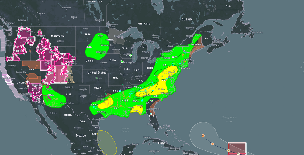
-
It looks like the NAM 3k from this morning. It had most of the heavy stuff slipping south of DC. It looks like it might be onto something.
-
being a week plus out we watch
-
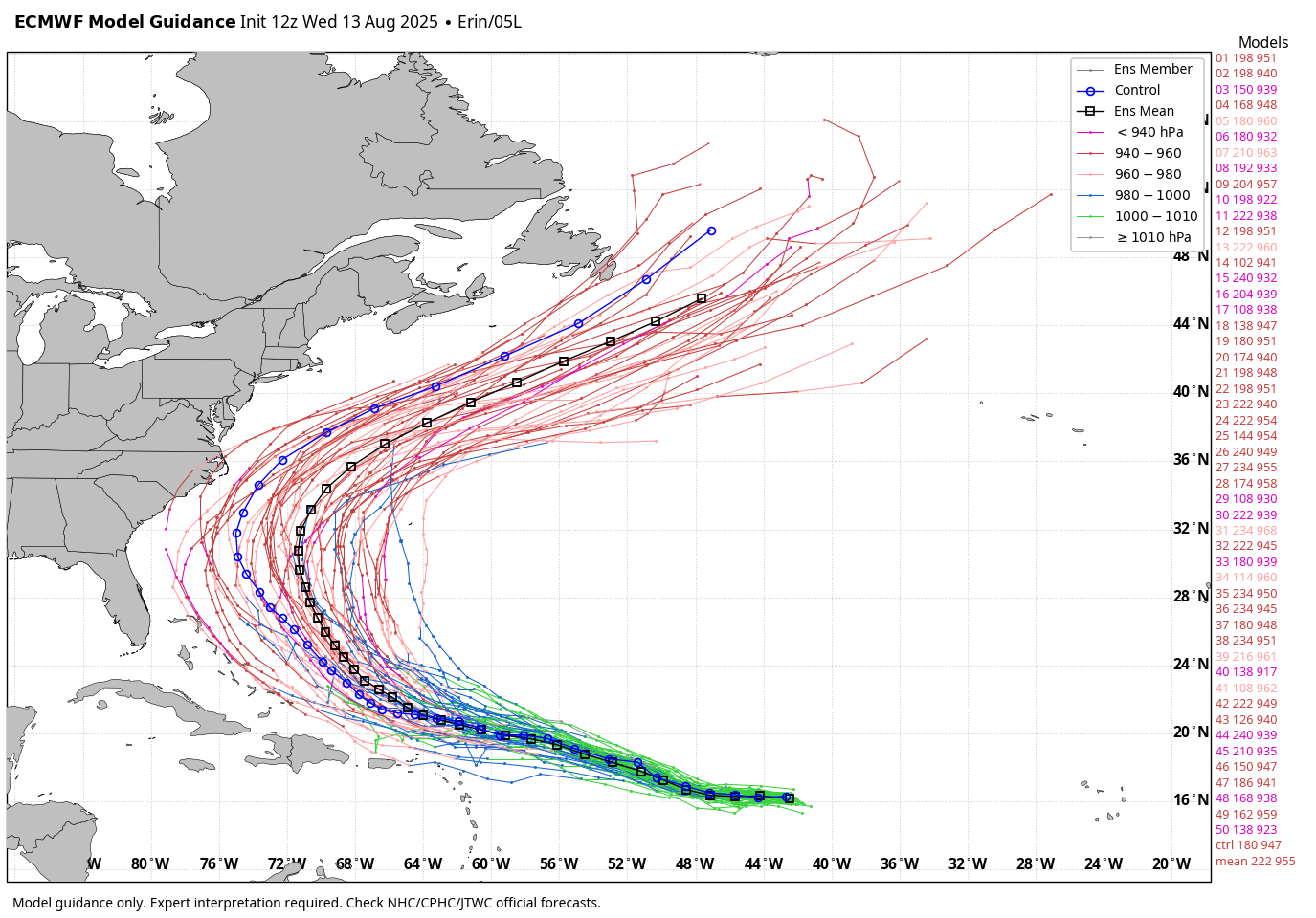
Long shot but yeah, still worth watching. The UL pattern over Canada is critical to how close this gets. Note how much less aggressive the trough is in SE Canada. That has a ripple effect across the steering pattern players. 00z 12z
-

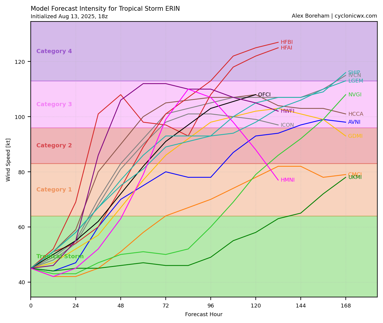
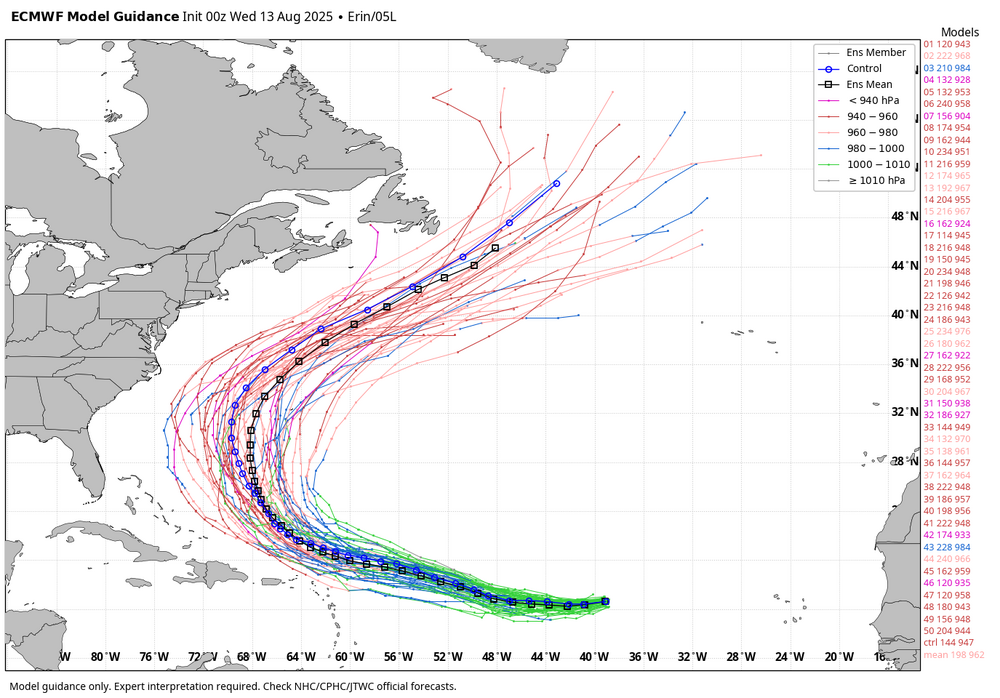
Tropical Storm Erin - NOW AT 45 KTS @ 18Z!
BarryStantonGBP replied to BarryStantonGBP's topic in Tropical Headquarters
COME ON ERIN BAM BAM BAM
-
4 extremely close strikes . A little rain
-
Tropical Storm Erin - NOW AT 45 KTS @ 18Z!
BarryStantonGBP replied to BarryStantonGBP's topic in Tropical Headquarters
AL, 05, 2025081318, , BEST, 0, 163N, 443W, 45, 1002, TS -
Well, it's still an outlier. For a closer approach you absolutely need the big ULL in Canada to back off. I don't think that's impossible. The cutoff in the GL region is a whole different level of complexity however imo. This still looks like a very very low chance for us, with meaningful risk in NF. I guess it's still worth a casual eye lol. Yeah...I'm not sure how that'll play out over time.
-
WB 12Z EPS did tick westward at 12Z compared to 0Z.

-
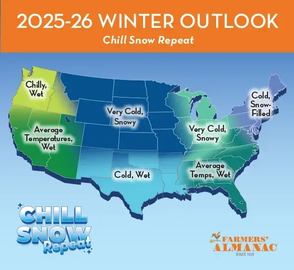
Enjoying the summer so far, it's been a great season for the pool this year. Warm water just about all summer (thanks to all the 90s). Pretty decent lightening show on the way to work this morning. Summer is cruising along. The older I get the less I look forward to the end of summer and fall and the start of Winter and he Holiday routine but don't worry I'll be in top form by November . This Farmers Almanac outlook would be sweet if it verified (probably as likely as the 384 GFS)
-
I saw this on the news last evening around yalls parts,that was crazy
-
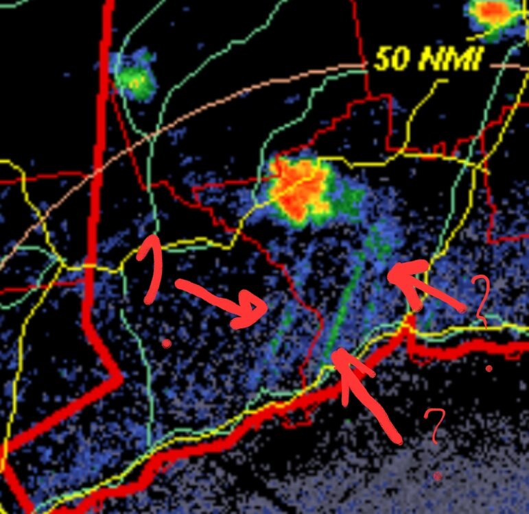
The radar has what looks like moisture being fed in strips to the storm nearby via the sound. Any other reason for the lines on the radar?
-
We knew
-
GFS way off here today. Latest GFS, 12z, had us at 95F here at 18z. High today has been 85.
-
-
This will be missed.
-

Tropical Storm Erin - NOW AT 45 KTS @ 18Z!
TriPol replied to BarryStantonGBP's topic in Tropical Headquarters
Err…40th. God I’m getting old. -
Tropical Storm Erin - NOW AT 45 KTS @ 18Z!
TriPol replied to BarryStantonGBP's topic in Tropical Headquarters
Come on Erin, you can do this! We’re in another drought up here in the northeast and it’s almost the 30th anniversary of Hurricane Gloria! -
That’s at least 2 straight 95s for HIE at over 1,000ft. I forget what they had the day prior.
-
If I get 0.25" of rain from this I'll feel lucky. Whatever this is, it is a far far cry from heavy Sent from my SM-G970U1 using Tapatalk
-
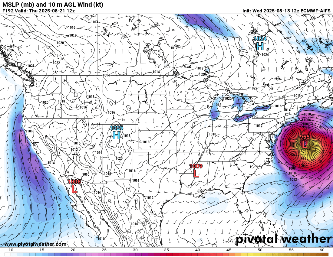
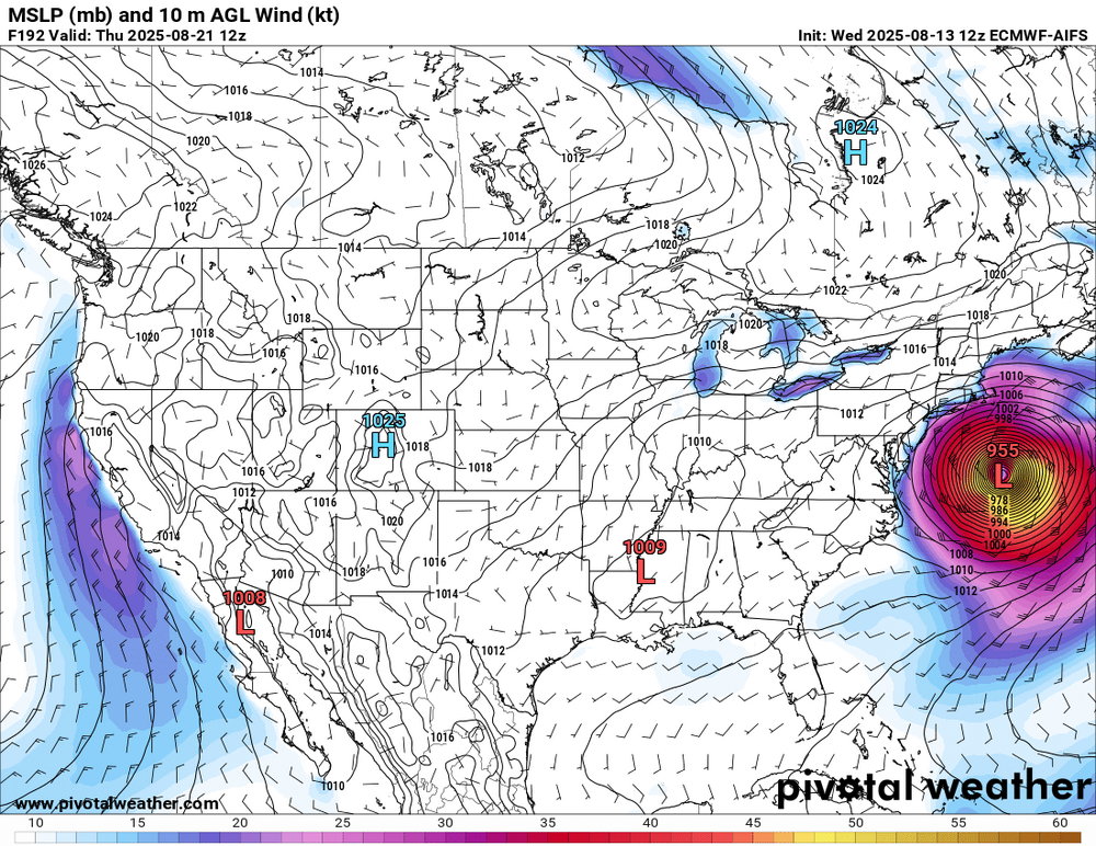
Afternoon run of the Euro would make me sweat a bit if I'm a coastal resident.
-
Poor Ditty…wrong again.
-
Sneaky severe day today: Surface CAPE 3,000 + across most of the area LI -6 or better east of US 15 High PWATs w/ some mid level drying to aid propagation of isolated wet microbursts. Surface lapse rates are decent Might see a few decent cells fire along some boundary.
-
OP is an outlier AWT...but the spread is insane
-
 Radar looks better for your area than mine Though storms seem to be moving more southeast now