All Activity
- Past hour
-

Central PA Fall Discussions and Obs
Superstorm replied to ChescoWx's topic in Upstate New York/Pennsylvania
51F at 6:14 am 0.48” of rain . -

2025-2026 Fall/Winter Mountain Thread
Buckethead replied to Buckethead's topic in Southeastern States
32 this morning in Wolf. 26 on Mt. Mitchell. Sent from my SM-S908U using Tapatalk -

Monday, October 20, 2025 Squall Line Potential
Torch Tiger replied to weatherwiz's topic in New England
Awt -
36.6 this morning! .
-

Monday, October 20, 2025 Squall Line Potential
CoastalWx replied to weatherwiz's topic in New England
Flaccid so far. Maybe it develops further east. -
0.18" Pretty much what latest guidance was advertising for here
- Today
-
Im impressed that its 68F at 430 am on 10/20…but I havent had coffee yet hahaha
-
Wow getting crushed
-
After a weak to very weak start to the SPV for the last 2 months, it looks like the long range forecasts for strengthening starting in November are going to verify
-
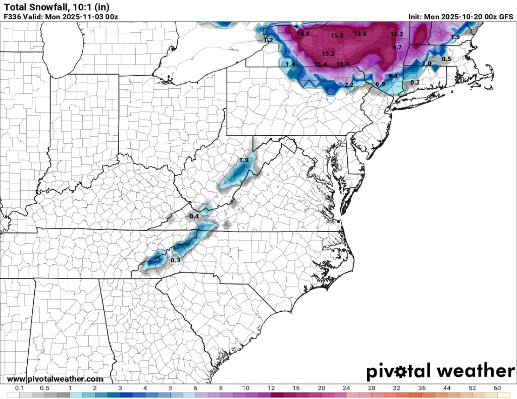
Entertainment only but the 00z gfs bringing the upslope snow. Sent from my SM-G998U using Tapatalk

-

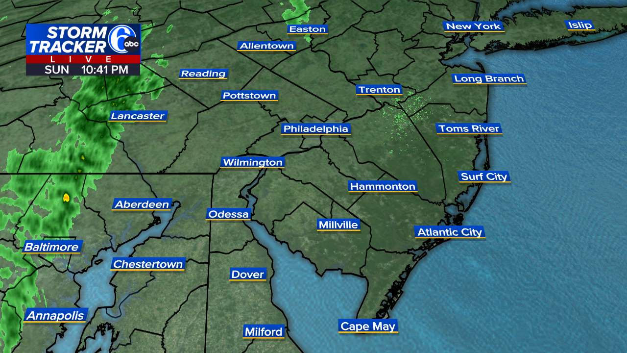
E PA/NJ/DE Autumn 2025 Obs/Discussion
Birds~69 replied to PhiEaglesfan712's topic in Philadelphia Region
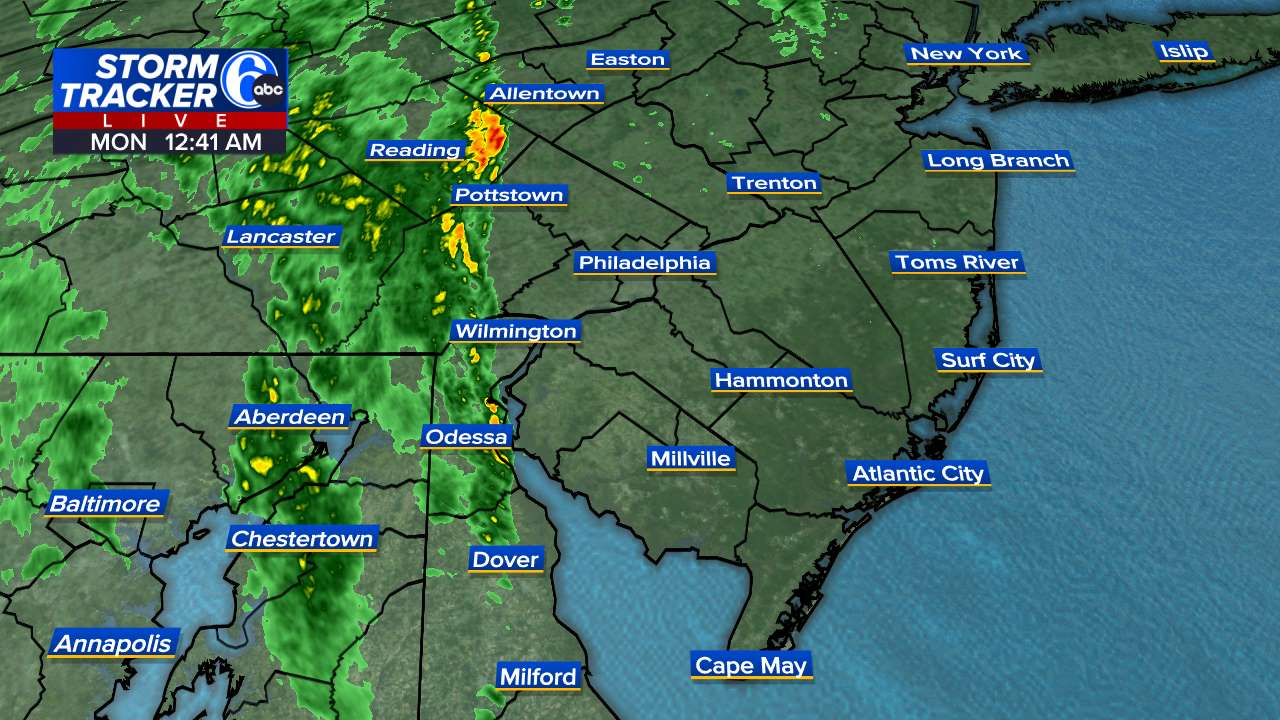
Some heavier stuff with this line.,.. gained some strength.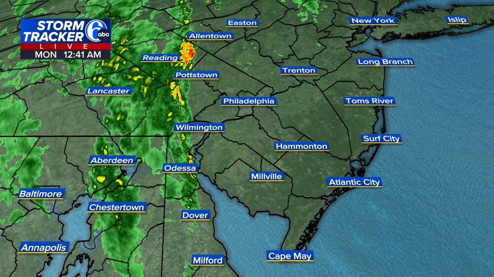
-

Central PA Fall Discussions and Obs
Jns2183 replied to ChescoWx's topic in Upstate New York/Pennsylvania
Florida State is making Penn State look like the paragon of financial prudence. Sent from my SM-G970U1 using Tapatalk -
Congrats on the rain!
-
Yeah I have an ob of sorts. This is hard to believe, but it is ONLY 57 55 degrees, with a dewpoint of 43 degrees. The wind is light out of the north If only I had some steady light to moderate rain to go with this delightful 55/42 coolness, I'd be so damn overly happy I'd run up and down Cabela's Blvd in Buda at 3am stark frackin' naked. HOWEVER tomorrow, BACK up to 94 degrees. This subtropical high just won't give up. Its the Summer With No End. I think there is no such thing, as a Pattern Change. Not this low sun season and not in Texas.
-
I really haven’t seen any reputable sources say very snowy to the point where you wish we skip winter. I think the most reasonable outlook I’ve seen the most from people that aren’t fishing for clicks and trying to spread hype is that below normal temperature stretches are definitely on the table but that the most likely outcome during those stretches would be cold and dry. Seems like our chances of getting any significant snow events is fairly unlikely as the ingredients would have to come together in a way that’s not typical for the pattern we will have in place this winter. Another winter where we will likely need to nickel and dime our way during the cold stretches if we want to get close to average snowfall.
-

Spooky Season (October Disco Thread)
powderfreak replied to Prismshine Productions's topic in New England
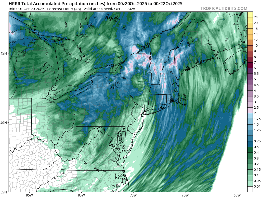
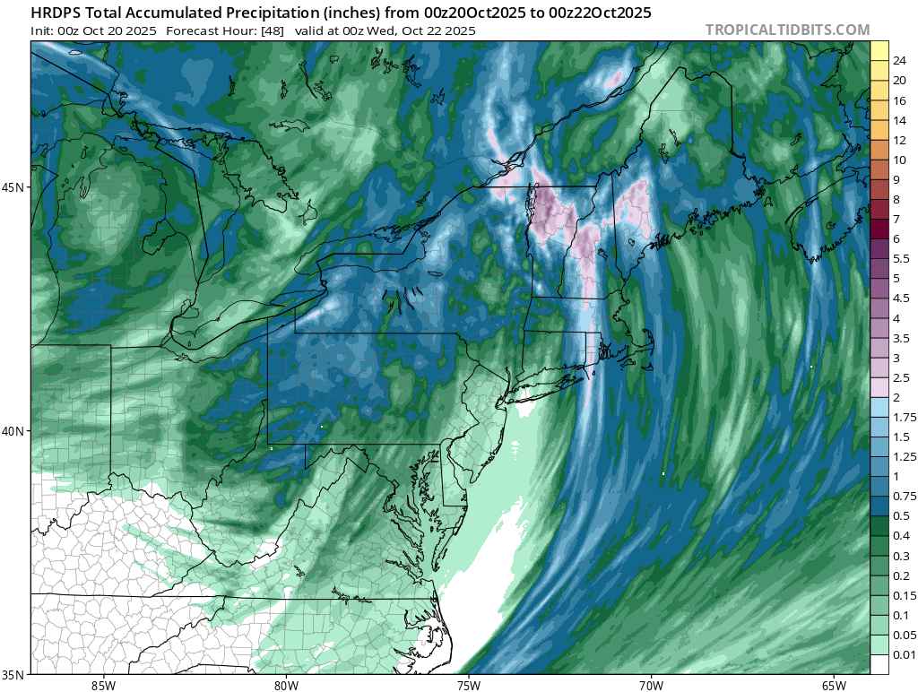
Some water coming to the drought zone. Likely overdone but a soaking rainfall en-route.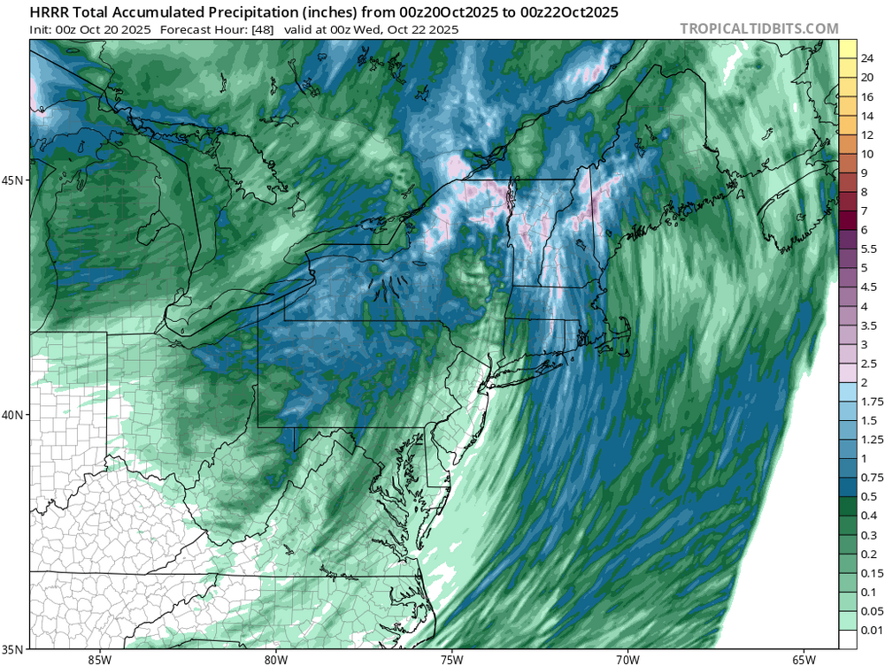
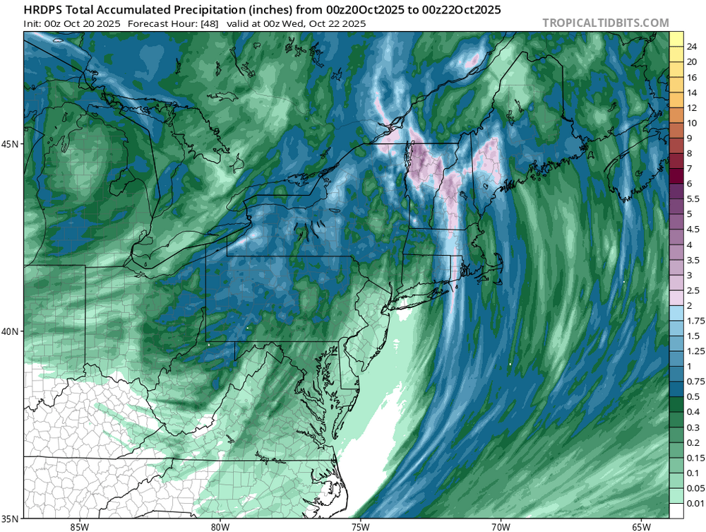
-
This is turning into a bit of an overperformer. Precip bands are almost out of the south right now.
-

Mountain West Discussion
mayjawintastawm replied to mayjawintastawm's topic in Central/Western States
There was an even crazier one 4-5 tiers high just north of Denver when I was driving into town this morning about 9:30. Couldn't take a picture though. Glad I was not in an airplane. First frost this morning, 32 degrees then it was 78 this afternoon. Typical October. The Front Range mountains are practically snow free after last week's warm rain. -
Right at 0.50 Nice eventful evening....
-
E PA/NJ/DE Autumn 2025 Obs/Discussion
Birds~69 replied to PhiEaglesfan712's topic in Philadelphia Region
Looks to be a 11:30 p.m. or so start time. Doesn't look like it will last long, 2 hours or so?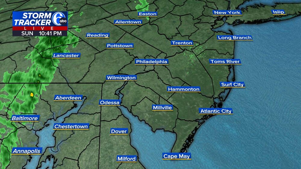
-
Raining hot and heavy here.
-
.30 - Alexandria.
-
It was pointed out that there may be possible first flakes occurring now at snowshoe wv.
-
Banter
-
Tornado warning in PG County.