All Activity
- Past hour
-
It’s weird, when we get extended arctic blasts they get record heat waves.
-

The “I bring the mojo” Jan 30-Feb 1 potential winter storm
StantonParkHoya replied to lilj4425's topic in Southeastern States
Downside of storm being near is the long wait between models -
Dan used the analog .
-

The Jan 31 Potential: Stormtracker Failure or 'Tracker Trouncing
Eskimo Joe replied to stormtracker's topic in Mid Atlantic
-
 Congrats someday I'll see one of those
 -
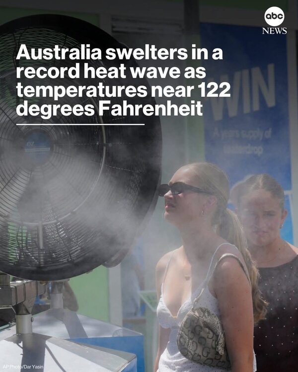
The frigid cold were getting looks to go well into February!!... Meanwhile in Australia!!!...
-

E PA/NJ/DE Winter 2025-26 Obs/Discussion
Ralph Wiggum replied to LVblizzard's topic in Philadelphia Region
If I can squeeze out a 2-4" event, I likely go over our seasonal avg (im just over 30" now iirc kdyl avg is 32ish"). -

The “I bring the mojo” Jan 30-Feb 1 potential winter storm
EarlGrey replied to lilj4425's topic in Southeastern States
What’s going on in Hawaii? -
Someone did the other day.
-

The Jan 31 Potential: Stormtracker Failure or 'Tracker Trouncing
Nomz replied to stormtracker's topic in Mid Atlantic
00z NAM is off and running -

January 2026 Medium/Long Range Discussion
Snowciopathic Snow Bro replied to snowfan's topic in Mid Atlantic
I think I still have some of those interactions archived somewhere. -

January 2026 Medium/Long Range Discussion
midatlanticweather replied to snowfan's topic in Mid Atlantic
Well, someone should make a February Medium to long range. The storm tracking thread should cover the next few days. -

Richmond Metro/Hampton Roads Area Discussion
chris624wx replied to RIC Airport's topic in Mid Atlantic
-

January 2026 Short/Medium Range Thread
Holston_River_Rambler replied to John1122's topic in Tennessee Valley
Trying to keep it fresh, salty, and buttery this evening. -

Pittsburgh/Western PA WINTER ‘25/‘26
RitualOfTheTrout replied to Burghblizz's topic in Upstate New York/Pennsylvania
I think we want that whole progression to happen further north, snow is almost at the pa line. I think its to much to ask for the coastal to be far enough inland to give us anything. All of this of course assumes the GFS doesn't cave to everything else anyways. -

The “I bring the mojo” Jan 30-Feb 1 potential winter storm
CentralNC replied to lilj4425's topic in Southeastern States
3/13/993 had a blizzard warning in Guilford and Forsyth counties -

Snow Contest January 25th-26th
Roger Smith replied to WeatherGeek2025's topic in New York City Metro
I did a quick look through the forecasts now that I know the outcomes and it looks like a close fight among a number of you, including our contest host, for lowest aggregate error. My blunder to say PHL 3.7" plus a lot of sleet, of course that was probably true except the sleet should be in the total too. Duh. KP for BOS however. A lot of us thought Albany would exceed 12.6" -- going back into charts to make sure they haven't revised that one. -

The Jan 31 Potential: Stormtracker Failure or 'Tracker Trouncing
Weather Will replied to stormtracker's topic in Mid Atlantic
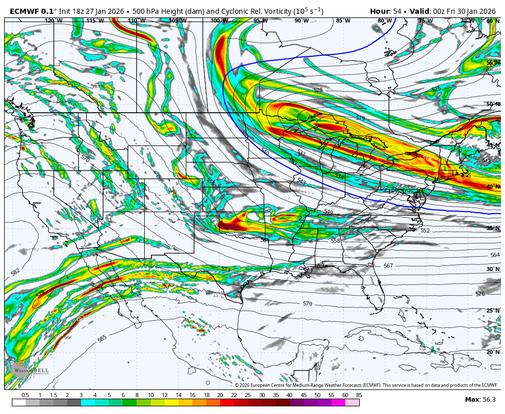
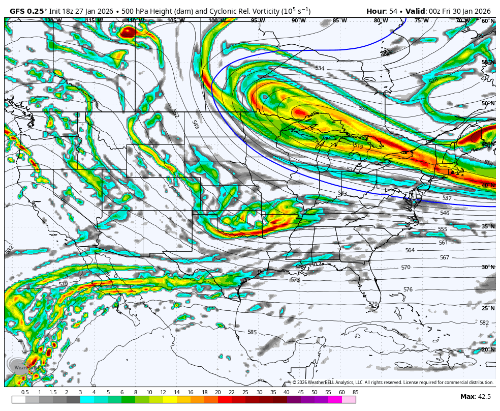
WB 0Z HRRR 7 pm Th.compared to 18Z EURO and GFS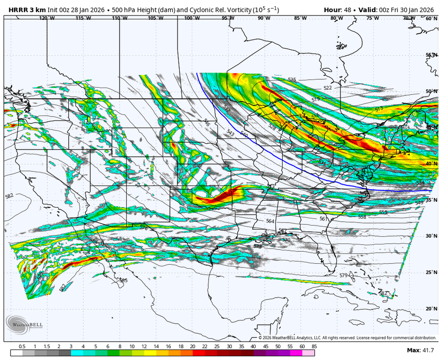


-

The Jan 31 Potential: Stormtracker Failure or 'Tracker Trouncing
bncho replied to stormtracker's topic in Mid Atlantic
Give me ~20 minutes. Waiting for somebody in SouthernWX to post it, then I'll share it here. -
With that energy at 925mb, I smell a lee trough surprise
-

1/24-1/25 Major Winter Storm - S. IL, IN, and OH
michsnowfreak replied to A-L-E-K's topic in Lakes/Ohio Valley
Lmao you complained about double digit snowstorms all the time back in the 2000s/10s. You did in 2014, even with 2 feet on the ground because with all the storms we had no individual fall was over 12". The very next year, when Detroit got nearly 17" of snow on Feb 1/2, 2015 you found plenty of critique saying it was boring and took 24 hours to achieve (despite hours of visibility below 1/4 mile). Our last double digit storm (Feb 2021) you dont remember (even though you were in FL) so I guess it didnt happen. In fact you ghost this board all year except in winter when youre in FL so you can troll/repeat how no 20" storms are hitting SE MI. Me posting how many 20"+ storms in every first order station in the entire non-lake belt midwest is not "bs", its actual weather data. And how extremely lucky that you've experienced several! Your job just happened to place you in a town the exact day a 20" storm hit. That's lotto lucky. As for the tundra. Theres deep snow in place and mountains of snow everywhere, so i dont mind it in the least. Perfect for winter rec. -

Pittsburgh/Western PA WINTER ‘25/‘26
Mailman replied to Burghblizz's topic in Upstate New York/Pennsylvania
Probably get a 3" report from Monessen from it. -
You did really well.
-

The Jan 31 Potential: Stormtracker Failure or 'Tracker Trouncing
MDstorm replied to stormtracker's topic in Mid Atlantic
Seeing the models evolve over the last 24 hours has me haunted by the Boxing Day storm of 2010. I was a bit younger then and don’t remember all of the details, but I do remember a snow shield essentially bypassing MD west of the bay as it hit VA, swung east around MD and then swung back to hit areas to the northeast. Someone please tell me that this is not going to happen with this storm. -

The Jan 31 Potential: Stormtracker Failure or 'Tracker Trouncing
Climate175 replied to stormtracker's topic in Mid Atlantic
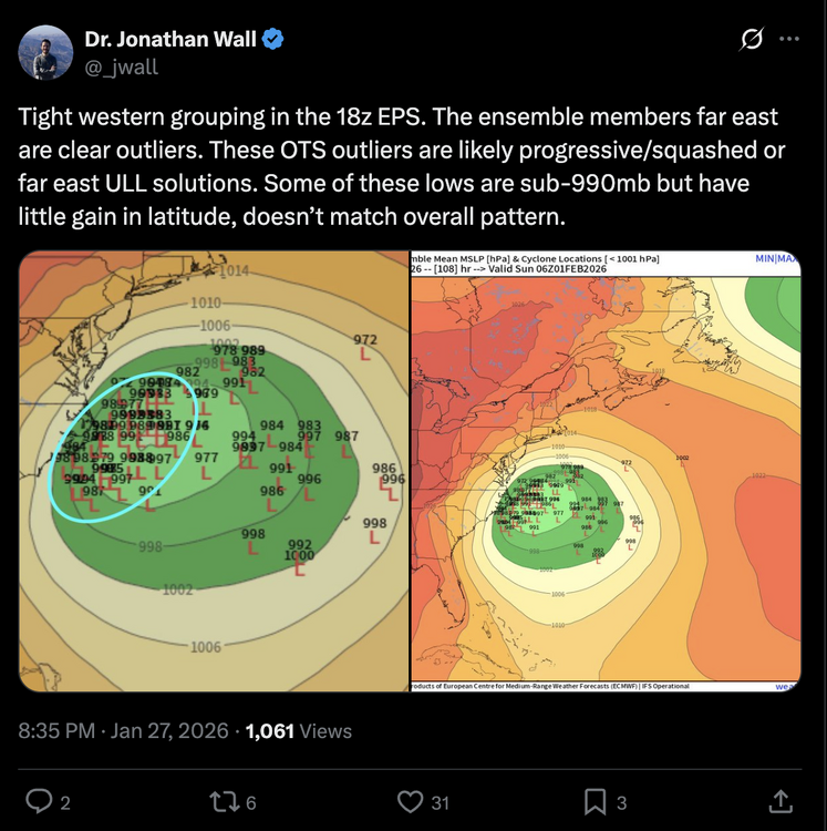
It said the 06z WeatherNext 2.0 was OTS and it indeed was. Let's see what the actual map says if someone is able to post it later.