All Activity
- Past hour
-
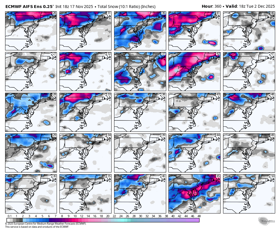
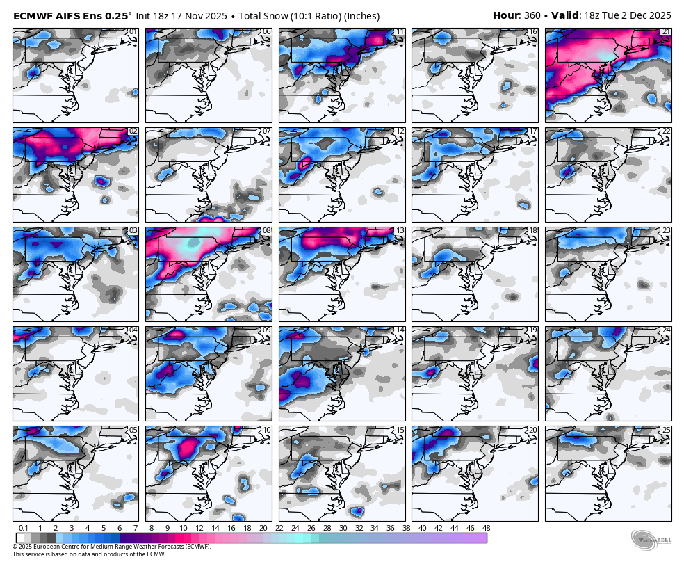
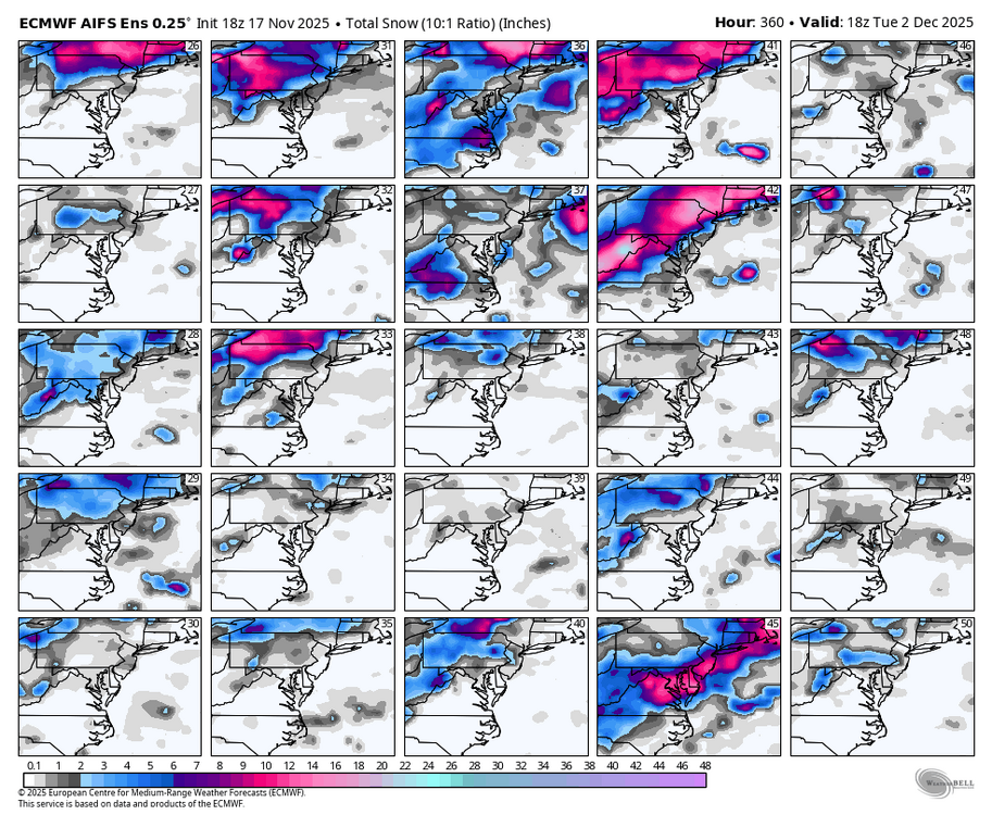
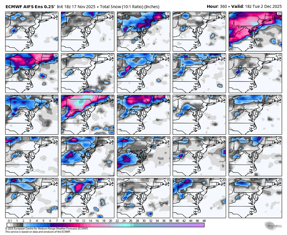
WB 18Z AI EPS: first threat of the season in early December?
-

November 2025 general discussions and probable topic derailings ...
WinterWolf replied to Typhoon Tip's topic in New England
We never go wire to wire you silly goose. Where the hell do you think you live? And You always try to put a spin on shit… -
 Find one great winter in SNE wire to wire with a bad PAC. Just 1
 -
The Christmas of a lifetime. The whole family was over and drunk and we opened the door and holy shit!
-
November 2025 general discussions and probable topic derailings ...
WinterWolf replied to Typhoon Tip's topic in New England
Actually it can…but the pacific looks to improve. The reversed Psych act is getting old. You’ll be going gung ho in a couple weeks….I’ll bump this when you do. -
Tomorrow will be another cool day with highs topping out in the 40s. Below normal temperatures will prevail through at least Wednesday and possibly Thursday. Highs will be mainly in the middle and upper 40s in New York City with lows in the middle and upper 30s. A milder pattern will likely develop during the latter part of the week. Some rain or rain showers are possible. Once in place, the milder pattern could continue for a week or longer. Meanwhile, today will be Central Park's 1,388th consecutive day without daily snowfall of 4" or more. The record of 1,394 days was set during February 22, 1929 through December 16, 1932. That stretch ended with 6.7" daily snowfall on December 17, 1932. The ENSO Region 1+2 anomaly was -0.7°C and the Region 3.4 anomaly was -0.7°C for the week centered around November 12. For the past six weeks, the ENSO Region 1+2 anomaly has averaged -0.16°C and the ENSO Region 3.4 anomaly has averaged -0.65°C. La Niña conditions will likely continue through at least mid-winter. The SOI was +19.47 today. The preliminary Arctic Oscillation (AO) was -2.297 today. Based on sensitivity analysis applied to the latest guidance, there is an implied 62% probability that New York City will have a cooler than normal November (1991-2020 normal). November will likely finish with a mean temperature near 47.5° (0.5° below normal). Supplemental Information: The projected mean would be 0.2° below the 1981-2010 normal monthly value.
-

December 2025 Short/Medium Range Forecast Thread
Daniel Boone replied to John1122's topic in Tennessee Valley
Couple duds in there. '72-73 and 08-09. 2005-06 slightly above Temperatures with slightly below average Snowfall. Very Mild January.. 85-86 was great. below average Temps, above average Snowfall. 64-65 was average with above Snowfall. 96-97 avg Temps and Slightly below Snowfall. 08-09 slightly above Temperatures, below average Snowfall. 80-81 below Average Temps, above Snowfall. 09-10 great. Below average Temps above average Snowfall. John, you probably have more detailed information in these. -

E PA/NJ/DE Autumn 2025 Obs/Discussion
RedSky replied to PhiEaglesfan712's topic in Philadelphia Region
I have seen snow before, this month even -

2025-2026 ENSO
Stormchaserchuck1 replied to 40/70 Benchmark's topic in Weather Forecasting and Discussion
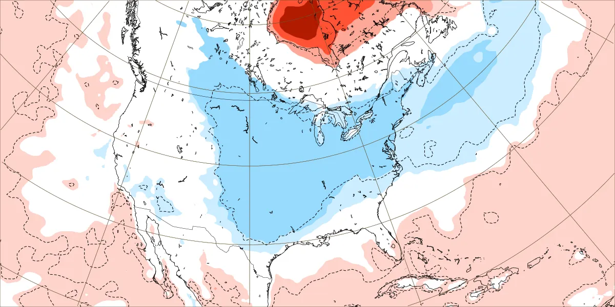
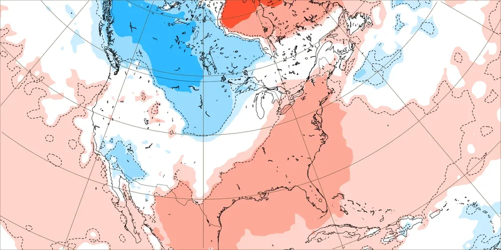
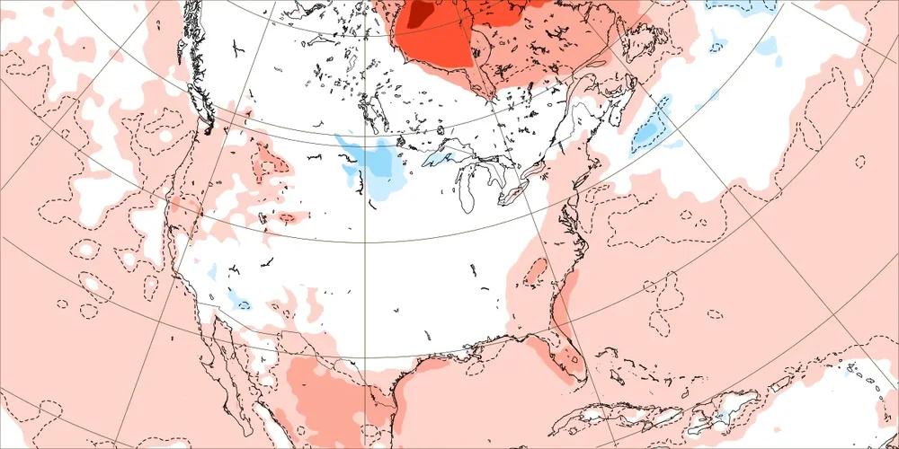
They are catching onto the time-lagged -NAO from November Stratosphere warming (late Dec -NAO). Still, that Dec 1-7 map is pretty significantly different from a few weeks ago.. the seasonal models don't fluctuate that much. -
This is by a good margin the weakest SPV on any run. If this verifies closely, this would be the weakest late Nov to early Dec SPV by a good margin since way back in 1987! We know that one month later there was a historic SE winter storm, which gave Atlanta 4” of sleet, very heavy snowfall in some other areas, and ZR down all of the way down here.
-
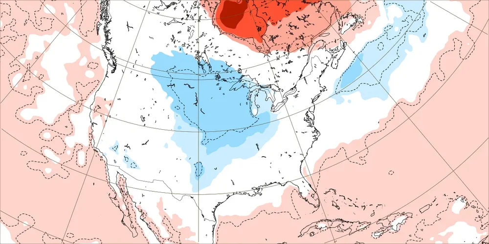
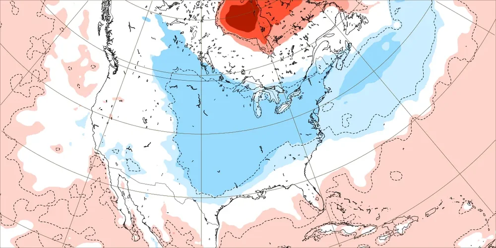
Per this EW run’s weekly 2m maps directly from the source, it remains a step down process from a mild E US start: Dec 1-7: mild Dec 8-14: cools some to slightly mild to normal Dec 15-21: cools to normal Dec 22-28: cold comes in around Christmas!
-

November 2025 general discussions and probable topic derailings ...
kdxken replied to Typhoon Tip's topic in New England
I'm surprised powder freak hasn't been rubbing it in our faces. -
lol oh ha. Didn’t even catch that
-

November 2025 general discussions and probable topic derailings ...
ORH_wxman replied to Typhoon Tip's topic in New England
It was fine last winter. We just couldn’t get the big storms.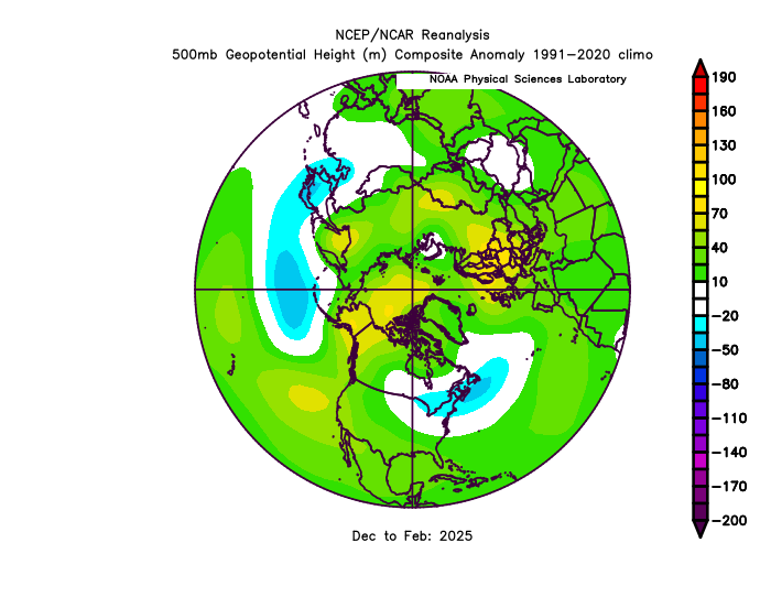
-
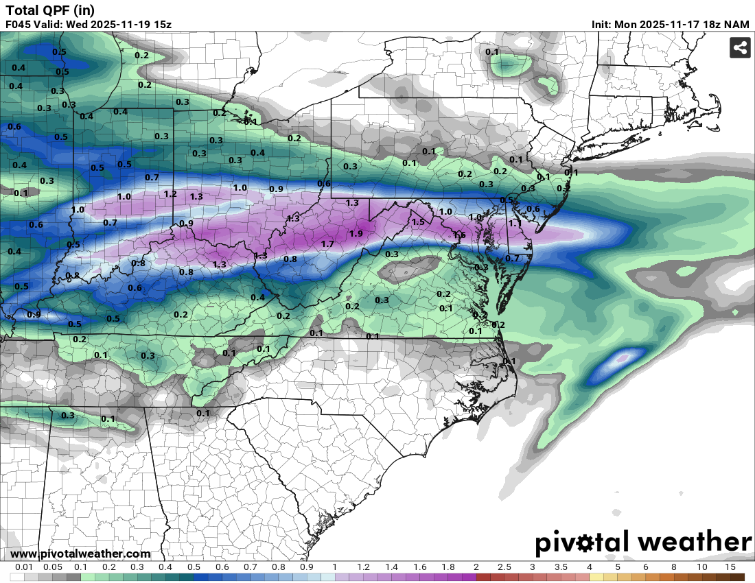
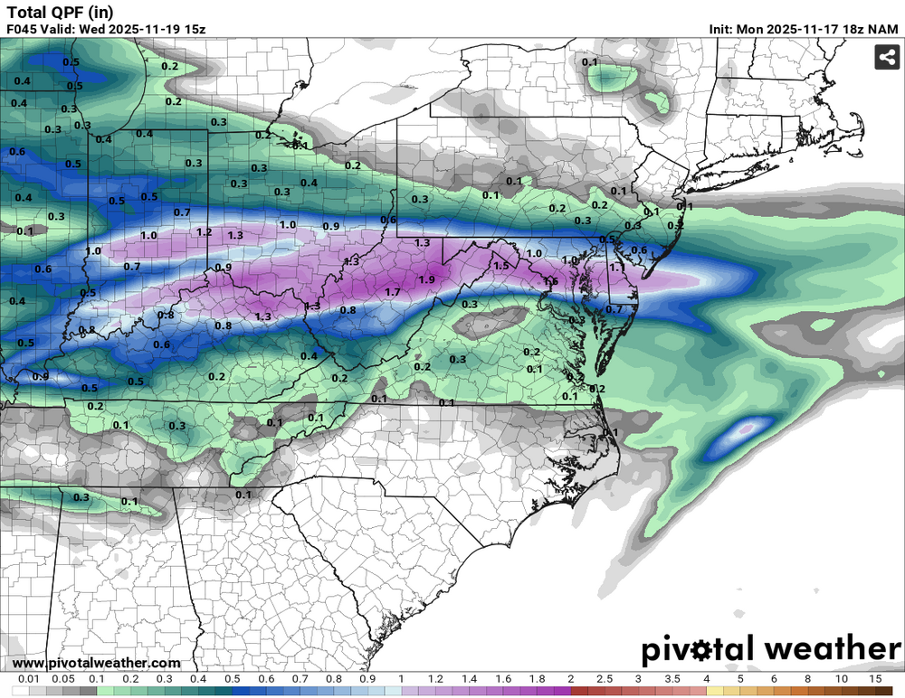
12km NAM doing its NAM thing on us, look at all that 1+" purple!
-
Some more shots I took from May 10th, 2024 that I never went through:
-

November 2025 general discussions and probable topic derailings ...
dryslot replied to Typhoon Tip's topic in New England
Its winter incoming with the NS version of Will with Uncle Leo!!! -

November 2025 general discussions and probable topic derailings ...
MJO812 replied to Typhoon Tip's topic in New England
This isnt true at all. Down here i would be screwed but you wouldn't -

November 2025 general discussions and probable topic derailings ...
CoastalWx replied to Typhoon Tip's topic in New England
Uncle Leo!! -
I think he's making a joke about it looking like it says negative 16 inches, lol
- Today
-
Are the two tornadoes in 1927 the same tornado?
-
Funny thing is 2016-17 had a very good December. It was the rest of the winter that was mild.
-

November 2025 general discussions and probable topic derailings ...
leo2000 replied to Typhoon Tip's topic in New England
Showing a fantasy storm for Nova Scotia already in the long range a good sign. Gfs 18z at 360 hours lol. -
It's too bad it's not a month later or this would be a decent snowstorm, at least here. It's the rising-out-from-negNAO storm.
-
A bad or negative Pacific cannot be overcome in the northeast. Particularly south of NNE. If it’s hostile . A good to great winter is virtually impossible