All Activity
- Past hour
-
I blame McLaurin. Hold out all summer and unsurprisingly gets injured. And his hold out was a distraction all training camp. Overrated Overpayed
-

Spooky Season (October Disco Thread)
kdxken replied to Prismshine Productions's topic in New England
I got to give this woman credit. (Pictured, her mother putting ice on a sting) Moments later she picked two out of her beer and flicked 'em. I appreciate people who value beer.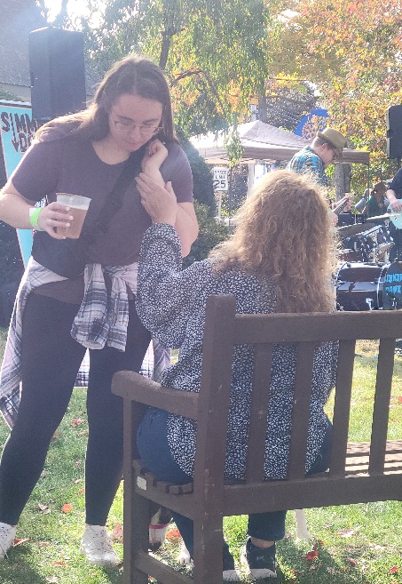
-
May get first Flakes early November in Valley Locations.
-
Larry it definitely was a historical event to remember..im glad yall got nailed.
-
Not for me. We usually have to wait many years and sometimes several decades between big winter storms. We loved our 3” of sleet, easily the heaviest sleet on record! Just like you guys love your snow, we loved our sleet and look forward to the next big winter storm in whatever decade that will be if we’re fortunate enough to still be around to enjoy it. And even if we had gotten nothing, just seeing a historic wx extreme like they had in FL of nearly a 10” max last winter would still have been fascinating on its own to follow. I don’t get upset when places south of us get a winter storm and I don’t.
-
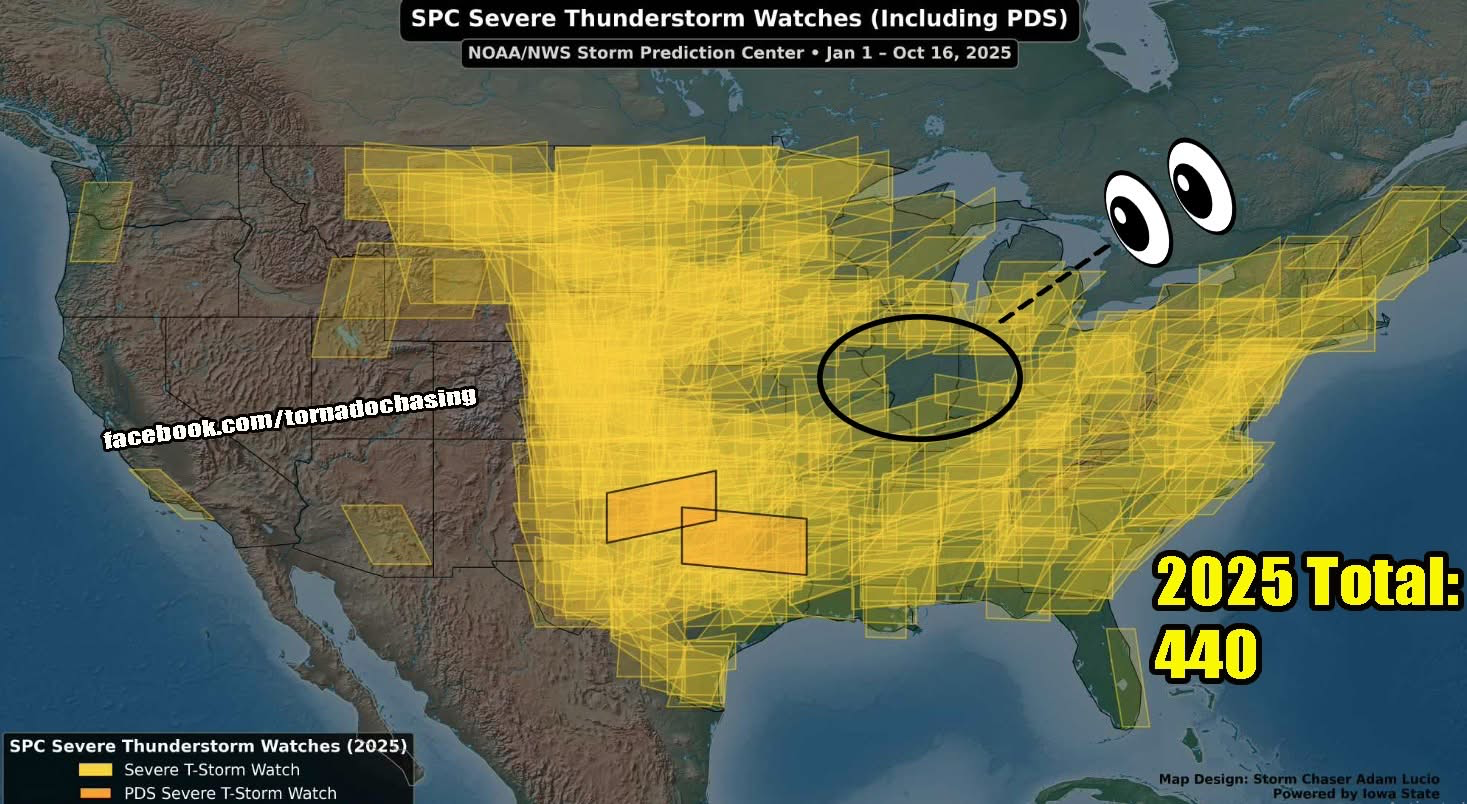
Wild map this year. Stolen from FB

-
So how’s hockey lookin? Cause the commanders are back to Snyder era playing
-

Spooky Season (October Disco Thread)
DavisStraight replied to Prismshine Productions's topic in New England
Guy at the golf course got stung last year at this time and was allergic, couldn't find his epi pen in time. Good guy too. -
Line warned in Allegany County/WV:
-
70.4 in Muttontown & 70.1 in Syosset for the high.
-
Cumberland gusted to 50 mph.
-

Central PA Fall Discussions and Obs
canderson replied to ChescoWx's topic in Upstate New York/Pennsylvania
Aside the fact it is 77. -

2025-2026 ENSO
donsutherland1 replied to 40/70 Benchmark's topic in Weather Forecasting and Discussion
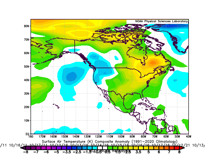
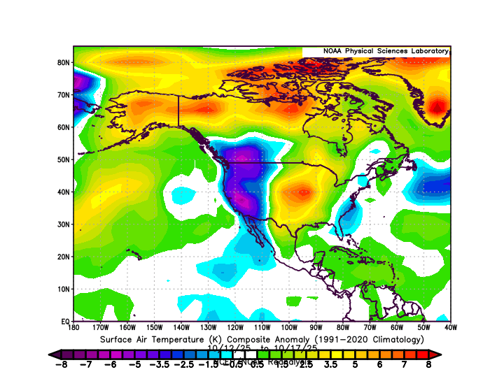
Analogs, because they are derived from boundary conditions, do not capture synoptic details. Thus, very short timeframes aren't great for assessing them. Periods of 1-3 months provide greater assessment value, as things essentially average out from a series of synoptic events. In theory, the better analogs should come up with a reasonable but not perfect approximation of the 1-3 month period. As North American data is available for October 12-17, I used that to make some comparisons: 2013-2024 Composite: 2011-2016-2021 Experimental Statistically-Generated Cases (discussed earlier in this thread): Actual: October 12-17, 2025: Overall, the actual 2025 data is more amplified than the composite analog cases, aside from spatial differences e.g., misaligned areas of cold and warm anomalies. These kind of differences are to be expected at the very short timeframes used, as synoptic details outweigh boundary conditions at such timeframes. If there is value in either set of analogs, that would become evident over the longer periods of time where boundary conditions outweigh synoptic details.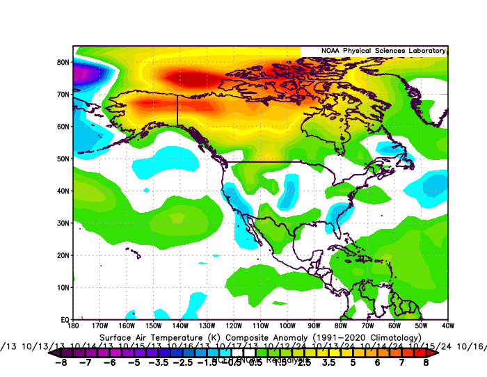
-
The Euro Weeklies this evening are depicting a cold pattern to end October and begin November...transient type of pattern. By the end of November, they look quite cold and storm.
- Today
-

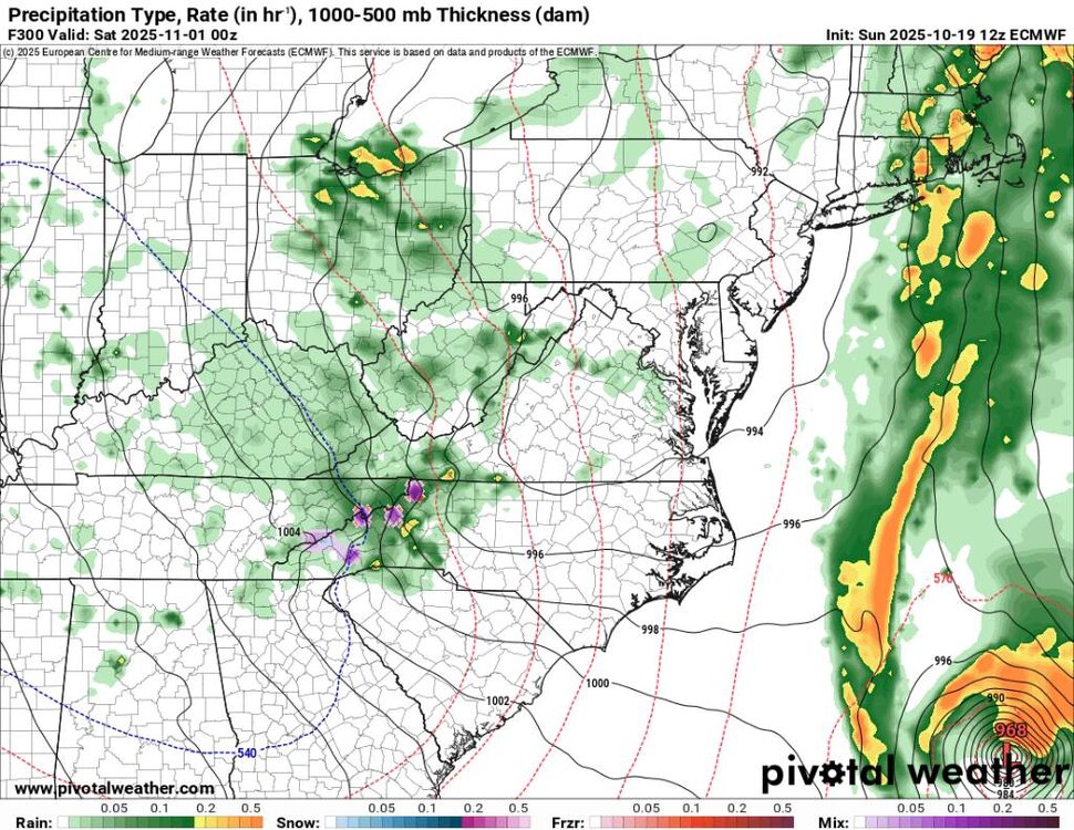
Monday, October 20, 2025 Squall Line Potential
metagraphica replied to weatherwiz's topic in New England
30-40 out of the SE in my hood and I'll lose power. Again. -
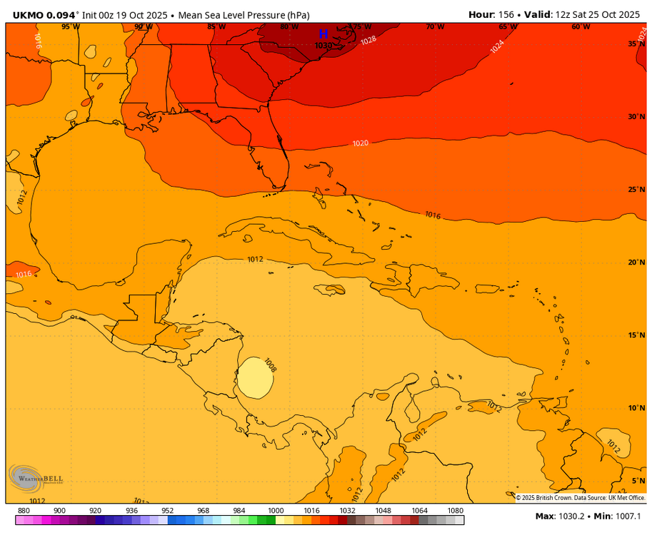
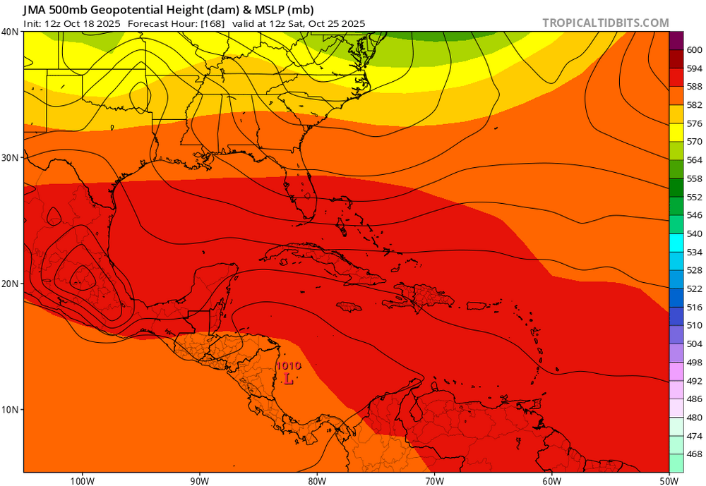
Followup: -12Z UKMET is still another headed into Nicaragua with a weak low -12Z JMA: after four 12z runs in a row of weak low into Nicaragua, today’s is a bit stronger (1005 mb) and slightly further N with a Mitch-like track that skims N coast of Honduras
-

Mid to long range discussion- 2025
WinstonSalemArlington replied to wncsnow's topic in Southeastern States
Monday morning wind chills -
70.6
-

Monday, October 20, 2025 Squall Line Potential
Damage In Tolland replied to weatherwiz's topic in New England
Clubs ripped out of bags and thrown into pond? -

Central PA Fall Discussions and Obs
Jns2183 replied to ChescoWx's topic in Upstate New York/Pennsylvania
I love this wind. It makes it fall for me. I nice south easter Sent from my SM-G970U1 using Tapatalk -
Yep! Sent from my SM-G998U using Tapatalk
-

Monday, October 20, 2025 Squall Line Potential
Chrisrotary12 replied to weatherwiz's topic in New England
Still waiting for my 10a golf tournament in Dover, NH to be cancelled. Otherwise it’s going to be wild. -
70 the high here today
-
Under mostly sunny skies, much of the region saw temperatures reach or exceed 70° today. Highs included: Atlantic City: 70° Bridgeport: 70° Islip: 70° New Haven: 71° New York City-Central Park: 70° New York City-JFK Airport: 70° New York City-LaGuardia Airport: 71° Newark: 73° Philadelphia: 72° A cold front will move across the region tonight into tomorrow morning. Low pressure will likely form along the front and move across the region. Periods of rain and perhaps some thunderstorms are likely into tomorrow. A period of severe weather is possible. A general 0.25"-0.75" rainfall with locally higher amounts appears likely. Following the frontal and storm passage, temperatures will top out in the lower and middle 60s through midweek. A stronger push of cold air could arrive afterward. Cool temperatures will likely persist through next weekend. The ENSO Region 1+2 anomaly was -0.1°C and the Region 3.4 anomaly was -0.3°C for the week centered around October 8. For the past six weeks, the ENSO Region 1+2 anomaly has averaged -0.12°C and the ENSO Region 3.4 anomaly has averaged -0.42°C. La Niña conditions will likely continue through mid-winter. The SOI was +7.60 today. The preliminary Arctic Oscillation (AO) was -0.919 today. Based on sensitivity analysis applied to the latest guidance, there is an implied 63% probability that New York City will have a warmer than normal October (1991-2020 normal). October will likely finish with a mean temperature near 58.5° (0.6° above normal). Supplemental Information: The projected mean would be 1.6° above the 1981-2010 normal monthly value.
-

Monday, October 20, 2025 Squall Line Potential
CoastalWx replied to weatherwiz's topic in New England
Ahh the clowns