All Activity
- Past hour
-
Radar shows it finally pulling west and north of Albany proper but damage is clearly done.
-
 JTWC says it is at 130kt, a strong category 4 (supertyphoon) possibly rising to 155kt, which is much above the category-5 critera.
 -
We need the PDO to go positive IMHO. Bastardi looked at it recently, and mentioned 23-24 as a year that occurred (Nino and -PDO). It tried to go cold but the cold ended up along the spine and front range of the Rockies. There was no mechanism to get the cold into the East for long periods of time. The needed QBO cycle(for cold, snowy) is what is counterintuitive given the solar state(dropping flux at the back en of this cycle?) and ENSO combo. Now, the PDO has moved towards neutral this year. That index really likes to double dip, but this has been a severely negative episode for several years, and I wonder if it flips positive for a bit. However, it could briefly go positive or neutral and then back negative.
-
You guys have some nice storms building from the SW. Be sure to unplug the force field projector.
-
Buddies of mine are sending videos from upstate. Parts of Albany proper are under feet of water. Even Stuyvesant Plaza, uptown by UAlbany, is flooding.
-
 Yesterday was the first day in 12 days where ORH was AN +0.5F MTD. Today will drop that a bit
 -
I agree with your thoughts here. I follow weather a lot and even I don't really understand the meaning of the "Tornado Warning" well. When I hear the alert, I'm instantly thinking there's a tornado somewhere on the ground near me, but the truth is that the warning is a predictor that there might be one on the ground near me or one could form near where I am.
-
Great question. One of the guys at WxBell maybe had an article about that. The best winter scenario might be opposite of what I think is normally best. I hate to guess. Let me go look. But the correlation w/ a strong Nino and PDO is tricky.
-
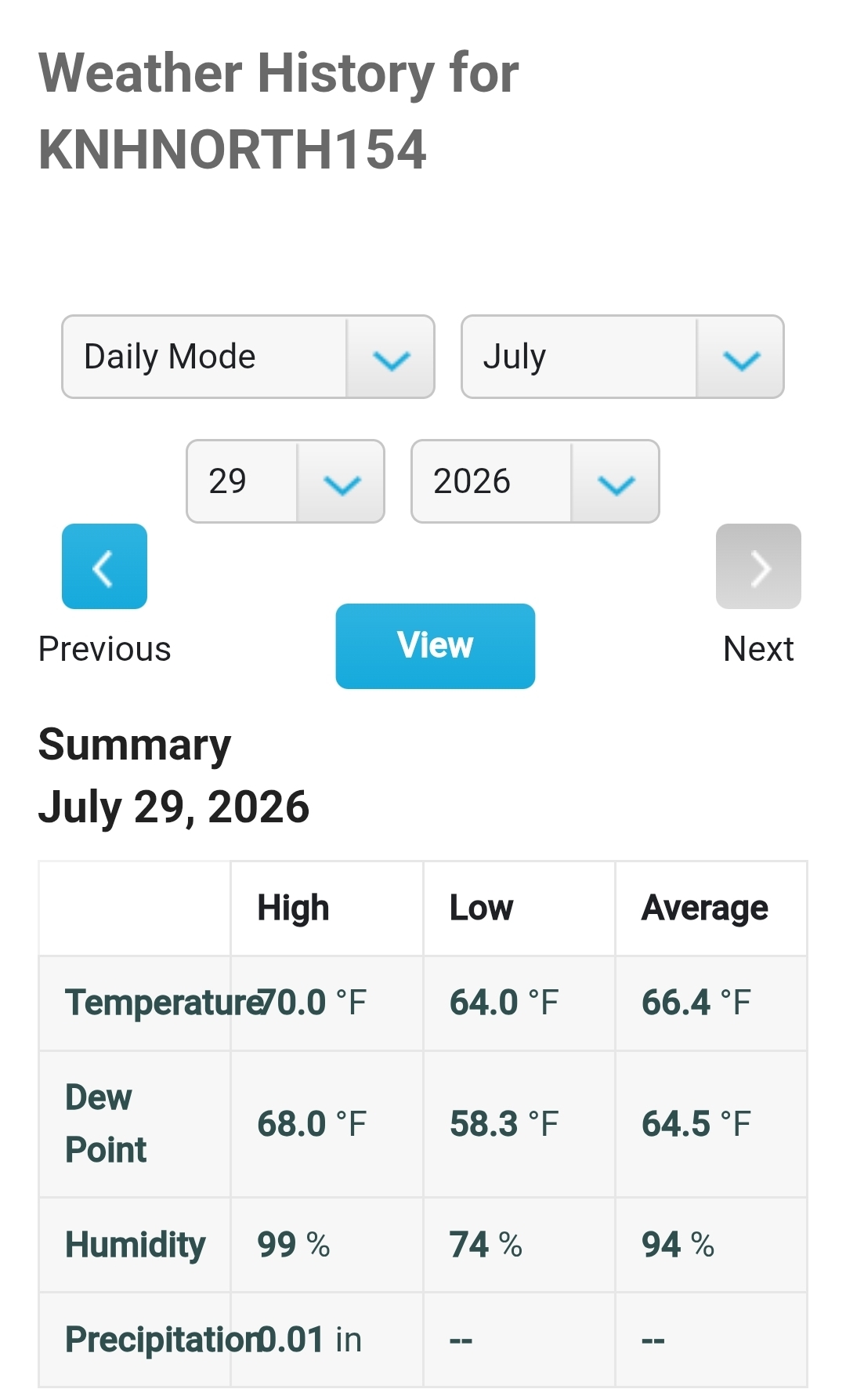
 Not my station, but 0.01” here too. Just a hundredth feels like a deluge. I’m 4…not 154.
 -
 Man what a stein. Did not expect that. Maybe more develops.
 -
 Pouring and getting some pretty good gust
 -
 Happy now?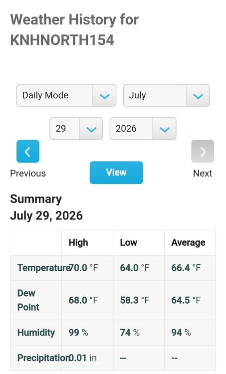
-
You asked for it.
-

2026-2027 Super El Nino
bluewave replied to Stormchaserchuck1's topic in Weather Forecasting and Discussion
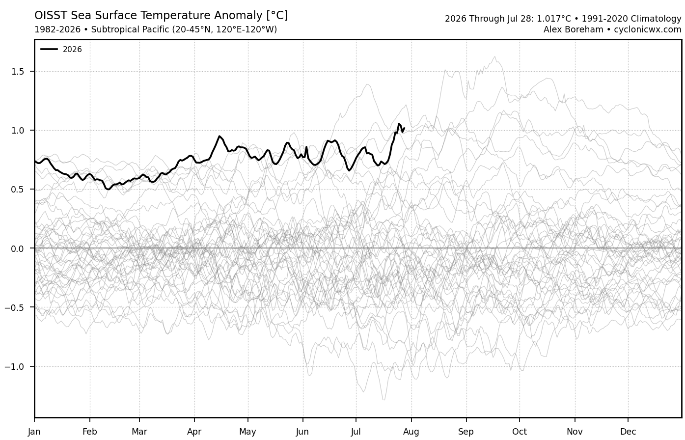
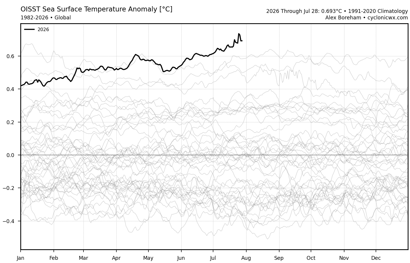
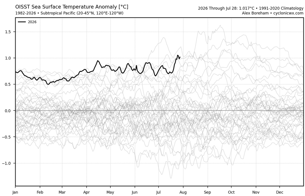
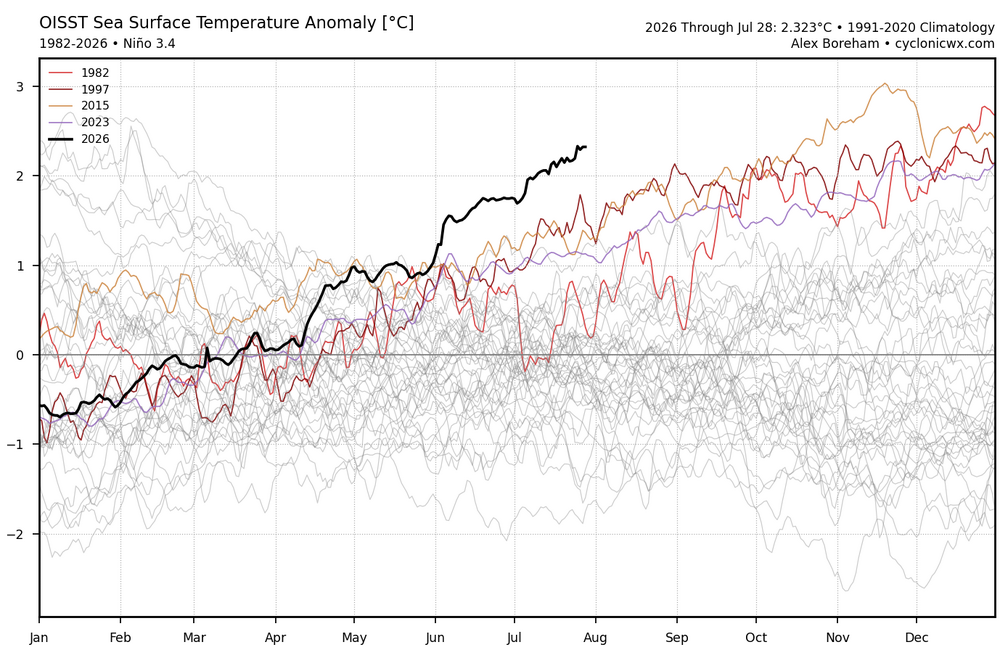
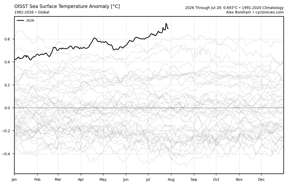
The Pacific mid-latitude SSTs are also near the record for the date. This has helped to drive the daily -PDO closer to -2. So no surprise that global SSTs are at record levels also.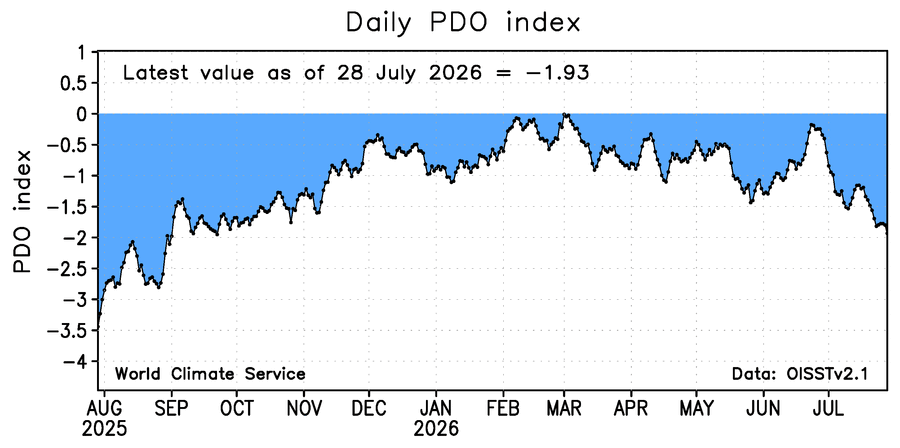
-
 I hope we get more than 0.5" but not planning on it. Salivating seeing SNE rack it up. 2-3" would have been ideal Sent from my SM-S921U using Tapatalk
 -

2026-2027 Super El Nino
snowman19 replied to Stormchaserchuck1's topic in Weather Forecasting and Discussion
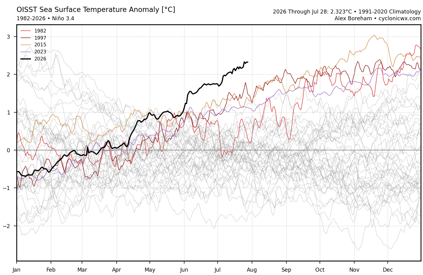
This Nino is about to go nuclear: ^ IMO the subsurface peaks at or around +12C. And the EURO keeps getting stronger with the next WWB forecast for August, which is going to cause another DWKW: Here comes the NH coupling: IOD is now officially positive: And the “ELI” ENSO Longitude Index, which measures how far east/west the deep convection/forcing (standing wave) is, is now in 2nd place for the furthest east on record to date, only, you guessed it, 1997 was further east and not by much. With the 30C isotherm east of the dateline, it’s virtually guaranteed that this year takes 1st place on that index for having the furthest east main tropical convective forcing: -
 wow
wow -
 Sunny in Southbury, yesss.
 -
Pouring here now
-
Incredible structure. Clear environment around it too, rare for central NC
-
 yeah, look at the extreeeeeeeeeeeeeeeeeme dewpoints! it feels so good, pouring rain with dews matching the temps. i sure hope DIT is outside enjoying this
 -
 Holy downpour! Make that 3”+ now.
 -
 Albany two-day rainfall (POR to 1874): 1 6.12 1999-09-17 Floyd 2 5.72 2010-10-01 0 3 5.69 1999-09-16 See #1 4 5.41 1948-12-31 0 5 4.96 1950-09-01 0 6 4.92 1960-09-12 Donna 7 4.84 1971-08-28 Doria 8 4.83 2011-08-28 Irene - 4.83 1927-08-29 0 10 4.76 1903-10-09 0 KALB is up to 5.92 and should make it past 6.12 pretty easily.