All Activity
- Past hour
-
Gonna wait on 12z run (possibly 18z)...but right now I wouldn't put 0% chance for MBY for snow, but it ain't much higher. Leaning toward flip a coin ice or cold rain here. Dont like the subtle changes in the Euro Op..baby stepping toward the AIFs.
-

January 2026 regional war/obs/disco thread
Spanks45 replied to Baroclinic Zone's topic in New England
I mean, looking at the 6z Euro, 6 days out sure looks ok to me...living in the Mid Atlantic for most of my life, I recall quite a few of these systems and their abilities to end up further north than forecasted 5 days out. Always seemed like the sleet line would make its way further north than foecasted, even within 24 hrs. The fact that the OPs are starting to bounce around, the closer we get definitely shows there is some wiggle room. Lets get some ridging in the SE.... -

January 2026 Medium/Long Range Discussion
SomeguyfromTakomaPark replied to snowfan's topic in Mid Atlantic
You’d be surprised how quickly this can all trend north and we end up with cold rain. -

Pittsburgh/Western PA WINTER ‘25/‘26
RitualOfTheTrout replied to Burghblizz's topic in Upstate New York/Pennsylvania
Nice morning, light snow and cold. Could be some heavier snow showers later today per NWS. Not sure what to make of the weekend storm. I think I'd rather flirt with too far NW than a miss to the south especially given most of our snow this season has been the lighter qpf variety. The AI models generally look good, but if we are looking at some anomalously setup they have not been trained on that could explain why they are further north right now. Focus for me is on the shortwave and hope it ejects in one piece, then timing of the PV and the cold. -
Do any of yall have any idea what the Google WeatherNEXT is? Apparently its verification scores are up there with the Euro and Euro AI, but I've never heard about it until joining SouthernWX.
-
I’d rather worry about mixing than getting smokin cirrus while the storm passes south.
-
I'm not sure it'll matter much with the temps we're looking at now... insane prolonged cold.
-

Richmond Metro/Hampton Roads Area Discussion
Conway7305 replied to RIC Airport's topic in Mid Atlantic
still holding steady
-
Low of 13 and have a snow shower now. Lake will most definitely freeze over this week (about halfway there already).
-
Yasssssss!!! It’s been soooooo long since we’ve needed this thread!! Let’s gooooooo!!!
-
My wife left to go to work this morning and she said she had to brake in our neighborhood for the recycling truck and she started skidding.
-
To keep from and mixing, we do not want to primary low running too deep into West Virginia. Also would need some sort of coastal transfer to lock in cold air east of the mountains.
-

Rise of the Machines: January 18-19 Winter Storm Obs Thread
Angus replied to WxWatcher007's topic in New England
5" right outside of Concord MA center. -
i'm hoping this weekend we get the big dumping that i've been waiting for all year!
-
Done.
-
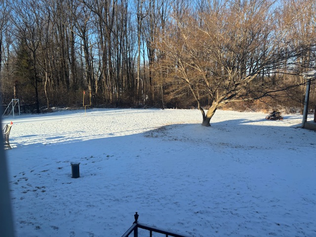
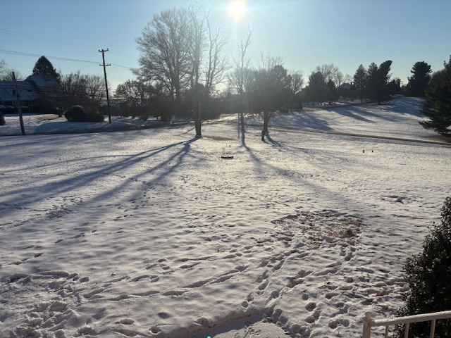
This weekend was absolutely amazing. Reminds me of winters of childhood. It was a long duration snowfall that dropped a good amount of snow. I feel like in the past decade when we get snow it is all much quicker and heavier. This was a nice steady snowfall. Looking ahead it looks great!
-
I mean the constancy here is great. Hope it has the right idea. Last 4 runs of euro ai.

-
We had not-even-close-to-accumulating flurries so I'm pretty sure they'll be a T. The discussion in this thread about slick streets is a completely different world from what we experienced around DC.
-
Too far out guys. Wait til Wed to start getting excited. Just going by my own unscientific observation: when this forum starts tracking 7 days out like its 2 days out, it never works out as planned.
-
Found these 0z comparisons at Dacula Wx...stilll working to find the AI verification in comparison. They have data fo the last calendar year. Notice the UKMET verification at 5 days? It is almost as bad as the GFS. The EPS and Euro models score highest at d4-5. The WPC medium range desk(conveniently? lol) scores the highest. The closer to the 1 models get...the better they are.
-

January 2026 regional war/obs/disco thread
WinterWolf replied to Baroclinic Zone's topic in New England
Certainly have to give them some weight now after what just happened over the weekend…no denying that. Will they be correct again is the question. Interesting. -

January 25/26 Jimbo Back Surgery Storm
NorthHillsWx replied to Jimbo!'s topic in Southeastern States
AI models did well this past weekend with temps. Different setup entirely but both kept central NC in 40s for most of storm while others were way too quick to cool -
Not a bad little weekend storm.
-
One would think the AI models would excel in a situation like this. I think the conventional wisdom that overrunning systems generally end up north of where originally modeled is the type of thing the AI models would "know" from historical data, which the models incorporate. OTOH, if this is the "rare" time the physics-based models are correct, the AI versions will have egg on their face.
-

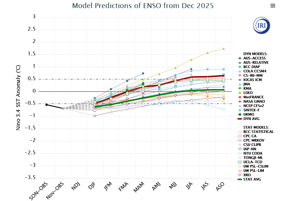
2025-2026 ENSO
donsutherland1 replied to 40/70 Benchmark's topic in Weather Forecasting and Discussion
A westerly wind burst appears to be developing. However, at present, it has not yet translated to the surface, as the SOI has remained at or above +20 for four consecutive days. The most recent ENSO Region 3.4 anomaly was -0.7°C during the week centered around January 14th. That's almost identical to its six-week moving average of -0.68°C. So, at least through the most recent week, the La Niña has been remarkably stable. The La Niña should gradually weaken, not collapse. Weekly ENSO Region 3.4 values could rise to neutral-cool levels late this month or during February. However, the fade appears likely to be gradual. As a result, La Niña will likely continue to exert an influence on the atmosphere through at least the first week of February. The AAM- is consistent with a La Niña-type pattern. The WPO-/EPO-/AO-/PNA+ pattern will likely be the biggest driver of North American weather conditions through the remainder of January. That pattern is typically the coldest January pattern for the eastern half or third of the U.S., along with at least southern Ontario and Quebec. One or more lows in the single digits and one or more highs in the teens is possible in New York City. Subzero cold is likely in places like Chicago, Detroit, and Toronto. The predominantly positive PNA comes with a heightened risk, relative to climatology, of moderate or significant snowstorms for the East Coast. With the PNA likely to be mainly positive into or through at least the first week of February, it is likely that at least one or more of the following cities will see at least one 6" or above snowstorm from the remainder of January through the first week of February: Baltimore, Boston, New York, Philadelphia, Richmond, and Washington, DC. Warmer than normal conditions will generally prevail in the Southwest.