All Activity
- Past hour
-
Looks like they just went up now!
-
Charleston going with this. I believe it's going to change between now and Saturday. WINTER STORM WATCH IN EFFECT FROM SATURDAY MORNING THROUGH MONDAY MORNING... * WHAT...Heavy snow expected. Total snow accumulations between 6 and 12 inches possible. Locally higher amounts are possible. * WHERE...Portions of northeast Kentucky, southeast Ohio, southwest Virginia, and central, northeast, northern, southeast, southern, and western West Virginia. * WHEN...From Saturday morning through Monday morning.
-

Richmond Metro/Hampton Roads Area Discussion
Conway7305 replied to RIC Airport's topic in Mid Atlantic
I know we’re focused on this one but check this out
-
You mean tomorrow PM?
-
Nearly 20 years in on these boards and pbp/reaction during big events never changes lol.
-
This disclaimer almost feels like an understatement >>> * ADDITIONAL DETAILS...This is a complicated forecast and details regarding the location of heaviest snowfall and freezing rain totals remain uncertain. Significant changes could occur in the coming days so please continue to monitor future forecasts.
-
So the euro is on delay. Maybe they found something that’s been causing problems. .
-
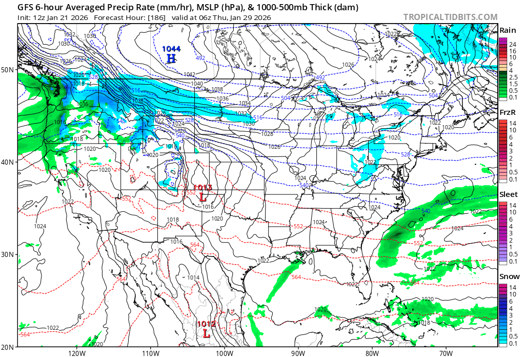
I mean it makes sense. That's the worst part. We are dealing with a completely different synoptic setup. For example we compare the 0z of today with yesterday's 0z and it shows the difference. Starting out at Friday 1pm we can already see the differences with how the old 0z has a more positively tilted SW and a further east NS lobe Compare that to 0z of today and the SW is more neg tilt, the NS is further west and importantly takes more energy from the parent lobe! So if we move this forward in time to Saturday afternoon we can see how much this changes our setup. Previously we are looking at a strong lobe over the northeast reducing the transient SE ridge and a messy phase happening out west between the NS and SW. Meanwhile today's 0z completely flips the script. It has the more consolidated phase out west AND because more of the NS broke west from the parent lobe we have less confluence out East. These two processes are NOT independent. I mean roll this forward and look at the consequences of these interlinked processes. Our confluence in the Northeast is gone. We have nothing to stop this thing from ramming the primary to Pittsburg if it wanted to. I mean for comparison again lets see the old 0z Despite still having that phase out west its fine as we have the confluence to block it. We need the models to rapidly switch course with how much of the NS lobe it chops to go phase out west if we want the ability to prevent this thing from cutting.
-

Possible Record Breaking Cold + Snow Sunday 1/25 - Tuesday 1/27
Nibor replied to TriPol's topic in New York City Metro
It's running now. -
Step into the freezer .
-
If anybody wants DT's most recent take here it is:
-
I know. I grew up in SE Ohio and watched Cheat Mountain, Snowshoe, Spruce Knob, the Maryland panhandle, all of those places get some crazy totals, but this is almost too over the top even for WV.
-
ICE ICE and more ICE. Maybe 1" of snow at the start and little sunday night . FMBY
-
No watches in our neck of the woods until Friday PM. We're 72+ hours out, and watches don't get issued until we're ~48 hours out.
-
You are southeast of me. I am counting everything blue or green. About 14.
-

Possible Record Breaking Cold + Snow Sunday 1/25 - Tuesday 1/27
SnoSki14 replied to TriPol's topic in New York City Metro
Good to have a mix of amped plus less amped solutions across models. -
Unfortunately I'm headed to dog training so can't do a pbp
-

Pittsburgh/Western PA WINTER ‘25/‘26
colonel717 replied to Burghblizz's topic in Upstate New York/Pennsylvania
Crazy almost 4 days away. I just hope there is no rug pull. We have seen storms this range go poof too many times. Also snow looks to be back building on radar. -
Can the National Guard be sent over to get the euro running
-
I’m in Vermont for some skiing and I noticed it was 12:30 so I got comfy in the lodge and got ready to watch the Euro come out. Instead I find out it’s delayed and who the hell knows when it’ll start to come out. This run better be good to make up for that.
-
Running now, Monitoring - We've seen the first hours of the ECMWF start to queue. Jan 21, 2026 - 12:38 EST
-

Pittsburgh/Western PA WINTER ‘25/‘26
Burghblizz replied to Burghblizz's topic in Upstate New York/Pennsylvania
Charleston on that early -
12z GEM went south. My sleet dropped from 3.0" to 1.5". Kuchera increased from 13.6 to 15.7. 850 and 700 a wash with 00z.
-
GSP just issued a Winter Storm Watch Winter Storm Watch URGENT - WINTER WEATHER MESSAGE National Weather Service Greenville-Spartanburg SC 1237 PM EST Wed Jan 21 2026 GAZ010-017-018-026-028-029-NCZ033-035>037-048>053-056>059-062>065- 068>072-082-501>510-SCZ008>014-019-101>109-220800- /O.NEW.KGSP.WS.A.0001.260124T1200Z-260126T1800Z/ Rabun-Habersham-Stephens-Franklin-Hart-Elbert-Avery-Alexander- Iredell-Davie-Madison-Yancey-Mitchell-Swain-Haywood-Buncombe- Catawba-Rowan-Graham-Northern Jackson-Macon-Southern Jackson- Transylvania-Henderson-Cleveland-Lincoln-Gaston-Mecklenburg- Cabarrus-Union-Caldwell Mountains-Greater Caldwell-Burke Mountains-Greater Burke-McDowell Mountains-Eastern McDowell- Rutherford Mountains-Greater Rutherford-Polk Mountains-Eastern Polk-Cherokee-York-Anderson-Abbeville-Laurens-Union-Chester- Greenwood-Oconee Mountains-Pickens Mountains-Greenville Mountains- Greater Oconee-Greater Pickens-Central Greenville-Southern Greenville-Northern Spartanburg-Southern Spartanburg- Including the cities of Salisbury, Saluda, Abbeville, Easley, Tuckasegee, Inman, Ashford, Glenwood, Gastonia, Kings Mountain, Bethlehem, Hartwell, Cruso, Sugar Hill, Celo, Baldwin, Ramseytown, Fero, Union, Walnut, Mill Spring, Spartanburg, Waterville, Cornelia, Canton, Charlotte, Landrum, Brevard, Boiling Springs Sc, Ellendale, Taylorsville, Kyle, Swiss, Cullowhee, Bryson City, Waynesville, Catawba, Kannapolis, Indian Trail, Rock Hill, Ninety Six, Pine Mountain, Valdese, Marshall, Demorest, Nebo, Fork Church, Reed Creek, Wesser, Mocksville, Morganton, Canon, Busick, Franklin, Matthews, Mauldin, Concord, Chester, Huntersville, Little River, Spruce Pine, Shelby, Candler, Sawmills, Hollywood, Robbinsville, Fletcher, Hendersonville, East Flat Rock, Toccoa, Mountain Rest, Glassy Mountain, Oakway, Highlands, Rutherfordton, Stony Point, Cove Creek, Nuberg, Westminster, Gumlog, Chimney Rock State Park, Dana, Asheville, Mars Hill, Tuxedo, Tryon, Rocky Bottom, Hickory, Great Falls, Ruckersville, Hot Springs, Newton, Wolf Mountain, Monarch Mills, Greer, Millersville, Farmington, Poplar, Forest City, Simpsonville, Anderson, Boydville, Crouse, Fingerville, Lavonia, Stecoah, Jonas Ridge, Royston, Blackstock, Clinton, Advance, Cedar Mountain, Trinity, Statesville, Almond, Old Fort, Ingalls, St. Stephens, Luck, Granite Falls, Walhalla, Calhoun Falls, Newland, Cashiers, Lenoir, Mooresville, Clarkesville, Banner Elk, Cornwell, Berea, Marion, Micaville, Monroe, Fork Shoals, Clemson, Wellford, Fountain Inn, Faust, Gaffney, Patterson, Fortsonia, Sylva, Columbus, Kings Creek, Clayton, Mountain City, Rainbow Springs, Franklin Springs, Spindale, Hiddenite, Luada, Lincolnton, Pleasant Grove, Seneca, Ware Shoals, Dysartsville, Taylors, Elberton, Lyman, Black Mountain, Duncan, Alarka, Woodlawn, Burnsville, Etowah, Allenstand, Weddington, Dacusville, Greenville, Middleton, and Laurens 1237 PM EST Wed Jan 21 2026 ...WINTER STORM WATCH IN EFFECT FROM SATURDAY MORNING THROUGH MONDAY AFTERNOON... * WHAT...Heavy mixed precipitation possible. Total snow and sleet accumulations between 1 and 6 inches and ice accumulations between four tenths and one inch possible. * WHERE...Northeast Georgia, Western North Carolina, and the South Carolina Upstate. * WHEN...From Saturday morning through Monday afternoon. * IMPACTS...Significant ice accumulation on power lines and tree limbs may cause widespread and long-lasting power outages. Ice and snow covered roadways will become treacherous and impassable. Widespread power outages are likely due to the weight of the ice and snow on tree limbs and power lines. The outages could last for days in some areas. The hazardous conditions could impact the Monday morning commute. * ADDITIONAL DETAILS...Highest snow and sleet accumulations are possible north of I-40. Highest ice accumulations are possible across the southern mountains of North Carolina, the mountains of northeast Georgia, and the mountains of South Carolina. PRECAUTIONARY/PREPAREDNESS ACTIONS... Monitor the latest forecasts for updates on this situation. Persons should consider delaying all travel. If travel is absolutely necessary, drive with extreme caution. Consider taking a winter storm kit along with you, including such items as tire chains, booster cables, flashlight, shovel, blankets and extra clothing. Also take water, a first aid kit, and anything else that would help you survive in case you become stranded.
-
@burgertimeyou still have paid access to Euro? If so can you do PBP?