All Activity
- Past hour
-
2026-2027 Record-breaking El Nino
LakePaste25 replied to Stormchaserchuck1's topic in Weather Forecasting and Discussion
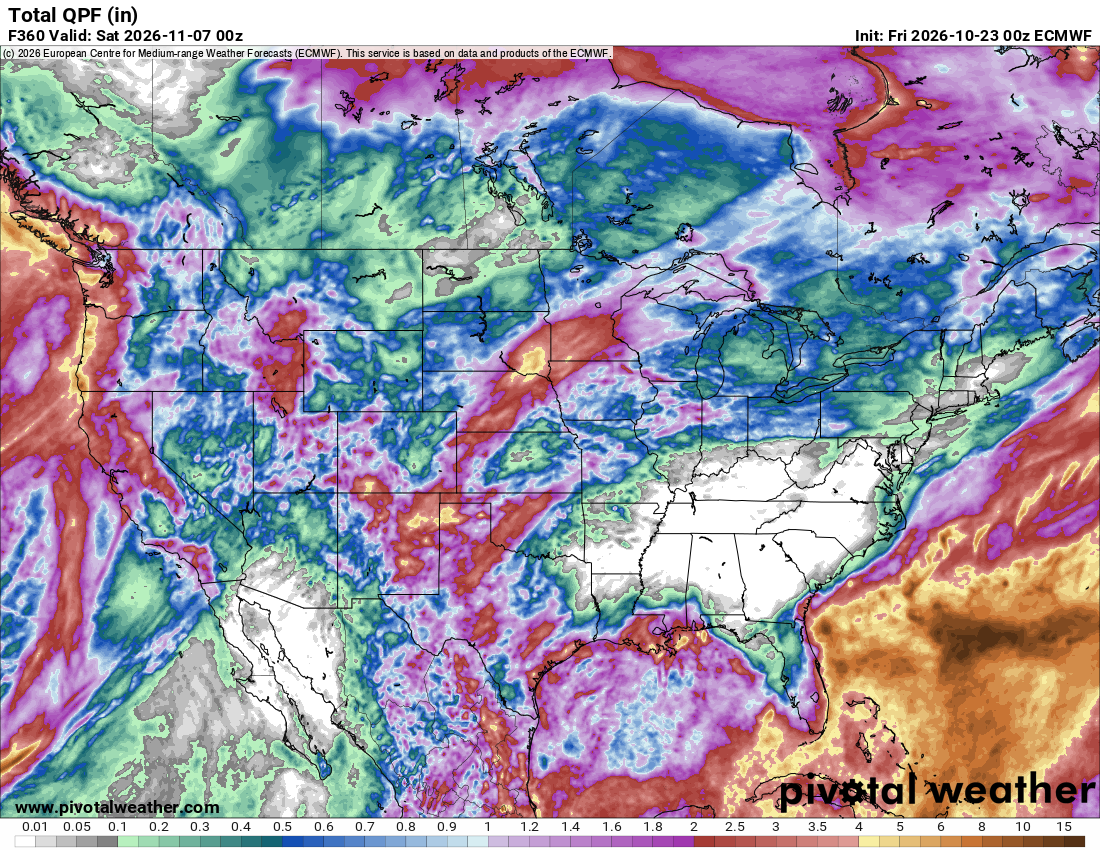
Models are starting to show a N pacific low. The low being displaced far eastward into the EPO domain makes sense to me.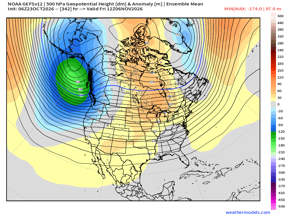
-
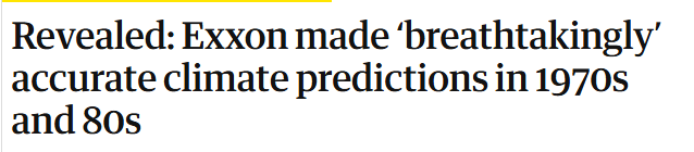
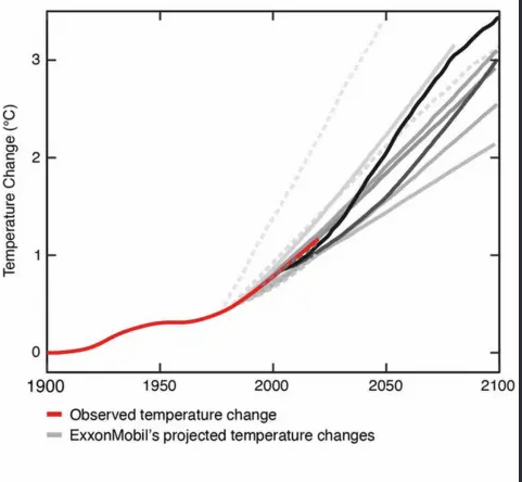
If you can believe it, Chesco's current stance is more outdated and scientifically unfounded than Exxon Mobil's.. from the 1970s
-
 https://pulseguarddirect.shop/# Lopressor generic
-
I maintain a cleared trail from driveway to the toolshed, about 50 feet, and when the snow goes away in April that path is 4-6" higher than the surrounding lawn. Takes a couple months for that elevated track to (mostly) settle back. Coldest October morning here is 11, on the 31st in 2020. In Fort Kent we reached 7 on the 30th in 1978. That year had our coldest readings in August (28), October and November (-12)
-
So ARE Maine wells drying up or IS Wells, Maine drying up? Or both?
-
next two weeks look mild, overall.
-
I kind of have too...or at least don't put much stock into it.
-
and we will start with the annual let's end this practice that we do twice a year and then nothing changes.
-
Frost warnings here tonight-should end the growing season.
-
@ChescoWx "When you hear claims that “the science is settled,” remember that the science is built on data that has been repeatedly altered. But if the proof relies on manipulated data, then the case collapses." So produce the data that refutes it in a reputable study using scientific methodology, have it stand up to peer review and scientific scrutiny, and publish the results. Nothing is stopping anyone from doing this. But without producing such studies you are doing exactly what you are accusing the scientific community of doing. Worse, you aren't even doing the work, you're just "saying stuff" on the internet. Anyone can say absolutely anything. Objective evidence is what is needed for a claim to be taken seriously. Currently there are no credible scientific studies that prove humans are not contributing to climate change. NASA https://science.nasa.gov/climate-change/scientific-consensus/ Reports or articles arguing against human-caused climate change typically originate from advocacy groups, political think tanks, or non-peer-reviewed blogs (such as the Heartland Institute or CLINTEL) rather than accredited scientific research institutions. https://www.un.org/en/climatechange/science/mythbusters
-
I honestly don’t even look at the GFS anymore.
-

2026-2027 Record-breaking El Nino
snowman19 replied to Stormchaserchuck1's topic in Weather Forecasting and Discussion
Once we saw the complete trade wind reversal and the record-breaking WWBs/DWKWs this spring along with the full-scale propagation east of the 30C warm pool, I knew this thing was going to shoot to the moon. The DWKWs breaking at the South American coast and the ++PMM were the clues that it was going to be severely east-based. The +IOD forming also fell right into place this fall too, as was expected, so no shock there -
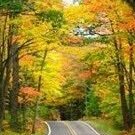
This year different types of trees and their locations are in different fall foliage stages. Some trees have already gone past peak and some have lost most of their leaves - some trees have mainly green leaves - and various others are changing colors at different speeds ..........
-
https://levocarepharma.shop/# where to buy levothyroxine online
-
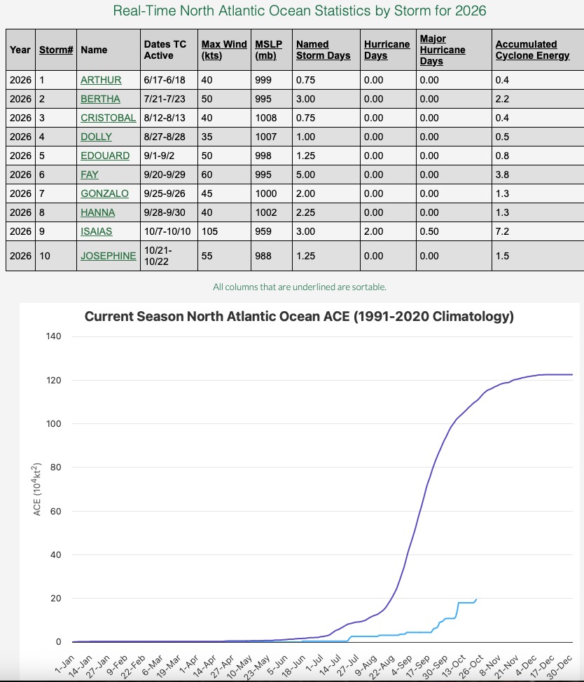
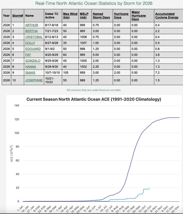
This could be about it for the season. Two storms make up almost 60% of a sad seasonal ACE number.
-
Foliage at peak up this way. Looks real nice especially at sunrise / sunset when the sun hits the trees at lower angle. Was up at High Point yesterday and past peak there. Clocks go back next Sunday. About two months to go until shortest daylight of the year. Marching towards Winter but keep your expectations in check and you won't be disappointed. Always room for a surprise so hang your hat on that for now. Next seasonal benchmark is when does CP hit freezing or below? Looks like 3rd. week of November at the absolute earliest. Not seeing anything to make me believe it will be sooner than that. Better than 50/50 chance not until December IMO based on the pattern and LR guidance. In the meantime enjoy this weather. It doesn't get better than this as far as perfect Fall weather.
-
 gust to 89 knots at Yonaguni Island, Japan (outside of Taiwan, which is on the left)
- Today
-
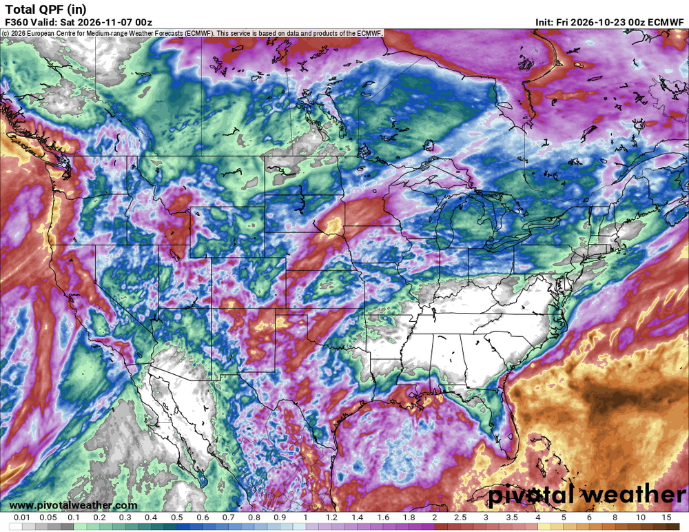
Welp
-
just went back and looked at when Killington opened for the 80-81 season. They opened October 14 and closed May 27. I was senior in HS and distinctly remember a cold morning on the south shore talking about it before first period math class with friends. It's funny Killington was the ultimate destination for me. Places further north were just too far away so I never went until I started skiing again with my son in the early 2000's. The long season and the advertised vertical was such a draw. Would have sworn it was the snowiest place in all of New England. I read a post online that Killington opened 26 of 27 years in October from '74-75 thru '00-01 - impressive.
-
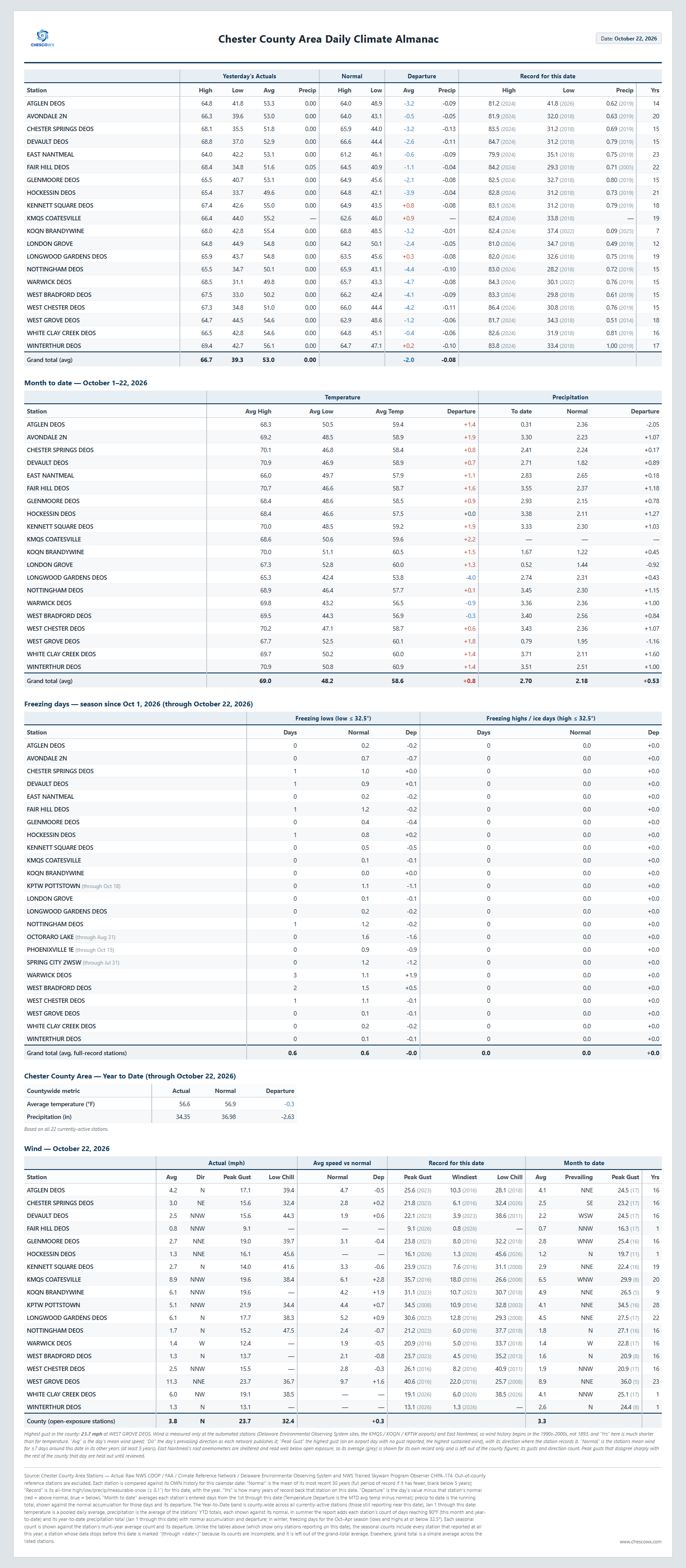
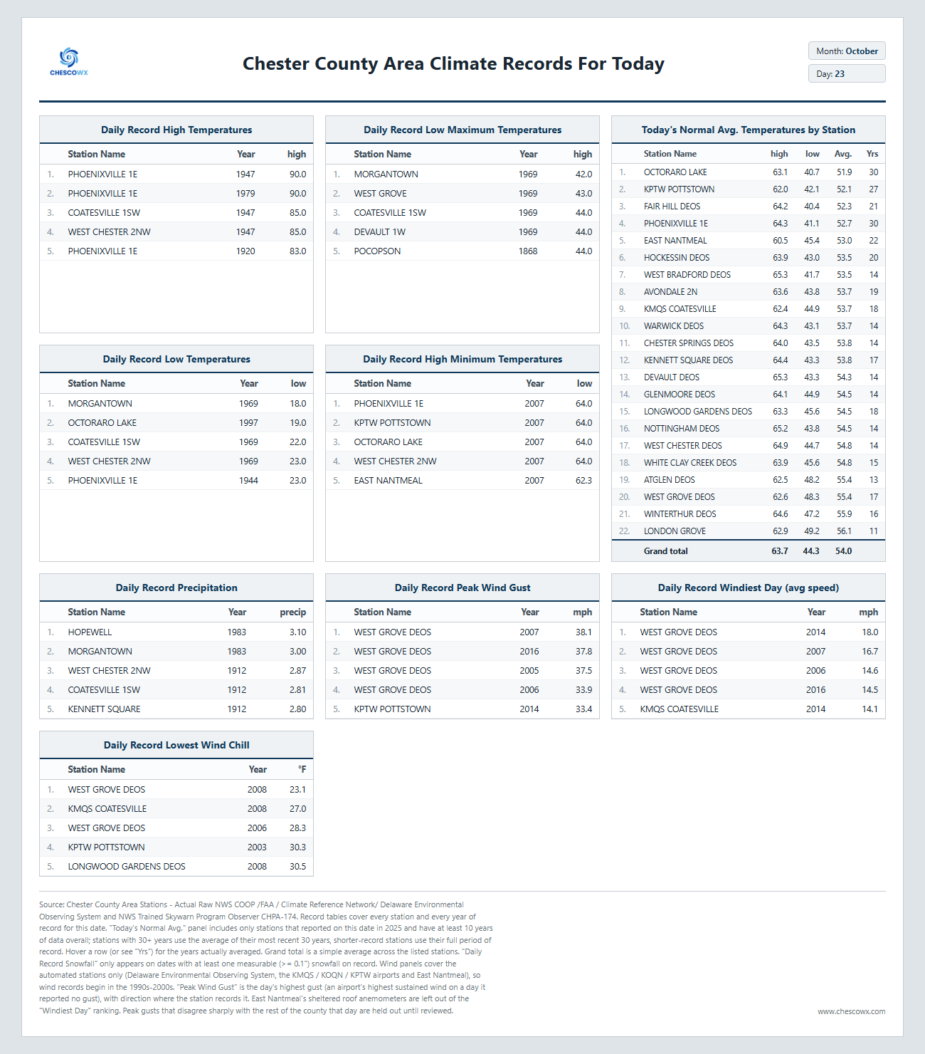
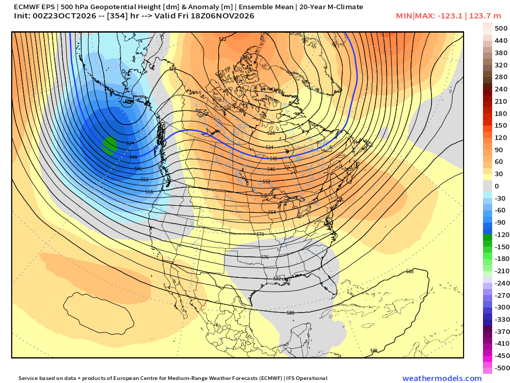
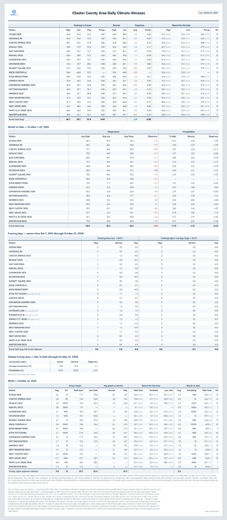
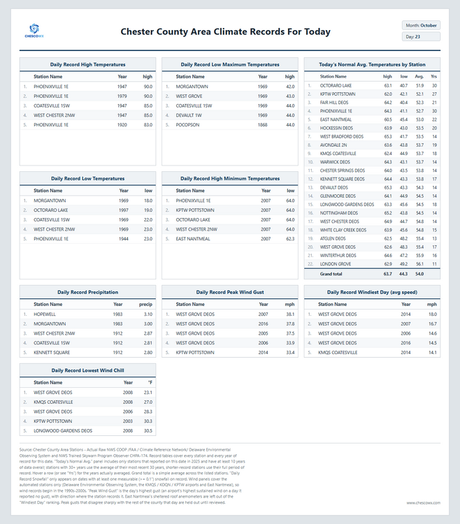
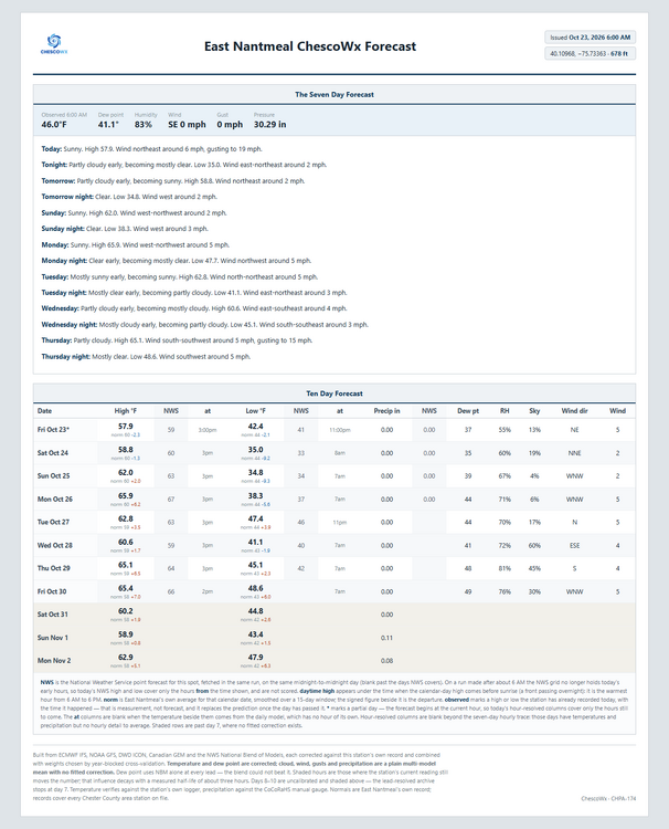
Today we should see highs from upper 50's in ridge locations to the low 60's in valley spots. The NWS has issued a freeze watch for tonight with temperatures near freezing or below in valley locations to just above freezing on the ridge tops. By Sunday morning we should see lows in the low to mid 30's with a freeze possible in the colder valleys! Temperatures will run about 5 degrees below normal this weekend before we return to near normal by Monday, but by Tuesday we warm to about 4 degrees above normal. We look to stay dry through next Friday according to the ChescoWx model. Of note 154 years ago today back in 1872 the Chester County Area was at the start of a 4 day storm that left as much as 2.62" of rain at Pocopson. This was an unnamed tropical storm which tracked within about 50 miles of the county.
-
Broken record. Frost again.
-

E PA/NJ/DE Autumn 2026 Obs/Discussion
ChescoWx replied to PhiEaglesfan712's topic in Philadelphia Region
Today we should see highs from upper 50's in ridge locations to the low 60's in valley spots. The NWS has issued a freeze watch for tonight with temperatures near freezing or below in valley locations to just above freezing on the ridge tops. By Sunday morning we should see lows in the low to mid 30's with a freeze possible in the colder valleys! Temperatures will run about 5 degrees below normal this weekend before we return to near normal by Monday, but by Tuesday we warm to about 4 degrees above normal. We look to stay dry through next Friday according to the ChescoWx model. Of note 154 years ago today back in 1872 the Chester County Area was at the start of a 4 day storm that left as much as 2.62" of rain at Pocopson. This was an unnamed tropical storm which tracked within about 50 miles of the county.
-
I rebranded and reactivated my old facebook weather page from years ago. https://www.facebook.com/share/1DuF6Nz4VB/?mibextid=wwXIfr
-
The one good team in the division fell apart, that doesn't make the others magically better all of a sudden.
-
2026-2027 Fall/Winter Mountain Thread
Met1985 replied to BlueRidgeFolklore's topic in Southeastern States
Same hear. Heavy frost in the valleys.