All Activity
- Past hour
-

Winter 2025-26 Medium/Long Range Discussion
Malacka11 replied to michsnowfreak's topic in Lakes/Ohio Valley
Right. And I'm sure Joe wouldn't be shocked if we reel a storm in either after all in a week or two, since he never really recanted his prior optimism in favor of remaining aloof. My point is that the second issues like sun angle and shit become a problem, I'd rather just save our year-to-year pretend climo snowfall luck for next season. If we miraculously manage to mitigate whatever warmup is locked in and we reel in a monster 10-14 days from now, great. Too bad we couldn't get it in December. Normally I'd be here excited for the DABs we've got coming but again, it's completely futile because we're completely resetting next week it seems. I understand this is a banter take but -
Pittsburgh/Western PA WINTER ‘25/‘26
EVLINC64 replied to Burghblizz's topic in Upstate New York/Pennsylvania
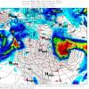
The American Storm @BigJoeBastardi · 42m Models are all over the place on late next week, something I have issued a big storm watch for the NE on Weatherbell based on studying pattern analogs and concluding a blend of 3/29/84,12/10/92,02/09/69 and 02/13/ work best. So the surface map for that gave me this for day 11, New euro went to it. So, like the storm a couple of weeks ago, where using 3 analogs gave a great solution a week out ( not perfect, but dang close), I started looking at this 5 days ago. The question then becomes, DO I HAVE THE RIGHT ANALOGS? But that means I am in charge of the idea, not the models ping ponging me. So you put out the idea and then wait and see if modeling comes to it. But it's not based on the models, it's based on pattern recognition and then doing the work to go back through all those maps and try to get the right package. This is how they did it in the old days, when 4 runs a day of computer models did not force a ping pong match among meteorologists. SO I RELY ON MY SKILL, NOT THE MODEL IN SETTING THIS UP! If you just look at models until a few days before you can get whip sawed, or you simply get on TV and say the models says this or that, and all you are is instead of a forecaster is a model spokesperson. The risk? That you do all this work and are wrong, and it's happened to me many times. But I would rather work and risk than outsource what God gave me. And besides, Bocelli is right in Un Nuovo Giorno: Solo rischiando tu vivrai. Only by risking do you live -
Wat https://x.com/ShamsCharania/status/2019119800098963674 https://x.com/ShamsCharania/status/2019119940767556049
-

E PA/NJ/DE Winter 2025-26 Obs/Discussion
Newman replied to LVblizzard's topic in Philadelphia Region
Long way out there, but it seems like models are hinting at two potential storm chances coming up: 2/11 and 2/15. Depending on how strong the first wave gets, it could dampen the flow and cause 2/15 to stay suppressed (ala 12z Euro AIFS). Everything will also depend on how strong the confluence holds across New England/southern Canada. Just first look seems like a SWFE would be favored with thump to ice/rain. Expect lots of changes until then -
They do realize this is Wake County right?
-
lol. Just under 2 weeks to go. Lock it in.
-

Is we back? February discussion thread
40/70 Benchmark replied to mahk_webstah's topic in New England
Oh, no.... That's the run we chase for 10 days only to never find again. -
Currently snowing and 32 degrees.
-
Everyone I talk to here in the Richmond area keeps saying the same thing. Removing the glaciers from the "snowcrete" has been such a task for so many with driveways and sidewalks. Especially here most storms you see the temperatures quickly get into the upper 30s and 40s after. Last week and into the beginning of this week we barely got above freezing (maybe one or two days), and overnight temperatures barely double digits and single digits a couple of them. That has been the difference.
-

2025-2026 ENSO
40/70 Benchmark replied to 40/70 Benchmark's topic in Weather Forecasting and Discussion
I haven't seen anyone predicting a +PNA for February, but if so, I would agree that they are woefully misguided. -
No please, I’m done with clearing ice jams off the roof and sending my poor heart into overdrive. Let’s put that on the backburner (or shall I say back breaker) for 2027, mmkay?
-

E PA/NJ/DE Winter 2025-26 Obs/Discussion
RedSky replied to LVblizzard's topic in Philadelphia Region
Todays euro doesn't hit 40F until the 17th -
Still waiting on WB maps, but first look seems like EPS is very juicy for Valentines day, and AIFS ens like mid next week a good bit, it's not loading any farther than that though..
-
Proving that it has zero value beyond warm nose events and that’s it. Just utterly useless for everything else
-
Half of those are very Steiny here for a d15 QPF total
-
Yes, us Penguins have a habit of losing games late we shouldn't be losing.
-
Speaking of OT, big ISLES win last night!
-

E PA/NJ/DE Winter 2025-26 Obs/Discussion
The Iceman replied to LVblizzard's topic in Philadelphia Region
Yeah but that day in the mid 40s is going to feel like 70! -

February 2026 Medium/ Long Range Discussion: Buckle Up!
Kevin Reilly replied to Weather Will's topic in Mid Atlantic
The snow pack will save us! I mean lock the cold air at the surface for freezing rain and power outages. -
What I like about next weekend is there’s been a signal for quite a while now. Probably something decent but uncertain and the euro AI got worse, showing a Miller a sliding off the southeast and middle Atlantic coast although a strong system. But I’m also interested in the 10-11th because euro AI got markedly better with that.
-

E PA/NJ/DE Winter 2025-26 Obs/Discussion
RedSky replied to LVblizzard's topic in Philadelphia Region
It's not nailed down and there may not be one but if there is the timing will be at night -

February 2026 Medium/ Long Range Discussion: Buckle Up!
dailylurker replied to Weather Will's topic in Mid Atlantic
I follow your page. That's a lie lol


