All Activity
- Past hour
-
Rainfall rates are legit. Someone might get 2”+ imo
-

2026 Mid-Atlantic Severe Storm General Discussion
AlexD1990 replied to Kmlwx's topic in Mid Atlantic
Looks like it was just issued -
2026 Mid-Atlantic Severe Storm General Discussion
AlexD1990 replied to Kmlwx's topic in Mid Atlantic
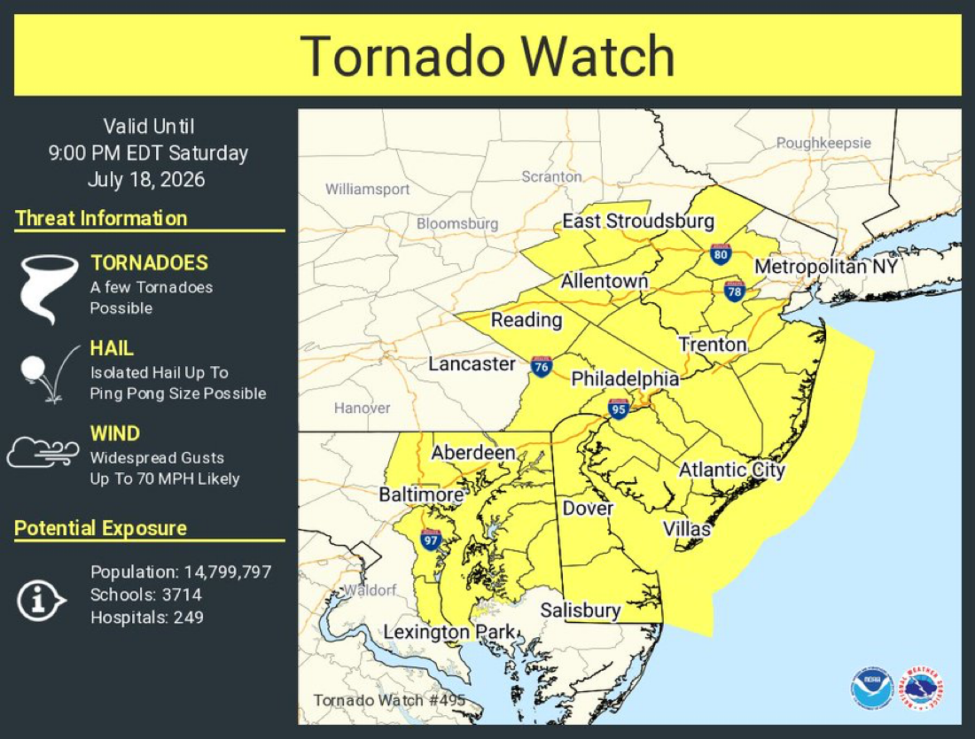
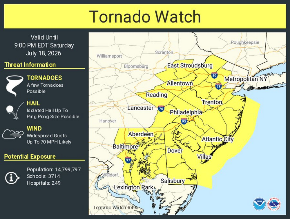
STW up for y'all bordering the tornado watch. Serious question for anyone, just how legitimate is the tornado threat on the Delmarva today? I have learned not to trust warm fronts... -
FDK storm really needs a TW...
-
Well I thought it weakened, but just got pulsed by serious downpours and a gust that briefly knocked out power. Places getting cored by this storm are gonna love it.
-

2026 Mid-Atlantic Severe Storm General Discussion
Eskimo Joe replied to Kmlwx's topic in Mid Atlantic
Wow, 55,000 ft tops on the warned storm just south of Charles Town! -
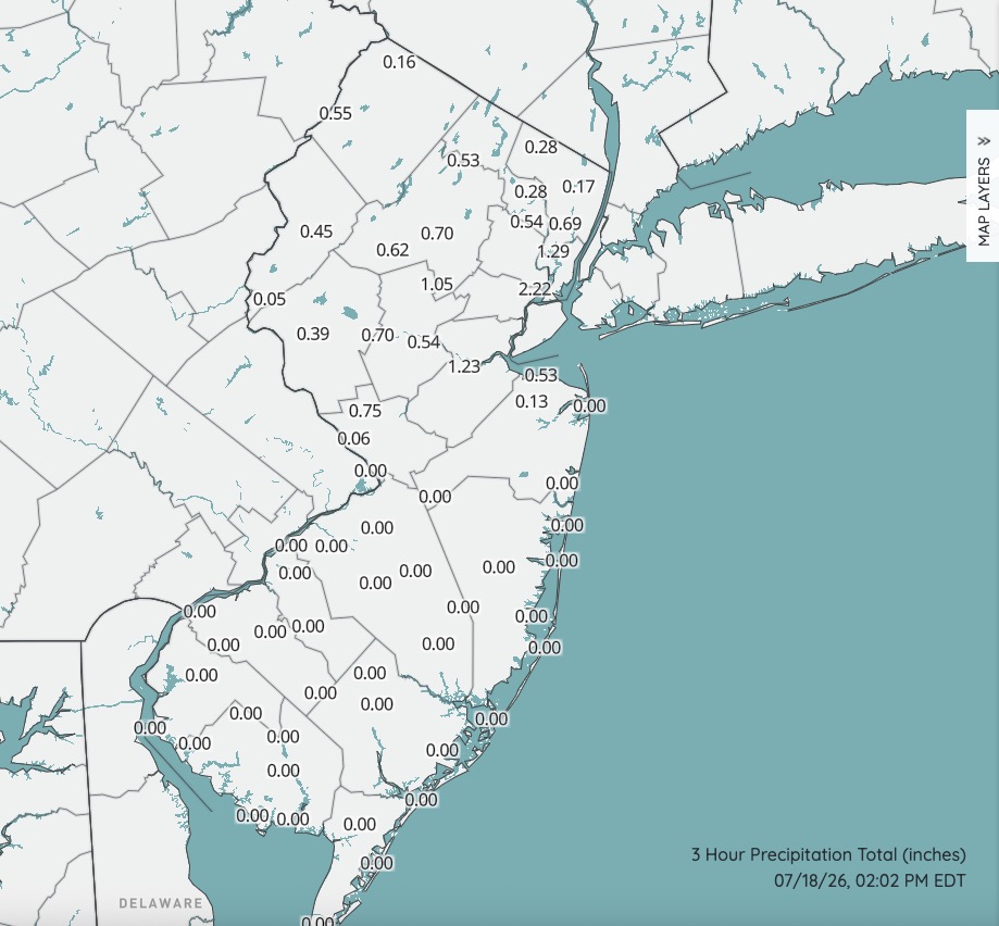
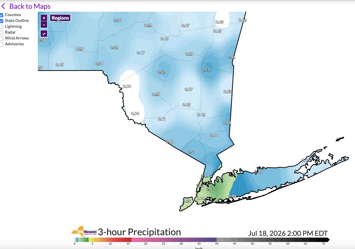
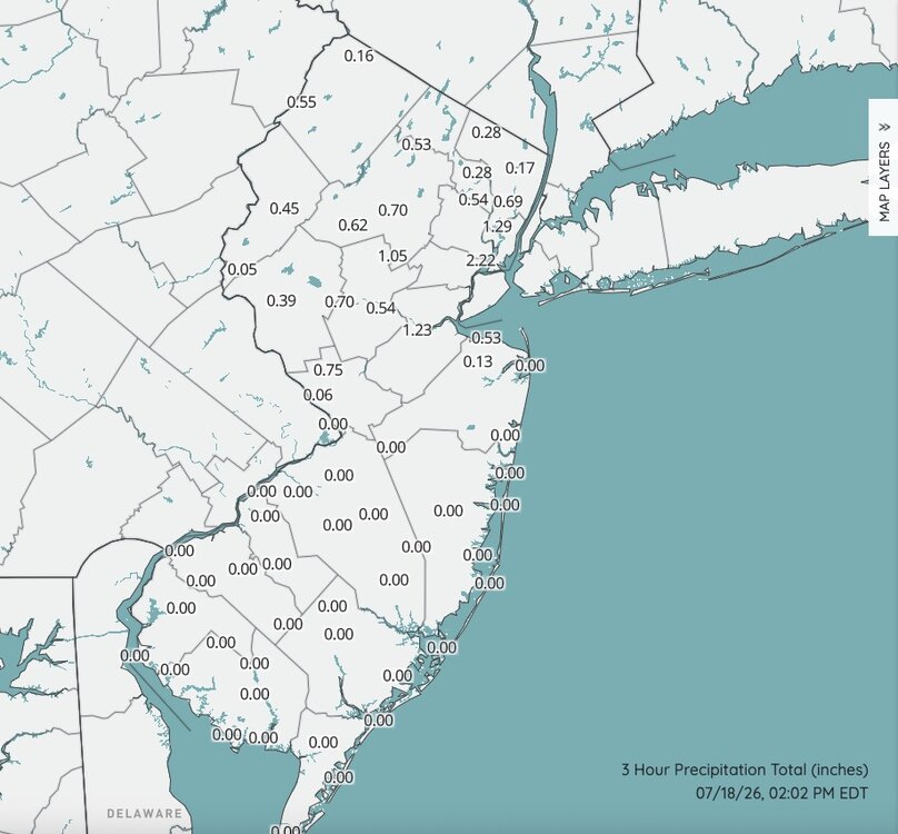
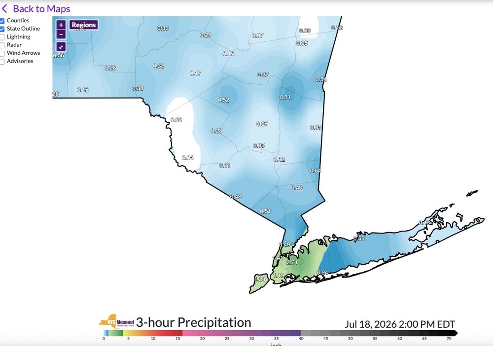
Snapshot of rainfall totals so far. Quite certain there are much higher totals in between these reporting sites. These drenching downpours are highly localized. I am also of the belief that anything truly severe is going to be south of a TTN to Sandy Hook line. I'm actually fairly confident on that and it could be a nasty go for some late this afternoon into the evening along and south of I195.
-

Saturday, July 18, 2026 Thunderstorm/Severe Weather Potential
tamarack replied to weatherwiz's topic in New England
Still at cloudy 65°, not a great sign of convection to come. -
2026 Mid-Atlantic Severe Storm General Discussion
Eskimo Joe replied to Kmlwx's topic in Mid Atlantic
Yup. We'll see that severe thunderstorm watch in the next 20 min I reckon.- 1,089 replies
-
- 1
-

-
- severe
- thunderstorms
- (and 7 more)
-
-

E PA/NJ/DE Summer 2026 Obs/Discussion
LVblizzard replied to PhiEaglesfan712's topic in Philadelphia Region
Sun is starting to peek out in Lehigh County. A little quicker than I expected. Hopefully that little blob of rain out near Harrisburg either fizzles or passes to the south so the atmosphere can continue to destabilize. -
Rain was so intense that the weepholes couldn’t keep up on our new window. I had to put a towel to catch overflow. The tray filled up. Thankfully i was home
-
FDK cell may need a TW soon... 70mph winds and tornado possible tag in it in latest SWS
-
Saturday, July 18, 2026 Thunderstorm/Severe Weather Potential
bristolri_wx replied to weatherwiz's topic in New England
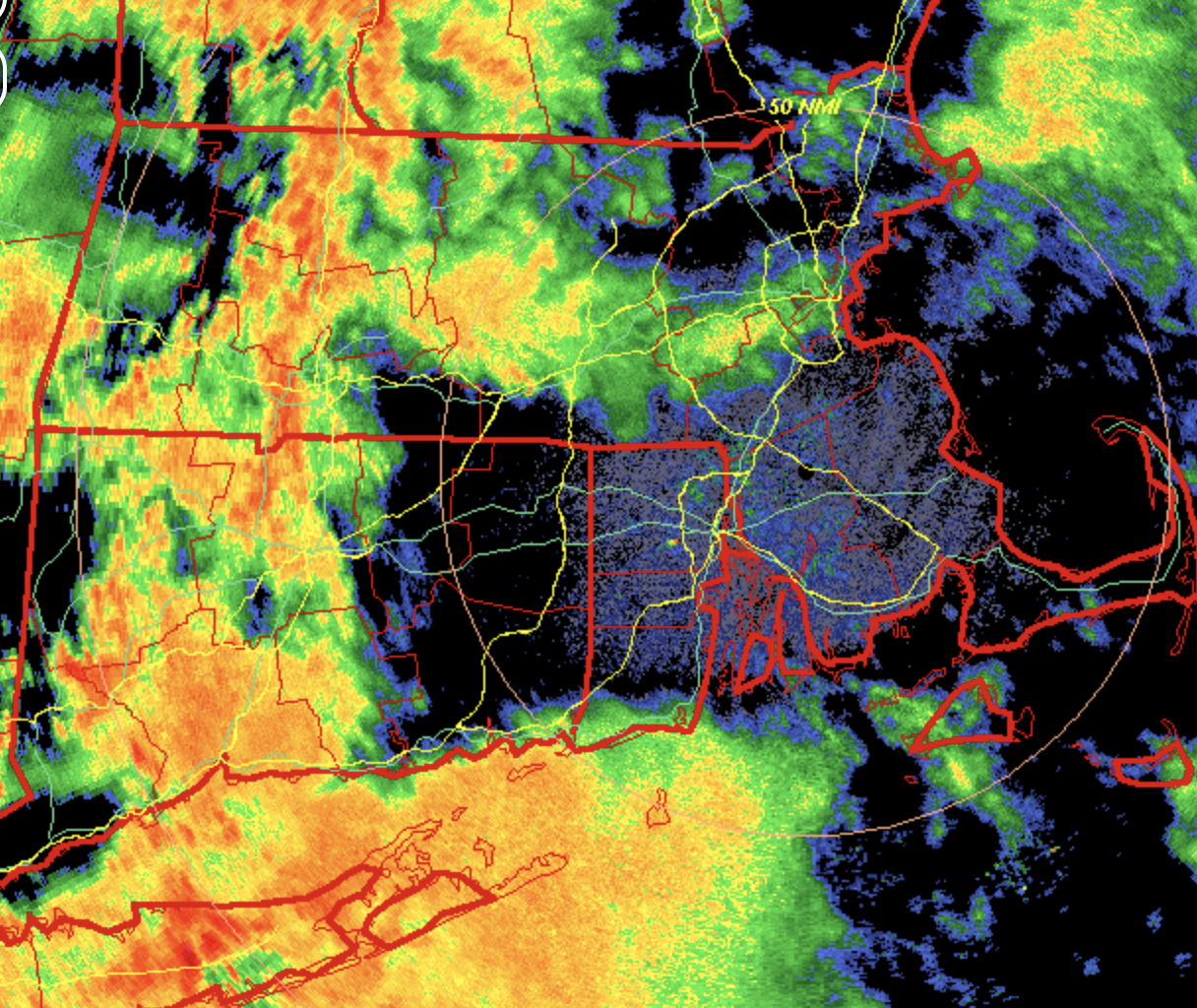
Gotta love how that intial heavy cluster of storms will not cross Long Island Sound into CT. Seems like you could be at the beach where it's dry and go swimming and it would pour on you.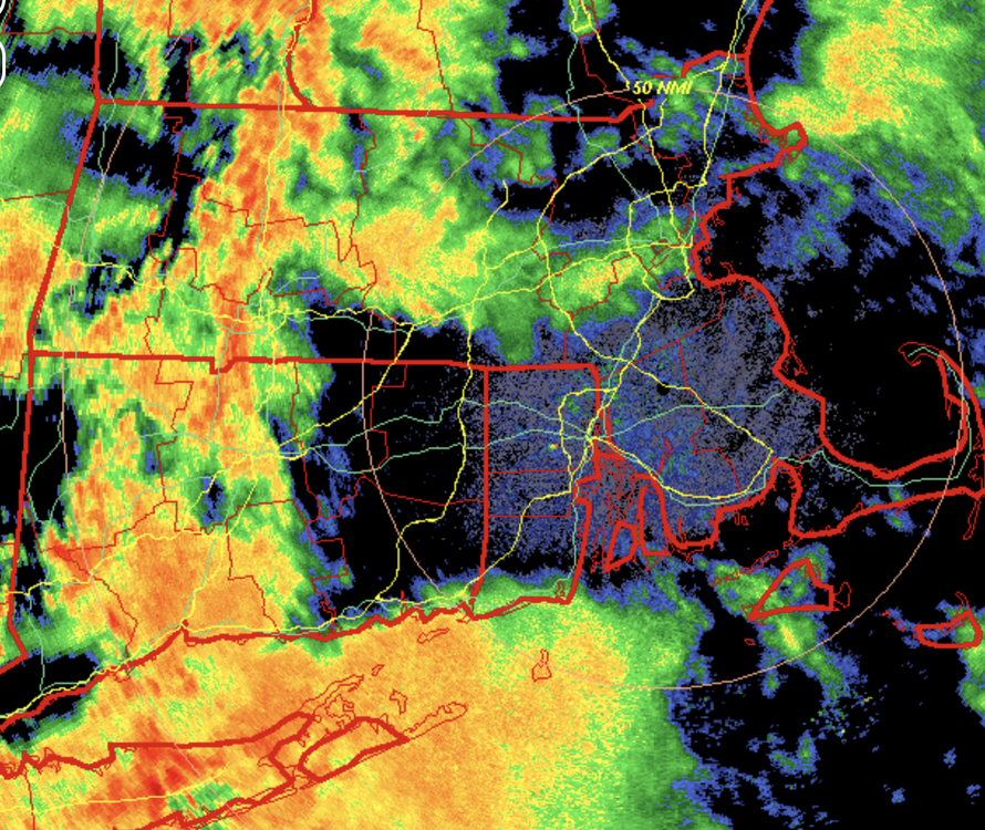
-

Saturday, July 18, 2026 Thunderstorm/Severe Weather Potential
dendrite replied to weatherwiz's topic in New England
Wow is his webbed grip strong. I apologize for the emoji. Please let it rain.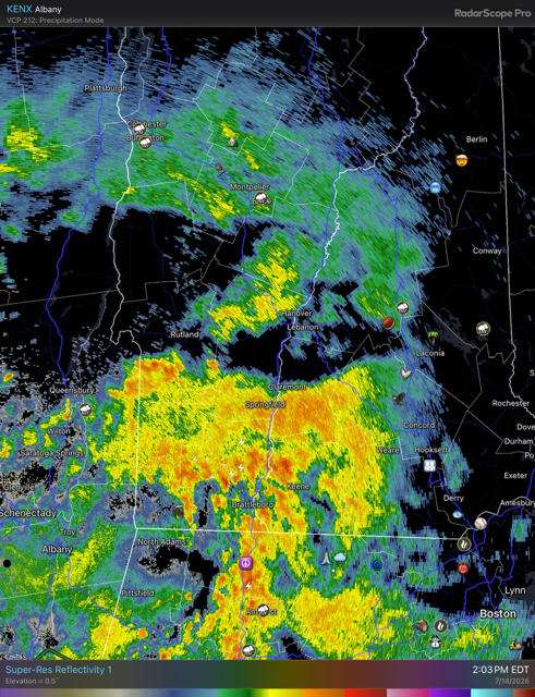
-
Storm weakened a bit on the northern side, but still getting a good shower. Looks like Ballenger Creek area is gonna get rocked.
-
Suddenly getting brighter here on the UWS. With the smoke, for all I know it could be clear?
-

Saturday, July 18, 2026 Thunderstorm/Severe Weather Potential
Brian5671 replied to weatherwiz's topic in New England
run of the mill thundershowers here-dropped about .75 but has ended -
While everyone is focused on the severe weather risk, we've busted into Heat Advisory criteria south of I-70. Some places pushing 110s for heat index.
-
1.13" and still raining heavily here, fairly frequent lightning for 2 hours now
-
Being on a lake in a storm is the worst!
-
Yeah that's where the biggest threat would be. No surprise here they are the tornado capital of the northeast
-

Saturday, July 18, 2026 Thunderstorm/Severe Weather Potential
CoastalWx replied to weatherwiz's topic in New England
I wonder if this stuff is gonna screw up SNE later. -
Another MCD for C into S VA into NC with STWatch needed soon in it... I guess we will get lumped into that Mesoscale Discussion 1649 NWS Storm Prediction Center Norman OK 1256 PM CDT Sat Jul 18 2026 Areas affected...ortions of southern Virginia...western North Carolina...far northeast Tennessee...southeastern West Virginia Concerning...Severe potential...Watch likely Valid 181756Z - 181900Z Probability of Watch Issuance...80 percent SUMMARY...Scattered to numerous thunderstorms will continue to increase in intensity this afternoon with a risk for damaging wind gusts. Trends are being monitored and a Severe Thunderstorm Watch is likely. DISCUSSION...Thunderstorms continue to develop across the higher terrain of WV, NC and VA at 1755z, and also along a confluence zone extending from northern VA into western NC. Despite weak mid-level lapse rates, diurnal heating of a moist boundary layer has contributed to MLCAPE of 2000 to 3000 J/kg and low-level lapse rates of 8.5 to 9 deg/C. In the presence of minimal CINH, storms should continue to increase in coverage through the afternoon and move generally east. Shear in the cloud-bearing layer will average 20-25 kts across northern portions of the discussion area and 15-20 kts farther south, sufficient for updraft organization and a risk for damaging wind gusts. Trends are being monitored and a Severe Thunderstorm Watch will be needed shortly. ..Bunting/Thompson.. 07/18/2026 ...Please see www.spc.noaa.gov for graphic product... ATTN...WFO...AKQ...MHX...LWX...RAH...RNK...RLX...GSP...MRX... LAT...LON 36938187 37458132 37957998 38207909 38197842 37907734 37557681 36927645 36077666 35487802 35237929 35118087 35298160 35678207 36228209 36938187 MOST PROBABLE PEAK WIND GUST...55-70 MPH MOST PROBABLE PEAK HAIL SIZE...UP TO 1.25 IN
- 1,089 replies
-
- 1
-
-
- severe
- thunderstorms
- (and 7 more)
-

Saturday, July 18, 2026 Thunderstorm/Severe Weather Potential
kdxken replied to weatherwiz's topic in New England
Rain and heavy smoke. For those on the spectrum enjoy.