All Activity
- Past hour
-
This thing died out for almost everyone in upstate NY and New England. Hope the Friday event doesn't for their sake. Looks like we're a hair too south in HV for significant Friday snow.
-
NAM is usually good at finding the warm tongues.
-

Feb 22nd/23rd "There's no way..." Storm Thread
Weather Will replied to Maestrobjwa's topic in Mid Atlantic
We are all hoping that that GFS/CMC combo is correct; but the current blend forecast keeps the coastal too far east to hit areas west of the Bay. The trough coming in from the west could give areas west of the Bay a light event. Reality sucks but it is what it is. Hopefully the NBM will look better by 0Z tomorrow. -
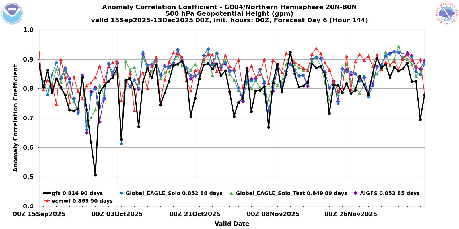
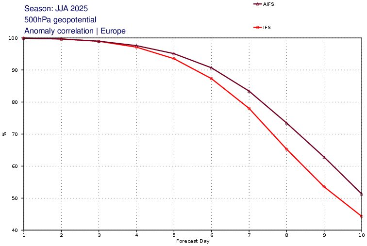
looking for more updated data.. but yea the AI models have been impressive at H5 compared to the traditional models. Here's D6 data with GFS vs AIGFS from late 2025 and AIFS vs IFS July-Aug 2025

-
Nam looks warmer aloft. Timing is a bit later. More Zr and sleet and less snow in interior SNE.
-
Uh oh its snowing and blowing again, HARD https://www.mammothmountain.com/on-the-mountain/mammoth-webcam/woolly-cam It WAS so nice there today only a little snow, 15 mph gentle wind, now its straight outta Compton again. Snow is blowing furiously off the snowpack right back onto the plowed Woolly Lot! This storm is mocking man's puny attempts to cope with its works! It's got five feet of fluffy snow to pick up and hurl across the resort! Its only ten degrees and that wind chill is so cold!
-
Think about who you're replying to. Will posting a map. He probably clears his attachment space once every 45 minutes.
-
Why are you posting such a random useless map
-
Someone from VA to NE has the potential to get absolutely buried if this goes negative close to shore. Absolute bomb potential
-

Feb 22nd/23rd "There's no way..." Storm Thread
HighStakes replied to Maestrobjwa's topic in Mid Atlantic
Meaningless at this point. -

Wednesday Feb 18 Mixed event. NOPE …ain’t happenin’
Modfan2 replied to HoarfrostHubb's topic in New England
.31” of rain and temp at 35F, I am assuming my pack to a decent hit. -

2025-2026 ENSO
michsnowfreak replied to 40/70 Benchmark's topic in Weather Forecasting and Discussion
The Euro weeklies are NOT a crystal ball. However that doesn't mean it won't be cold at the end of March. I mean i have no idea what march will bring either, but if the first 2/3 of March was warmer than avg then I would bank on the last third being cold. We've seen it countless times in the past with a slew of snowstorms in the post-March 17th timeframe. -
Ai has crushed the OPs actually
-

E PA/NJ/DE Winter 2025-26 Obs/Discussion
BBasile replied to LVblizzard's topic in Philadelphia Region
Sun Angle... -

February 2026 OBS & Discussion
WeatherGeek2025 replied to Stormlover74's topic in New York City Metro
Radar is back just in time for the big blizzy lol -
On January 14th we had a 30%-50% chance of snow showers, expecting a dusting, and ended up with 6.2" of snow by the morning of the 15th.
-

E PA/NJ/DE Winter 2025-26 Obs/Discussion
LVblizzard replied to LVblizzard's topic in Philadelphia Region
Sun angle is much higher than in December which makes it feel warmer and more like spring. That’s my guess anyway. -

Wednesday Feb 18 Mixed event. NOPE …ain’t happenin’
ORH_wxman replied to HoarfrostHubb's topic in New England
What idiot started this thread? -
Earlier today, this wide-ranging storm system was strung out WNW-ESE across the continent. It's pulling itself apart. Strange U-shaped snow forecast coming up for tomorrow. Also note: the Sierra Nevada is going to get a precipitation total of about 6" (60"+ of snowfall) out of this multi-day weather event.
-

Wednesday Feb 18 Mixed event. NOPE …ain’t happenin’
The 4 Seasons replied to HoarfrostHubb's topic in New England
-
Umm... sure
-
lol... At this point, I'd be happy to settle for a layup 2"
-
That was the joke - Jerimoth is RI's Mount Washington. I believe Mt. Jefferson is the second or third highest mountain in NH.
-
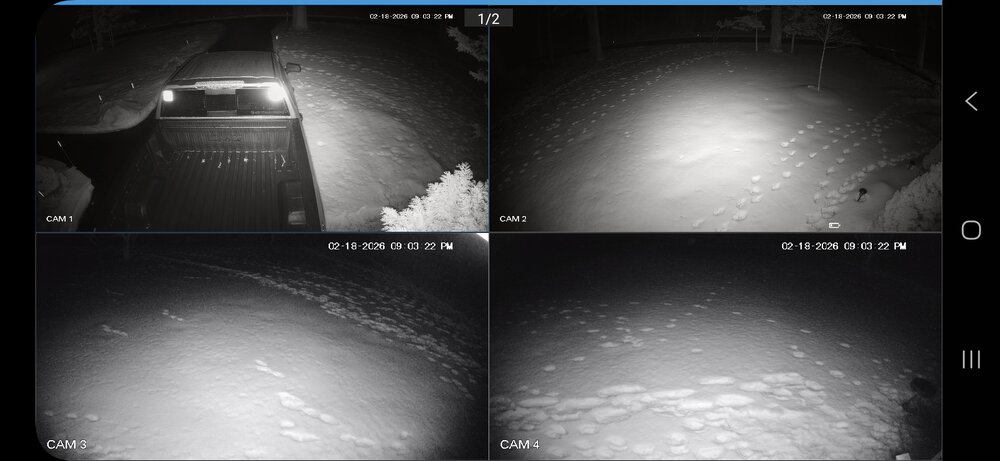
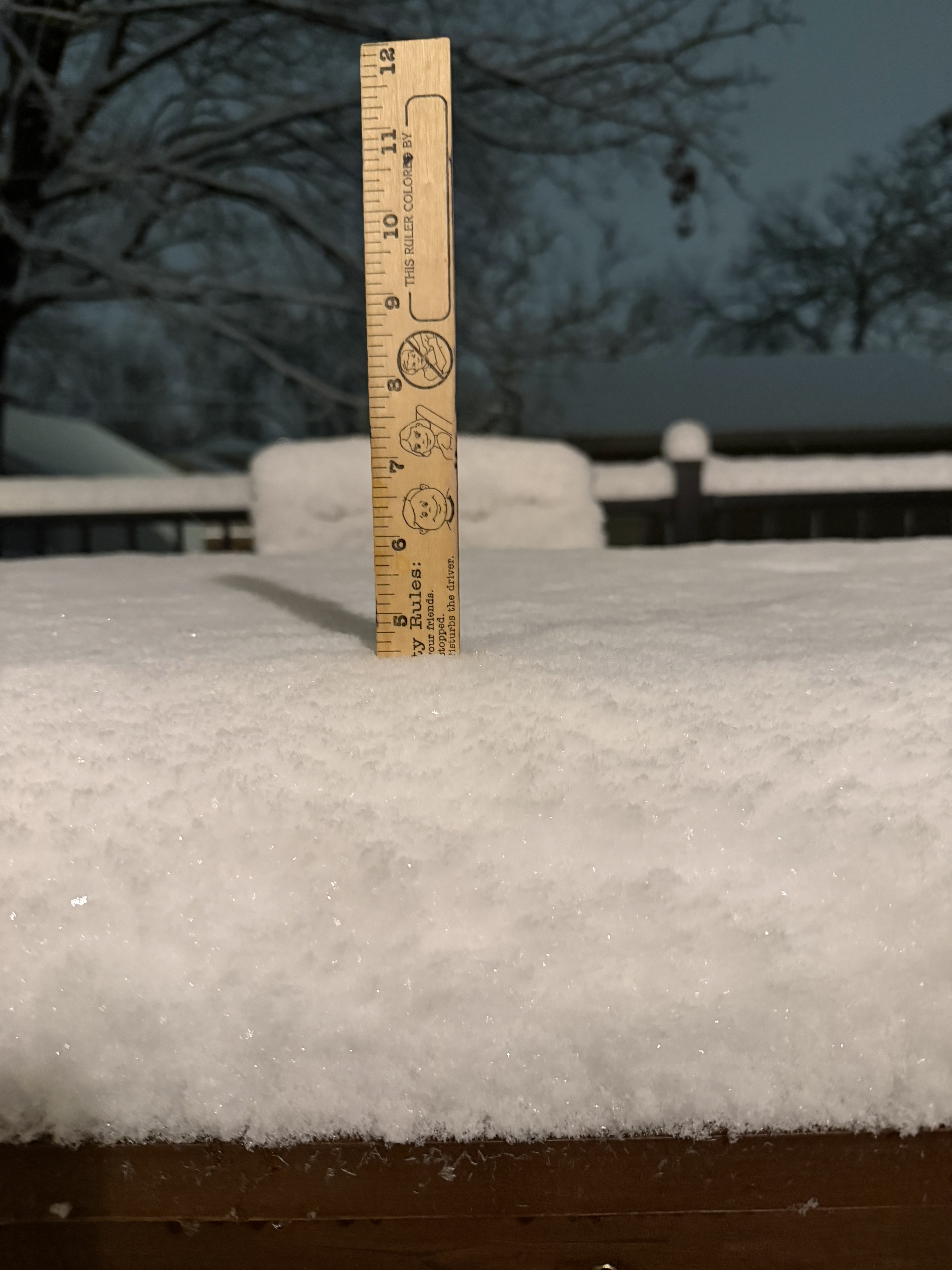
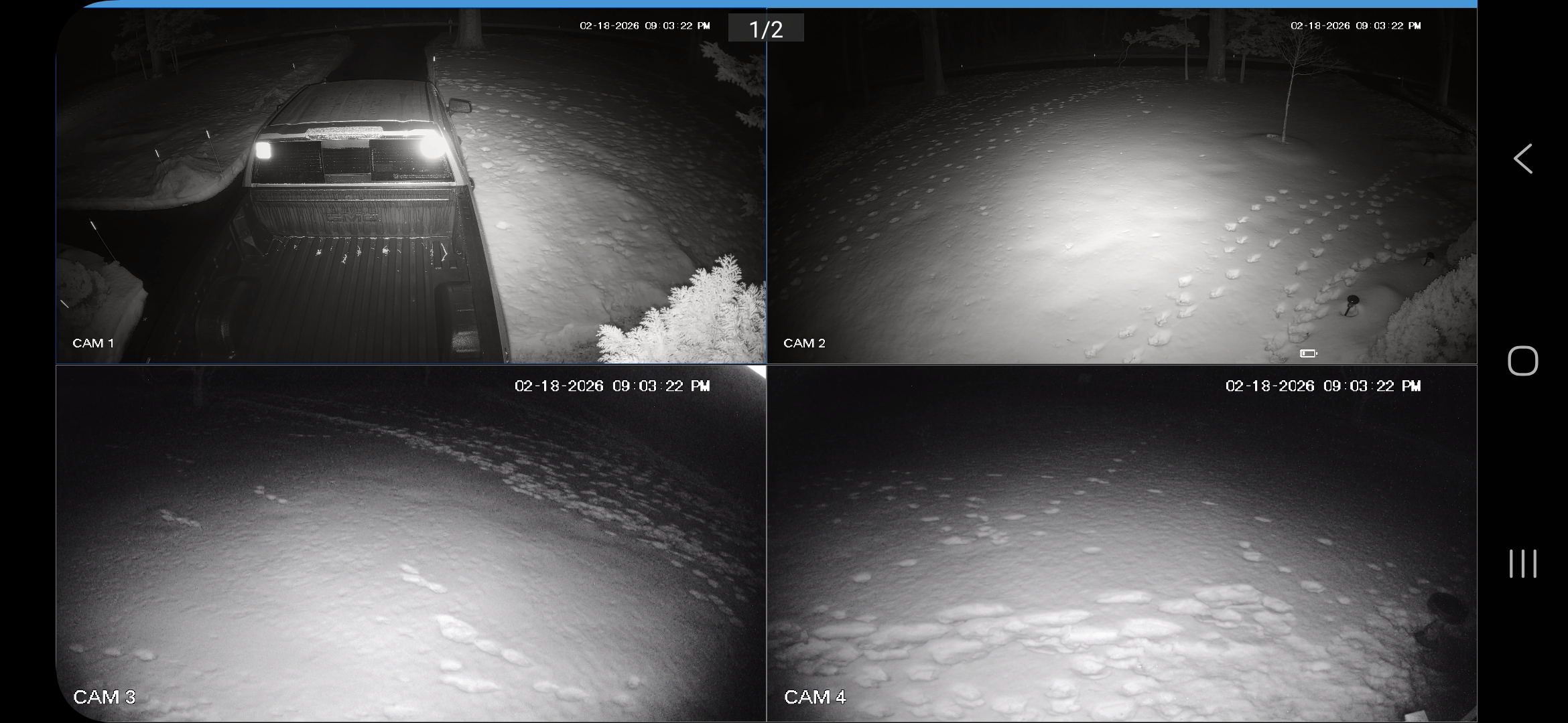
Same here. 5” in play. Just goes to show how there’s still plenty of surprises even with modern technology.
-
Looks almost as good when we got it bank in January lol