All Activity
- Past hour
-

Central PA Summer 2026 Discussion/Obs Thread
pawatch replied to Voyager's topic in Upstate New York/Pennsylvania
3.92” -

Augdewst 2026: Summer's Last Stand
powderfreak replied to Prismshine Productions's topic in New England
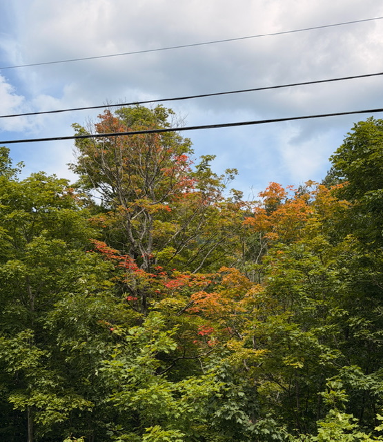
I dunno, tree didn’t look that healthy. Some bare branches mixed in where those colored leaves are. -
.41” for me.
-

Augdewst 2026: Summer's Last Stand
Ginx snewx replied to Prismshine Productions's topic in New England
Our swamp maples are changing by the end of the month a good month before anything else. Last night was the first night I really noticed the night being earlier. Mornings were lost last week -

2026-2027 Super El Nino
FPizz replied to Stormchaserchuck1's topic in Weather Forecasting and Discussion
Pretty sure they were pondering if it could eventually be a modoki, not that is was one already. If you told him that though, he'd block you because hes a puss -
Grass looks good. The Davis siting does not.
-

Augdewst 2026: Summer's Last Stand
dendrite replied to Prismshine Productions's topic in New England
18z models are pretty wet here. We pray. -

2026-2027 Super El Nino
LakePaste25 replied to Stormchaserchuck1's topic in Weather Forecasting and Discussion
-
Augdewst 2026: Summer's Last Stand
Ginx snewx replied to Prismshine Productions's topic in New England
That's not stress though. Oh definitely on the downswing due to light differences. Buds are swollen with lots of white hairs too always a early sign to remind us of a not to far off seasonal change -
Augdewst 2026: Summer's Last Stand
dendrite replied to Prismshine Productions's topic in New England
There’s a large maple down the road here that gets 1/2 color in July and loses most of its leaves by the end of August. -

E PA/NJ/DE Summer 2026 Obs/Discussion
Birds~69 replied to PhiEaglesfan712's topic in Philadelphia Region
84F/DE 72F Stuff from the S moving up... -
I'm nearing 2" now and yes the radar looks good. Drought terminated.
-
2.46” as of 6:25pm so looks like I’m a winner today
-
Models definitely missed this one. I was expecting any decent rain to stay west of DC today and tonight. It looks like a fire hose aimed at PG and AA county. I was expecting this to be over Frederick this evening
-
1.5 in my gauge so far from two flush hits and more incoming. I'd love to see moderate rain all evening with a few rumbles of thunder. We deserve this!
-

Occasional Thoughts on Climate Change
donsutherland1 replied to donsutherland1's topic in Climate Change
Denver has quietly reached and then surpassed 40 90° or above days. What was once an uncommon event has now become routine in the warming climate. Through August 2, 2026, Denver has had 41 such days. During 1872-1999, Denver saw 40 or more such days about once every 7.5 years. Since 2000, such years have occurred once every 1.2 years. Eleven of the last 12 years have seen 40 or more such days. -

E PA/NJ/DE Summer 2026 Obs/Discussion
BBasile replied to PhiEaglesfan712's topic in Philadelphia Region
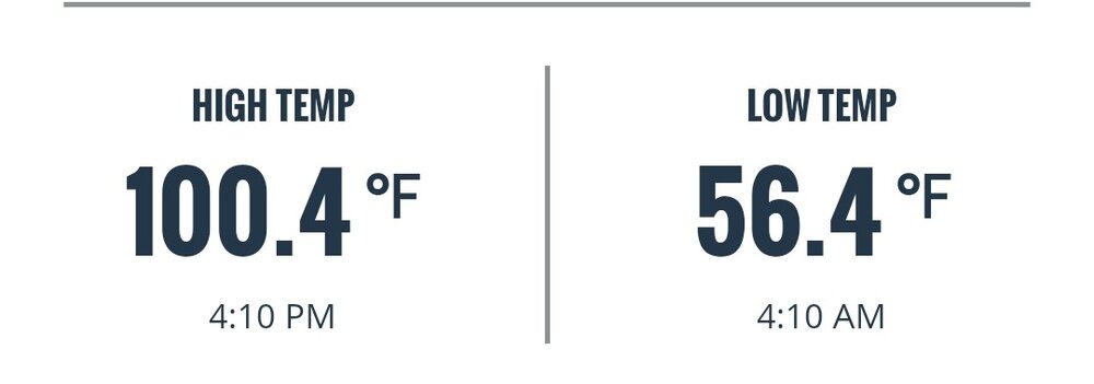
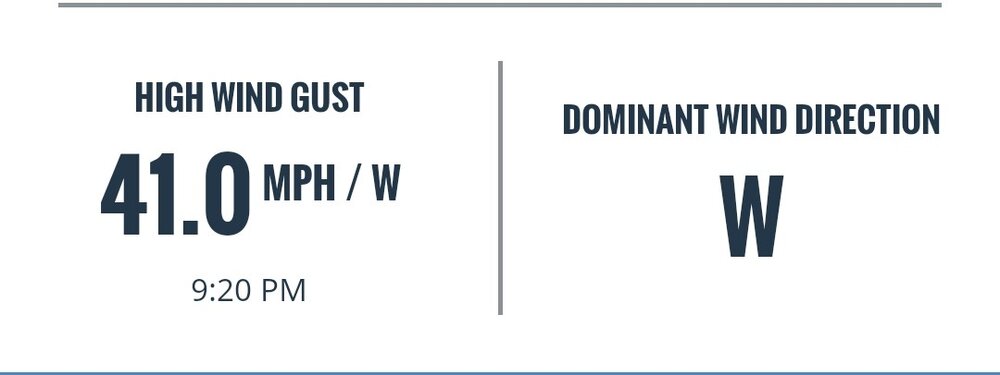
July 2026 Records: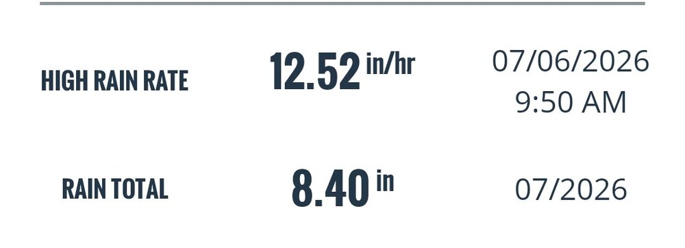
-
Incredible bust for short term model guidance. Some places about to pick up 3" of rain on the day.
-

E PA/NJ/DE Summer 2026 Obs/Discussion
JTA66 replied to PhiEaglesfan712's topic in Philadelphia Region
Must be your location. Crickets and katydids have been doing their thing for a few weeks here. -
I’m laying that grass seed down right after Labor Day. If they don’t ditch the water restrictions, I’m going to protest.
-

Central PA Summer 2026 Discussion/Obs Thread
Elim72 replied to Voyager's topic in Upstate New York/Pennsylvania
3.60 still going. -
It appears per radar that I’m about to get clobbered with heavy rain. Rain started ~5:50PM.
-
RDT_20260802_162958.mp4
-

Pittsburgh PA Summer 2026 Thread
Mailman replied to TheClimateChanger's topic in Upstate New York/Pennsylvania
BULLETIN - EAS ACTIVATION REQUESTED Tornado Warning National Weather Service Pittsburgh PA 540 PM EDT Sun Aug 2 2026 The National Weather Service in Pittsburgh has issued a * Tornado Warning for... West Central Allegheny County in southwestern Pennsylvania... Northern Washington County in southwestern Pennsylvania... * Until 615 PM EDT. * At 540 PM EDT, a severe thunderstorm capable of producing a tornado was located near Imperial, or 8 miles southwest of Moon Township, moving northeast at 30 mph. HAZARD...Tornado. SOURCE...Radar indicated rotation. IMPACT...Flying debris will be dangerous to those caught without shelter. Mobile homes will be damaged or destroyed. Damage to roofs, windows and vehicles will occur. Tree damage is likely. * Locations impacted include... Moon Township, Robinson Township, Kennedy Township, Stowe Township, Coraopolis, Sewickley, Imperial, Emsworth, North Fayette Township, Edgeworth, Sewickley Heights, Glen Osborne, Glenfield, Haysville, Pittsburgh International Airport and Enlow. PRECAUTIONARY/PREPAREDNESS ACTIONS... Move to an interior room on the lowest floor of a well-built building away from windows. If you are outdoors, in a mobile home, or in a vehicle, move to the closest substantial shelter and protect yourself from flying debris. - Today
-
Augdewst 2026: Summer's Last Stand
powderfreak replied to Prismshine Productions's topic in New England
Yeah nothing abnormal. We’ve seen a few up here.