All Activity
- Past hour
-
 nah... sat and rad trends expose a massive cosmic dildo pounding the bum of convective hopefuls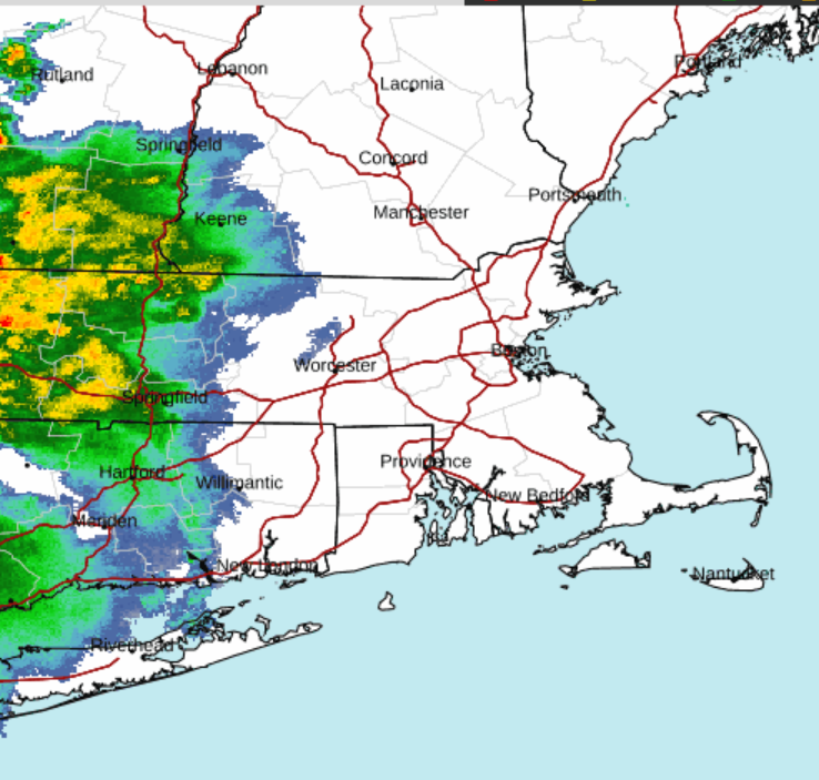
-
 maybe because its a bit elevated but surprised no warning or at least a SPS on that cell heading towards Fairfield County/Danbury...decent wind signature on velocity
 -
Mind posting? On mobile so can’t look easily
-

Pittsburgh PA Summer 2026 Thread
PghPirates27 replied to TheClimateChanger's topic in Upstate New York/Pennsylvania
Looks like most of the heavy rain is going to be south of I-70 -
Looking upstream, if we can get these debris clouds over West Virginia to fade out, we should be okay for at least some thunder. The cluster of storms coming through Columbus, OH right now has an uptick in CG and seems to be drifting southeast. Wonder if that's our show for later?
-
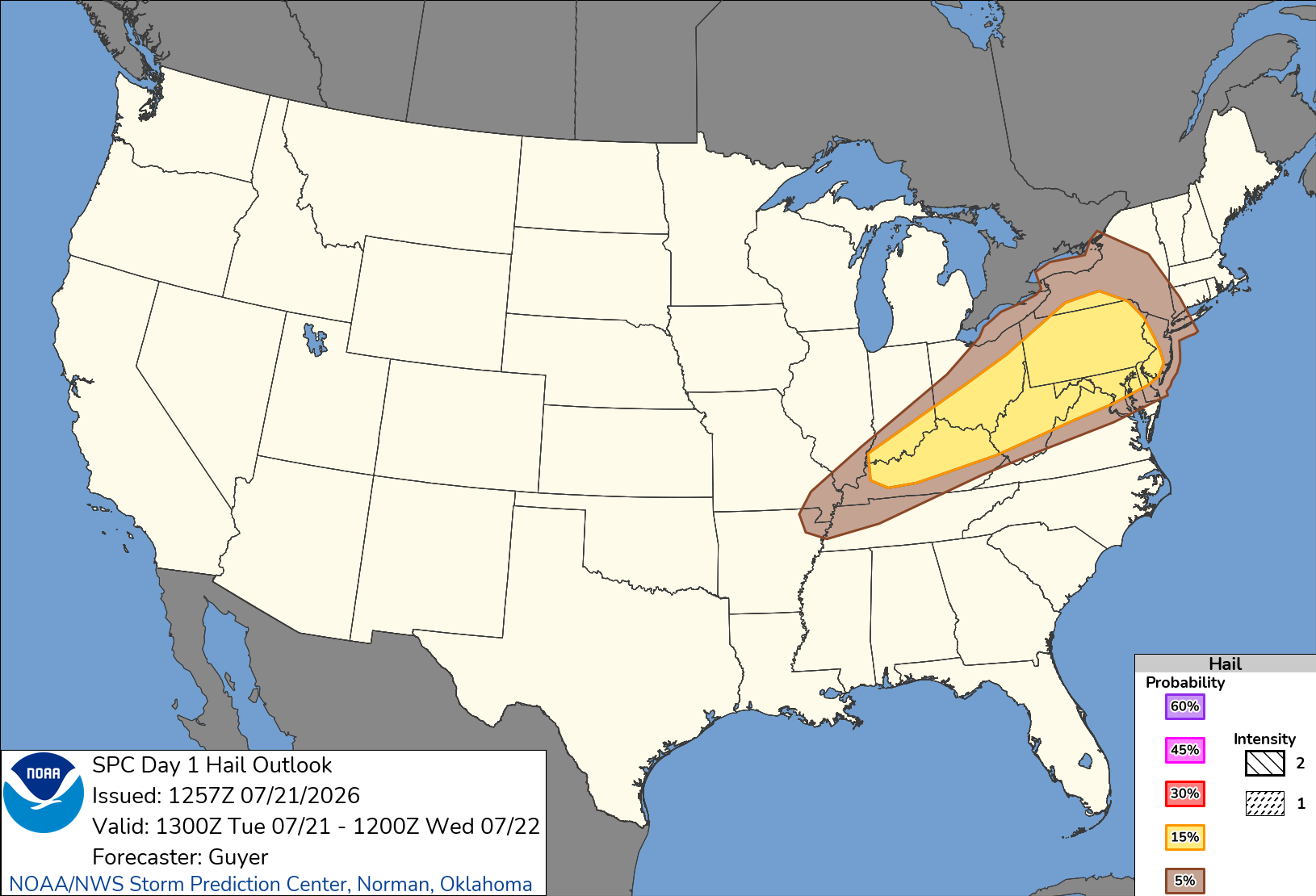
Could be a nice line that organizes early tomorrow afternoon for E CT and points east
-
 At least they drive on the right...that helps when you are not focusing on the road!
 -
Some of the most intense rain that I have ever witnessed. Deafening. Oakland NJ.
-
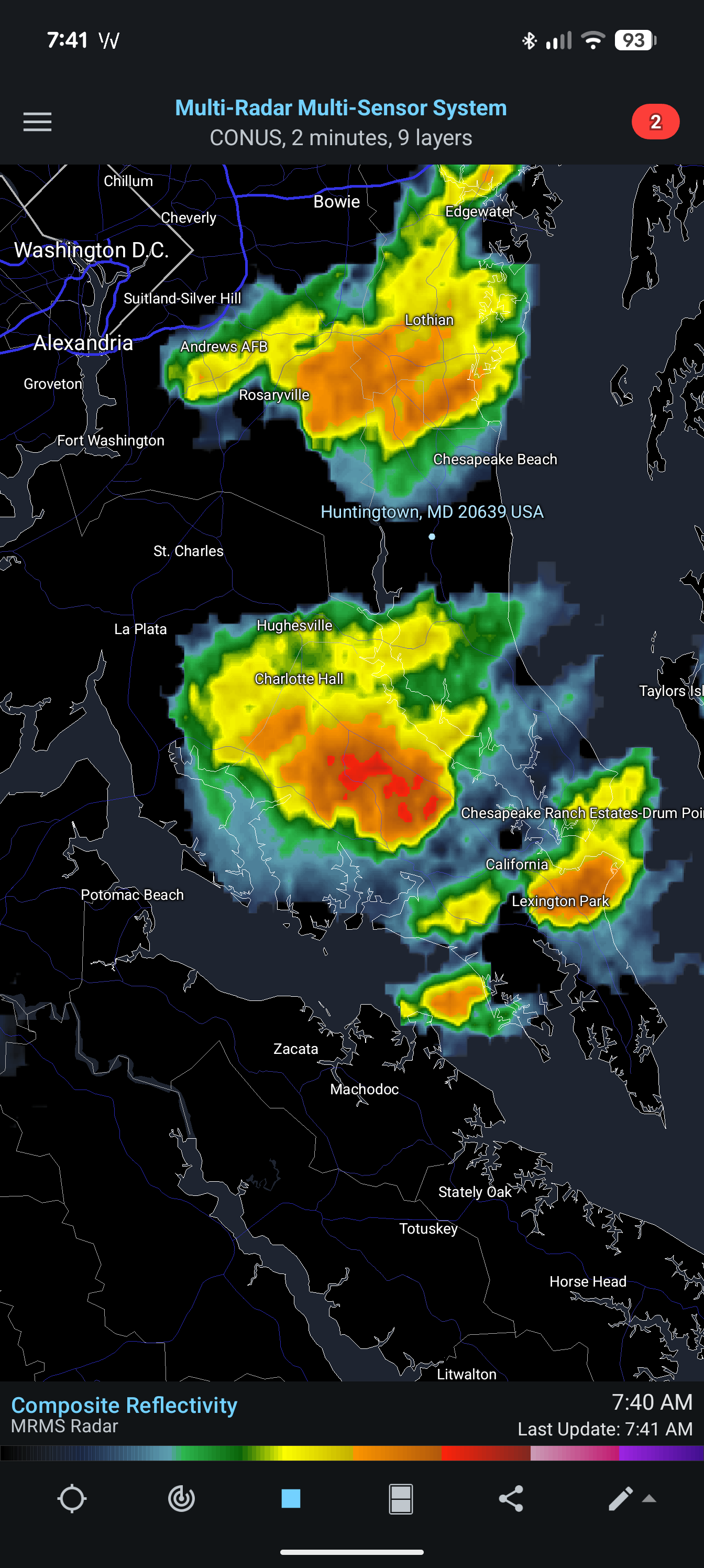
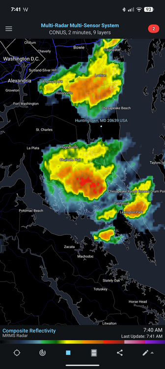
The Huntingtown split was in effect yet again this morning. Feels extra gross out too.
-
Bad Gateway -related delay/ping failure has returned. Check for another wave of foreign shitheads Also, probably could have been a part of the enhanced severe stuff today if it were not this piece of shit useless timed nocturnal garbage waste ... just exquisitely timed to make sure nothing happens but light mosquito rain
-
 That’s beautiful though. I could live there if it wasn’t for the lack of light in winter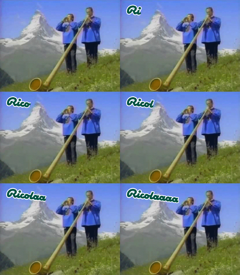
-
 Looks like southwestern CT will be having some fun in an hour or so
 -

Central PA Summer 2026 Discussion/Obs Thread
canderson replied to Voyager's topic in Upstate New York/Pennsylvania
The good news is it looks like any above normal / heatwaves will be muted until at lest middle August. -

Central PA Summer 2026 Discussion/Obs Thread
Elim72 replied to Voyager's topic in Upstate New York/Pennsylvania
That cluster out west looking good. Hopefully, it ramps down a little on the instability. -

Central PA Summer 2026 Discussion/Obs Thread
AccuChris replied to Voyager's topic in Upstate New York/Pennsylvania
Lebanon area has had highly localized heavy rain totals this month but my station in North Cornwall Twsp has missed the heavy stuff so far this month and only at 2.20” and 19.44” on the year . -

Central PA Summer 2026 Discussion/Obs Thread
Itstrainingtime replied to Voyager's topic in Upstate New York/Pennsylvania
Yes, it's been a good month overall. I'm at 5.92". I just know how quickly things can dry out with any extended period without rain. -
12z NAM throwing out some nasty hodographs and STP numbers between 21z and 00z KFDK at 00z DCA at 00z
-
Looks like a hell of a drive on the thruway, even if it only lasts a few minutes, that's some serious precip.
-
If you liked the 11z HRRR, you'll love the 12z HRRR. Legit squall line.
-
.thumb.gif.f92b16c631a1d15d405ed77b33f0710d.gif) if that's the case...it's barely BN
if that's the case...it's barely BN -
Looks like 12z HRRR has some discrete convection from 18z to 20z across the region before QLCS (?) comes through around 22z-23z
-
(002).thumb.png.6e3d9d46bca5fe41aab7a74871dd8af8.png) AI knew the Chesco COOPs are included in the SE PA climate division but did not feel it material enough to change the statistical fact that the raw data at Chesco was cooling the same as the surrounding stations so again no need for further cooling. Plus with all those AM TOB readings at Coatesville and West Chester why didn't NCEI apply some warming adjustments? Again only non-stop chilling adjustments.
AI knew the Chesco COOPs are included in the SE PA climate division but did not feel it material enough to change the statistical fact that the raw data at Chesco was cooling the same as the surrounding stations so again no need for further cooling. Plus with all those AM TOB readings at Coatesville and West Chester why didn't NCEI apply some warming adjustments? Again only non-stop chilling adjustments. -
That is shocking
-

E PA/NJ/DE Summer 2026 Obs/Discussion
BBasile replied to PhiEaglesfan712's topic in Philadelphia Region
Lets try again.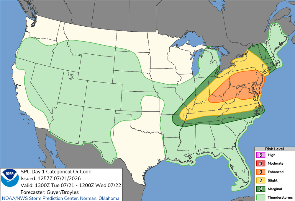
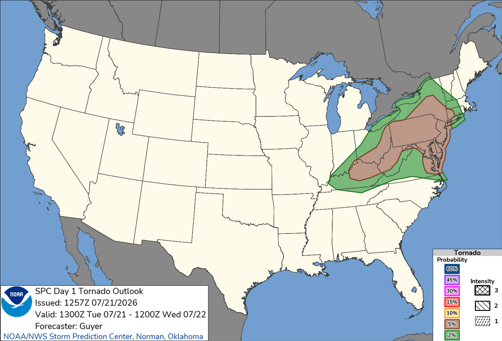
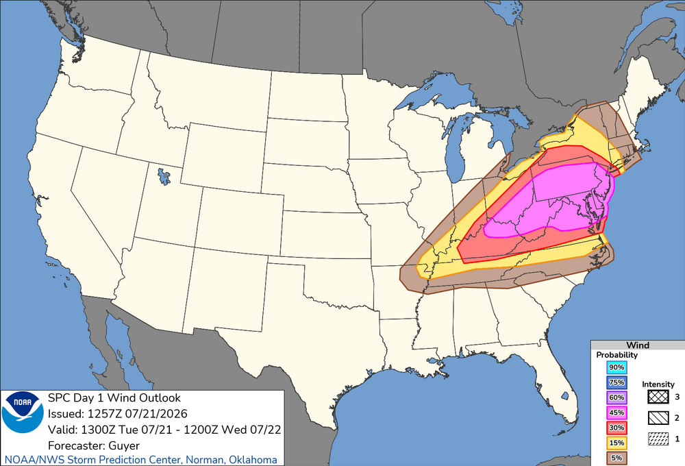
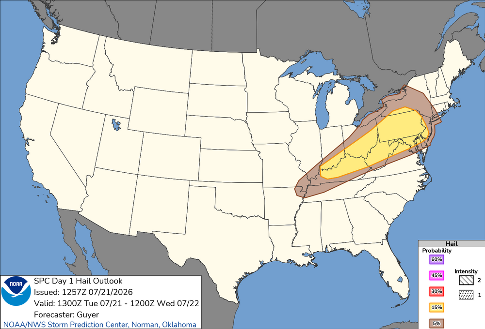
-

Central PA Summer 2026 Discussion/Obs Thread
Mount Joy Snowman replied to Voyager's topic in Upstate New York/Pennsylvania
I hear ya, hoping for the same. Latest HRRR loves that 4-6pm timeframe for a juicy line to come through. I got .19" over the weekend but have 5.8" for the month.