All Activity
- Past hour
-
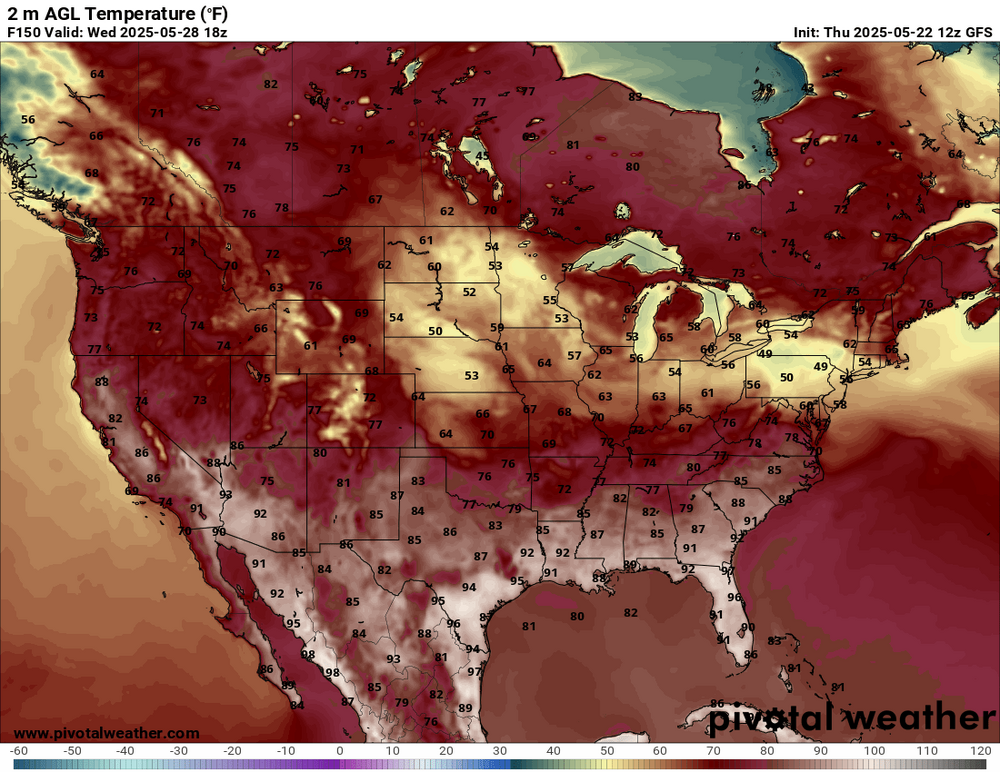
Not in early June. Mid to upper 80s is decently above average.
-
But the normal highs for the for the first week of June are still in the upper 70s.
-
Like we typically do every summer when the average high is 87
-

2025-2026 ENSO
40/70 Benchmark replied to 40/70 Benchmark's topic in Weather Forecasting and Discussion
Its a combination of shrinking overage AND predominately -PNA/+NAO/+WPO. -
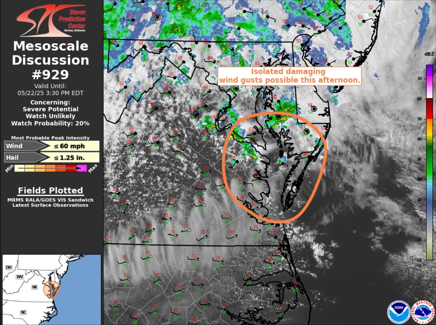
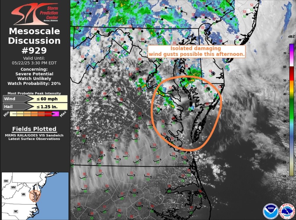
https://www.spc.noaa.gov/products/md/2025/md0929.html
-
Upslope enhancement for the 395 corridor in E CT?
-
Once this pattern breaks we're seeing 85+ easily
-
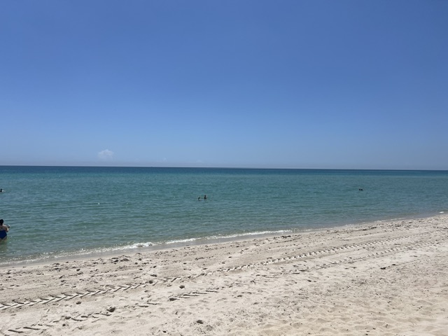
Coastal looking great here in S FL, haha!
-
yeah there wasn't much wind outside of the beaches.
-
I’m never been a fan of the wide ranges. But they’re not the only ones with that. CyclonicWx, 20/20, and Accuwx have similarly wide ranges. OTOH, I like that CSU forecasts with no range.
-
Just cracked the ten inch mark for the month of May. 10.03" to be exact as of 1:10pm on 5/22.
-
Late May cool here, over the top heat for Canada. Easy to call the last 5 years.
-
42.8F Light rain. On May 25 2012 I recorded 3.1" of thundersnow within about a 2 hour period. I believe the temperature was 33F during that event. That was the latest snow I have recorded. We will not repeat that tonight but at my elevation of 1100 feet it will be interesting to see if I can manage some mangled flakes. Any guesses? What do you think Brian?
-
Sun is out and it's feels warmer and more humid. The storms look to miss my area for now. Maybe later.
- Today
-
Mrs Canderson hinted she wants the heat turned back on
-
Columbia — Total event rainfall since late Tuesday and as of noon Thursday: 1.03” Obs: partly sunny, no rain, 60°
-
We pray it rains
-
Staying dry so far but tonight looks pretty nasty. Been running the mini-split heat off and on for a few weeks...no AC needed for quite some time is my guess. 48/44
-
That is a wall of water to the south, lots of convection too.
-
If it stays dry in the Hartford area from like 4-8 PM I will do naked cartwheels down Main Street
-
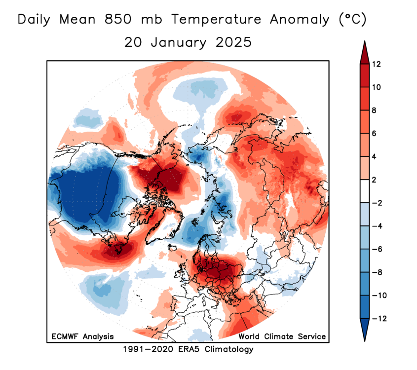
I remember seeing this and posting it last winter ... I'm wondering if we're still seeing some vestigial tendency to be strangely cold in the local space, comparatively
-
this low has bombed down to 1004 mb
-
Media had family members whipped up into a frenzy. Instead of cold windy day, 6pm news last night WAS BREAKING WEATHER ALERT
-
Is that an 86F up there on the shore of..
-
Storms starting to fire up. Breaks in the clouds with sun peeking through in Ellicott City