All Activity
- Past hour
-
This and Aug 27th were the best two storms of the year on the Rockville/Gaithersburg border. At least for lightning. It intensified right as it went down the I-270 suburb corridor.
-

2026 Mid-Atlantic Severe Storm General Discussion
dailylurker replied to Kmlwx's topic in Mid Atlantic
The summer of the severe warned storms that don't even produce thunder lol -

2026 Mid-Atlantic Severe Storm General Discussion
SolidIcewx replied to Kmlwx's topic in Mid Atlantic
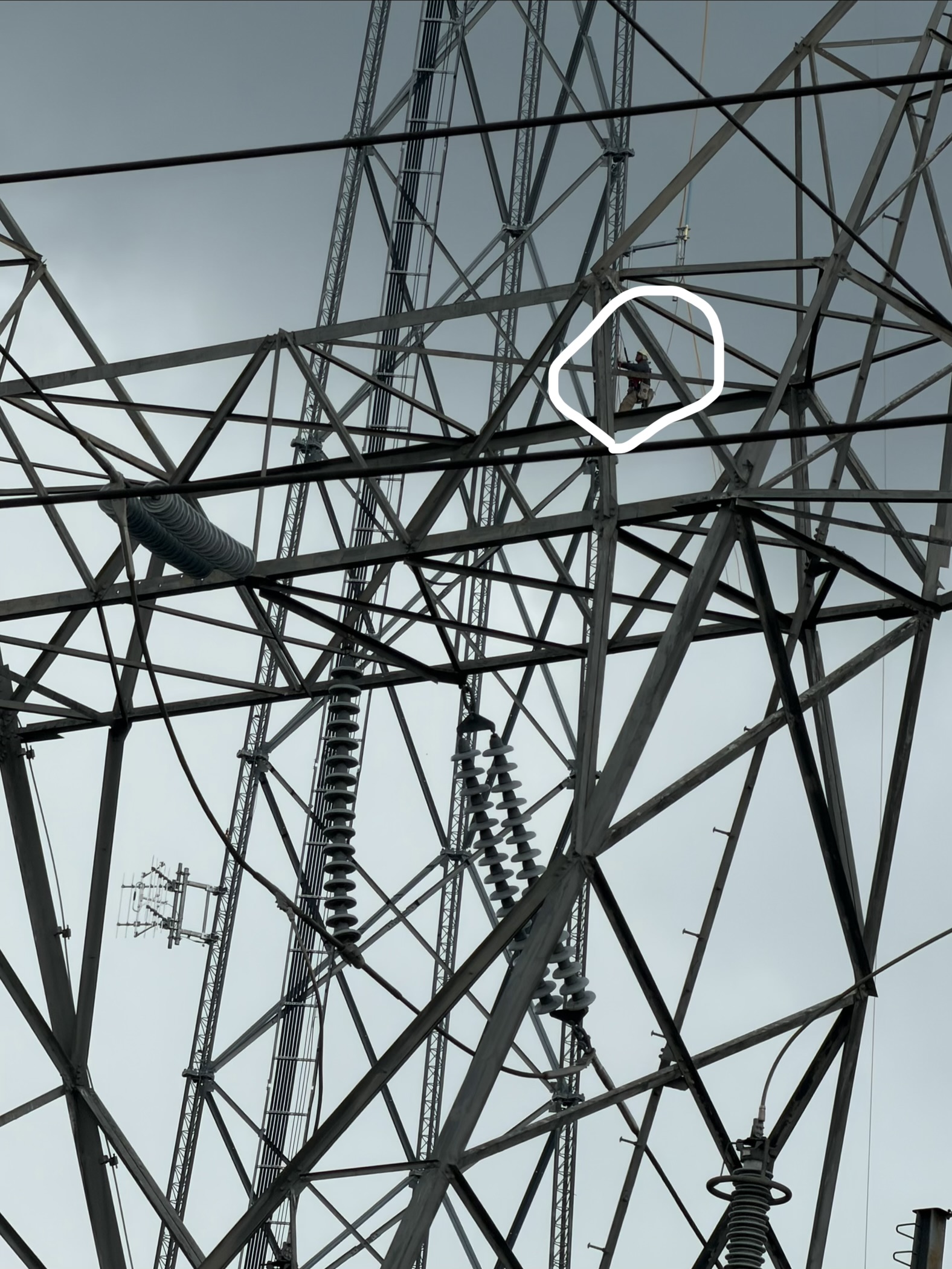
Poor guy on a tower as the winds and rain move in.
-

Septorcher 2026 Discussion - Endless Summer
weatherwiz replied to Damage In Tolland's topic in New England
I am going to miss being able to just throw on shorts and short sleeved shirt after showering in the morning. Here it is September and I’m still wearing shorts. I’ve adapted quite a bit over the past few years -

2026-2027 Record-breaking El Nino
GaWx replied to Stormchaserchuck1's topic in Weather Forecasting and Discussion
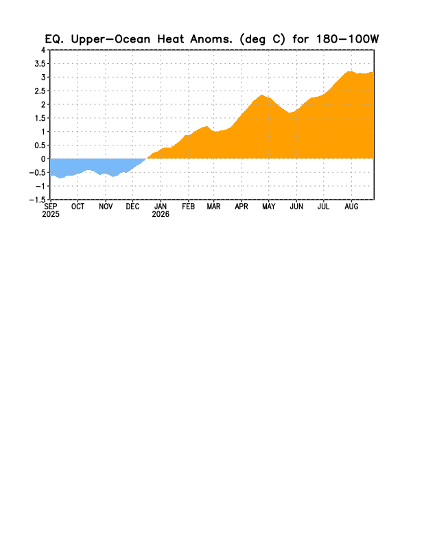
OHC monthly rose to a new record high that last month had set (note these aren’t adjusted for GW in a “relative” sense, but they’re still very impressive): 2025 11 -0.02 -0.33 -0.46 2025 12 0.26 0.01 -0.03 2026 1 0.64 0.45 0.49 2026 2 1.08 1.02 1.15 2026 3 1.38 1.39 1.36 2026 4 1.85 2.07 2.24 2026 5 1.67 1.97 1.99 2026 6 1.79 2.14 2.26 2026 7 2.03 2.50 2.96 2026 8 2.19 2.75 3.20 The following image is for the same longitudes as that for the 3rd column and it jibes fairly well: Prior to 2026, this had been the record high for the last 2 columns: 1997 10 1.35 2.05 2.56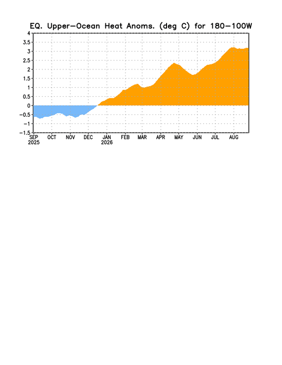
-
Nope, closing in on 1” here. Not severe but some decent thunder and torrential rains.
-
Beneficial rain in Colesville. A touch of thunder but that's it (so far)
-

2026 Mid-Atlantic Severe Storm General Discussion
GramaxRefugee replied to Kmlwx's topic in Mid Atlantic
Gusty rain just hitting Annapolis about 13:35 No T&L AFAICT -
large storms already NW of Toronto
-
NAM has been going out with a whimper this storm season. It has struggled in almost every event. I agree we’re probably down until tomorrow sometime.
-
Hurricane Karina has been 125kt from last night into this afternoon. Just add a "T" and you've got Hurricane Katrina!
-
Honestly I will say that I have not checked that specific map very often. It's not of particular interest, day to day, for me. It seemed like some individual days in the 2016 El Nino were very high like +0.8C or something. For example, Feb 2016 is listed as +0.817C on that web site. The recently monthly anomaly values, like July and August 2026, are high (on that web site), +0.764C and +0.942C. So that's pretty insane.
-
not one model showed that cluster
-
Radar definitely exploded out here
-
Special Marine Warning National Weather Service Baltimore MD/Washington DC 115 PM EDT Wed Sep 2 2026 The National Weather Service in Sterling Virginia has issued a * Special Marine Warning for... Tidal Potomac from Indian Head to Cobb Island MD... Tidal Potomac from Key Bridge to Indian Head MD... * Until 315 PM EDT. * At 114 PM EDT, strong thunderstorms were located along a line extending from near Fort Smallwood State Park to 16 nm north of Key Bridge to 24 nm northwest of Tidal Basin to 31 nm northwest of Reagan National Airport, moving south at 25 knots. HAZARD...Wind gusts 34 knots or greater.
-

2026-2027 Record-breaking El Nino
Terpeast replied to Stormchaserchuck1's topic in Weather Forecasting and Discussion
At least its showing up on modeling, now lets see if it actually verifies. -
Also an uptick in lightning near Barnesville, MD ETA - radar presentation loops LEWP-esque
-
The 12z NAM nest earlier seemed to want to blow a huge line through at like 2am. Not seeing that on other models. I think this line is the only show - especially if we are overturned.
-
Reports of trees down in the area showing up on FB. School sent a message saying buses would be delayed due to having to reroute them. I’m surprised, it wasn’t that windy at my house
-
45mph gust in Frederick
-

2026 Mid-Atlantic Severe Storm General Discussion
ThePhotoGuy replied to Kmlwx's topic in Mid Atlantic
Heavy rain but nothing severe. No thunder yet either.- 2,350 replies
-
- 1
-

-
- severe
- thunderstorms
- (and 7 more)
-
That storm track looks so unusual over central MD, almost due south.
-

2026 Mid-Atlantic Severe Storm General Discussion
jewell2188 replied to Kmlwx's topic in Mid Atlantic
Going to be pretty disappointing if this is it and done for the day. -

2026-2027 Fall/Winter Mountain Thread
BooneWX replied to BlueRidgeFolklore's topic in Southeastern States
How many beans in the jar folks? -
2026 Mid-Atlantic Severe Storm General Discussion
dailylurker replied to Kmlwx's topic in Mid Atlantic
Oh look. A dieing line on my doorstep. At least I got my thundershower warning lol