All Activity
- Past hour
-
Beautiful evening in OC. Reminds me of decades ago when I used to bring jeans and a light jacket on my summer vacations to the eastern shore.
-
Clouds from around 4pm today looking clear tomorrow, mainly sunny Sat and Sun.
-
Today's Highs: TEB: 84 New Brnswck: 83 PHL: 83 NYC: 83 EWR: 82 TTN: 82 LGA: 82 ACY: 81 ISP: 81 JFK: 80 BLM: 80
-

2026-2027 Super El Nino
raindancewx replied to Stormchaserchuck1's topic in Weather Forecasting and Discussion
If you go by the June -SOI (-22 is very strong for an El Nino historically) you'd expect a cooler than average Great Basin & New England. Not what we have. Moisture is closer though, its wet / dry in mostly the right areas, although spottier than I'd like. Long-term, -SOI in July is a weak cold West signal for Sept, and then the eastern ~5/6 of the lower 48 is weakly favored cold in October. Dec goes to Cold West, Warm East, Mild Plains favored. December also has the first deeper blue signal for precipitation - strongly favoring the Midwest/Southwest for a wet month. No big signals for January via July SOI. In February, SE is strongly favored cold, NW strongly favored warm. March is then a strong SW / Plains wet signal, weak SW cold signal. We're in a flash flood warning here - it's been a good monsoon day statewide (finally). So the precip map should move closer to the correlation map for New Mexico after today. -
 Leftovers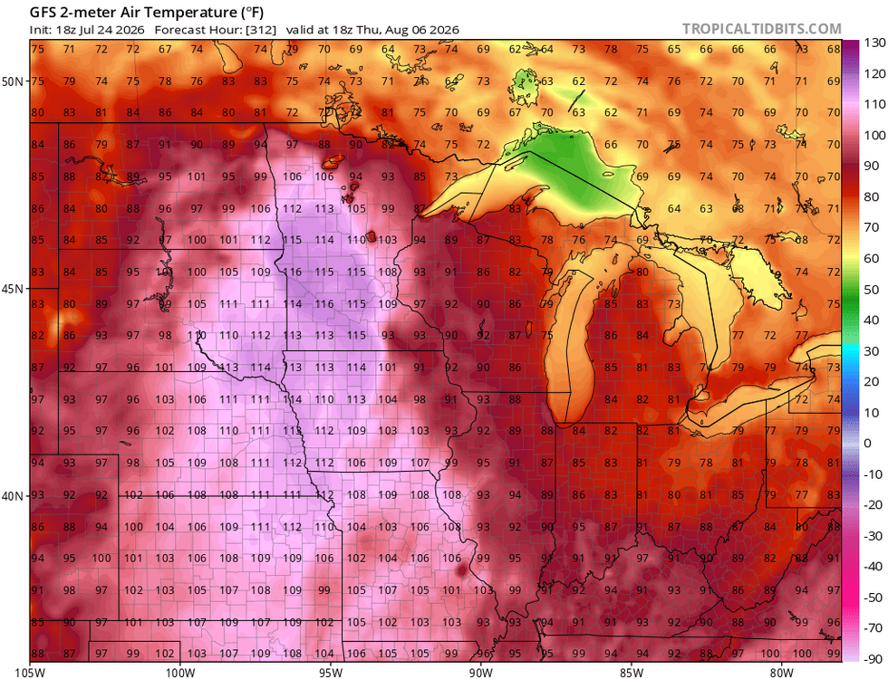
-
.thumb.gif.f92b16c631a1d15d405ed77b33f0710d.gif) wowzers
wowzers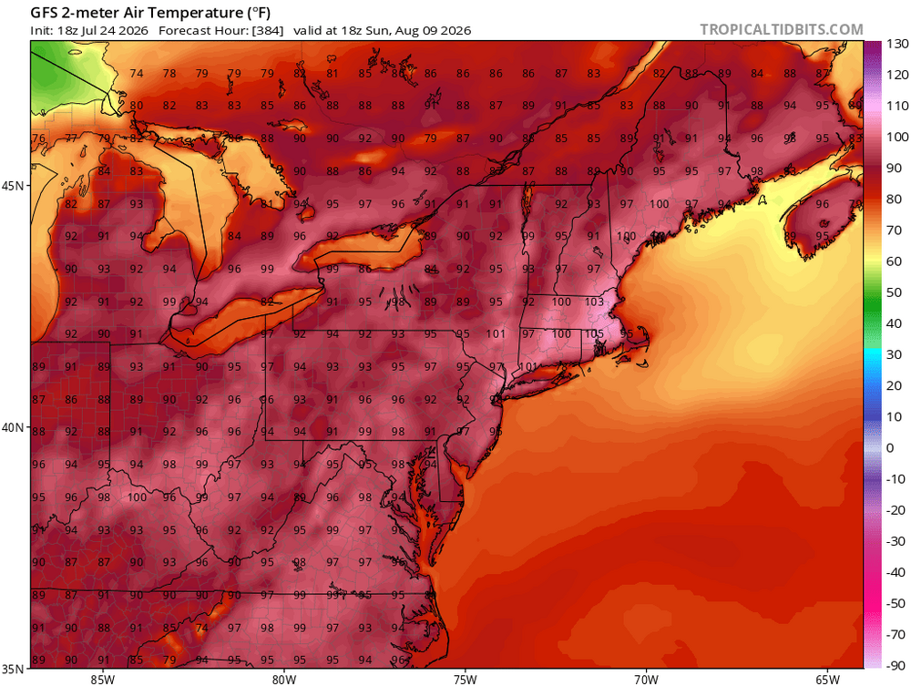
-
Yeah no kidding!
-
 God you are a genuine insufferable git. A joyless misery day in day out.
 - Yesterday
-
I am definitely skinny CAPE- relatively modest updrafts but over a vertically deep layer(quite long/tall) and with lots of juice. @ravensrulewill be along shortly
- 1,463 replies
-
- 1
-

-
- severe
- thunderstorms
- (and 7 more)
-
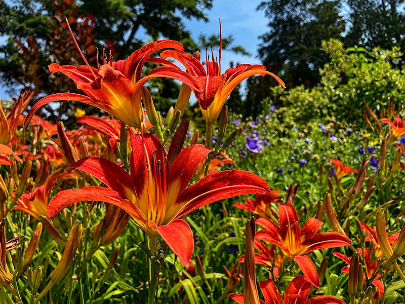
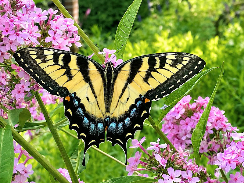
With temperatures topping out in the lower 80s, today was a great day to photograph some of the flowers and butterflies at the New York Botanical Garden. Five photos:

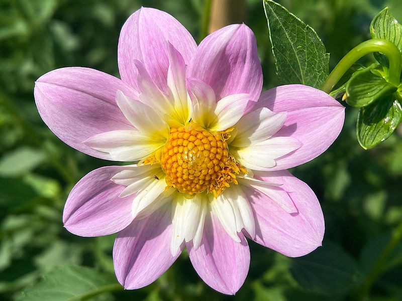
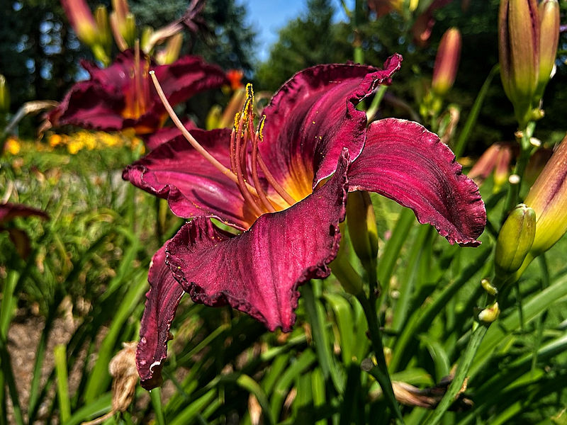
-

2026 Spring/Summer Mountain Thread
Maggie Valley Steve replied to Buckethead's topic in Southeastern States
And they are efficient rain makers to boot! -
 Euro and gfs pretty much nuke the entire week save for Monday and early Tuesday
 -
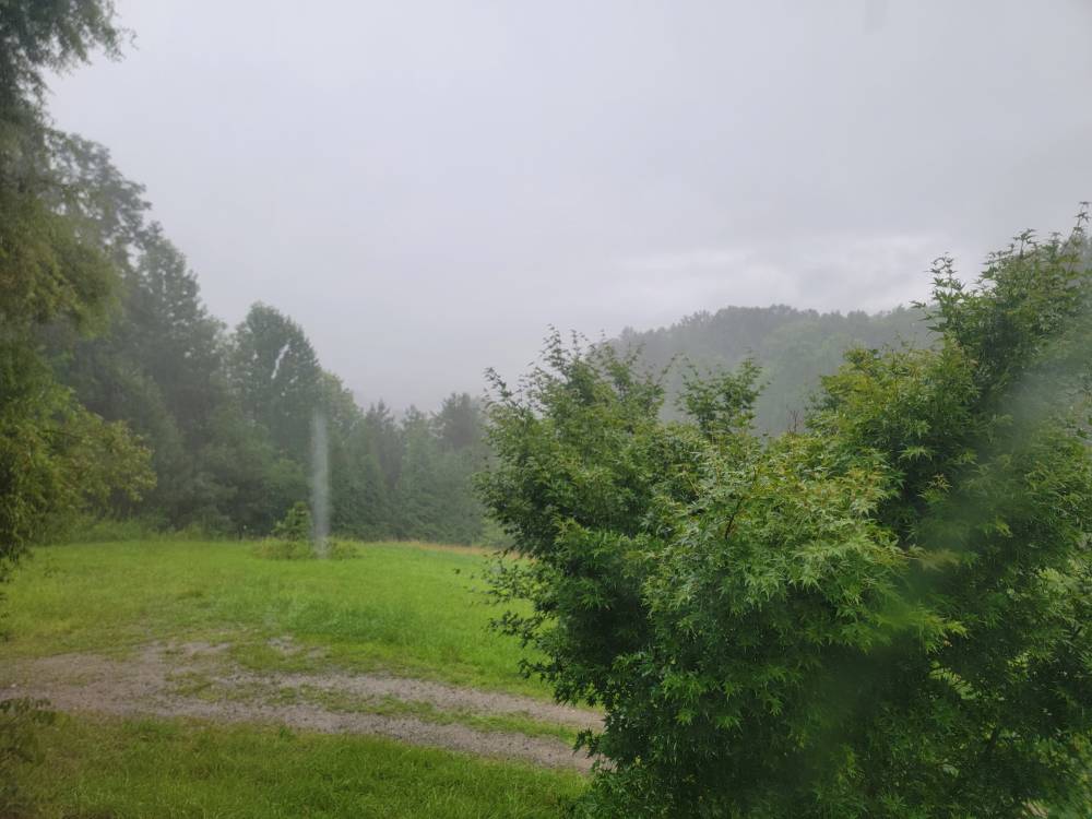
Pouring. Sent from my SM-G998U using Tapatalk
-
Absolutely dumping the rain this evening. Radar doesn't look like much but it's coming down hard.
-
81/58 split today.
-

Occasional Thoughts on Climate Change
donsutherland1 replied to donsutherland1's topic in Climate Change
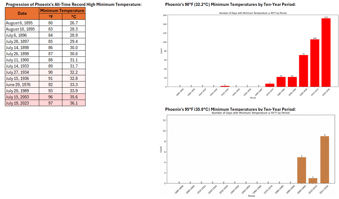
Phoenix is on track to tie its all-time record highest minimum temperature today. Minimum temperatures of 90° or above and 95° or above have increased in frequency in recent years due to a combination of the urban heat island effect and anthropogenic climate change.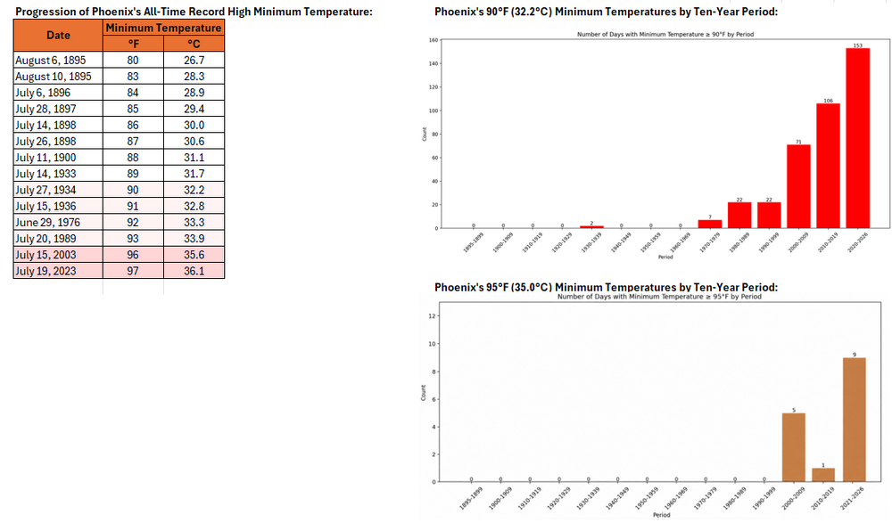
-
Steady rainfall this evening.
-
 Clowns to the left of me, jokers to the right, here I am stuck in the middle with....unfortunately no one.
 -
Clouds wtf..will they be out by tomorrow
-
Maybe in October on the day of peak leaf color we will get a big noreaster and it'll dump all the leaves in a couple hours. I'd be for it if it means a couple inches of rain.
-
For some reason mine didn't come with the rods. It's like they forgot to pack them. Luckily the birds have plenty of better choices for perches around here so hopefully it won't be an issue.
-
You guys are making me so jealous! It wont get this cool for me til November down here.
-
2026-2027 Super El Nino
donsutherland1 replied to Stormchaserchuck1's topic in Weather Forecasting and Discussion
I agree. I suspect that 1982-83 likely had at least a comparable streak. Unfortunately, I have found no daily data prior to 1991. -

2026-2027 Super El Nino
EasternLI replied to Stormchaserchuck1's topic in Weather Forecasting and Discussion
Looking through the JMA archives of VP anomalies. There's not really many years at all that are comparable in the strength of the Walker cell at this stage of the evolution. It's really only the super nino years that are comparable at all to this year thus far(basing this on the ONI data). The strong el nino years such as 57-58, 65-66, 72-73, 91-92, 23-24 don't even hold a candle to the VP obs over the past 30 days of this year. 87-88 also gets included in that group. That one gets a little bit of a shout out being as it's far closer in this regard than any of the others I listed. However that was a 2nd year event so I'm guessing that has something to do with it. That leaves 82-83, 97-98, 15-16 super nino's which I will post below along with this year. These are the 30 day means(!) Of those 15-16 I'd say probably looks the closest match to date although I'd also say that's probably because that's the most recent one. 82-83 not terrible. 97-98 seems to have ramped up a little more slowly than we're seeing now but that one absolutely gets included. Images below are this current year followed by the other 3 in chronological order. Yeah, this one probably ends up unprecedented in strength given all of the other data available. What that would ultimately look like is anyone's guess given an inherently small sample size. Guess we'll all find out. -

2026-2027 Super El Nino
40/70 Benchmark replied to Stormchaserchuck1's topic in Weather Forecasting and Discussion
Man, the Euro has big-time NAO blocking in January....I don't agree with that, but tries to pull a 1966.