All Activity
- Past hour
-

2026 Mid-Atlantic Severe Storm General Discussion
SnowenOutThere replied to Kmlwx's topic in Mid Atlantic
The lack of lightning does indicate how these storms were relatively low topped. Just seems odd as forecasted soundings showed a high enough EL point and we had big CAPE throughout the layer. I’m sure something caused it though. -
Southern and SW burbs of Chicago getting hit pretty good.
-
Small cell out in this part of south west Morris County doing work… heavy rain, constant lightening and rolling thunder.
-
Epicosity between Northern Illinois and Southern Michigan One contiguous line of tornado and or severe thunderstorm warnings from Grand Rapids Michigan to Springfield, Illinois, actually all the way down to Texas
-
Lightening strikes are way down in the past few radar loops as is precip intensity. I have lightening off to my north from that cell over pike/northern sussex county, but other than that, the main show is over.
-
Absolutely insane velocity scans on that cell.
-
yeah we used to call that "heat lightning" quite a bit of it now on Union/Middlesex border being caused by a little storm that popped up near Tewksbury just north of Rt. 78
-
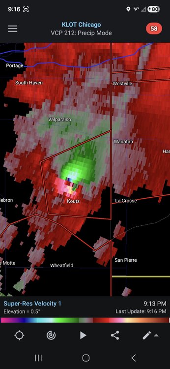
I honestly don't know if I've seen that color orange on a velocity sig before
-
A smidge over 0.2”.
-
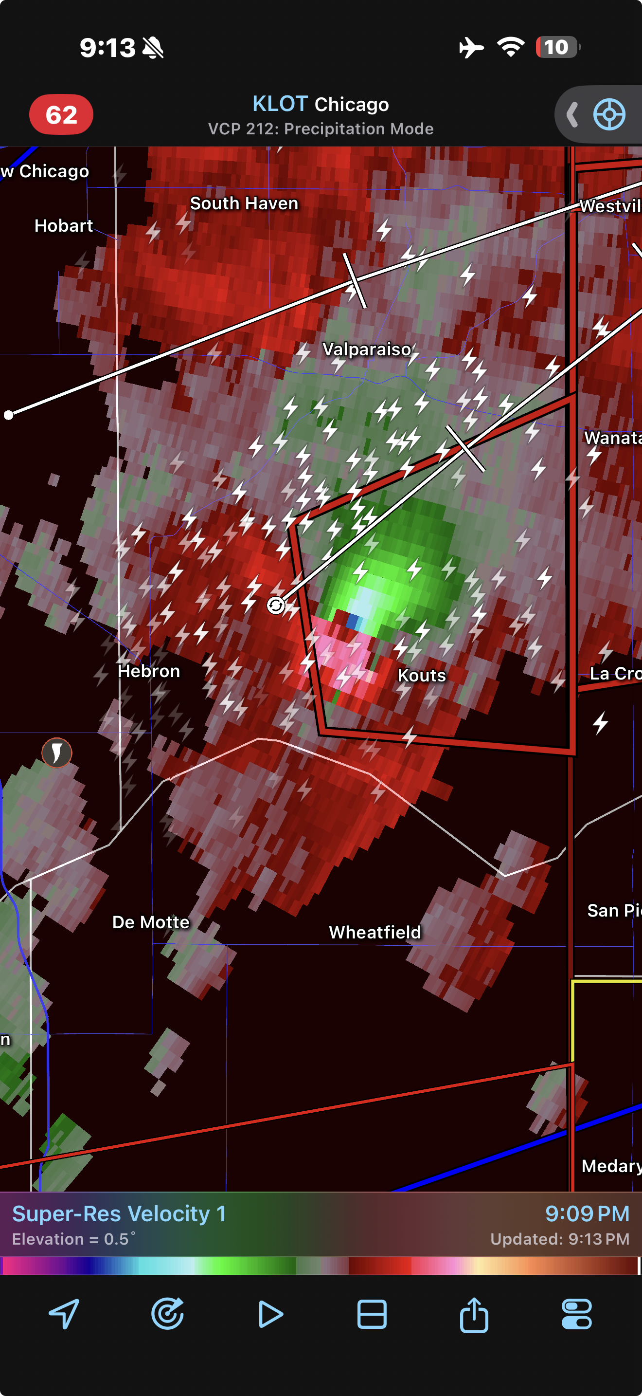
100mph+ inflow from both KLOT and IWX radars. That's a yikers
-
Cc just dropped again so it is eating
-
That's a wild velocity sig
-

Central PA Summer 2026 Discussion/Obs Thread
Voyager replied to Voyager's topic in Upstate New York/Pennsylvania
Yeah, it was a joke here. Three rumbles of thunder, an 8.4 mph wind gust, and, like you, 0.10" of rain. -
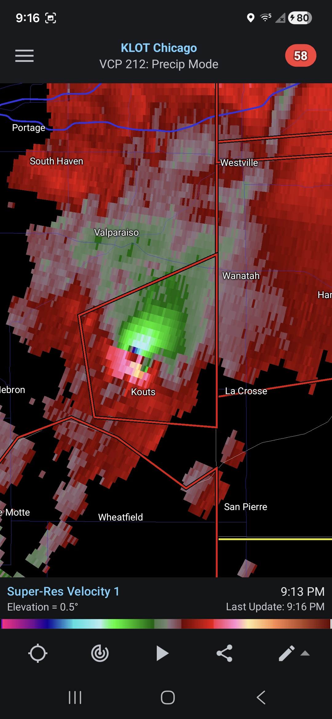
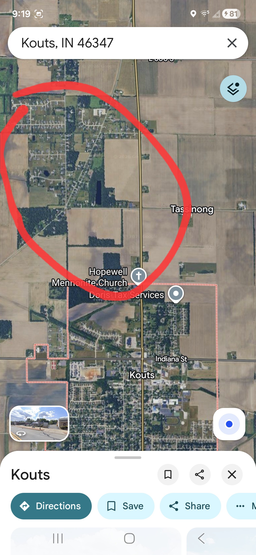
Huge wedge tornado reported NE of Kouts per Isaac Polanski.
-
There's a fairly decently sized housing development just north of Kouts, hopefully it's not hitting that. Couplet looks even stronger now.

-

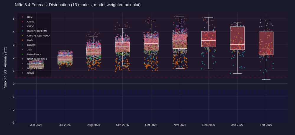
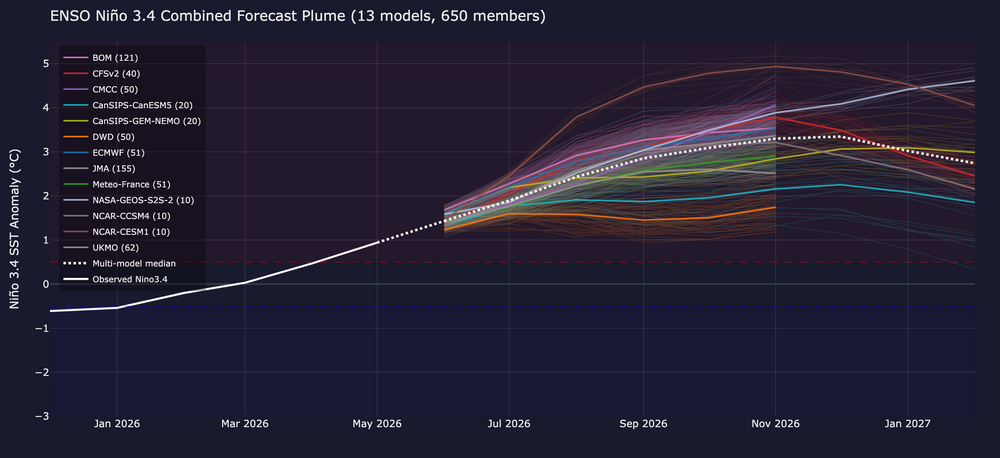
2026-2027 Super El Nino
olafminesaw replied to Stormchaserchuck1's topic in Weather Forecasting and Discussion
-
Fwiw i hit a perfect drive on 16. And then somehow hit an 8 iron 2 clubs too far and ruined my even par back 9. my front 9 was closer to yesterdays dew point however.
-
not sure they’re gonna fall apart just yet, lot of distant lightning
-
Drizzled for 5 mins, we got lucky. turns out one of the guys i golfed with was a weather buff too lol
-
I’m sure this is fine.

-
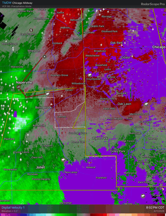
Let’s take down the Midway radar.
-
Lets hope the sun setting calms these things down. Anything popping out ahead of that shrimp belly is rotating like instantly. Primo conditions currently in NW IN S MI
-

2026 Mid-Atlantic Severe Storm General Discussion
George BM replied to Kmlwx's topic in Mid Atlantic
Yeah these storms reminded me of a lower CAPE day but with steep LLLRs still allowing for big wind. Kind of similar to June 26, 2024 with a line of impressive wind producing storms with limited lightning. Hopefully LWX was able to launch the 00z sounding before the storms rolled through. The sounding would probably show some clues as we did have large CAPE and decent MLLRs (6.5+C) during the day. -
There were huge storms from pawling north today. Lots of damaging hail and wind. Just south of 84 and nothing. Huge difference.
-
Sirens