All Activity
- Past hour
-
I just mean I was higher than you, cooler than you during the warmup, and we ended up tied at 8” the other day. Not calling you out. Just surprised I was losing snow faster than you.
-

2026 Mid-Atlantic Severe Storm General Discussion
high risk replied to Kmlwx's topic in Mid Atlantic
But is that too much shear for the very modest cape? -

2026 Mid-Atlantic Severe Storm General Discussion
Eskimo Joe replied to Kmlwx's topic in Mid Atlantic
70 - 125 kt shear on a neutral to negatively tilted trough in March is a recipe for a decent event. -

Pittsburgh/Western PA WINTER ‘25/‘26
Gordo74 replied to Burghblizz's topic in Upstate New York/Pennsylvania
Well don’t I look the fool for making fun of the ides of March storm and now I’ve been without power since 6pm with no ETA. -
In rare form this morning, ha.
-
Is the Spring Equinox going to get delayed on Friday?
-
Pretty good snow shower here on my walk. Windy, chilly day.
-
I’ll have what he’s having
-
Looks like Central and Western Mass have some snow right now too.
-
What did you have in the flizzard? I have a 10" in the that, and then avoided melting in the March 5-6 deal, as I added 1.5" of pack-preserving sleet, while rest of SNE rained and NNE had a few inches of fluff.
-
How many Pope-A-Wheelies today?
-
Give it a rest. Posted like 30 times this morning for boredom and 1.5” of snow.
-
Wouldn't mind joining the Yoopers in the UP for a few days. Green Bay will have some mixing issues but a bit further N and NE, Damn.
-
Snowing up here in Presque Isle. Delaying my drive home.
-
.thumb.jpg.6a4895b2a43f87359e4e7d04a6fa0d14.jpg)
Central PA Spring 2026 Discussion/Obs Thread
Yardstickgozinya replied to Voyager's topic in Upstate New York/Pennsylvania
Not only will it likely get expanded, but once they better pinpoint, where the concentration of discrete cells will be, I expect an upgraded considering the anomalous kinematics. Make no mistake, there's been indications that there will be discrete convection in our area before the front can move through. That's what facilitated such an early thirty percent highlight. -
TBH, my locale is in a local valley, despite not being right on the river...I also noticed that I consistently come in a bit lower than the Culligan guy from Salem, NH, too.....I don't think he's misrepresenting, though I know you are just nut-crunching.
-
Discussion from SPC:

-
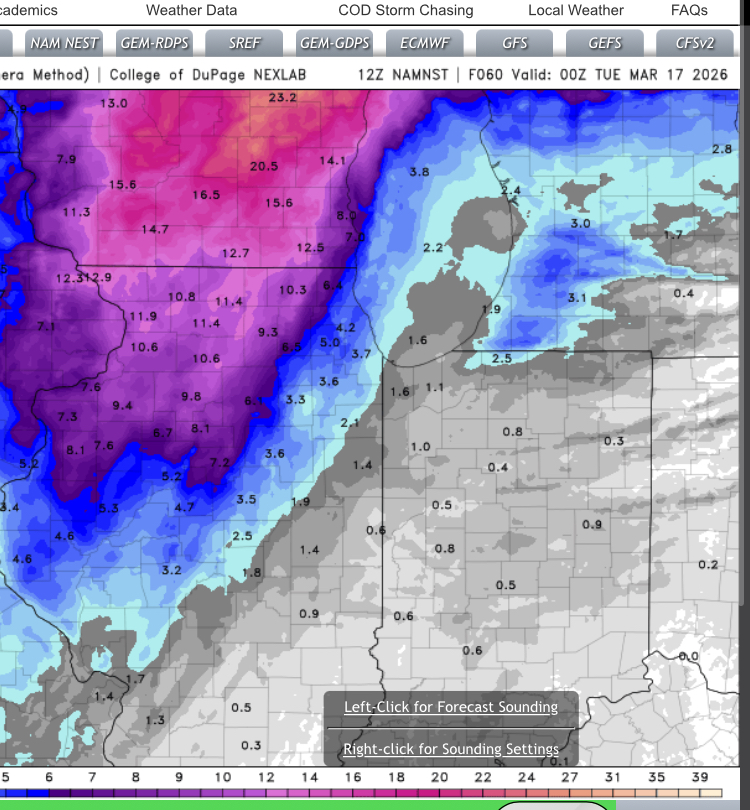
NAM Hi-res. Maybe not a big hitter for Chicago, but a good lolz run for me in Boone County.
-
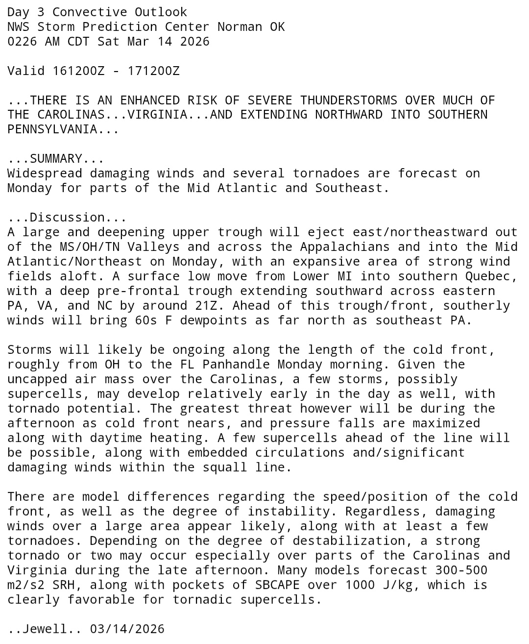
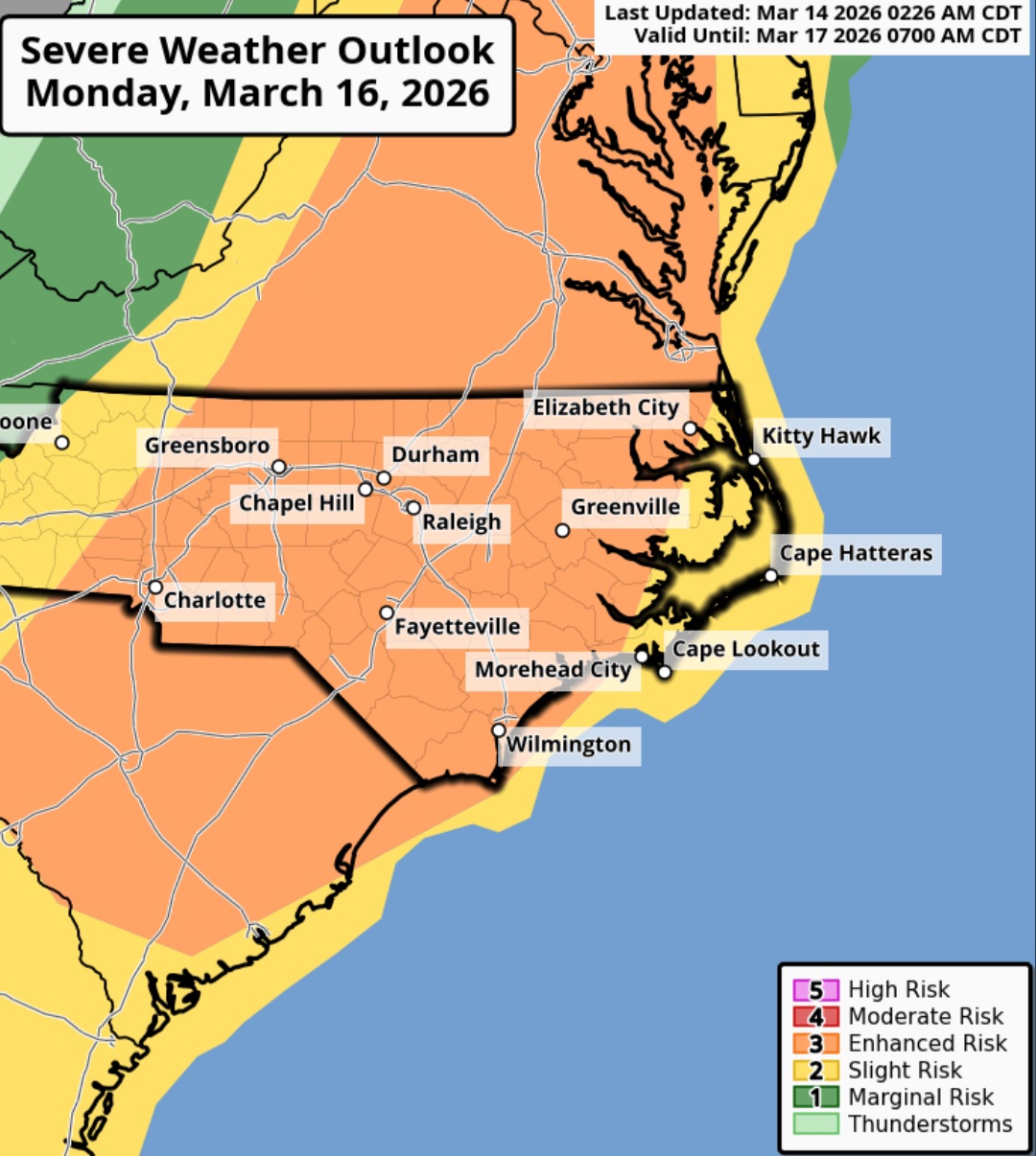
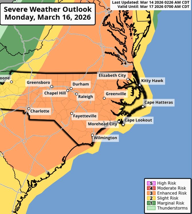
Day 3 Enhanced Risk for much of South Carolina, North Carolina, and Virginia.
-
My area is like the garbage disposal of SNE...I clean up in the events no one in SNE wants Methuen...the island of misfit snow.
-
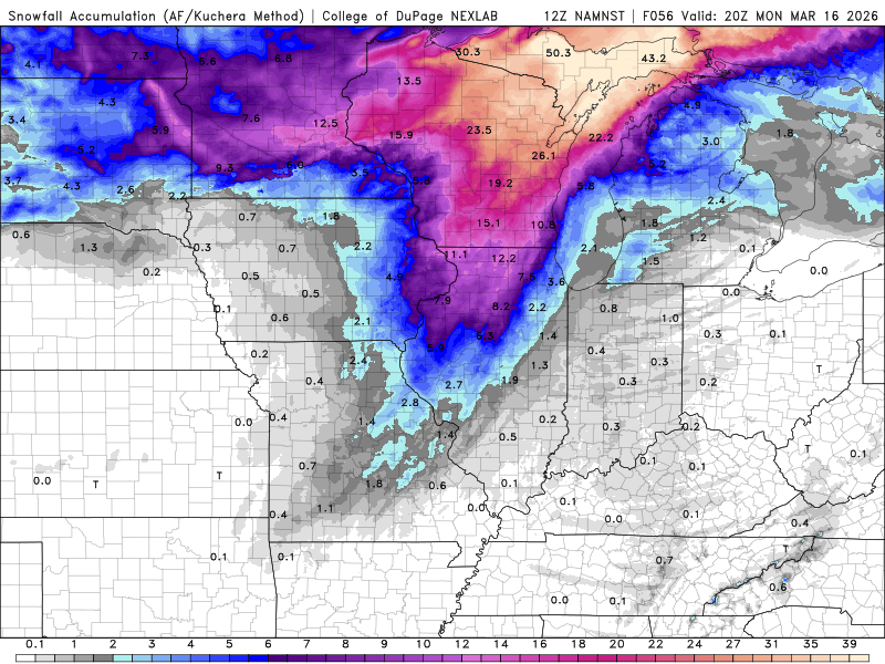
12Z 3KM NAM (The same model your Fav HRRR is birthed from)

-
Great Slant 1717?
-
Last night was a perfect example of #1....right on cue.
-
NWS Phoenix…crazy stuff. .LONG TERM /TUESDAY THROUGH NEXT SATURDAY/... The area of high pressure suppressed and shoved westward by the transient disturbance will rebound and eventually migrate off the Eastern Pacific by Tuesday. As it moves, regional H5 heights will rise markedly, reaching near 588-590dm. However, global deterministic guidance takes things further showing heights aloft peaking near 594-596dm by Thursday. For reference, sounding climatology data for Las Vegas, Flagstaff, and Tucson all show record H5 heights for March are around 590dm and April 591dm, 593dm, and 592dm respectively. With that being said, this high will be near to slightly stronger than any ridge this region has seen in recorded history, not only for March, but for April as well. This anomalously strong high will translate to record temperatures, not just at the surface, but throughout much of the atmosphere as well. H7-H5 temperatures will reach all-time records for this time of year by Tuesday, with H8 readings joining the fray by Wednesday. These climatological records will not last one day either as forecasts show these abnormal values extending through the end of the work week and even into next weekend. At the surface, lower desert highs by Tuesday will be in the upper 90s to near 100 degrees with values climbing to around 105 degrees for much of the lower deserts by Thursday. If these temperatures are realized, those readings would be 25 to almost 30 degrees above normal. It should not come as much of a surprise that numerous records are likely to be broken at some point next week with Tuesday likely being the first day when all-time daily MaxTs begin to fall. However, with the lack of movement from the ridge overhead, consecutive days with new record temperatures appear likely. What is also very unusual about how hot this pattern will be is how much high temperatures could potentially best previous records. For instance, the current forecasted high temperature for Phoenix for Friday is 106 degrees. While it is typical to see records beaten by a few degrees at most, this forecast high may beat Fridays record of 96 by 10 degrees. Monthly records are also at risk of falling during this upcoming heat wave. The all-time March records for Phoenix, Yuma, and El Centro are 100, 102, and 101 degrees respectively. All of those values could be tied or eclipsed as early as Wednesday. The record setting potential doesn`t end there. The earliest 100 degree day recorded in Phoenix is March 26, which was observed back in 1988, and is actually the only other time since records began when triple digits were achieved in the month of March for the city. It appears that a new earliest instance of 100 degree will be set as it is a matter of when, not if, it will happen. Current forecasts suggest that will occur on Wednesday the 18th, 8 days ahead of the previous record.
-
Oh please stop lol...there have been numerous times when Ray has measured more snow and there have been numerous times that I have measured more snow during minor events...if debating 1/4 of an inch is going to make your day ..have at it lol