All Activity
- Past hour
-
The core of the cold in these smaller geographic footprint Arctic outbreaks are more frequently missing the Northeast.
-
The 1989 blocking was started by a combination of an early SSWE and a very strong MJO wave that went 7-8-1-2 in November, which lead to the Thanksgiving snowstorm up I-95 and the record cold December….
-
Is the wind ever going to stop?
-
The news is comical right now. The bad, false info about SSWEs they are putting out is astonishing. A real disservice honestly. They don’t even talk about the lag effect and are hyping an ice age coming up the end of this month
-

November 2025 general discussions and probable topic derailings ...
jsw replied to Typhoon Tip's topic in New England
Thank you for bringing me on topic! - Today
-
Enderlin, ND EF5 Tornado
BobRodriquez replied to Newman's topic in Weather Forecasting and Discussion
A tornado during nighttime adds another dimension of terror. -

November 2025 general discussions and probable topic derailings ...
powderfreak replied to Typhoon Tip's topic in New England
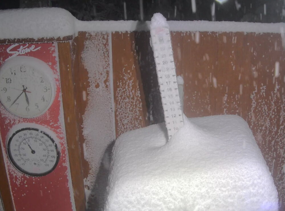
lol. It unloaded last night and is still dumping on the hill. Nothing really in the backyard and a few miles away getting smoked. -

Best Mid-Atlantic winter storm of the last 50 years
Jebman replied to PrinceFrederickWx's topic in Mid Atlantic
The EPIC 2009-2010 winter was so good because I got to go with Dad to Charles Town that entire winter. They got a hell of a LOT more snow than Dale City did. I saw drifts so high it was unbelievable, especially the ones along Rt 9!!!!! All I could say was wow wow wow wow the entire way. Just MASSIVE jebwalks in Charles Town, the snow was so damn DEEP it was utterly beyond belief! I had NEVER, EVER personally experienced snow THAT deep! I was beside myself with joy! Some of the drifts were so high, and even the snow depths on a level, as far as I could tell, were downright intimidating! I kept records over there in W. Va., and to this day they bring back incredible memories! How that incredibly deep snow affected me! How fun it was to try and walk in it! How fun it was to watch some of it come down in real time! -
You WILL get lucky!!
-
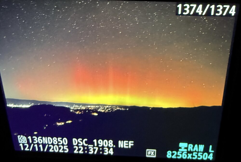
While the possibility existed, no grand finale of aurora tonight. Ingredients just did not coexist simultaneously to produce a notable show. There were some eye visible periods of reds. But compared to last night, well, it didn’t compare. Still riding the high of the past week. Quite a treat to get slammed by terrestrial and space weather in short succession. Now to settle back into a slumber and wait. Can’t get too greedy.
-

Winter 2025-2026 Thoughts
Roger Smith replied to donsutherland1's topic in Weather Forecasting and Discussion
I don't foresee anything very different from the above, would just add that there may be potential for some heavy lake effect snowfall events and large temperature variations in the Midwest that could include a few episodes of near-record cold there. This makes me wonder if the snowfall anomaly will be highly positive in the upper Midwest trailing southwest and with a secondary maximum over the central Rockies. I think the east coast will be lucky to see one major coastal storm but could have a half dozen moderate snowfall events from redeveloping lows. -
Boston, MA _____ 47" NewYork, NY(Central Park) ____ 24" Philadelphia, PA ___ 23" Baltimore, MD ____ 17" Washington, DC __ 13" Albany ___ 62" Hartford, CT __ 50" Providence, RI ___ 38" Worcester, MA ___ 77" Hyannis, MA ____ 28" Burlington, VT __ 87" Portland, ME ____ 70" Concord, NH ____ 67" Above normal snowfall will be mostly confined to some snow belts of Great Lakes, and parts of the upper Midwest, parts of Colorado, Wyoming and Utah. Storm track will often be across the Ohio valley into northern New England, and infrequently near the east coast, but it won't be as mild a winter as some of the past few. Snow will be generally around 80% of long-term normals for most of the northeast and mid-Atlantic regions.
-

2025-2026 ENSO
Stormchaserchuck1 replied to 40/70 Benchmark's topic in Weather Forecasting and Discussion
I wonder if the Stratosphere warming forecast is going to stay so strong going into the last week of November, with models tonight taking away the -NAO in the long range. Here's the 1989/2005-analog pattern with weak-negative ENSO and strong -QBO. This is for Nov 28, based on tonights 0z GEFS -
Good news and bad news The bad news is, models took away the prolonged/sustained west-based -NAO that it had been showing, the last few runs. The good news is, around the turn of the month they are developing a strong -WPO pattern with +PNA underneath of it -- a Pacific based cold pattern that should put much of the CONUS below average to start off December 0z GEFS mean hr384
-
Modeling is now indicating 5 inches of liquid over the Sierra with the incoming system but there is going to be a ton of warm air as well, most of this is going to be heavy wind whipped rain, except at elevations above 9,200 feet. The highest peaks well above 9,200 feet are expected to eke out a foot of slushy wet slimy potato type snow paste ugh. We may well be facing a Sunday River, Maine ski resort type of scenario here, with so much rain that entire ski runs get carved out several feet deep in the rocky soil from so damn much rain. The weather system is expected to slow down greatly enabling warm air to persist longer causing heavy rains to last longer piling up rain tallies. Immense amounts of the rain waters will rush down into the valleys causing freezing cold flooding issues for travelers and residents alike. EDIT 10.32pm PST, which is 12.32am here in TX, I have noted some very wet flurry activity at Mammoth even at 39 degrees. They can do that at those elevations, but that warm air is gonna work in. https://www.mammothmountain.com/on-the-mountain/mammoth-webcam/main-lodge
-
Didn’t BWI hit 17 for a high 3 consecutive days?
-
Add your Snowfall predictions 25/26 winter
Snowcrazed71 replied to Ginx snewx's topic in New England
Ambitious. Lol -

E PA/NJ/DE Autumn 2025 Obs/Discussion
LVblizzard replied to PhiEaglesfan712's topic in Philadelphia Region
Saw a bit of a glow on the horizon through the camera lens earlier. That’s about it for tonight. From what I’m seeing tonight is underperforming compared to last night at lower latitudes. Plus I’m now shrouded in clouds here so no hope of seeing anything else. -
The following winters to the years mentioned above. Jan 1962, roller coaster of roller coasters. There was a nearly 80 degree spread in temps that month. A -10 low and a 68 degree high late in the month. The cold and moisture met well. There was a 4 inch snow event on New Years, a 14 inch snow event on the 8th, 9th and 10th that led to single digit highs and the -10 degree temp. After the 68 degree high, it snowed 2 inches on Jan 28th. With the extremes, the month was about -2 overall. Winter took a hiatus in February, a few cold days and a few days of snow showers but nothing major. There was a 4.5 inch snow event on March 5th/6th and a 6 inch event on March 9th. (Back when March was always good for 4-8 inches of snow it seemed like) Jan 1968 was -3 overall. Coldest low was 0 on back to back days, 8th and 9th. It snowed 3 inches on the 9th, changed to rain and freezing rain the next day. It then snowed 2 to 3 inches a day for 3 days in a row. Finally warmed into the 60s a week later, then by the 24th rain changed to snow and 4 inches fell. February 1968 was an ice box but fairly dry. Snow fell on 10 days but the biggest was 2 inches until leap day, when 5 inches fell on the 29th. February finished -11. March was around -2 and a 2.5 inch ran to snow happened on March 23rd. 1969/70 I already talked about January, December 1969 was cold early, a little bit of snow on 6 different days between 12-12 and 12-23, then a big daddy hit Christmas day and the 26th, 10 inches total. Knox had around 8-9 inches that Christmas too and I believe is their biggest Christmas snow ever. February of 1970 was just as harsh as January. It was true wall to wall winter. It snowed 4 inches on February 3rd and was -9 on February 4th, and -7 on the 5th. It snowed 1/2 inch on Feb 6th, then 3 inches on Feb 9th. After that, February had a few more cold days, and some warm ones but no snow events. It finished around -4 for the month. March stayed around -2 but 1.5 inches of snow on the 16th was it for the month as far as accumulating snow. It also snowed a dusting on April 4th and 15th that year.
-
Looking at all those years week by week every year was about 4 weeks on average when the full effects of the SSW were felt. Its a good bet the affects of this SSW will be late DEC at the earliest & into JAN.
-
-
Got the 1st substorm on camera then my tripod falling and breaking my lens combined with an 8am class made me retreat before round two.
-

MO/KS/AR/OK 2025-2026 Winter Discussion
stormdragonwx replied to stormdragonwx's topic in Central/Western States
And now we got potential record highs coming this weekend! lol -

November 2025 general discussions and probable topic derailings ...
WinterWolf replied to Typhoon Tip's topic in New England
Happy birthday bro. Hope you had a great day.


