All Activity
- Past hour
-

2026-2027 Record-breaking El Nino
40/70 Benchmark replied to Stormchaserchuck1's topic in Weather Forecasting and Discussion
I would be careful with the CANSIPS...it's still evolving this El Nino too much towards the Modoki end of the spectrum. It's in error in that respect. Raindance just pointed that out, as did I in my blog last week. -
It does look better, but sat and radar show it filling in primarily in its outer bands, the inner core is not solid rain w/ dry slots present, and the center ring is not closed off. The blob nature of the developing convection is not a sign of imminent RI IMHO. 88D winds from LCH 4-5k ft show winds no higher than 50 mph, so even though I bet the pressure is now 998-1000 mb, the winds have not responded much yet.
-
2026-2027 Record-breaking El Nino
40/70 Benchmark replied to Stormchaserchuck1's topic in Weather Forecasting and Discussion
-

Monday, August 31 - Thursday, September 3, 2026 Convective Episodes
CoastalWx replied to weatherwiz's topic in New England
Danbury S and W -
SPC discusses potential/conditional need for CIG1 and higher probabilities for D2 depending on timing and such.
-
2026-2027 Record-breaking El Nino
40/70 Benchmark replied to Stormchaserchuck1's topic in Weather Forecasting and Discussion
No surprise with an El Nino this powerful...no way it's going to be a -EPO in the seasonal mean. -
2026-2027 Record-breaking El Nino
40/70 Benchmark replied to Stormchaserchuck1's topic in Weather Forecasting and Discussion
I been noticing that, too, which isn't a shock since we all know that the Modoki look that it and the JMA have been selling is overcooked. -
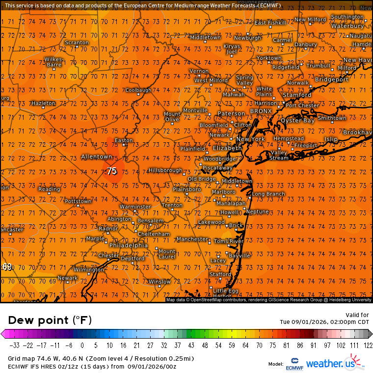
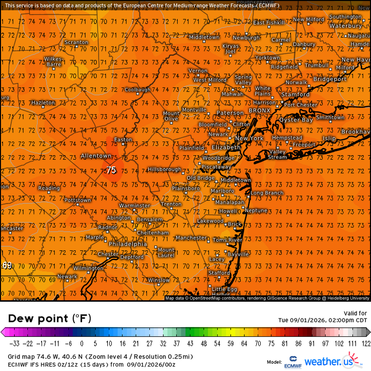
September getting off to a high dewpoint start.
-
Radar looks like a system about to explode, that is a very tight circulation with more uniform banding around it. As I said yesterday we will be posting that it’s lucky this doesn’t have more time over water. I’m still thinking 50 kt landfall, it would take a serious convective burst ASAP to approach hurricane status, not sure it’s gonna happen. Cool system
-
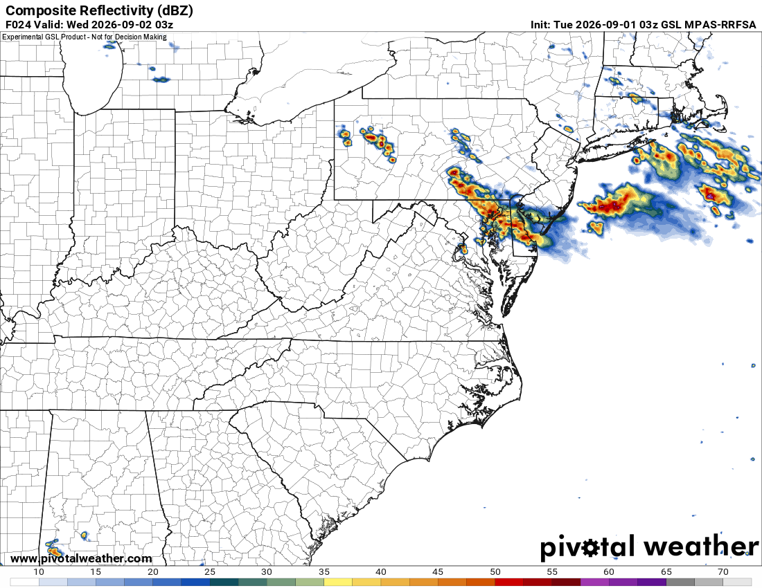
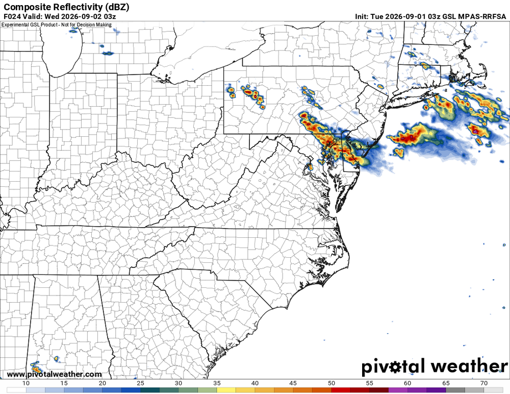
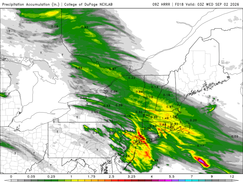
It appears today will remain capped. HRRR and RRFS have next to nothing. 700 temps warm from around 8C at 06z to 11 C by 00z and 1000-500 thk gets to 580, so that should cap things off. However, some nocturnal action appears possible as the BDF approaches from the NE. The RRFS MPAS looks impressive at 03z. It is on its own, but look at the MUCAPE axis on the HRRR at 07z Wed. And Wed aftn looks good w/ the front NNW to SSE across the areas. Surprised SPC does not have at least 2% tor risk in the area.
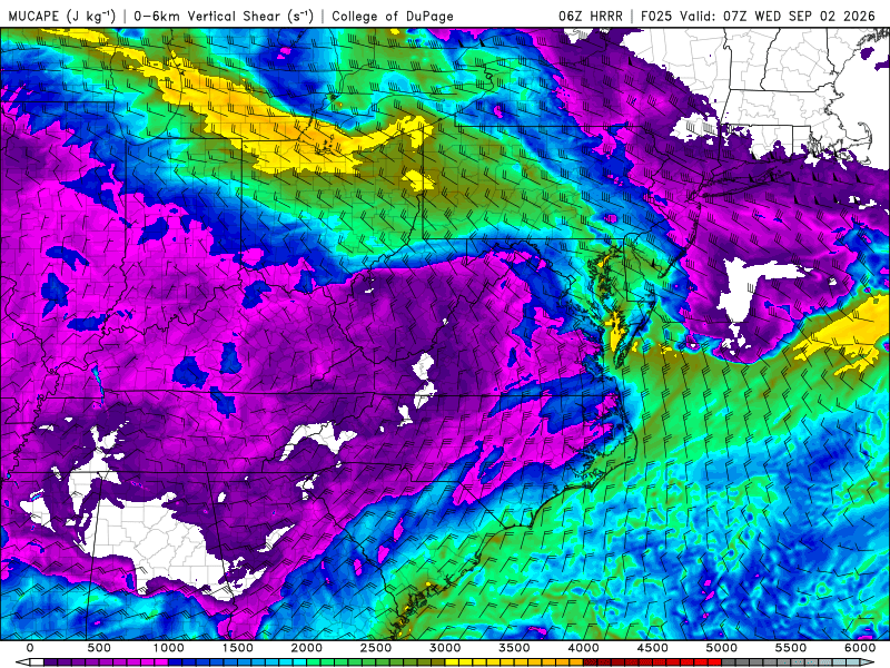
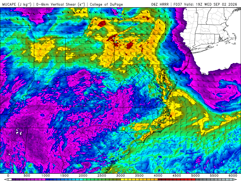
-
Nice write up about the severe weather potential around here from OKX AFD this morning: The main focus of concern will come this afternoon into early this evening. A warm front will lift north of the area this morning, but only for a brief time. Strengthening high pressure across eastern Canada into New England will send the front back to the southwest as a backdoor cold front late this afternoon into this evening. Winds will back around to the east behind it. While there is some uncertainty as to how much the airmass will destabilize in the warm sector today, HREF mean SBCAPE values are still 1000-2000 J/KG across the marginal and slight risk areas. Greatest instability will be north and west of the NYC metro. Additionally, there is 40-50kt of deep-layer shear and decent directional shear 0-3km. SPC has included part of the area in a low probability for tornadoes (less than 5 percent). However, mid-level lapse rates are marginal around 6C. The flood threat remains low with the area under a marginal risk of excessive rainfall. This is for an isolated flash flood threat. While the airmass is loaded with moisture, PW values around 2 inches, there is decent storm motion in the westerly flow aloft. Training does not seem likely in this event. SPC HREF probabilities are greater than 50 percent for an 1" in 3 hours, but less than 10 percent for 3" in 3 hours. Much of the strong to severe convection should drop south and west of the area around or shortly after 00Z (8 PM). .KEY MESSAGE 2... An easterly flow will result in a much more stable airmass across the area on Wednesday. The frontal boundary is expected to stay south and west of the region before starting to move back in Wednesday night into Thursday as a warm front. SPC has the western half of the area in a marginal risk for severe weather, mainly due to some uncertainty with how far south and west the front gets. Right now, expecting mainly scattered showers for the western half of the forecast area. Greater coverage of showers and thunderstorms is expected Wednesday night into Thursday morning with the warm front lifting across the area. The airmass will then warm up and destabilize Thursday in the warm sector with another chance of strong to severe convection with the cold front late Thursday afternoon/evening. SPC has western portions of the area under a marginal/slight risk and WPC has the entire area under a marginal risk of excessive rainfall. Details should fall better into line in the next 24h.
-

Septorcher 2026 Discussion - Endless Summer
Brewbeer replied to Damage In Tolland's topic in New England
66/66 and raining -
 The showers entering WConn are strengthening on approach...a rare sight!
 -
I just saw the catch. Wow.
-

2026-2027 Record-breaking El Nino
MJO812 replied to Stormchaserchuck1's topic in Weather Forecasting and Discussion
Too many people are prematurely giving up on winter already. -
If we correct for the trees close to the NYC ASOS artificially cooling the highs, then NYC finished August warmer than average like the other stations. August maximum temperature departures NYC….-0.7 EWR….+0.9 LGA….+0.2 JFK…..+1.2 HPN…..+0.9 BDR….+0.4 ISP……+0.8 NBW….+1.5 PHL…..+1.5 MPO….+0.6 SMQ…..0.0 FWN….+1.5
-
The look on Kittrage's face at 12:35
-

Septorcher 2026 Discussion - Endless Summer
dendrite replied to Damage In Tolland's topic in New England
The Boston UHI is baked into the normals already. BDL’s ASOS was fixed a couple years ago and it seemed to drop their temp a bit. The high temp used to be much higher than surrounding sites and now it’s more in line. So I’m not surprised if they have cooler departures than other sites going forward.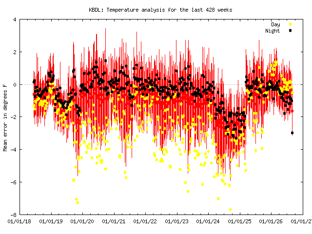
-
June and July were very wet here (July because of the big event at the end of the month), but I only got 2.88" in August.
-

Monday, August 31 - Thursday, September 3, 2026 Convective Episodes
vortex95 replied to weatherwiz's topic in New England
Swrn CT...again!!! Scott mad....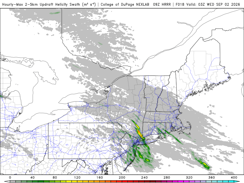
-

Central PA Summer 2026 Discussion/Obs Thread
mahantango#1 replied to Voyager's topic in Upstate New York/Pennsylvania
US National Weather Service State College PA Favorites · · Tuesday - September 1, 2026 @ 6 AM EDT: A nearly stationary frontal boundary from the Endless Mountains Northeast of Williamsport to the Greater Philadelphia area will provide the focus for a few rounds of showers and thunderstorms this afternoon and evening. Some of the storms could become severe with strong, damaging winds, frequent lightning, hail and locally heavy rainfall. Heat indices this afternoon will reach 95 to 100 degrees across the Lower Susquehanna Valley and Southeastern PA -
This is a bad year for apple scab on the crabapple trees here because of all the rain. My biggest tree is supposed to be resistant, but it has really been dumping leaves for the last month. I've spent a lot of hours tediously cleaning them out of the garden under the tree. One of these years it might not be worth the trouble anymore.
-
 Probably River west. Not here
 -
 I think we get a Tornado watch today, any strong storm that forms will be rotating