All Activity
- Past hour
-
As a caregiver for a dementia patient believe me i know memories are the first to be distorted or altered. The point is whenever I see people discussing '96 or '15 I don't even have to look at the models to know that things probably aren't going well in terms of snow.
-

December 2025 Short/Medium Range Forecast Thread
nrgjeff replied to John1122's topic in Tennessee Valley
EPS followed the ECMWF warmer but it could be a one-off. AI version still has the back door front chances northeast Tenn. This is all for closer to the New Year. Of course Carvers I'm always down for mixing weather and basketball. Just like the Vols are back on track, perhaps the ECMWF will get colder again. The warm GEFS does not concern me. PS that Vols game was about the only major vs major this week - a nice treat! -
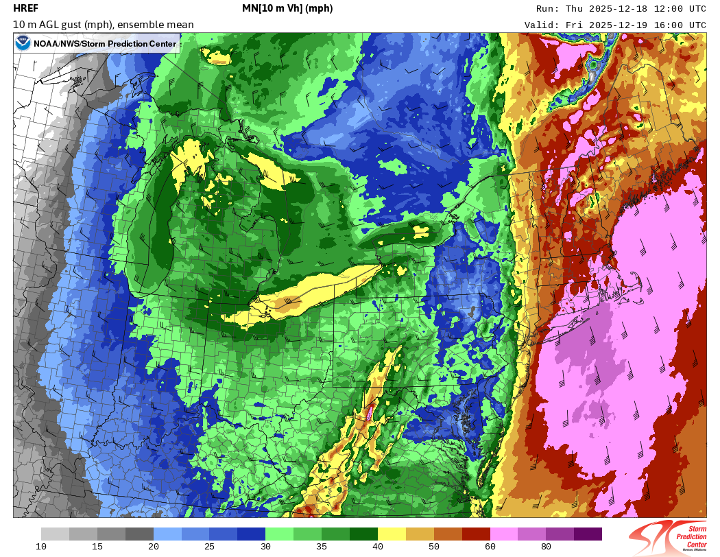
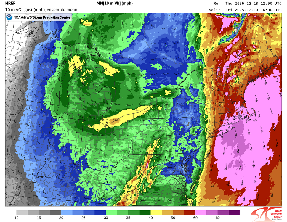
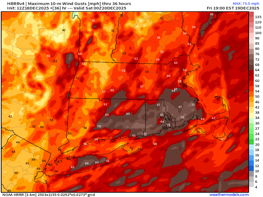
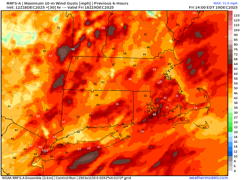
They have dramatically upped wind amounts from Max of 40-45 mph gusts to gusts over 60 mph now.
-
LOL, the NC/VA state line getting 200-300% of yearly snowfall.
-

December 2025 Short/Medium Range Forecast Thread
Carvers Gap replied to John1122's topic in Tennessee Valley
I like it a lot better than 16 straight days of chinooks on deterministic runs. LOL. It might still get warm, but I gotta have room for some surprises. -
Weirdly felt like barbecue weather. Clouding up here now by IAD. 51.
-
The NWS map looks underdone to me for eastern/central LI and eastern Connecticut. I would expect widespread gusts of 55+ mph and scattered 65-70 mph gusts. HREF *mean* has 70 mph hugging the South Shore of Suffolk County and the Twin Forks, and HRRR is similar. We often overperform in southerly windstorms in the winter ahead of cold fronts.
.thumb.png.a645a0596a3ba5e938b09a1f53ba198c.png)
-

December 2025 regional war/obs/disco thread
WinterWolf replied to Torch Tiger's topic in New England
Same shit last week…12z sucks, 6z good. Laughable. -
I'm curious to see the resulting snow results for BWI & NYC after those PNA spike years...but off the top of my head it seems only two ninos and 13-14 produced down this way. -ENSO was all below average.
-
Not sure what got into the 12z guidance, but vomit worthy today. Hope that changes.
-
Models not great for next week-warmer and wetter but wait 6 hrs it'll change. On a serious note we might have to wait until the 28th-29th for the pattern to fully set up
-

Central PA Winter 25/26 Discussion and Obs
AccuChris replied to MAG5035's topic in Upstate New York/Pennsylvania
12z model cycle was not very winter-friendly. The good news is run-to-run consistency is basically non-existent beyond Day 5 it seems . -
Why? Because one run of the GFS 240+ hours out said so?
-

December 2025 Short/Medium Range Forecast Thread
Golf757075 replied to John1122's topic in Tennessee Valley
Model chaos at its best lol. We do it every winter -
December 2025 regional war/obs/disco thread
WinterWolf replied to Torch Tiger's topic in New England
Yup..it’s very close. -

E PA/NJ/DE Winter 2025-26 Obs/Discussion
RedSky replied to LVblizzard's topic in Philadelphia Region
More patience dude it's going to take longer then that to clear out the massive West Coast troughing forcing ridging in the east -

December 2025 regional war/obs/disco thread
Ginx snewx replied to Torch Tiger's topic in New England
All this crying will be a memory by New Year's -
At least we have a home address.
-
One little change here or there is like a 30F difference for us lol.
-
I told you guys we have to wait until the back half of January
-
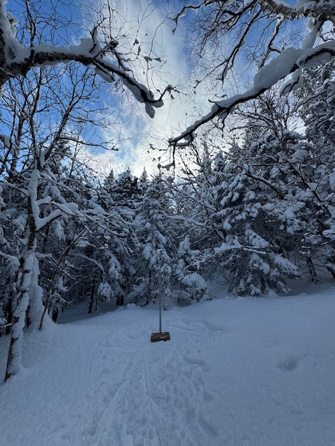
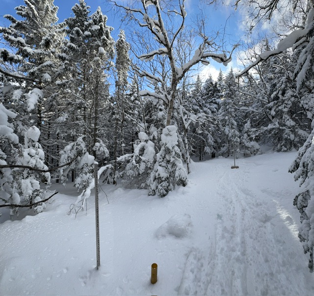
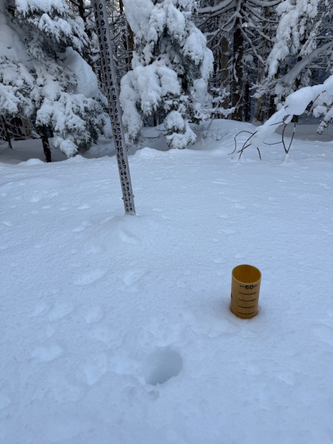
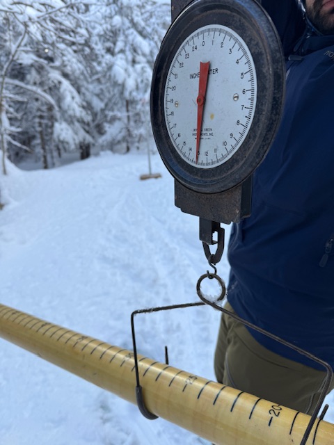
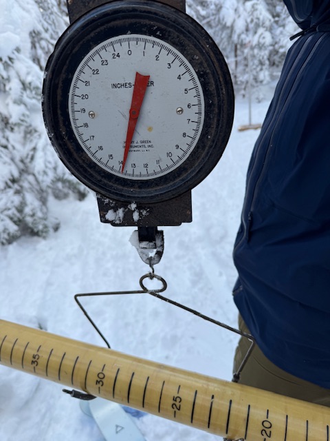
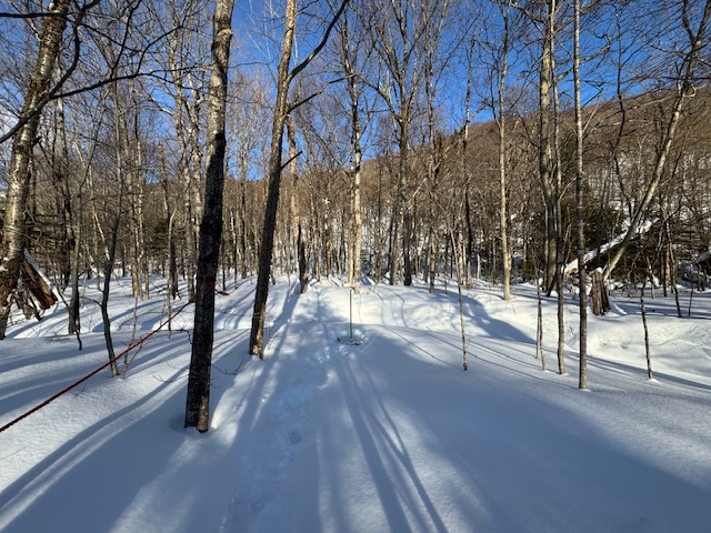
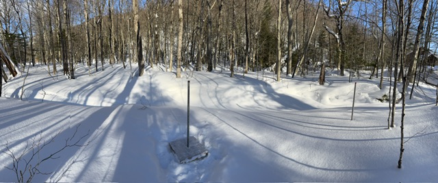
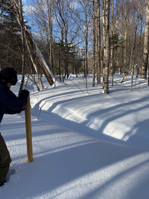
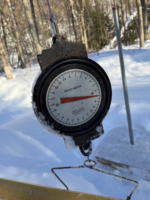
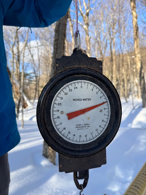
Love seeing the snow cores making it into the AFD. .HYDROLOGY... Sharp rises on streams and rivers are anticipated on Friday into Friday night associated with warm temperatures, snow melt, and moderate rainfall. Rainfall of 0.50 to 1.25 is expected with snow melt adding another 0.75 to 1.25 inches into the river basins. Given dewpoints will be above freezing during the day today and tomorrow, efficient snow melt will be likely. Snow core analysis Tuesday near Mt Mansfield indicated at 3000 feet snow depths were 53 to 58 inches with 12 to 14 inches of water, while at 1550 feet snow depths were 22 to 30 inches with 5 to 7 inches of water. The rivers with greatest potential to reach action stage, given expected rainfall and snow melt are the Ausable, Mad, Winooski at Essex Junction, and Otter Creek at Center Rutland on Friday afternoon and evening. Crests on the Mad and Ausable Rivers will be Friday afternoon, and Otter Creek and the Winooski cresting closer to Friday evening/early Saturday morning. Lastly, while any river ice may move, the threat of ice jams remains low. 3,000ft High Road Plot… 1500ft Barnes Camp…
-
December 2025 regional war/obs/disco thread
Ginx snewx replied to Torch Tiger's topic in New England
Actually you will learn your memories keep you alive. -
December 2025 regional war/obs/disco thread
WinterWolf replied to Torch Tiger's topic in New England
We knew you’d be in as soon as you saw a negative comment…as regular as clockwork. Nowhere to be found when the talk was about tuesdays potential..but right there when Scott stokes the fire. -
My neighbors are gonna love that I left my balcony furniture out and I won’t be back for another 10 days.
-
The GEFS really wants a storm over the central CONUS, destination unknown! Extremely evident even on just 6hr QPF at over 200 hours. So the storm is there, it just does not know where to go with it once it gets spun up!!


.png.b19e8ab728095a5d29313deb2a52caf3.png)