All Activity
- Past hour
-
Brunson is a killer man. Dude is on Kobe or Jordan's level in terms of that.
-
https://www.kissin925.com/eye-in-the-sky/ time-sens, nice storms near Joplin MO
-
that 3k NAM looked pretty good for tomorrow night.
-
Nice baroclinic support so far into June with the GEFS, EPS, and AIFS ensemble means all showing a 992-995mb low traversing southern Lake Michigan late Wednesday. Looks like most likely a cool rain for MBY.
-
Checking in from Alaska. We ended the winter with 77 inches of snow which was only 1 inch below average. Coldest winter in nearly 20 years. Coldest March on record. 4th coldest Spring on record. Snowiest January on record which made up for the snowless December. Highest wind gust ever recorded at Anchorage airport when we hit 75MPH back in December. December was a beast when it came to these back to back destructive Matansuka Valley wind events. I'm seeing a lot of photos and videos from Waycross, GA today on Facebook of significant damage from that thunderstorm earlier today. No warning was on it and multiple people are saying it was absolutely a tornado. That or a microburst. Interesting video from the storm below. https://www.facebook.com/share/r/1LW4kAXRzY/
- Today
-
RDU high a “much cooler” 96 today vs 103 yesterday.
-
0.00” here for the day, 0.00” for the month
-
I'm originally from just NW of BOS, and the biggest thing I recall locally from that 6/1/11 was the nasty +CGs coming out of the supercell anvils overhead. The storm cores were 30 mi to my W. Don't see that too often in New England! Then another supercell just missed me in the evening that crushed BOS. Here is video (not mine) taken about 10 mi to my N in Lowell MA. This is telltale supercell lightning. Very frequent, quick flickering pulses in the upper part of the CB. You can actually see short cloud-to-cloud bolts at times, known in chaser slang as, "anvil zits!"
-
It's gonna rain.
-
It's frustrating that I had three tornadoes within a few miles of my house and I couldn't see any of them. All three were embedded in the line that was producing widespread 65-70 MPH straight-line gusts. June 13, 2026 National Weather Service Confirms Three EF1 Tornadoes in Huntington County HUNTINGTON COUNTY, IN — The National Weather Service Northern Indiana has completed official storm damage surveys following the severe weather event that impacted Huntington County on June 11, 2026. Survey teams confirmed three EF1 tornadoes occurred across portions of Huntington County with estimated peak winds of 95 mph. No fatalities or injuries were reported. Andrews, IN Tornado Rating: EF1 Estimated Peak Wind: 95 mph Path Length: 5.83 miles Maximum Width: 75 yards Fatalities: 0 Injuries: 0 Start Date: June 11, 2026 Start Time: 10:33 PM EDT Start Location: 3 SSW Andrews / Huntington County / IN Start Lat/Lon: 40.8146 / -85.6399 End Date: June 11, 2026 End Time: 10:41 PM EDT End Location: 2 ENE Andrews / Huntington County / IN End Lat/Lon: 40.8708 / -85.5574 Survey Summary: A tornado developed southwest of Andrews, racing northeast toward Huntington. At least two properties on W Division Rd were impacted, as indicated by a loss of shingles, siding, and roof panels. Numerous trees were damaged as well, including trees snapped. Near the intersection of W 100 N and N 800 W, additional tree damage was observed and an outbuilding lost several roof panels. Along W 200 N, a number of trees were damaged at one property. Across the street, a mobile home lost its roof. The tornado appears to have lifted prior to reaching the Yake Subdivision, just south of the Wabash River. In the subdivision, isolated tree branches were down. Warren, IN – 4 Miles Northwest Tornado Rating: EF1 Estimated Peak Wind: 95 mph Path Length: 7.90 miles Maximum Width: 50 yards Fatalities: 0 Injuries: 0 Start Date: June 11, 2026 Start Time: 10:39 PM EDT Start Location: Pleasant Plain / Huntington County / IN Start Lat/Lon: 40.6993 / -85.5487 End Date: June 11, 2026 End Time: 10:48 PM EDT End Location: 1 WSW Plum Tree / Huntington County / IN End Lat/Lon: 40.7377 / -85.4080 Survey Summary: A tornado touched down north of Pleasant Plain, at a residence on S 500 W. Here, nearly two dozen trees were damaged, including multiple trees snapped at least halfway up their trunks. Tree damage appeared to continue into a tree line off to the northeast. Throughout its nearly 8-mile-long path to the northeast, sporadic instances of tree damage occurred until it approached State Route 5, just northwest of I-69. Here, the tornado caused almost total destruction to a newly built barndominium. Only the eastern wall was left standing with debris lofted at least 100 yards into adjacent fields. Tree damage continued east-northeast of here where at least two tree trunks were snapped. The tornado lifted just east of I-69, along S 200 E. Huntington, IN – 2.5 Miles Northeast Tornado Rating: EF1 Estimated Peak Wind: 95 mph Path Length: 0.65 miles Maximum Width: 25 yards Fatalities: 0 Injuries: 0 Start Date: June 11, 2026 Start Time: 10:44 PM EDT Start Location: 2 NW Bowerstown / Huntington County / IN Start Lat/Lon: 40.9122 / -85.4743 End Date: June 11, 2026 End Time: 10:45 PM EDT End Location: 2 NW Bowerstown / Huntington County / IN End Lat/Lon: 40.9178 / -85.4644 Survey Summary: In an open area north of US 24 and east of State Route 9, an incredibly brief tornado appears to have touched down and impacted a single residence. Here, a two-story home completely lost its roof and debris was deposited into adjacent fields. Hardly any rafters remain and no roof decking is present. Intense dirt and insulation splatter was noted on the east and north side of the home. Additionally, a detached garage to the south-southeast of the home was demolished by the tornado. A property less than 500 yards to the northeast was not impacted, suggesting the tornado quickly lifted beyond 600 N.
-
Shoulda known better
-
Retired model
-
June 1, 2011 was the New England tor event w/ the EF3 Springfield-Monson MA. This is the last high-end tor event for New England, About every 10-15 years New England gets a high-end tor event, so one could say, "they're due!"
-
Planes are running out of beer coming from Scotland, plus they are the most stoked but respectful fans… they look like a fun crowd. The Boston PD officer juggling the soccer ball for a lot of touches, inside a crowd of kilt wearing fans, that go wild when he’s done… the World Cup seems like a fun scene.
-
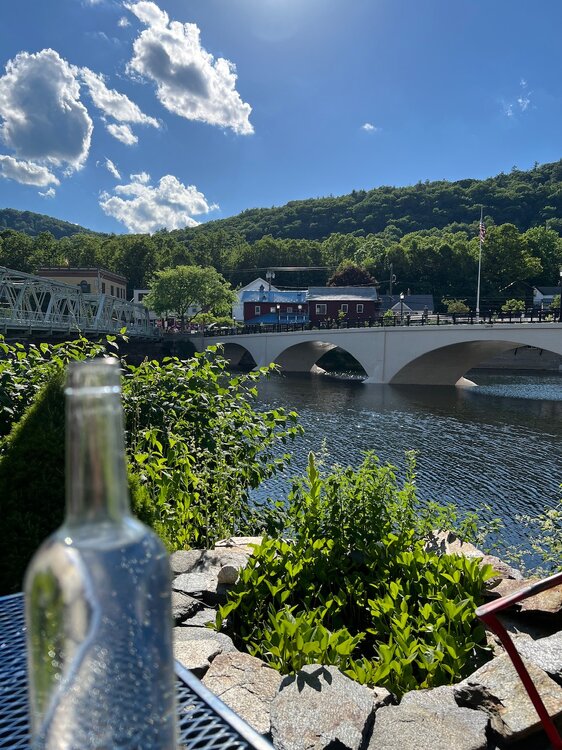
Beautiful evening in Shelburne Falls to see a show.

-
I am "guessing" we might have had .25 inches in Garner I am usually close based on duration/rate
-

2026-2027 Super El Nino
roardog replied to Stormchaserchuck1's topic in Weather Forecasting and Discussion
So I actually looked this news article up and it’s kind of what I thought it was going to be. The headline isn’t what he said at all. Basically this guy says he expects a strong El Niño but a dry winter in Wyoming isn’t guaranteed since nothing is guaranteed in weather that far in advance. -
I got sundogs right and left of the sun
-
Cue Richard Marx right here waiting. he always is
-
When I posted, I thought of it this way, in a overall synoptic sense, you don't track a 990 mb or deeper sfc low across southern Ontario/Quebec this time of year, and *not* have something big happen convectively! What that is exactly is and where? Way too early, but all the main pieces are there, so that's the first step. Work from there. What is really cool now is that modelling and knowledge have come to the point we now can reasonably see high-end/record-setting events potential well in advance. The first time I really took l note of this was a couple days before the Oct 29-30, 2011 snowstorm. I noticed how cold the short-range ensembles were showing the 850 mb temps, and I said, "this is going to be epic/really bad," and look what happened. Then a year later, we saw what the ECMWF was doing w/ Sandy (even before the system was named Sandy!) 9 days out, and again, look what happened! Now we had advanced enough to see high-end svr convective potential days 4-8. From a wx passion standpoint, it's really cool to know such things in advance now. Growing up, I recall the uncertainty factor seemed always so high, and so many surprises (snowstorms over-performing was a biggie). And from a societal POV, us knowing ahead of time is a tremendous benefit so we can prepare for them and mitigate impacts.
- 663 replies
-
- 1
-

-
- severe
- thunderstorms
- (and 7 more)
-
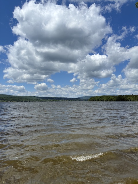
The lake was a little rough this morning.
-
Topped out @ 88F here today.
-
Those Scottish dudes just make me want to hang out and party with them lol.
-
-
What a night for a soccer match. Absolutely perfect. I'm sure they'll return home and tell friends they must visit Boston. The weather's great! The friends will come on memorial Day...

.thumb.gif.f92b16c631a1d15d405ed77b33f0710d.gif)