All Activity
- Past hour
-
Question, would the difference be due to sampling some of pieces that are needed to make this the storm
-
Also pretty cool that it doesn't seem to get above freezing for at least the week after the storm.
-
Nothing safe with this one.
-
Not liking the north trend with the snow line here. Going the wrong direction.
-

January 2026 regional war/obs/disco thread
DavisStraight replied to Baroclinic Zone's topic in New England
Lewiston sled shop in the news, you know it dryslot? Says they need another 6 inches for ideal sledding. -
GFS really is out to lunch lmfao. I should learn this by now. How does a model go from literally nothing to warning level snowfall in 1 run
-
The southern edge is sharp as a knife. Be careful within 100 miles of that. Have your weather kit prepared. Ice ice baby .
-
Probably the best GFS run I have ever seen for WNC. That was impressive and it starts precipitation late Friday night. 48 hour event.
-
Hi 24, low 16 Tuesday.
-
Also, as you head north the ratios increase incrementally so the northern tier of the snow maps will be higher and more uniform due to the higher ratios.
-
The real question becomes...where does that sleet line set up?
-
Winter 2025-26 Medium/Long Range Discussion
HillsdaleMIWeather replied to michsnowfreak's topic in Lakes/Ohio Valley
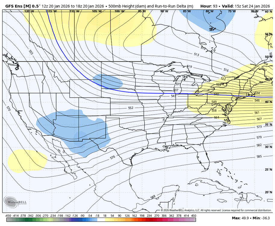
18Z gfs would shut down the southeast for days Insane run -
High of 25. Good weather for fire concerns. 22% RH and west wind gusting to 23.
-

January 25/26 Jimbo Back Surgery Storm
Brick Tamland replied to Jimbo!'s topic in Southeastern States
have to see what the Euro shows next, but I think it could actually happen. It seems the models have mostly been increasing totals than cutting them back. And we still have 3 days to go. -

Pittsburgh/Western PA WINTER ‘25/‘26
colonel717 replied to Burghblizz's topic in Upstate New York/Pennsylvania
That includes a couple inches for tomorrow. But nice jump north. As Miser said won't know for 3 days. -
Possible Record Breaking Cold + Snow Sunday 1/25 - Tuesday 1/27
Prue11 replied to TriPol's topic in New York City Metro
Is this looking like a Sunday night into Monday event? -
-
Likely not that high around here at least, but pushing 12:1 or so is possible during some part of the event I'd think.
-
You're the best breakout star of this winter. You've already made a lot of people happy.
-
gfs is the most garbage model
-
Maybe we've found the true replacement for the NAM?
-
Here's the IP and ZR
-
MO/KS/AR/OK 2025-2026 Winter Discussion
MoWeatherguy replied to stormdragonwx's topic in Central/Western States
Looking better for sure. -
January 25/26 Jimbo Back Surgery Storm
WinstonSalemArlington replied to Jimbo!'s topic in Southeastern States
We have a new avatar -
January 25/26 Jimbo Back Surgery Storm
franklin NCwx replied to Jimbo!'s topic in Southeastern States
6 inches of sleet with .5 inch freezing rain around Jefferson GA!


