All Activity
- Past hour
-
Feb 22nd/23rd "There's no way..." Obs Thread
MN Transplant replied to Maestrobjwa's topic in Mid Atlantic
I have partially melted snowflake mixing in at 36.0 degrees -
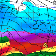
Changeover will come earlier than progged for many of you. That swirl in the Great Lakes is going to combine with the developing coastal low and bring some heavy snow to many of you. Many will be pleasantly surprised. Man I wish I was in New Jersey where 24 inches of wind driven snow is imminent. It would look very Mammoth-ish.
-

“Cory’s in NYC! Let’s HECS!” Feb. 22-24 Disco
HoarfrostHubb replied to TheSnowman's topic in New England
We had 30” in March 2023 (sorry Scooter…ptsd) 23” Jan 2026. I won’t complain unless we get under 12” here. Expecting 16-20 -
Question is does it just sort of flip from N/W to S/E and then stay all snow (even if non-accumulating for awhile), or does it pulse back and forth and be rate dependent during the middle of the day before a flip to snow for good mid-late afternoon?
-

Feb 22nd/23rd "There's no way..." Obs Thread
Paleocene replied to Maestrobjwa's topic in Mid Atlantic
Moderate rain at a toasty 37 in silver spring. Need the winds to turn and crank in the deeper cold from El Norte -
The ground is coated from the light snow in Larchmont.
-

Central PA Winter 25/26 Discussion and Obs
Itstrainingtime replied to MAG5035's topic in Upstate New York/Pennsylvania
Light rain and 35. .02" of rain so far. -

“Cory’s in NYC! Let’s HECS!” Feb. 22-24 Disco
RUNNAWAYICEBERG replied to TheSnowman's topic in New England
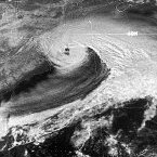
It’s been 16 years since I hit 20”. Regardless, this could be an all timer when you run a cat 2 cane through the BM in Feb … -
“Cory’s in NYC! Let’s HECS!” Feb. 22-24 Disco
Kitz Craver replied to TheSnowman's topic in New England
It’s gonna be top 5 for me, could be #1. NEMO is the only one I can remember that compares to what’s on the table. -
Light sprinkles of rain at 37 F here.
-
Jimbo! started following The Allsnow Blizzard of 2026
-
Yeah, anything we get, in my book, is a bonus. I have been around long enough, can only count big busts by Wakefield on one hand. Rooting for the northern neck and wish I could have chased to the peninsula.
-
Not sure I have the so-called protective areas, but I do get your point. I do feel it can still be done though with fairly decent accuracy. But winds and drifting do indeed make storms like this on the tougher side to measure things normally.
-
We're all just waking up. Any snowy weather is still half a day plus away.
-

Feb 22nd/23rd "There's no way..." Obs Thread
Warm Nose replied to Maestrobjwa's topic in Mid Atlantic
34, only rain at 800’ here in Western Loudoun. -
So the Blizzard of '26 begins as light rain. As Joe Beradelli says, "The devil is in the details". Is the western ridge positioned correctly? Is the high to our north oriented for favorable cold air? Where will the dry slot form? Will the dry slot be too large? Many things to consider besides just model agreement. As stated before, I hate the term "banding". Most convective systems produce "waves" of varying degrees of intensity of the precipitation. When I think of banding, I tend to think more in terms of deformation zones, points of occlusion, ocean air warm fronts, etc. Throwing banding out there is just a cop out. Models are crunching areas of higher precipitation, like eastern Monmouth County in NJ and Staten Island. Will we have winds of 35 mph or more for greater than 3 hours across a major portion of the region, or will this be confined to just eastern parts of Long Island or the Jersey shore? Since the potential exists, the NWS is obligated to issue the warning. But as some mets know, wind is perhaps the most overly "exaggerated" feature forecast by the models. We shall see shortly. Probably my last best chance of a major snow storm before my move down to Tennessee. Best of luck to all...
-

Blizzard of 2026 Storm Thread/OBS
Prairie Dog replied to Mikeymac5306's topic in Philadelphia Region
Joe Cioffo of the famed Joe and Joe Weather show just upped his total for my area to 15 to 20 inches. He pushed the area wet of Philly up as well. This was 7 AM. His reasoning is some of the short range models are not picking up the underlying explosive dynamics of the storm -

"Don’t do it" 2026 Blizzard obs, updates and pictures.
Ginx snewx replied to Ginx snewx's topic in New England
Gorgeous full clouds here. About half inch last night think it snowed for like 4 hours -
I have no idea what to think up here. We’re going to miss it on the meat of CCB for sure, but does look like we’re in a decent spot to be deformed. Could be 20’’ if we rot under a fronto band, could be 9’’ if we smoke exhaust all day. Think I’d tell people 12-18’’ but it’s very uncertain. Jealous of SEMA either way. That wind and fire hose is going to be special.
-

Feb 22nd/23rd "There's no way..." Obs Thread
Terpeast replied to Maestrobjwa's topic in Mid Atlantic
Most pws obs around me are at 36 -
Feb 22nd/23rd "There's no way..." Obs Thread
87storms replied to Maestrobjwa's topic in Mid Atlantic
Light precip, but seems kinda icy. Might explore further in a bit. -
Looking at everything this mornin im going with a trace south to 1-2 well north. South NN 3/4 of an inch. RIC the same
-
This may be the widest range of forecasts I have seen for a snowstorm in quite some time up here in the Lehigh Valley. The NWS is all in at 10-20”. The Weather Channel is basically out - 4-6”. AccuWeather splits the difference at 6-10”. Local meteo at WFMZ is all in as well at 8-14”.
-

“Cory’s in NYC! Let’s HECS!” Feb. 22-24 Disco
Sey-Mour Snow replied to TheSnowman's topic in New England
Over 20" is top 3 of my lifetime, very possible.. I always fall between 15-20" in these (3 : 20" storms and several 15-18") Only 96 and 2013 were more 30" and 40" respectively both guesstimates based on nearby reports.. -

Winter 2025-26 Medium/Long Range Discussion
RogueWaves replied to michsnowfreak's topic in Lakes/Ohio Valley
I scored my 0.7" yesterday and another dust-up this morning. Actual grass had JUST made its appearance since before Thanksgiving, then we cover it all up and start over again. Clipper pattern I thought was dead making a resurgence this week. Large totals run N or S of here these last two winters - ready to move on to spring tbh.


