All Activity
- Past hour
-
We need to stop the strat talk STAT! If there's any winter weenie index over the last 10+ years that basically ensures a nasty struggle then epic fail... its the Amwx SSW index. The more posts about it the less chance of anything good happening. There's literally 100s if not 1000s worth of post data backing this up. I mean sure, scientifically a SSW can be a precursor to blocking and cold/snow in the east but the more it gets hyped here, the less chance of it working out. This is a fact. But weenies gotta ween and my yards gotta fail. Thanks man
-

E PA/NJ/DE Autumn 2025 Obs/Discussion
Birds~69 replied to PhiEaglesfan712's topic in Philadelphia Region
-
I hope it makes it here
-
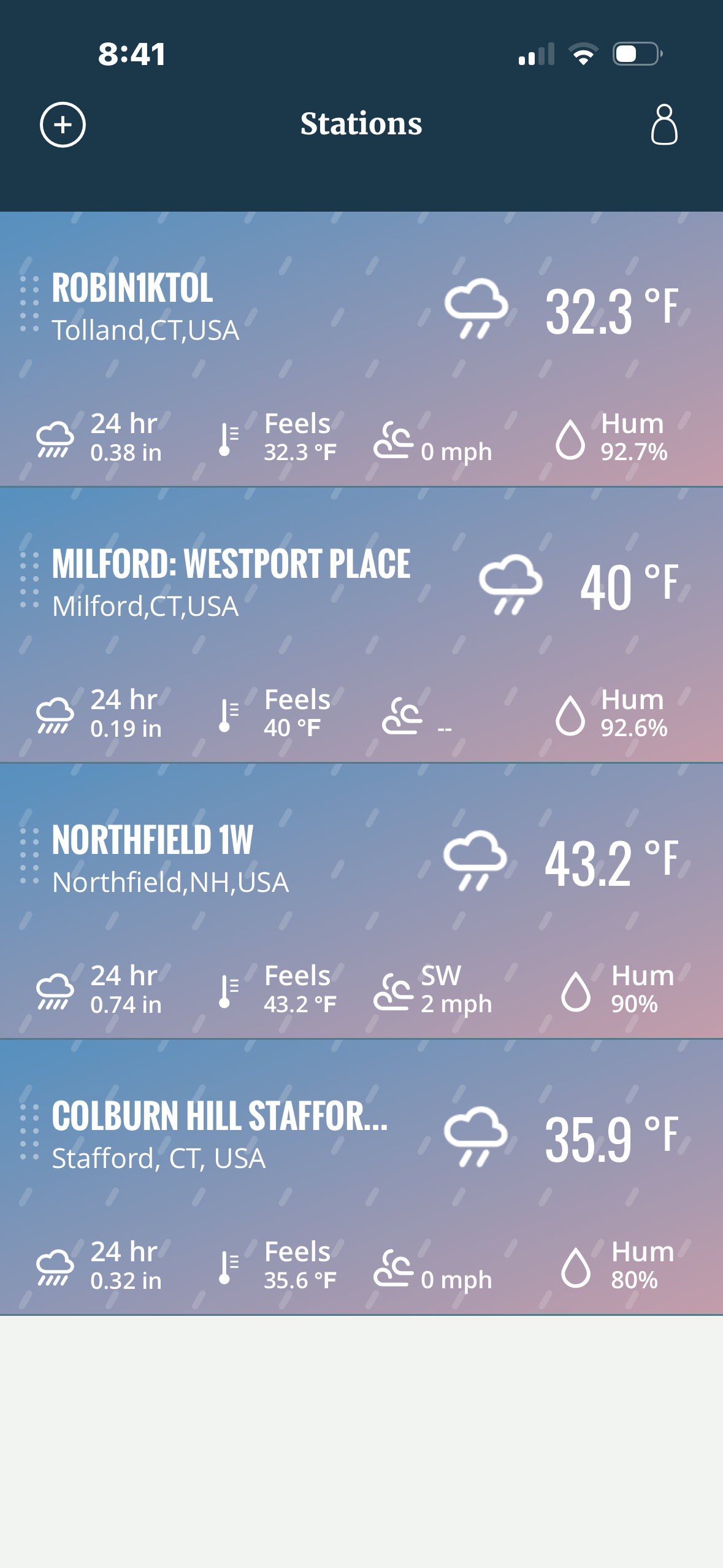
 Coldest of the year. Hold me
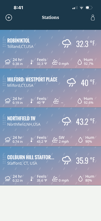
-
While we'll be freezing tomorrow, there is very good model agreement that we get quite warm on Sunday.
-

November 2025 general discussions and probable topic derailings ...
CoastalWx replied to Typhoon Tip's topic in New England
This reminds me of some event and it was in November in 1995 when it was like 60 and pouring rain here but a similar set up gave Baltimore like 3 to 4 inches of thunder paste. I was livid. -
November 2025 general discussions and probable topic derailings ...
CoastalWx replied to Typhoon Tip's topic in New England
He’s at the edge of his seat waiting for someone to report 6”. I see 5” around BTV now. They’ll pull 6 -
-
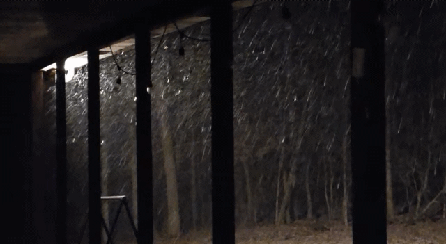
Big ol' fatties falling currently, heaviest snow so far.
-
-
 http://www.reddit.com/r/soccercirclejerk/s/O91EM5KPfY
 -

2025-2026 Fall/Winter Mountain Thread
MotoWeatherman replied to Buckethead's topic in Southeastern States
Yeah...can't say I don't have wind issues. LOL. I'm slightly exposed to the NW wind thinning things out. LOL -
This evening, the temperature fell into the 30s for the first time this season in New York City. Last year's first such reading occurred on November 13th. The 1991-2020 normal first such date is October 24th. The temperature will likely bottom out near freezing in New York City. The normal first freeze occurs on November 21st. Outside the City, widespread 20s are likely. Highs tomorrow will only reach the upper 30s and lower 40s. Parts of the region could see some snow flurries or even some snow showers. It will then turn somewhat milder. Wednesday through Friday will see highs mainly in the upper 40s to lower 50s. The ENSO Region 1+2 anomaly was -0.2°C and the Region 3.4 anomaly was -0.7°C for the week centered around November 5. For the past six weeks, the ENSO Region 1+2 anomaly has averaged -0.07°C and the ENSO Region 3.4 anomaly has averaged -0.55°C. La Niña conditions will likely continue through at least mid-winter. The SOI was +3.94 today. The preliminary Arctic Oscillation (AO) was -0.955 today. Based on sensitivity analysis applied to the latest guidance, there is an implied 57% probability that New York City will have a cooler than normal November (1991-2020 normal). November will likely finish with a mean temperature near 47.4° (0.6° below normal). Supplemental Information: The projected mean would be 0.3° below the 1981-2010 normal monthly value.
-
Snow flurries around the ATL area this afternoon! Nice to see! I am not sure if this is one of the earliest snow flurries days for ATL or not. Mark it the 10th of November.
-

2025-2026 Fall/Winter Mountain Thread
Buckethead replied to Buckethead's topic in Southeastern States
You must have more blowing snow than me or something. I have some wind, but I'm typically protected on the leeward side of my mountain during nwf. Sent from my SM-S908U using Tapatalk -
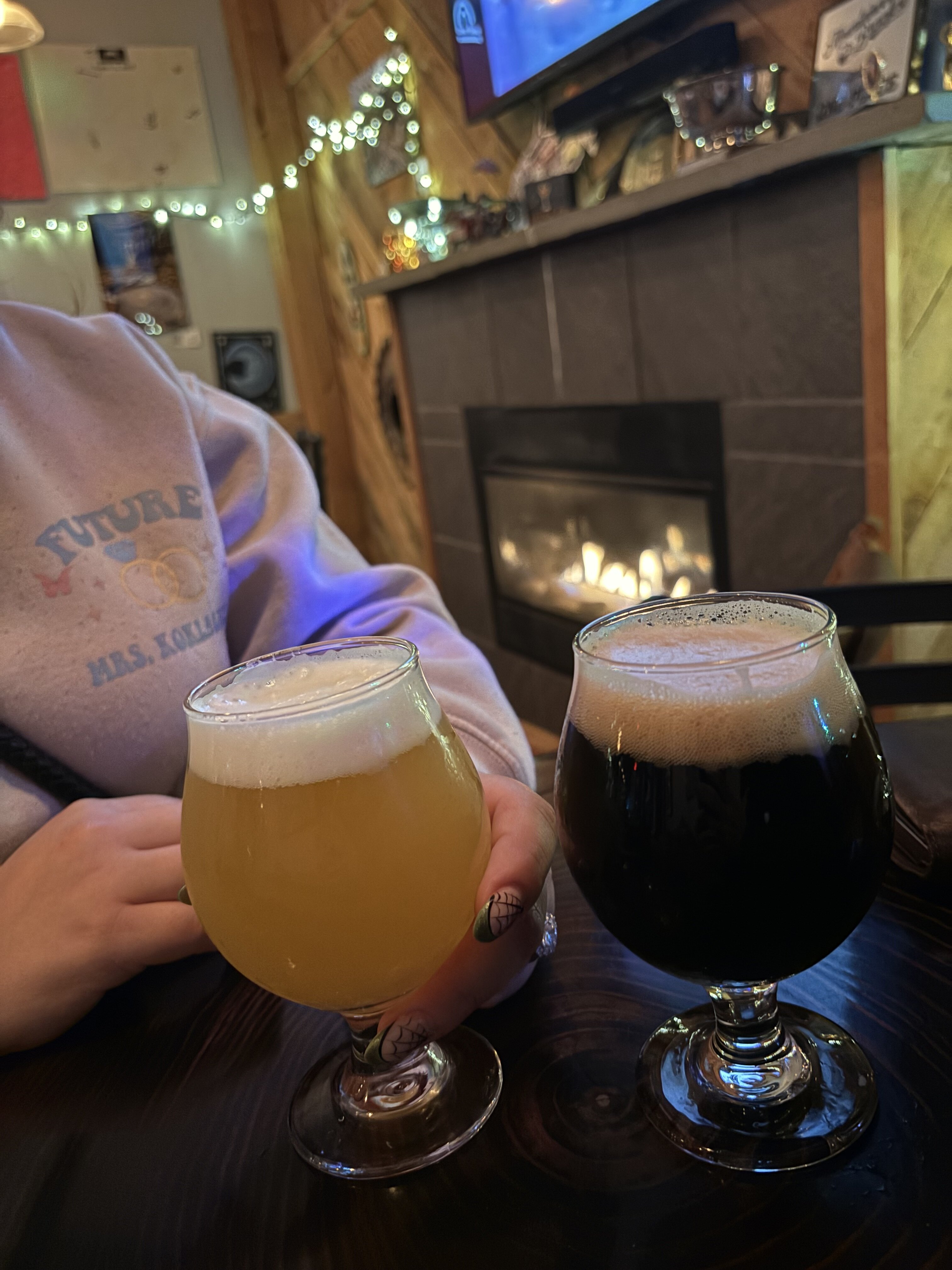
A nice Porter at Stumptown to end a fun day of snow chasing! Highly recommend the trip to anyone that has the time and the means!

-
Yay! Now to wait out here in the NNK, but I think it would take something like the higher returns over the west end…
-
Yea, the goods last long in DEC than 1st half. I was really loose with wording. And of course, we have to break before Christmas & have temporary blowtorch to get through Christmas, ha.
-
I’m happy for the Charlotte folks. If it couldn’t be my area, I’m glad it’s them. No metro area in the SE has been shafted more these past several winters than them. They whiffed on 2 winter storms last season and watched Raleigh take both to the bank. Not to mention the many misses leading up to last year. Enjoy!
-
Doubt we go below freezing here. Probably level off 33/34. 38 now.
-

November 2025 general discussions and probable topic derailings ...
ineedsnow replied to Typhoon Tip's topic in New England
Hoping to see atleast flakes here the next couple of days -
 Bennington VT this evening
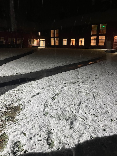
-

Richmond Metro/Hampton Roads Area Discussion
mikeeng92 replied to RIC Airport's topic in Mid Atlantic
Yes definitely see some flakes in the west end of Richmond ! -

2025-2026 Fall/Winter Mountain Thread
Maggie Valley Steve replied to Buckethead's topic in Southeastern States
Nearing 4 inches at the house and still snowing. Down to 18. -
38 here, very uniform with CAA