All Activity
- Past hour
-

Nov 28-30th Post Turkey Day Winter Storm
Jackstraw replied to Chicago Storm's topic in Lakes/Ohio Valley
Watch out for those COD snow maps, their algorithm ain't right. Go with pivotal snow maps. Also 10/1 gonna be closer to reality. Might go Kuchera on anything past early Sunday morning (if it's there) and next week. Like I said on my call I'm literally still on the make or break line lol ( kitchen sink climo for these slow cutters). For the record the Ukie and the Canuk have been the most consistent in their forecast the last 60 hours or so. Whether they verify well.... KIND calling for roughly 3-5 here but 2 miles to my N IWX is calling for 4-8 Iol. Sticking to my guns on my 6" call as we tend to underperform by a bit or overperform by a lot in these setups where the low tracks just to the NW by the southern lake yet there's decent antecedent cold air in place prior. While I think we may get some liquid I thing it may only be a couple hundredths of drizzle at most. This is a setup where a dry slot could be my friend. Think I'm in good spot to avoid a rainer chaser. Sub surface ground temps around my property are just above freezing in full sun so I dont think there will be a lot of melting but there could certainly be a little bit. Wipe the board properly when measuring and compaction dont count in a total! Regardless it looks like Nov '25 will beat my entire winter last year which is really BAD! lol. I think you, Kokomo and even Tipton in a lot better shape. As it says in Stebo's comment in my sig, I'm a bird fart away from warning snows or slushy mud-cicles lol. Good luck! -

First Winter Storm to kickoff 2025-26 Winter season
Ginx snewx replied to Baroclinic Zone's topic in New England
Some seem to think getting a perfect setup in early Dec is the way it should be. In fact there is a reason most of us average under 4 inches up to Dec 15th, although the 3rd to 5th seems to be a special period in good years. -

Nov 28-30th Post Turkey Day Winter Storm
HillsdaleMIWeather replied to Chicago Storm's topic in Lakes/Ohio Valley
Iwx just upped the amounts to 9 to 14, must be something juicy in the 18Z suite -
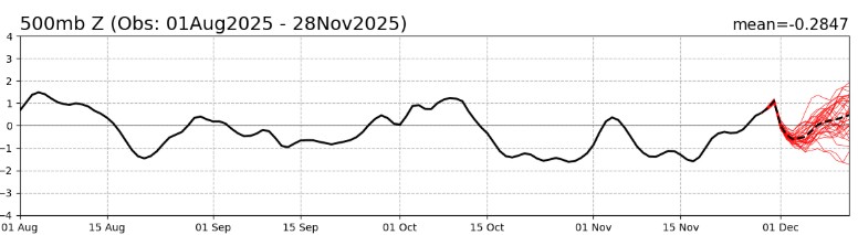
Yeah, just after posting about indexs showing positive AO and NAO just like that the Model's flip to showing them going negative and the very Pattern that's needed.
-
Yes it can, storms can deepen more, perhaps more cold air to work with. Storm track is still key
-
Yup, it was 3” in 24 when I posted that. Two hours later it’s 5”. Really not much difference between 1,500ft and 3,000+ feet. 1” last night and 4” since 6am.

-

November 2025 general discussions and probable topic derailings ...
ineedsnow replied to Typhoon Tip's topic in New England
and.... dumping supposed to go to the Trans Siberian Orchestra in Manchester tonight hopefully ther roads don't get to bad.. -

Nov 28-30th Post Turkey Day Winter Storm
Harry Perry replied to Chicago Storm's topic in Lakes/Ohio Valley
Must be contagious. First it was GRR for several years, now DTX too. I agree with you 100%. Second busiest holiday travel day in conjunction with 5-8” of snow and 30+ mph winds… just issue the warning. For many it’s the difference between waiting a day or two and just hunkering down vs. in the ditch with a wrecked vehicle or worse. Who cares if the amount of snow doesn’t specifically meet “warning” criteria, it’s irrelevant when it comes to life & safety IMO. -
November 2025 general discussions and probable topic derailings ...
ineedsnow replied to Typhoon Tip's topic in New England
Just got really dark I think were about to rip here -
November 2025 general discussions and probable topic derailings ...
ineedsnow replied to Typhoon Tip's topic in New England
awesome!! -
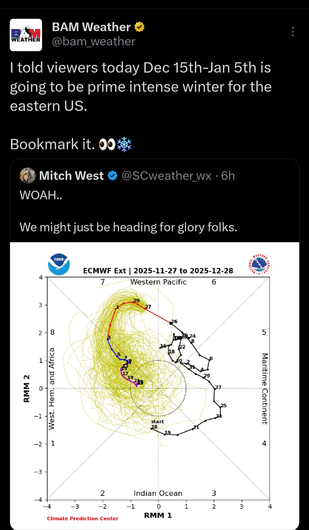
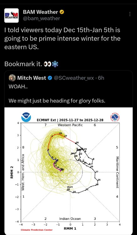
Any chance the NAO going negative right in time for the Dec 2nd storm helps out any?
-

November 2025 general discussions and probable topic derailings ...
dendrite replied to Typhoon Tip's topic in New England
Yeah a few bursts here. It whitens…it melts. Rinse repeat. -
I was curious who everyone's favorite weather YouTuber is? I am in the South East (SC), and I watch a lot of WxRisk with DT. I was wondering if anybody else gives a big picture to the nation's weather, and or the South East.
-
Happy Hour coming, what’s your beverage today?
-

November 2025 general discussions and probable topic derailings ...
UnitedWx replied to Typhoon Tip's topic in New England
Quite a few bursts of snow showers through Westfield this afternoon. Setting the stage... we'll see -

First Winter Storm to kickoff 2025-26 Winter season
ORH_wxman replied to Baroclinic Zone's topic in New England
SE areas will need big time rates to get more than advisory snows I'm thinking. So it's a tough needle to thread....on one hand, you want a colder/SE solution, but on the other, you still need those big rates. Best way to get it is probably push that initial cold front a little further south but also keep the shortwave fairly potent, so you get both. -
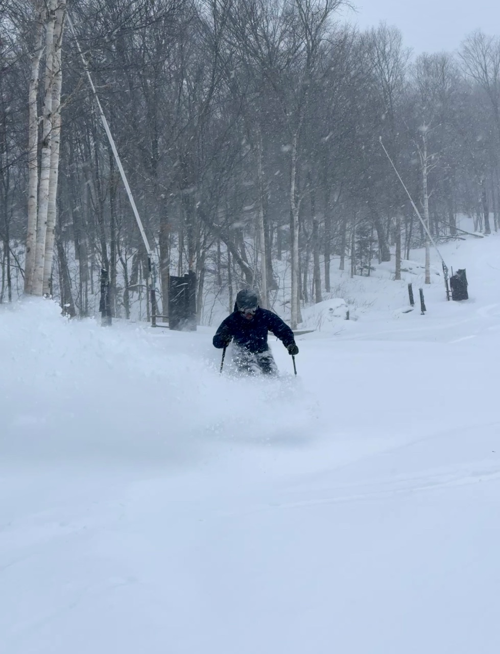
 Nice mood flakes, Reminds us winter weather is here.
 -
Lars' runt son he wouldn't acknowledge
-

-
-

-

December 2025 Short/Medium Range Forecast Thread
Daniel Boone replied to John1122's topic in Tennessee Valley
That's what we need. -

November 2025 general discussions and probable topic derailings ...
LSC97wxnut replied to Typhoon Tip's topic in New England
Yeah, drove through a decent little snow shower driving around Newton a few minutes ago. -
Just saw flurries! 37
-
16.6 for you 23.8 for me