All Activity
- Past hour
-

Digital Snow Thread Winter 2024-2025
WinstonSalemArlington replied to SnowenOutThere's topic in Mid Atlantic
-
Mid to long range discussion- 2025
WinstonSalemArlington replied to wncsnow's topic in Southeastern States
-
Just in time for xmas. Lock it up. Sent from my SM-S921U using Tapatalk
-
Very early in the season. Hopefully the region will score this season.
-
Mid to long range discussion- 2025
WinstonSalemArlington replied to wncsnow's topic in Southeastern States
December 15 -

Dec 6-7th (It's not a clipper) Clipper
Paulie21 replied to Chicago Storm's topic in Lakes/Ohio Valley
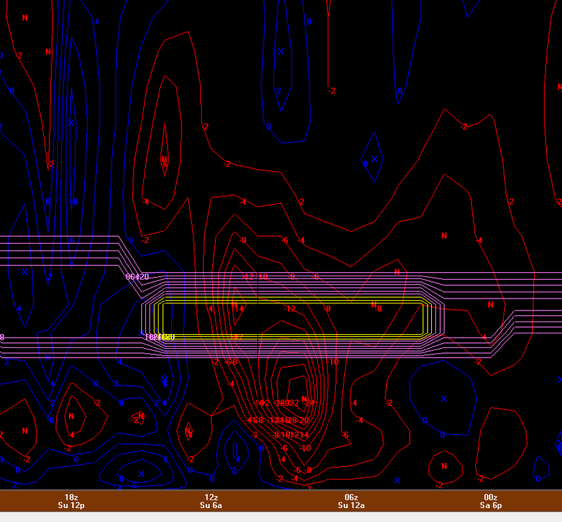
Pretty much all models hinting at a nice corridor of higher UVVs for northern IL tonight between 850mb - 750mb. Not perfectly co-located with the small area of DGZ but not bad at all for a couple hours of 1"+/hr rates perhaps. Not perfectly textbook case but looks like theta-e lines in the cross section are more spaced out and climbing. Perhaps some slantwise convection possible? Not a perfect setup but it does coincide with best LRs (saturated) in the sounding, strong speed shear above veering wind profile, AND weak absolute vorticity. Could really thump right before dawn.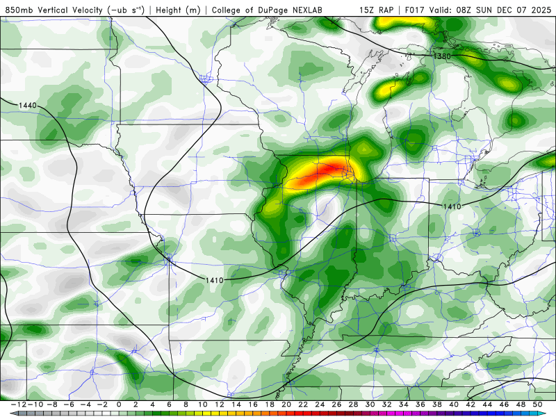
-

December 2025 regional war/obs/disco thread
AstronomyEnjoyer replied to Torch Tiger's topic in New England
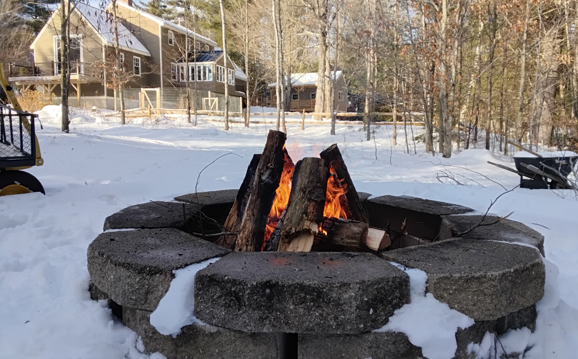
Sun came out and temp rocketed up to 37.9°. Taking advantage of the nice weather to get rid of some of the softwood that was a little too sporty for the inside fireplace.
-
Unfortunately you can’t. I was just looking on pivotal. You can see more of a wider view for the EPS on tropical tidbits, but that roles out after 3.
-

December 2025 regional war/obs/disco thread
Go Kart Mozart replied to Torch Tiger's topic in New England
Where can I see a continental view of these? The Pivotal free site has only the US view. -
And it's gone. Nothing but a memory. Hopefully we get a lot more. It was an enjoyable little event. It was nice having a deep winter day in early December.
-
Sun is out in Eastern CT, temp 42F, feels nice out!
-

December 2025 Short/Medium Range Forecast Thread
Daniel Boone replied to John1122's topic in Tennessee Valley
So far the truly cold air hasn't been making it into the Great Valley this Month. You can see how it fell down west and East of the Great Valley in the Month T Plot. It's in the 40's Today. That falls within Average for here. This Mornings Low was above Average due to being socked in with Fog and low St Deck. Yesterday was near Normal as far as daily goes. The point being, although much of the East( MW, Oh Valley, NE and MA have been very cold, our Area and Southeastward hasn't in comparison. Qustion to debate is, the Reason why?. I'd like to see what everyone can come up with and get a common denominator . Mine is no strong Hp press down western slopes of Apps. Then there has been the residual heat Sourh of us left over from the Cuban HP that weakened and moved on SEward that pulls up toward the Jet and mixes. If Modeling is correct showing the strong HP coming down from Canada into the Plains we will be in the Icebox as well as we all know. -

December 2025 regional war/obs/disco thread
Kitz Craver replied to Torch Tiger's topic in New England
Little OT, but it’s pretty funny how psyched we were for T-.5” this am. Damn, it’s been desperate times, lol -

Central PA Fall Discussions and Obs
Itstrainingtime replied to ChescoWx's topic in Upstate New York/Pennsylvania
Just seems hard to imagine we get through the next few weeks without all of us getting some snow. But we've been snakebit in recent years which leaves me feeling a bit jaded. Still, I'll roll with this pattern. -
-
Grabbed another 0.25” yesterday evening/early morning. 2.25” total.
-

December 2025 regional war/obs/disco thread
Baroclinic Zone replied to Torch Tiger's topic in New England
Nice progression. Let’s hold that -
Yeah at least if it’s all gone, so is the grid.
-
Has been a common theme in recent years with the heavy road salting especially behind the 18-wheelers.
-

December 2025 regional war/obs/disco thread
butterfish55 replied to Torch Tiger's topic in New England
Not only do we not have any snow on the ground, we haven't seen a single flake of snow here in TBlizzland. Definitely not a memorable December here so far Pouring now, btw -
Euro has quite the rollercoaster on Thursday the 18th. Waking up to temperatures in the 50s with showers/thunderstorms. Dropping to freezing by the evening, ending with a burst of snow/ice, then dipping down into the teens by Friday morning.
-
Back at the old stomping grounds today! .
-
Yesss the more cold we have coming in ...a good snowstorm is bound to meet the cold!
-
GEFS also trending to a better, taller + PNA, hope it happens !
-
One of the funnier discussions I’ve seen. Don’t blame that at all though!