All Activity
- Past hour
-
No mention - just straight line winds where the most severe storms occur - which is yet to be determined BUT at the looks of radar and where the front is now central and south NJ along with Philly look to be most likely IMO
-
CEF made it today with a 90.3 max so far.
-
DPs are still holding firm in the mid to upper 60s. That works.
-
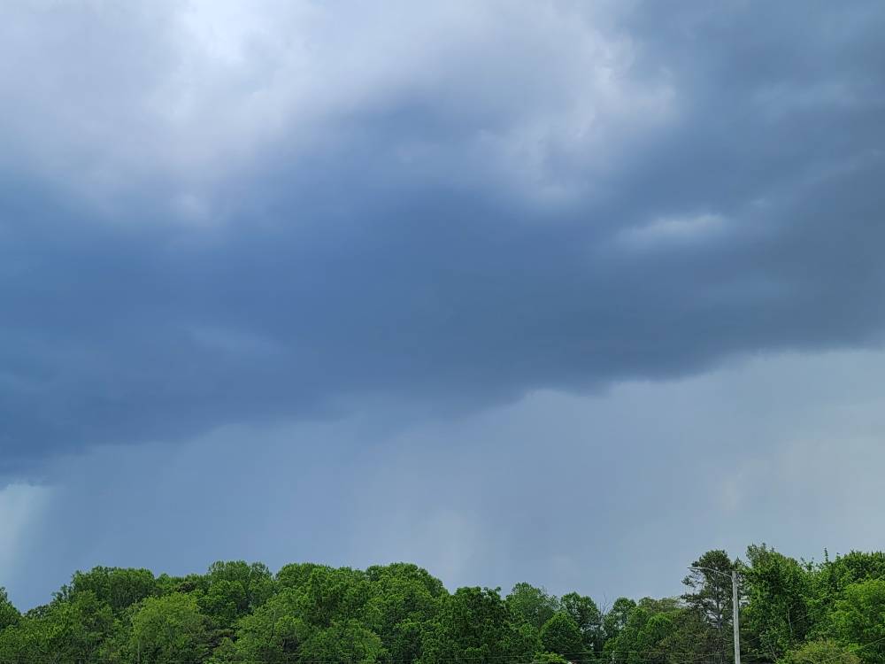
Storming here now mixed with a bit of hail.
-
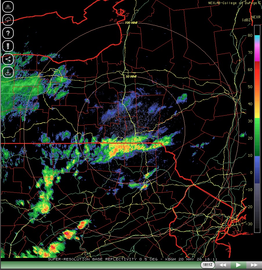
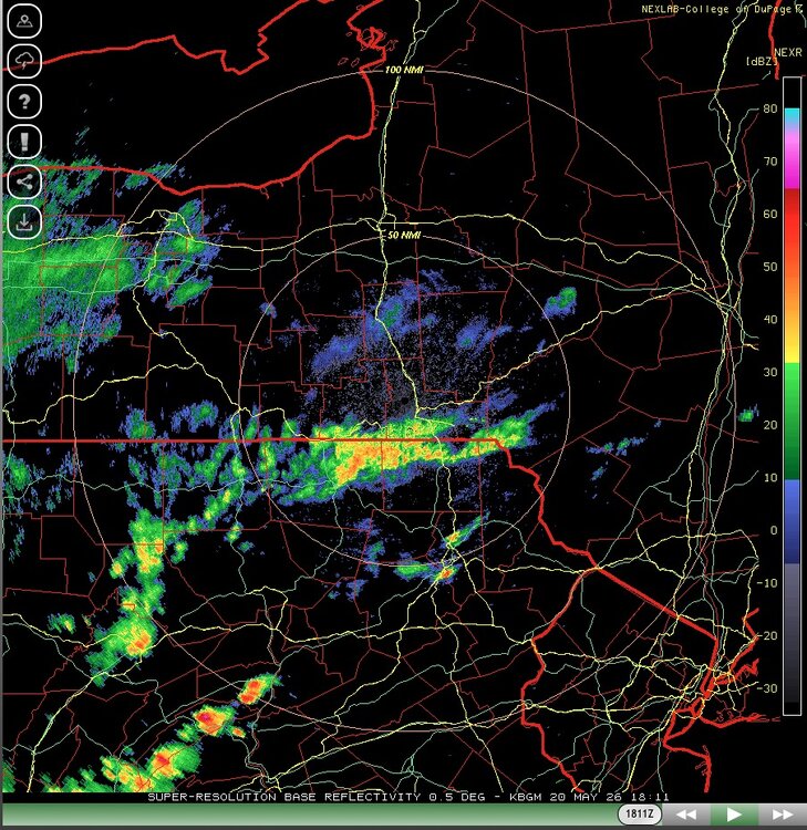
Small clusters of storms developing over CPA
-
Getting more organized now. Sent from my SM-G998U using Tapatalk
-
Does the HRRR effectively kill everything out west right now?
-

E PA/NJ/DE Spring 2026 Obs/Discussion
Hurricane Agnes replied to PhiEaglesfan712's topic in Philadelphia Region
I had nothing measurable but if it did something after I went to bed to wet the walks, it was evaporated by early this morning! SPC in Norman is up with the Severe Thunderstorm Watches - -
I'm on my way back from NC. Ring cam shows it did rain. I can't get wxunderground to work atm.
-
Cooking at JFK upon landing. 92 at my stations with DP of 63, not bad at all out there.
-
Watch posted sub forum wide.
-
All we really need to know are the parameters of the orbit of Jupiter anyhow. JB's already on the case.
-
any chance of a tornado this evening?
-
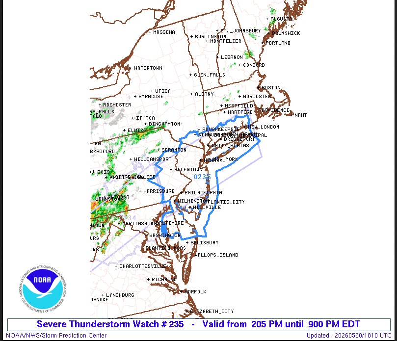
URGENT - IMMEDIATE BROADCAST REQUESTED Severe Thunderstorm Watch Number 235 NWS Storm Prediction Center Norman OK 205 PM EDT Wed May 20 2026 The NWS Storm Prediction Center has issued a * Severe Thunderstorm Watch for portions of Southern Connecticut Delaware Eastern Maryland New Jersey Southeast New York Eastern Pennsylvania Coastal Waters * Effective this Wednesday afternoon and evening from 205 PM until 900 PM EDT. * Primary threats include... Scattered damaging wind gusts to 70 mph likely Isolated large hail events to 1 inch in diameter possible SUMMARY...Scattered thunderstorms will develop and track eastward across the watch area through the afternoon and evening. Hot and unstable conditions will lead to conditions supportive of damaging wind gusts in the strongest storms. The severe thunderstorm watch area is approximately along and 55 statute miles north and south of a line from 35 miles northwest of Wilmington DE to 25 miles southeast of Groton CT. For a complete depiction of the watch see the associated watch outline update (WOUS64 KWNS WOU5). PRECAUTIONARY/PREPAREDNESS ACTIONS... REMEMBER...A Severe Thunderstorm Watch means conditions are favorable for severe thunderstorms in and close to the watch area. Persons in these areas should be on the lookout for threatening weather conditions and listen for later statements and possible warnings. Severe thunderstorms can and occasionally do produce tornadoes. && OTHER WATCH INFORMATION...CONTINUE...WW 234... AVIATION...A few severe thunderstorms with hail surface and aloft to 1 inch. Extreme turbulence and surface wind gusts to 60 knots. A few cumulonimbi with maximum tops to 500. Mean storm motion vector 27030. ...Hart
-
yeah basically the entire DC-NYC corridor is under a watch now.
-
WWUS from KWNS Severe T- Storm watch NYC- NJ and other parts of region WOUS from KWNS
-
New Severe Thunderstorm Watch issued from Cecil/Kent counties northeast into Philadelphia.
-
I always "forget" - but lightning is SUCH a good indicator a lot of times in terms of how a storm is trending. The one well NW of Luray has COPIOUS lightning with it.
-
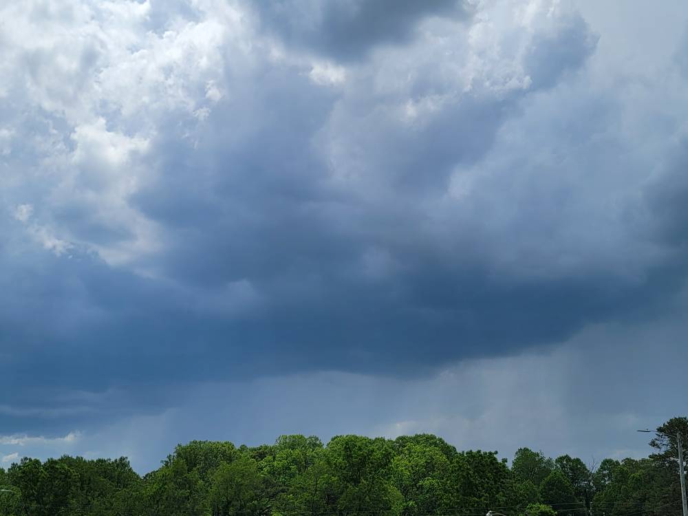
Little cell Sent from my SM-G998U using Tapatalk
-
What’s up with that hair? He looks like he belongs on “Welcome Back Kotter!” Arnold Horshack’s brother.
-
Got a little cell blowing up on the Haywood Buncombe line currently.
-
Someone just turned on the wind machine.
-

-

Central PA Spring 2026 Discussion/Obs Thread
Voyager replied to Voyager's topic in Upstate New York/Pennsylvania
Still sunny and warm at my favorite place. Hazleton... -
Hit 95.5 IMBY so far per Mesonet