All Activity
- Past hour
-
Roll away the dew!!
-
 We kick off the month of July with a trough digging into the western United States and a large ridge of high pressure building into the midwestern states (I refuse to call this a heat ridge...another stupid, hyped up term) resulting in high heat and humidity building into the eastern third of the country. Here in the Northeast, we will find ourselves on the northern or northeastern periphery of the upper-level ridge. This will place us in a favor position for the advection of higher heat/humidity in the lower-levels while favoring a northwestern flow in the mid-to-upper levels. This pattern can be favorable for MCS propagation into the Northeast region as well as the advection of elevated mixed-layer plumes. In terms of severe weather potential, computer forecast models hint at some shortwave energy rounding the northern periphery of the ridge into the Northeast (uncertainty as to exactly where). With temperatures well into the 90's and dewpoints well into the upper 60's to 70's under the presence of steep mid-level lapse rates, the potential exists for moderate-to-extreme instability to develop with potential for 2500-4000 J/KG of MLCAPE with potential for 30-40+ knots of bulk shear. Should a shortwave work into this environment the potential would exist for numerous thunderstorms, including the potential for some of these to be severe with potential for damaging wind gusts, large hail, and even the potential for tornadoes if enough directional shear is present. The high heat and humidity has finally arrived
 -
I finished somewhere between 4 and 5”, leaves and a stick screwed it all up yesterday after another couple tenths.
-
Just west of DC? I’m having all kinds of trouble getting on LWX’s site. Edit: I see it now on CWG’s app. Fairfax county and old DC proper.
-
Really nice unexpected treat this morning. Looks like a wake low. Healthy amount of rain will keep the garden happy with the incoming heat.
-
Record SJT on June 26. .
-
Rain total yesterday was .33". Total for the week was 3.88". Glad I got lucky with some heavier totals before the heat arrived. Looks like a hot stretch mid and late week. I'm thinking @MJO812 and @nycwinter will be hunkered down until further notice. Really wish CP had the instrumentation back at Belvedere Castle where it was properly sited so we could get a better sense of NYC temperatures. Thankfully we have the NYC Micronet sites across the city. CP bothers me only because that is what the media uses to give temperatures for the city and it is what people hear on new reports etc. Will be interested to see what CP tops out at vs surrounding sites.
-
Localized flood watch
-
Send that precip south to the fires. Sad story from Eagle Point.
-
Pretty nice MCV making a direct hit on the MSP area this morning. Dews are in the 60s here this morning, but should be well into the 70s by this afternoon. Non-stop 70s to occasionally 80s for dews from here on out until at least July 10th. Ready 2 sweat.
-
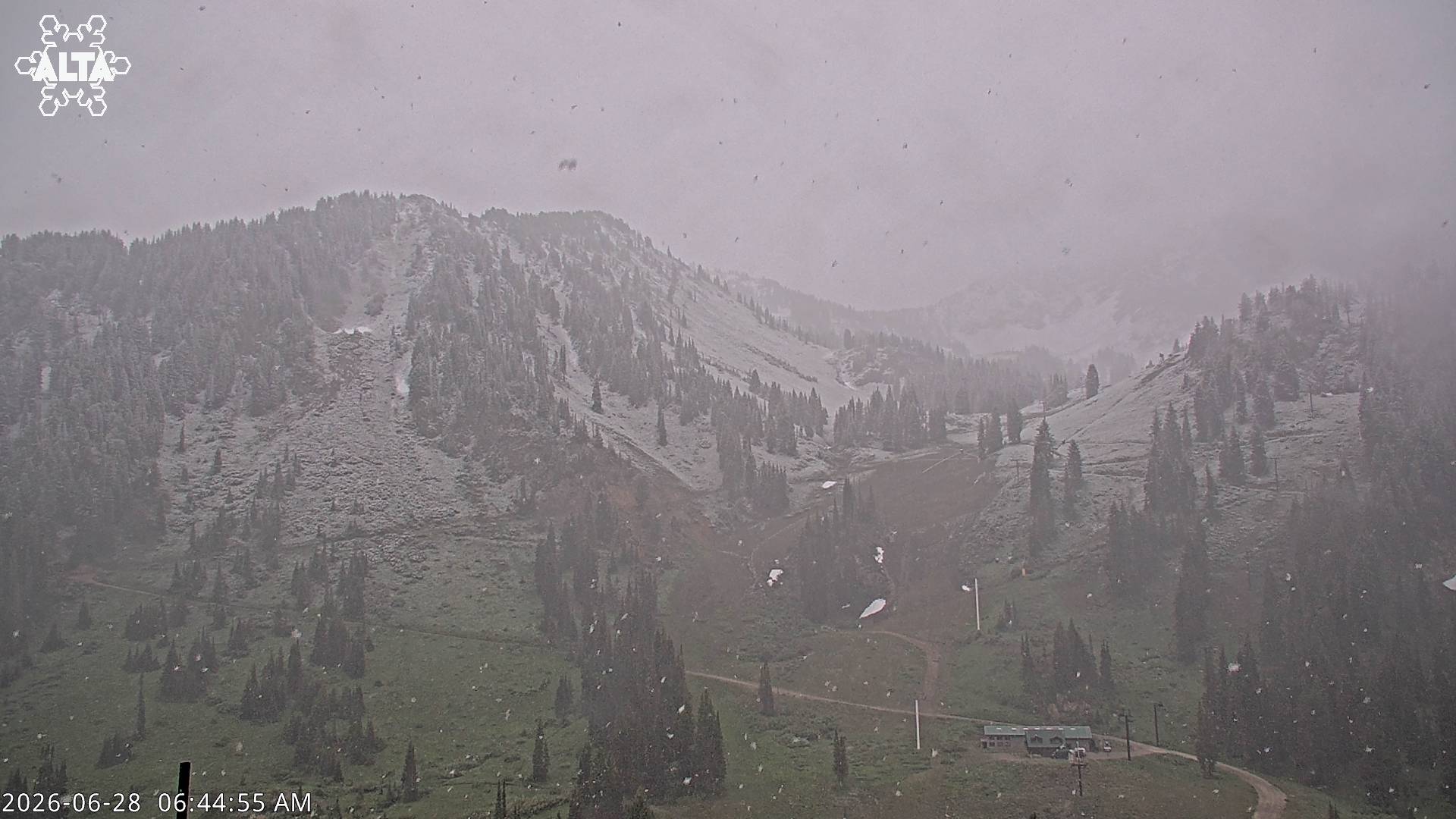
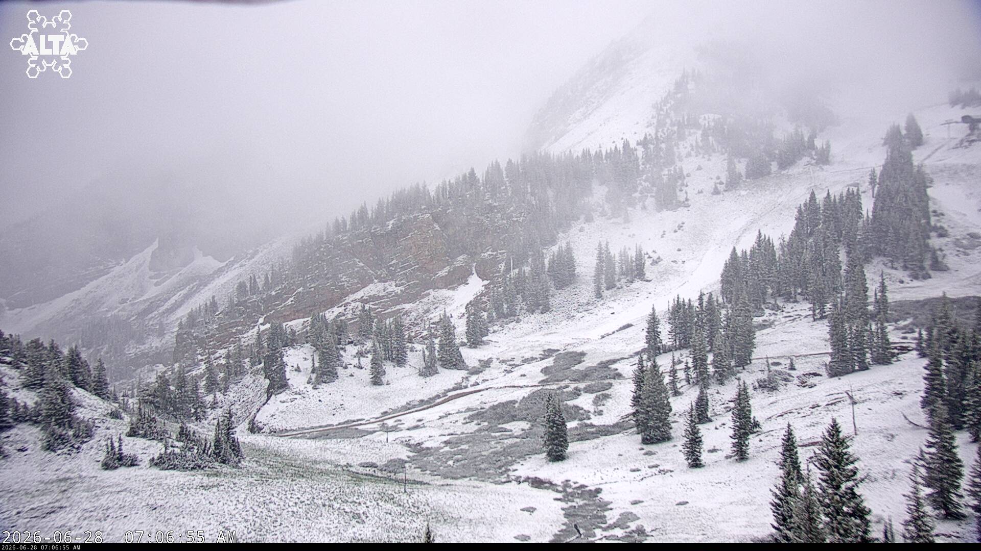
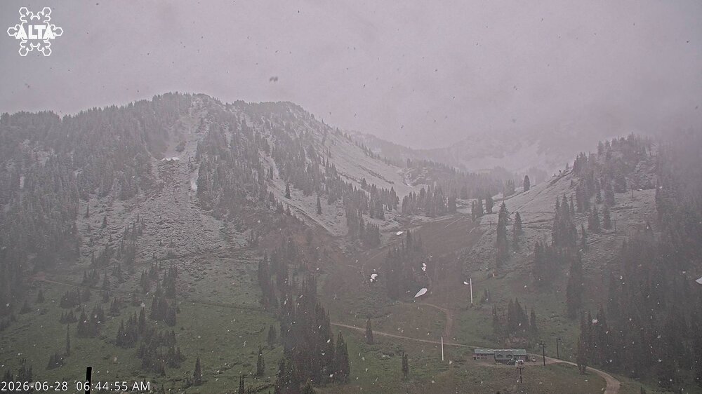
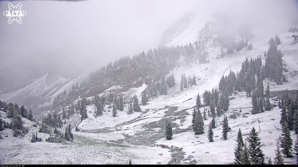
For @vortex95... snowing this morning at Alta and the neighboring Wasatch peaks around Salt Lake City.
-
I’m just watering gardens. Gave up on the lawn in the early innings this year.
-
Mt holly issued an extreme heat watch already
-
If DCA hits 90° by 10am, 100° is almost a lock. You almost need 90°by 11am or its not happening. Getting 100° in these parts is rare, getting 100°+ is even rarer.
-
My heart goes out to Doug Kammerer
-
Welcome to the club. Lawns have been toast here for a month.
-
Sitting under the last part of New England still under the clouds.
-

Junorch obs and discussion 2026
Damage In Tolland replied to Damage In Tolland's topic in New England
Definitely gonna be some bigtime Rainers today. Dews and the clouds have that look. Towering CU already -
.3 at home yesterday. That fog this morning was no joke.
-
Very small rain blob right over central-western Fairfax County since at least sunrise. I keep waiting for this rain cell to move east and for us to get some sunshine to reduce the dewpoint a little, but it keeps on not happening. Pretty frustrating,
-

E PA/NJ/DE Summer 2026 Obs/Discussion
The Iceman replied to PhiEaglesfan712's topic in Philadelphia Region
Anyone else having trouble getting on the weather.gov site? side note, as extreme as this heat event looks, more interesting to me is long range, afterwards doesn’t look at that hot. Usually these heat events are harbingers of above average months but this looks relatively short lived. Will be interesting to see the final anomalies for July. With how extreme of a start we will have, a +1 or +2F month would be cool honestly -
yep
- Today
-
Skies are clearing and the sun just feels crazy strong today.
-

Central PA Summer 2026 Discussion/Obs Thread
Blizzard of 93 replied to Voyager's topic in Upstate New York/Pennsylvania
Yesterday I only got near .10 of rain, which was disappointing. My lawn is drying out & getting crispy in some areas. This week’s extreme heat will certainly not help. At least this heat wave is happening in the heart of Summer. In another 6 weeks, we will be able to begin to see our way out to Fall. -
Is the NWS website down for anyone else?